Category:Huis Het Enzerinck
| Object location | | View all coordinates using: OpenStreetMap |
|---|
 | |||||
| Upload media | |||||
| Instance of | |||||
|---|---|---|---|---|---|
| Part of | |||||
| Location | Vorden, Gelderland, Netherlands | ||||
| Street address |
| ||||
| Heritage designation |
| ||||
 | |||||
|
This is a category about rijksmonumentcomplex number 520263
|
Landhuis:
|
This is a category about rijksmonument number 520264
|
Historische aanleg:
|
This is a category about rijksmonument number 520265
|
Koetshuis:
|
This is a category about rijksmonument number 520277
|
Schuur:
|
This is a category about rijksmonument number 520278
|
Pijlers:
|
This is a category about rijksmonument number 520279
|
Speelhuisje:
|
This is a category about rijksmonument number 520280
|
Pomp:
|
This is a category about rijksmonument number 529086
|
Pijlers:
|
This is a category about rijksmonument number 529087
|
| Address |
|
Media in category "Huis Het Enzerinck"
The following 61 files are in this category, out of 61 total.
-
 Detail van de westgevel van het huis - Vorden - 20330267 - RCE.jpg 1,192 × 1,200; 410 KB
-
 Detail van schouw - Vorden - 20247021 - RCE.jpg 1,200 × 964; 234 KB
-
 Detail van schouw - Vorden - 20247022 - RCE.jpg 1,200 × 961; 254 KB
-
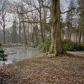
 Enserinck tuin.jpg 2,135 × 1,475; 829 KB
-
 Exterieur - Vorden - 20247016 - RCE.jpg 1,200 × 965; 308 KB
-
 Exterieur - Vorden - 20247017 - RCE.jpg 1,200 × 953; 319 KB
-
 Exterieur - Vorden - 20247018 - RCE.jpg 1,200 × 959; 337 KB
-
 Goudvisvijver - Vorden - 20330258 - RCE.jpg 1,186 × 1,200; 485 KB
-
 Goudvisvijver - Vorden - 20330259 - RCE.jpg 1,185 × 1,200; 526 KB
-
 Houten schuur, kapconstructie - Vorden - 20330261 - RCE.jpg 1,187 × 1,200; 302 KB
-
 Huis, westgevel, detail voegwerk - Vorden - 20330262 - RCE.jpg 1,193 × 1,200; 407 KB
-
 Huis, westgevel, detail voegwerk - Vorden - 20330263 - RCE.jpg 1,192 × 1,200; 384 KB
-
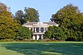 HuizeHetEnzerinck.jpg 466 × 311; 28 KB
-
 Interieur - Vorden - 20247019 - RCE.jpg 1,200 × 960; 212 KB
-
 Interieur met schouw - Vorden - 20247020 - RCE.jpg 1,200 × 958; 245 KB
-
 Kas, overzicht interieur - Vorden - 20330265 - RCE.jpg 1,189 × 1,200; 383 KB
-

-

-
 Koetshuis - Vorden - 20330280 - RCE.jpg 1,188 × 1,200; 354 KB
-
 Kweekbakken met kleine windmolen - Vorden - 20330284 - RCE.jpg 1,188 × 1,200; 519 KB
-
 Laan naar het noorden bij de goudvisvijver - Vorden - 20330260 - RCE.jpg 1,187 × 1,200; 459 KB
-
 Oostelijke ingang - Vorden - 20330248 - RCE.jpg 1,191 × 1,200; 387 KB
-
 Oostelijke ingang, pijler - Vorden - 20330247 - RCE.jpg 1,193 × 1,200; 419 KB
-
 Overzicht achtergevel huis - Vorden - 20330287 - RCE.jpg 1,191 × 1,200; 365 KB
-
 Overzicht houten schuur - Vorden - 20330277 - RCE.jpg 1,191 × 1,200; 368 KB
-
 Overzicht houten schuur - Vorden - 20330278 - RCE.jpg 1,189 × 1,200; 397 KB
-
 Overzicht ingang koetshuis - Vorden - 20330289 - RCE.jpg 1,191 × 1,200; 324 KB
-
 Overzicht kas - Vorden - 20330285 - RCE.jpg 1,189 × 1,200; 358 KB
-
 Overzicht koetshuis - Vorden - 20330275 - RCE.jpg 1,188 × 1,200; 325 KB
-
 Overzicht koetshuis en houten schuur - Vorden - 20330288 - RCE.jpg 1,188 × 1,200; 395 KB
-
 Overzicht koetshuis en Huis Enzerinck op de achtergrond - Vorden - 20330281 - RCE.jpg 1,189 × 1,200; 374 KB
-

-
 Overzicht omgeving. Oostelijke begrenzing - Vorden - 20330246 - RCE.jpg 1,192 × 1,200; 501 KB
-
 Overzicht rechter zijgevel huis - Vorden - 20330286 - RCE.jpg 1,191 × 1,200; 357 KB
-
 Overzicht voorgevel en linker zijgevel hui - Vorden - 20330282 - RCE.jpg 1,184 × 1,200; 433 KB
-
 Overzicht voorgevel en rechter zijgevel huis - Vorden - 20330283 - RCE.jpg 1,186 × 1,200; 353 KB
-
 Overzicht voorgevel Huis Enzerinck - Vorden - 20330279 - RCE.jpg 1,188 × 1,200; 371 KB
-
 Overzicht, pad ten noord-oosten van het huis - Vorden - 20330252 - RCE.jpg 1,188 × 1,200; 489 KB
-
 Pad ten oosten van waterpartij, zicht richting het noorden - Vorden - 20330251 - RCE.jpg 1,186 × 1,200; 487 KB
-
 Pomp bij het koetshuis - Vorden - 20330264 - RCE.jpg 1,190 × 1,200; 270 KB
-
 Rest van de bakoven - Vorden - 20330256 - RCE.jpg 1,189 × 1,200; 511 KB
-
 Rest van de bakoven - Vorden - 20330257 - RCE.jpg 1,191 × 1,200; 513 KB
-
 Schuur, kap, kapconstructie - Vorden - 20330268 - RCE.jpg 1,190 × 1,200; 312 KB
-
 Tempeltje in de tuin aan de westkant van het huis - Vorden - 20330276 - RCE.jpg 1,190 × 1,200; 432 KB
-

-
 Tuinaanleg ten westen van het huis met tuinvaas - Vorden - 20330269 - RCE.jpg 1,191 × 1,200; 445 KB
-
 Voor- en zijgevel kleurrepro Q.Verhuell, 1823 - Vorden - 20504092 - RCE.jpg 1,200 × 900; 143 KB
-
 Voorgevel huis, terras met zuilen en balkon daarboven - Vorden - 20330274 - RCE.jpg 1,193 × 1,200; 362 KB
-
 Voorgevel met overkapping met zuilen en balkon daarboven - Vorden - 20330292 - RCE.jpg 1,191 × 1,200; 421 KB
-
 Voorgevel, balkon en klok - Vorden - 20330290 - RCE.jpg 1,193 × 1,200; 325 KB
-
 Waterpartij ten noord oosten van het huis - Vorden - 20330249 - RCE.jpg 1,191 × 1,200; 499 KB
-
 Waterpartij ten noord oosten van het huis - Vorden - 20330250 - RCE.jpg 1,191 × 1,200; 493 KB
-
 Westelijke ingang huis Het Enzerinck - Vorden - 20330253 - RCE.jpg 1,190 × 1,200; 438 KB
-
 Westelijke ingang huis Het Enzerinck - Vorden - 20330254 - RCE.jpg 1,198 × 1,200; 420 KB
-
 Westelijke ingang, vaas op een van de pijlers - Vorden - 20330255 - RCE.jpg 1,193 × 1,200; 295 KB
-
 Westgevel huis met (bijna droogliggende) vijver - Vorden - 20330266 - RCE.jpg 1,188 × 1,200; 442 KB
-
 Westgevel van het huis, detail voegwerk - Vorden - 20330272 - RCE.jpg 1,193 × 1,200; 427 KB
-
 Westgevel van het huis, detail voegwerk - Vorden - 20330273 - RCE.jpg 1,193 × 1,200; 343 KB
-
 Zichtas naar het westen - Vorden - 20330293 - RCE.jpg 1,188 × 1,200; 346 KB
-
 Zichtas vanuit het huis aan de achterzijde - Vorden - 20330271 - RCE.jpg 1,192 × 1,200; 368 KB
-
 Zij- en achtergevel hooiberg kleurrepro Q.Verhuell - Vorden - 20504091 - RCE.jpg 1,200 × 900; 120 KB


_vijver_-_Vorden_-_20330266_-_RCE.jpg)


