Category:Huis ter Leede
| Object location | | View all coordinates using: OpenStreetMap |
|---|
Dutch manor house in Sassenheim  | |||||
| Upload media | |||||
| Instance of | |||||
|---|---|---|---|---|---|
| Part of | |||||
| Location | Sassenheim, South Holland, Netherlands | ||||
| Street address |
| ||||
| Heritage designation |
| ||||
 | |||||
|
This is a category about rijksmonumentcomplex number 528392
|
Hoofdgebouw:
|
This is a category about rijksmonument number 528393
|
Historische tuin- en parkaanleg:
|
This is a category about rijksmonument number 528394
|
Boerderij:
|
This is a category about rijksmonument number 528395
|
Stalgebouw:
|
This is a category about rijksmonument number 528396
|
Oranjerie:
|
This is a category about rijksmonument number 528397
|
Moestuinmuur:
|
This is a category about rijksmonument number 528398
|
Historische tuin- en parkaanleg:
|
This is a category about rijksmonument number 528400
|
Toegangshek:
|
This is a category about rijksmonument number 529198
|
| Address |
|
Media in category "Huis ter Leede"
The following 27 files are in this category, out of 27 total.
-
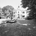
 Exterieur OVERZICHT - Sassenheim - 20311303 - RCE.jpg 1,200 × 960; 280 KB
-
 Exterieur VOORGEVEL - Sassenheim - 20311304 - RCE.jpg 1,200 × 1,197; 430 KB
-

-
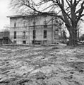
 Huis ter Leede, aanzicht - Sassenheim - 20194593 - RCE.jpg 1,200 × 813; 219 KB
-
 Huis ter Leede, achtergevel - Sassenheim - 20194606 - RCE.jpg 1,192 × 1,200; 462 KB
-
 Huis ter Leede, achtergevel bijgebouw - Sassenheim - 20194592 - RCE.jpg 1,200 × 1,200; 413 KB
-
 Huis ter Leede, achtergevel bijgebouw - Sassenheim - 20194597 - RCE.jpg 1,197 × 1,200; 420 KB
-
 Huis ter Leede, achtergevel bijgebouw - Sassenheim - 20194598 - RCE.jpg 1,195 × 1,200; 447 KB
-
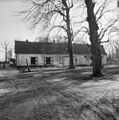
 Huis ter Leede, boerderij - Sassenheim - 20194594 - RCE.jpg 1,200 × 812; 269 KB
-
 Huis ter Leede, detail inrijhek - Sassenheim - 20194600 - RCE.jpg 1,192 × 1,200; 309 KB
-
 Huis ter Leede, detail inrijhek - Sassenheim - 20194601 - RCE.jpg 1,188 × 1,200; 504 KB
-
 Huis ter Leede, hekwerk - Sassenheim - 20194596 - RCE.jpg 1,200 × 809; 286 KB
-
 Huis ter Leede, inrijhek - Sassenheim - 20194599 - RCE.jpg 1,192 × 1,200; 463 KB
-
 Huis ter Leede, linker zijgevel bijgebouw - Sassenheim - 20194590 - RCE.jpg 1,195 × 1,200; 402 KB
-
 Huis ter Leede, linker zijgevel boerderij nummer 45 - Sassenheim - 20194608 - RCE.jpg 1,188 × 1,200; 459 KB
-
 Huis ter Leede, rechter zijgevel bijgebouw - Sassenheim - 20194591 - RCE.jpg 1,190 × 1,200; 374 KB
-
 Huis ter Leede, schuur - Sassenheim - 20194595 - RCE.jpg 1,200 × 812; 370 KB
-
 Huis ter Leede, voorgevel bijgebouw - Sassenheim - 20194589 - RCE.jpg 1,192 × 1,200; 404 KB
-
 Huis ter Leede, voorgevel boerderij nummer 45 - Sassenheim - 20194607 - RCE.jpg 1,195 × 1,200; 355 KB
-

-
 Huis ter Leede, zij en achtergevel - Sassenheim - 20194605 - RCE.jpg 1,197 × 1,200; 504 KB
-
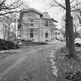
 Huis ter Leede, zijgevel - Sassenheim - 20194603 - RCE.jpg 1,191 × 1,200; 496 KB
-
 Huis ter Leede, zijgevel - Sassenheim - 20194604 - RCE.jpg 1,185 × 1,200; 431 KB
-
 Leede.jpg 2,119 × 1,459; 594 KB
-
 Rechter zijgevel boerderij nummer 45 - Sassenheim - 20194609 - RCE.jpg 1,191 × 1,200; 380 KB
-
 Ruïnes van het Huis ter Lee of ter Lynden, aan de Rijn tegenover Rhenen.jpg 5,998 × 3,892; 3.74 MB
-
 Zomerhuis en stal - Sassenheim - 20194611 - RCE.jpg 1,190 × 1,200; 468 KB


