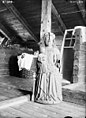
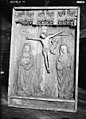
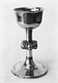
Category:Humla kyrka
| Object location | | View all coordinates using: OpenStreetMap |
|---|
church building in Ulricehamn Municipality, Västra Götaland County, Sweden  | |||||
| Upload media | |||||
| Instance of | |||||
|---|---|---|---|---|---|
| Location | Ulricehamn Municipality, Västra Götaland County, Sweden | ||||
| Diocese | |||||
| Connects with |
| ||||
| Has use |
| ||||
| Occupant | |||||
| Heritage designation |
| ||||
 | |||||
Svenska: Humla kyrka tillhör Redvägs församling i Skara stift i Ulricehamns kommun.
|
This is a category about an ecclesiastical monument in Sweden, number 21300000003214 in the RAÄ buildings database.
|
|
This is a category about a protected building in Sweden, number 21400000443857 in the RAÄ buildings database.
|
Media in category "Humla kyrka"
The following 30 files are in this category, out of 30 total.
-
 Humla kyrka - KMB - 16000200158412.jpg 778 × 600; 62 KB
-
 Humla kyrka - KMB - 16000200158413.jpg 345 × 600; 31 KB
-
 Humla kyrka - KMB - 16000200158414.jpg 517 × 600; 64 KB
-
 Humla kyrka - KMB - 16000200158415.jpg 884 × 600; 105 KB
-
 Humla kyrka - KMB - 16000200158417.jpg 802 × 600; 90 KB
-
 Humla kyrka - KMB - 16000200158418.jpg 844 × 600; 77 KB
-
 Humla kyrka - KMB - 16000200158421.jpg 970 × 600; 94 KB
-
 Humla kyrka - KMB - 16000200158423.jpg 861 × 600; 82 KB
-
 Humla kyrka - KMB - 16000200158424.jpg 430 × 600; 83 KB
-
 Humla kyrka - KMB - 16000200158428.jpg 437 × 600; 51 KB
-
 Humla kyrka - KMB - 16000200158429.jpg 433 × 600; 52 KB
-
 Humla kyrka - KMB - 16000200158430.jpg 435 × 600; 48 KB
-
 Humla kyrka - KMB - 16000200158431.jpg 450 × 600; 76 KB
-
 Humla kyrka - KMB - 16000200158432.jpg 429 × 600; 62 KB
-
 Humla kyrka - KMB - 16000200158433.jpg 992 × 600; 85 KB
-
 Humla kyrka - KMB - 16000200158434.jpg 806 × 600; 104 KB
-
 Humla kyrka - KMB - 16000200158435.jpg 806 × 600; 121 KB
-
 Humla kyrka - KMB - 16000200158436.jpg 394 × 600; 35 KB
-
 Humla kyrka - KMB - 16000200158437.jpg 446 × 600; 29 KB
-
 Humla kyrka - KMB - 16000200158438.jpg 419 × 600; 23 KB
-
 Humla kyrka - KMB - 16000200158439.jpg 411 × 600; 26 KB
-
 Humla kyrka - KMB - 16000200158441.jpg 437 × 600; 42 KB
-
 Humla kyrka - KMB - 16000200158442.jpg 448 × 600; 27 KB
-
 Humla kyrka - KMB - 16000200158443.jpg 439 × 600; 28 KB
-
 Humla kyrka - KMB - 16000200158444.jpg 442 × 600; 24 KB
-
 Humla kyrka - KMB - 16000200158445.jpg 210 × 600; 16 KB
-
 Humla kyrka - KMB - 16000200158446.jpg 145 × 600; 6 KB
-
 Humla kyrka - KMB - 16000200158447.jpg 254 × 600; 21 KB
-
 Humla kyrka - KMB - 16000200158448.jpg 490 × 600; 41 KB
-
 Humla kyrka 01.JPG 2,255 × 3,193; 3.43 MB


