Category:Humshaugh
village in United Kingdom  | |||||
| Upload media | |||||
| Instance of | |||||
|---|---|---|---|---|---|
| Location | Northumberland, North East England, England | ||||
| Located in or next to body of water | |||||
| Said to be the same as | Humshaugh (Wikimedia duplicated page, civil parish) | ||||
 | |||||
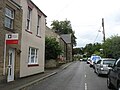
English: Humshaugh is a parish in Northumberland, England. This small village is just north of Chollerford, which is located near Chesters Fort on Hadrian's Wall and is about 21 miles west of Newcastle upon Tyne. The village of Humshaugh lies just off the military road running from Newcastle to Carlisle which was built by General Wade during the Jacobite rebellion. Other nearby villages include Low Brunton and Walwick.
Subcategories
This category has the following 9 subcategories, out of 9 total.
C
- Chesters, Humshaugh (3 F)
- The Crown Inn, Humshaugh (8 F)
H
- Haughton Castle (17 F)
- Humshaugh railway station (2 F)
L
- Lookwide Camp (3 F)
P
- St Peter's Church, Humshaugh (16 F)
W
- Humshaugh War Memorial (3 F)
- Wester Hall (4 F)
Media in category "Humshaugh"
The following 200 files are in this category, out of 278 total.
(previous page) (next page)-
 A prospect of Humshaugh - geograph.org.uk - 6479923.jpg 640 × 480; 110 KB
-
 A stretch of Hadrian's Wall near Black Carts Farm - geograph.org.uk - 3499146.jpg 2,592 × 1,944; 2.01 MB
-
 Aerial mast at Lincoln Hill - geograph.org.uk - 1353378.jpg 640 × 480; 120 KB
-
 Approach to the Barracks remains, Cilurnum - geograph.org.uk - 3650557.jpg 1,824 × 1,368; 933 KB
-
 B6318 heading east - geograph.org.uk - 3431160.jpg 640 × 480; 81 KB
-
 B6318 heading east - geograph.org.uk - 3431168.jpg 640 × 480; 69 KB
-
 B6318, Walwick - geograph.org.uk - 3351558.jpg 640 × 480; 499 KB
-
 B6320 - geograph.org.uk - 3100611.jpg 3,888 × 2,592; 1.25 MB
-
 B6320 at Heatheridge - geograph.org.uk - 3192322.jpg 640 × 481; 529 KB
-
 B6320, Layby near Heatheridge - geograph.org.uk - 3192324.jpg 640 × 481; 501 KB
-
 Barley field ripening south of Heatheridge - geograph.org.uk - 4584821.jpg 1,024 × 770; 349 KB
-
 Black Carts Farm (2) - geograph.org.uk - 1203832.jpg 640 × 480; 88 KB
-
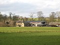 Black Carts Farm (3) - geograph.org.uk - 1217568.jpg 640 × 480; 68 KB
-
 Black Carts Farm - geograph.org.uk - 1017673.jpg 640 × 480; 78 KB
-
 Black Carts Farm - geograph.org.uk - 1203823.jpg 640 × 480; 96 KB
-
 Black Carts Farm - geograph.org.uk - 3499139.jpg 2,592 × 1,944; 2.1 MB
-
 Black Carts Turret - geograph.org.uk - 2890218.jpg 800 × 600; 122 KB
-

-

-
 BPSA Scouts climbing.JPG 401 × 385; 15 KB
-
 Bridleway near Styden Wood - geograph.org.uk - 4584689.jpg 1,024 × 768; 211 KB
-
 Bridleway north of Walwick - geograph.org.uk - 4583165.jpg 1,024 × 768; 219 KB
-
 Bridleway north of Walwick - geograph.org.uk - 4583175.jpg 1,024 × 768; 209 KB
-
 Bridleway west of Leazes Head - geograph.org.uk - 4584715.jpg 1,024 × 768; 159 KB
-
 Bucolic scene on Haughton Pasture - geograph.org.uk - 3205349.jpg 640 × 480; 70 KB
-
 Burn Lane, Humshaugh - geograph.org.uk - 4585701.jpg 1,024 × 768; 206 KB
-
 Chesters Roman Fort, south side - geograph.org.uk - 5491321.jpg 1,024 × 768; 285 KB
-
 Chesters Stud - geograph.org.uk - 1018648.jpg 640 × 480; 82 KB
-
 Chollerford Weir on the River North Tyne - geograph.org.uk - 2434245.jpg 3,888 × 2,592; 6.22 MB
-

-
 Cockplay - geograph.org.uk - 3100598.jpg 3,344 × 2,592; 964 KB
-
 Coldwell Farm - geograph.org.uk - 1044018.jpg 600 × 450; 119 KB
-
 Coldwell Farm - geograph.org.uk - 1083014.jpg 640 × 480; 104 KB
-

-

-
 Cottage at Haughton Pasture - geograph.org.uk - 4584907.jpg 1,024 × 768; 178 KB
-
 Cottage at Haughton Pasture - geograph.org.uk - 4584951.jpg 1,024 × 768; 239 KB
-
 Cottage at Haughton Strother - geograph.org.uk - 2199795.jpg 600 × 450; 299 KB
-
 Cottage by the River North Tyne - geograph.org.uk - 4818227.jpg 1,897 × 771; 352 KB
-
 Country Road near Cockplay - geograph.org.uk - 1819790.jpg 640 × 480; 70 KB
-
 Cowper Hill - geograph.org.uk - 1043965.jpg 600 × 450; 101 KB
-
 Daffodils in bloom - geograph.org.uk - 1620924.jpg 640 × 480; 121 KB
-

-
 Dam on Unnamed Stream - geograph.org.uk - 3848194.jpg 1,066 × 800; 451 KB
-

-
 Disused quarry near Walwick - geograph.org.uk - 3205266.jpg 640 × 480; 96 KB
-
 Downstream River North Tyne - geograph.org.uk - 3650902.jpg 1,824 × 1,368; 1.15 MB
-
 Dried up Pond near Coldwell - geograph.org.uk - 3848190.jpg 1,066 × 800; 270 KB
-
 Driveway to Wester Hall, Haughton - geograph.org.uk - 1044046.jpg 600 × 450; 156 KB
-
 East Cockplay - geograph.org.uk - 3100606.jpg 3,888 × 2,592; 1,024 KB
-
 Easy Cockplay - geograph.org.uk - 2200661.jpg 600 × 450; 239 KB
-
 Entering Walwick - geograph.org.uk - 2890579.jpg 800 × 600; 151 KB
-
 Fairshaw Plantation - geograph.org.uk - 3100592.jpg 3,888 × 2,592; 1.14 MB
-
 Fairshaw Plantation - geograph.org.uk - 3100595.jpg 3,029 × 2,392; 924 KB
-
 Farm conversion at Coldwell - geograph.org.uk - 1044016.jpg 600 × 450; 109 KB
-
 Farmland and Cross Plantation - geograph.org.uk - 3243633.jpg 640 × 480; 69 KB
-

-

-
 Farmland by Haughton Castle - geograph.org.uk - 4696166.jpg 2,592 × 1,944; 1.8 MB
-
 Farmland east of Cross Plantation - geograph.org.uk - 3243624.jpg 640 × 480; 68 KB
-
 Farmland east of Green carts - geograph.org.uk - 3074919.jpg 640 × 480; 61 KB
-
 Farmland east of Haughton Strother - geograph.org.uk - 3074925.jpg 640 × 480; 82 KB
-
 Farmland east of The Scroggs - geograph.org.uk - 3086484.jpg 640 × 480; 114 KB
-
 Farmland north of Heatheridge - geograph.org.uk - 3086353.jpg 640 × 480; 89 KB
-
 Farmland north of Heatheridge Cottages - geograph.org.uk - 3086360.jpg 640 × 480; 110 KB
-
 Farmland south of Haughton Castle - geograph.org.uk - 3243609.jpg 640 × 480; 81 KB
-
 Farmland southwest of Keepershield - geograph.org.uk - 3086355.jpg 640 × 480; 99 KB
-
 Farmland west of Heatheridge - geograph.org.uk - 3086337.jpg 640 × 480; 101 KB
-
 Field Boundary - geograph.org.uk - 1819795.jpg 640 × 480; 100 KB
-
 Field crossed by ditch - geograph.org.uk - 5922813.jpg 1,999 × 970; 1.46 MB
-
 Field with cattle below Walwick - geograph.org.uk - 6479711.jpg 640 × 480; 77 KB
-
 Fields and woods on Graydon Hill - geograph.org.uk - 3499125.jpg 2,592 × 1,944; 2.12 MB
-
 Flat Calm on North Tyne - geograph.org.uk - 441297.jpg 640 × 480; 95 KB
-
 Footpath from Chollerford to Humshaugh - geograph.org.uk - 4585785.jpg 1,024 × 768; 220 KB
-
 Footpath near Heatheridge - geograph.org.uk - 6231630.jpg 640 × 480; 143 KB
-
 Footpath near Humshaugh Burn - geograph.org.uk - 4584982.jpg 1,024 × 768; 184 KB
-
 Footpath west of Humshaugh - geograph.org.uk - 4585779.jpg 1,024 × 768; 227 KB
-
 Ford on the River North Tyne^ - geograph.org.uk - 1044004.jpg 600 × 450; 94 KB
-
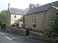 Former Methodist Chapel - Humshaugh - geograph.org.uk - 2066576.jpg 640 × 480; 75 KB
-
 Gate and field at Walwick Farmhouse - geograph.org.uk - 3270742.jpg 640 × 480; 81 KB
-
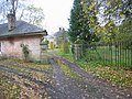
 Gatekeeper's Cottage, Haughton Castle - geograph.org.uk - 1044068.jpg 600 × 450; 151 KB
-
 Gates at Chesters - geograph.org.uk - 4583079.jpg 1,024 × 768; 272 KB
-
 Gateway and Lodge at Chesters - geograph.org.uk - 5024418.jpg 800 × 600; 136 KB
-
 Getting ready for the next 10 miles - geograph.org.uk - 2890746.jpg 800 × 600; 95 KB
-
 Grassland west of Leazes Head - geograph.org.uk - 4584802.jpg 1,024 × 768; 174 KB
-
 Graveyard - geograph.org.uk - 4727226.jpg 640 × 480; 123 KB
-
 Graydons Hill - geograph.org.uk - 4583137.jpg 1,024 × 768; 181 KB
-
 Grazing, Walwick - geograph.org.uk - 3431158.jpg 640 × 480; 46 KB
-
 Green Carts - geograph.org.uk - 3100582.jpg 3,592 × 2,208; 668 KB
-
 Green Carts - geograph.org.uk - 3100600.jpg 3,632 × 2,133; 775 KB
-
 Hackbank Cottages - geograph.org.uk - 1195398.jpg 640 × 480; 91 KB
-
 Hadrian's Wall - geograph.org.uk - 6233670.jpg 640 × 480; 137 KB
-
 Hadrians Wall at Blackcarts, Humshaugh, Chollerford, Northumberland 1.jpg 1,940 × 2,587; 1.6 MB
-
 Hadrians Wall at Blackcarts, Humshaugh, Chollerford, Northumberland 2.jpg 1,940 × 2,587; 1.56 MB
-
 Haughton Castle Lodge - geograph.org.uk - 1083312.jpg 640 × 480; 86 KB
-
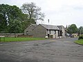
 Haughton Paper Mill - geograph.org.uk - 98919.jpg 640 × 480; 100 KB
-
 Haughton Pasture (2) - geograph.org.uk - 3205346.jpg 640 × 480; 74 KB
-
 Haughton Pasture - geograph.org.uk - 1091714.jpg 640 × 383; 81 KB
-
 Haughton Pasture - geograph.org.uk - 3100608.jpg 3,837 × 2,515; 937 KB
-
 Haughton Pasture - geograph.org.uk - 3192332.jpg 640 × 480; 467 KB
-
 Haughton Pasture - geograph.org.uk - 3205342.jpg 640 × 480; 79 KB
-
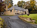
 Haughton Strother Farmhouse - geograph.org.uk - 2199799.jpg 600 × 450; 311 KB
-
 Haughton Strother Gravel Pits - geograph.org.uk - 2200639.jpg 600 × 450; 233 KB
-
 Haughton Strother Gravel Works - geograph.org.uk - 1576395.jpg 640 × 480; 129 KB
-
 Heading towards Milecastle 28 - geograph.org.uk - 2890559.jpg 800 × 600; 143 KB
-
 Heading towards Walwick - geograph.org.uk - 2890418.jpg 800 × 600; 141 KB
-
 Heatheridge - geograph.org.uk - 4584888.jpg 1,024 × 768; 171 KB
-
 Heatheridge Cottages - geograph.org.uk - 1043985.jpg 600 × 450; 139 KB
-
 Heatheridge House (Humshaugh) - geograph.org.uk - 3848207.jpg 1,066 × 800; 268 KB
-
 Heatheridge House - geograph.org.uk - 1043989.jpg 600 × 450; 95 KB
-
 Humshaugh - geograph.org.uk - 1272850.jpg 640 × 395; 93 KB
-
 Humshaugh - geograph.org.uk - 1272859.jpg 640 × 427; 100 KB
-
 Humshaugh - geograph.org.uk - 3099570.jpg 3,833 × 1,809; 430 KB
-
 Humshaugh - geograph.org.uk - 3193238.jpg 640 × 481; 468 KB
-
 Humshaugh - geograph.org.uk - 3193251.jpg 640 × 481; 453 KB
-
 Humshaugh - geograph.org.uk - 3193588.jpg 640 × 480; 631 KB
-
 Humshaugh - geograph.org.uk - 3193592.jpg 480 × 640; 480 KB
-
 Humshaugh - geograph.org.uk - 3193598.jpg 640 × 481; 506 KB
-

-
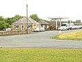
 Humshaugh Medical Centre - geograph.org.uk - 841295.jpg 640 × 480; 63 KB
-
 Humshaugh Methodist Church - geograph.org.uk - 3193608.jpg 640 × 481; 459 KB
-
 Humshaugh School - geograph.org.uk - 4585773.jpg 1,024 × 768; 162 KB
-
 Humshaugh Surgery, East Lea - geograph.org.uk - 3193261.jpg 640 × 481; 488 KB
-
 Humshaugh Village Hall - geograph.org.uk - 3193255.jpg 640 × 481; 629 KB
-
 Humshaugh Village Shop - geograph.org.uk - 4585770.jpg 1,024 × 766; 215 KB
-
 Humshaugh Village Shop - geograph.org.uk - 4727218.jpg 640 × 480; 81 KB
-
 Humshaugh, Farm Lane - geograph.org.uk - 3193593.jpg 480 × 640; 499 KB
-
 In Humshaugh village - geograph.org.uk - 4696188.jpg 2,592 × 1,944; 1.32 MB
-
 Island in the River North Tyne - geograph.org.uk - 4818233.jpg 1,066 × 800; 262 KB
-
 Keepershield - geograph.org.uk - 1272836.jpg 640 × 431; 144 KB
-
 Keepershield Farm - geograph.org.uk - 1043992.jpg 600 × 450; 110 KB
-
 Keepershield Farm Buildings - geograph.org.uk - 1043997.jpg 600 × 450; 95 KB
-
 Keepershield Farmhouse - geograph.org.uk - 1043995.jpg 600 × 450; 128 KB
-
 Ladder Stile and Signpost - geograph.org.uk - 3188977.jpg 640 × 480; 468 KB
-
 Layby at Heatheridge - geograph.org.uk - 3192311.jpg 640 × 481; 539 KB
-
 Leazes Head - geograph.org.uk - 3100615.jpg 3,888 × 2,520; 1.48 MB
-
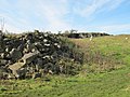
 Lime kiln near Walwick (2) - geograph.org.uk - 3205221.jpg 640 × 480; 123 KB
-
 Lime kiln near Walwick (3) - geograph.org.uk - 3205228.jpg 640 × 480; 135 KB
-
 Lime kiln near Walwick - geograph.org.uk - 3205214.jpg 640 × 480; 101 KB
-
 Lime kiln near Walwick - geograph.org.uk - 5023148.jpg 720 × 540; 125 KB
-
 Lime kilns at Green Carts (2) - geograph.org.uk - 3074911.jpg 640 × 480; 151 KB
-
 Lime kilns at Green Carts - arch - geograph.org.uk - 3074912.jpg 480 × 640; 110 KB
-

-
 Lime kilns at Green Carts - geograph.org.uk - 3074909.jpg 640 × 480; 142 KB
-
 Lime kilns at Green Carts - geograph.org.uk - 3905867.jpg 640 × 480; 65 KB
-
 Lincoln Hill - geograph.org.uk - 1043975.jpg 600 × 450; 108 KB
-
 Lincoln Hill - geograph.org.uk - 3188973.jpg 640 × 480; 458 KB
-
 Lincoln Hill - geograph.org.uk - 4583147.jpg 1,024 × 768; 193 KB
-
 Lincoln Hill House - geograph.org.uk - 1043974.jpg 600 × 450; 139 KB
-
 Lines of mown grass - geograph.org.uk - 5922825.jpg 2,000 × 1,079; 2.04 MB
-
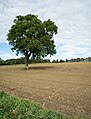 Lone tree in earthen field - geograph.org.uk - 5923925.jpg 2,000 × 2,622; 4.22 MB
-
 Looking east along the B6318 - geograph.org.uk - 2890720.jpg 800 × 600; 123 KB
-
 Looking east along the North Tyne - geograph.org.uk - 2890779.jpg 800 × 600; 110 KB
-
 Looking north along a minor road - geograph.org.uk - 2890567.jpg 800 × 600; 129 KB
-
 Looking west along the North Tyne - geograph.org.uk - 2890783.jpg 800 × 600; 104 KB
-
 Marshy grassland near Humshaugh Burn - geograph.org.uk - 4584993.jpg 1,024 × 768; 242 KB
-

-
 Military Helicopter near Humshaugh - geograph.org.uk - 3848183.jpg 1,066 × 800; 123 KB
-
 Minor road at Heatheridge Cottages - geograph.org.uk - 4584867.jpg 1,024 × 768; 283 KB
-
 Minor road near Cowper Hill - geograph.org.uk - 4583126.jpg 1,024 × 768; 235 KB
-
 Minor road near Graydons Hill - geograph.org.uk - 4583133.jpg 1,024 × 768; 191 KB
-
 Minor road north of Chesters - geograph.org.uk - 4583098.jpg 1,024 × 768; 282 KB
-
 Motorcycles on the B6320 - geograph.org.uk - 3192329.jpg 640 × 481; 503 KB
-
 Muddy Bridleway near Heatheridge - geograph.org.uk - 1043983.jpg 600 × 450; 123 KB
-
 Muddy bridleway to Walwick - geograph.org.uk - 3086340.jpg 640 × 480; 147 KB
-
 Near East Cockplay - geograph.org.uk - 6231628.jpg 640 × 480; 154 KB
-
 Near Walwick - geograph.org.uk - 6231637.jpg 2,048 × 1,536; 1.21 MB
-
 Near Walwick 2 - geograph.org.uk - 6231647.jpg 640 × 480; 144 KB
-

-
 Old lane north of Humshaugh - geograph.org.uk - 4585622.jpg 1,024 × 768; 288 KB
-
 Old tree by Humshaugh Burn - geograph.org.uk - 4585665.jpg 1,024 × 768; 366 KB
-

-
 Outlet Pipe form Dam on Unnamed Stream - geograph.org.uk - 3848196.jpg 1,066 × 800; 444 KB
-
 Pant and Almshouses - Humshaugh - geograph.org.uk - 2066614.jpg 640 × 480; 87 KB
-
 Pasture north of Heatheridge Bridge - geograph.org.uk - 4584966.jpg 1,024 × 768; 280 KB
-

-
 Pastures north of Hetheridge Bridge - geograph.org.uk - 3205337.jpg 640 × 480; 77 KB
-
 Pastures southeast of Keepershield - geograph.org.uk - 3205356.jpg 640 × 480; 74 KB
-
 Pastures west of Spruce Wood - geograph.org.uk - 3243603.jpg 640 × 480; 79 KB
-
 Play That Trumpet - geograph.org.uk - 5526769.jpg 2,592 × 3,300; 2 MB
-
 Pond near Haughton Castle - geograph.org.uk - 1195427.jpg 640 × 480; 126 KB
-
 Poppies in a rape field - geograph.org.uk - 868920.jpg 640 × 359; 71 KB
-
 Ready....Aim..... - geograph.org.uk - 5526774.jpg 4,175 × 3,238; 2.54 MB
-
 River North Tyne - geograph.org.uk - 3191195.jpg 640 × 480; 474 KB
-
 River North Tyne - geograph.org.uk - 3848187.jpg 1,066 × 800; 217 KB
-
 River North Tyne - geograph.org.uk - 4210306.jpg 4,192 × 2,554; 1.57 MB
-
 River North Tyne at Chesters - geograph.org.uk - 3189003.jpg 640 × 480; 483 KB
-
 River North Tyne, Chollerford - geograph.org.uk - 3191190.jpg 640 × 481; 441 KB
-
 River Tyne at Chesters Fort - geograph.org.uk - 5526871.jpg 3,888 × 2,592; 2.5 MB
-
 Riverside Campsite - Chollerford - geograph.org.uk - 4118248.jpg 4,180 × 2,567; 3.89 MB
-
 Riverside Tea Rooms and Filling Station, Chollerford - geograph.org.uk - 2450985.jpg 4,320 × 3,240; 1.33 MB
-
 Road west of Lincoln Hill - geograph.org.uk - 4583158.jpg 1,024 × 768; 235 KB
-
 Romans Go Home - geograph.org.uk - 5526757.jpg 3,251 × 2,592; 2.19 MB
-

-
 Rye Hill - geograph.org.uk - 1129343.jpg 640 × 480; 55 KB
-
 Rye Hill Farm - geograph.org.uk - 3499133.jpg 2,592 × 1,944; 1.38 MB
-
 Seasonal pond on Humshaugh Burn - geograph.org.uk - 4584863.jpg 1,024 × 768; 234 KB
-
 Sheep grazing in Humshaugh - geograph.org.uk - 3243596.jpg 640 × 480; 114 KB
-
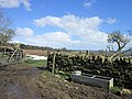
 Sheep pens near West Cockplay - geograph.org.uk - 3086318.jpg 640 × 480; 83 KB
-
 Silage crop near Humshaugh - geograph.org.uk - 4585639.jpg 1,024 × 770; 222 KB


_-_geograph.org.uk_-_1203832.jpg)
_-_geograph.org.uk_-_1217568.jpg)


,_Haughton_Strothers_-_geograph.org.uk_-_2200633.jpg)


_-_geograph.org.uk_-_3205346.jpg)


_-_geograph.org.uk_-_3848207.jpg)


_-_geograph.org.uk_-_3205221.jpg)
_-_geograph.org.uk_-_3205228.jpg)


_-_geograph.org.uk_-_3074911.jpg)


_by_Humshaugh_Burn_-_geograph.org.uk_-_4585600.jpg)


