Category:Hunsdon
village and civil parish in Hertfordshire, England  | |||||
| Upload media | |||||
| Instance of | |||||
|---|---|---|---|---|---|
| Location | East Hertfordshire, Hertfordshire, East of England, England | ||||
 | |||||
Subcategories
This category has the following 4 subcategories, out of 4 total.
D
- St Dunstan's Church, Hunsdon (9 F)
H
- Hunsdon House (2 F)
- Hunsdon Mead (9 F)
- Hunsdon War Memorial (2 F)
Media in category "Hunsdon"
The following 146 files are in this category, out of 146 total.
-
 A square from the air - geograph.org.uk - 611440.jpg 640 × 575; 51 KB
-
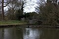
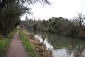
 Approaching Roydon Lock - geograph.org.uk - 4917201.jpg 640 × 424; 82 KB
-
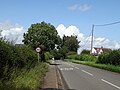 B180 approaching Hunsdon - geograph.org.uk - 6218217.jpg 800 × 600; 115 KB
-
 B180 through Hunsdon - geograph.org.uk - 6218248.jpg 800 × 600; 105 KB
-
 B180 towards Hunsdon - geograph.org.uk - 6218209.jpg 800 × 600; 224 KB
-
 Barns, Fillets Farm - geograph.org.uk - 4594720.jpg 640 × 428; 105 KB
-
 Brickhouse Farm - geograph.org.uk - 1445344.jpg 640 × 480; 103 KB
-
 Bridge near Hunsdon Lock - geograph.org.uk - 6092716.jpg 5,202 × 3,465; 3.96 MB
-
 Bridge over the River Stort - geograph.org.uk - 3502856.jpg 640 × 430; 108 KB
-
 Building at Roydon Lock - geograph.org.uk - 3502867.jpg 640 × 430; 117 KB
-
 Canal towing path approach to Roydon Lock from the east - geograph.org.uk - 5129134.jpg 4,608 × 3,456; 4.99 MB
-
 Cereal crop near Hunsdon - geograph.org.uk - 6218220.jpg 800 × 600; 128 KB
-
 Cereal crop off Hunsdon Road (B180) - geograph.org.uk - 6218200.jpg 800 × 600; 131 KB
-
 Channel to the River Stort - geograph.org.uk - 3502931.jpg 640 × 430; 113 KB
-
 Clapboard houses on High Street, Hunsdon - geograph.org.uk - 6218241.jpg 800 × 604; 107 KB
-
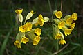 Cowslip Closeup - geograph.org.uk - 4917187.jpg 640 × 424; 40 KB
-
 Cowslips in Hunston Mead - geograph.org.uk - 4917177.jpg 640 × 424; 59 KB
-

-
 Drury Lane, Hunsdon, Hertfordshire - geograph.org.uk - 2027038.jpg 1,024 × 768; 209 KB
-
 Eastwick Road west of Harlow - geograph.org.uk - 6119955.jpg 1,872 × 1,204; 1.41 MB
-

-
 Elizabeth II postbox, Hunsdon Post Office - geograph.org.uk - 6219812.jpg 2,227 × 4,193; 2.2 MB
-
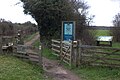
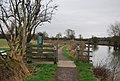 Entrance to Hunsdon Mead - geograph.org.uk - 3502949.jpg 640 × 430; 80 KB
-

-
 Former parachute packing store - geograph.org.uk - 4544426.jpg 640 × 480; 127 KB
-
 Former shelter, RAF Hunsdon - geograph.org.uk - 4542218.jpg 640 × 428; 167 KB
-
 Giant pylon off the Harcamlow Way - geograph.org.uk - 5316367.jpg 4,608 × 3,456; 3.65 MB
-
 Harcamlow Way - geograph.org.uk - 3503013.jpg 640 × 430; 62 KB
-
 Harcamlow Way bordering Moat Wood - geograph.org.uk - 5214350.jpg 4,608 × 3,456; 5.87 MB
-
 Harcamlow Way, Stort Navigation - geograph.org.uk - 3512824.jpg 640 × 430; 75 KB
-
 Hedgerow tree - geograph.org.uk - 3895180.jpg 640 × 480; 110 KB
-
 High Street, Hunsdon - geograph.org.uk - 6218240.jpg 800 × 600; 79 KB
-
 House on the B180, Hunsdonbury - geograph.org.uk - 6218214.jpg 800 × 531; 109 KB
-
 Hunsdon Brook - geograph.org.uk - 320442.jpg 640 × 428; 208 KB
-
 Hunsdon church - geograph.org.uk - 3885038.jpg 640 × 480; 141 KB
-
 Hunsdon Convenience Store and Post Office - geograph.org.uk - 6219814.jpg 5,184 × 3,888; 3.92 MB
-
 Hunsdon House- a rather limited view - geograph.org.uk - 4779820.jpg 4,320 × 3,240; 3.49 MB
-
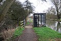
 Hunsdon Lock - geograph.org.uk - 2430049.jpg 1,024 × 768; 394 KB
-
 Hunsdon Lock - geograph.org.uk - 3512843.jpg 640 × 430; 79 KB
-
 Hunsdon Lock - geograph.org.uk - 3512845.jpg 640 × 430; 71 KB
-
 Hunsdon Lock - geograph.org.uk - 3512848.jpg 640 × 430; 110 KB
-
 Hunsdon Lodge Farm (geograph 4542209).jpg 640 × 428; 105 KB
-
 Hunsdon Lodge Farm - geograph.org.uk - 320444.jpg 640 × 428; 92 KB
-
 Hunsdon Mead - geograph.org.uk - 3502956.jpg 640 × 430; 66 KB
-
 Hunsdon Mead - geograph.org.uk - 3503007.jpg 640 × 430; 44 KB
-
 Hunsdon Mead - geograph.org.uk - 3503009.jpg 640 × 430; 45 KB
-
 Hunsdon Mead - geograph.org.uk - 3503029.jpg 640 × 430; 47 KB
-
 Hunsdon Mead - geograph.org.uk - 3503031.jpg 640 × 430; 40 KB
-
 Hunsdon Mead - geograph.org.uk - 3503036.jpg 640 × 430; 50 KB
-
 Hunsdon Mead - geograph.org.uk - 3503117.jpg 640 × 430; 53 KB
-
 Hunsdon Mead - geograph.org.uk - 3512761.jpg 640 × 430; 47 KB
-
 Hunsdon Mead - geograph.org.uk - 3512763.jpg 640 × 430; 48 KB
-
 Hunsdon Mead - geograph.org.uk - 3512767.jpg 640 × 430; 46 KB
-
 Hunsdon Mead - geograph.org.uk - 3512804.jpg 640 × 430; 86 KB
-
 Hunsdon Mead - geograph.org.uk - 3512829.jpg 640 × 430; 57 KB
-
 Hunsdon Mead - geograph.org.uk - 3512837.jpg 640 × 430; 73 KB
-
 Hunsdon Mead nature reserve - geograph.org.uk - 2430028.jpg 1,024 × 768; 236 KB
-
 Hunsdon Mead nature reserve - geograph.org.uk - 2430032.jpg 1,024 × 768; 339 KB
-
 Hunsdon Mead Nature Reserve - geograph.org.uk - 5191360.jpg 4,608 × 3,456; 5.1 MB
-
 Hunsdon Mead Nature Reserve, Roydon - geograph.org.uk - 4212361.jpg 3,648 × 2,052; 1.44 MB
-
 Hunsdon Mead Nature Reserve, Roydon - geograph.org.uk - 4212366.jpg 1,600 × 900; 337 KB
-
 Hunsdon Mead Nature Reserve, Roydon - geograph.org.uk - 4212371.jpg 3,648 × 2,052; 1.57 MB
-
 Hunsdon Mill Lock – view south-west - geograph.org.uk - 5191355.jpg 4,608 × 3,456; 4.15 MB
-
 Hunsdon Road (B180) - geograph.org.uk - 6218203.jpg 800 × 600; 133 KB
-
 Hunsdon Village Centre, Hertfordshire - geograph.org.uk - 2027030.jpg 1,024 × 768; 268 KB
-
 Hunsdon Village Hall - geograph.org.uk - 6218237.jpg 800 × 467; 96 KB
-
 Hunsdon Village Hall, Hunsdon, Hertfordshire - geograph.org.uk - 2027025.jpg 1,024 × 768; 248 KB
-
 Hunsdon Village Sign, Hertfordshire - geograph.org.uk - 2026999.jpg 768 × 1,024; 422 KB
-
 Hunsdon Village Sign, Hertfordshire - geograph.org.uk - 2027004.jpg 1,024 × 768; 383 KB
-
 Hunsdon Village, Hertfordshire - geograph.org.uk - 2027009.jpg 1,024 × 768; 250 KB
-
 Hunsdon, church and churchyard - geograph.org.uk - 3603638.jpg 711 × 1,024; 126 KB
-
 Hunsdon, view from the village pump - geograph.org.uk - 3603577.jpg 1,024 × 768; 147 KB
-
 Hunsdonbury lower churchyard - geograph.org.uk - 1445405.jpg 640 × 480; 244 KB
-
 Hunsdonbury lower churchyard - lych gate - geograph.org.uk - 1445409.jpg 640 × 480; 211 KB
-
 Incognito - geograph.org.uk - 1317271.jpg 435 × 640; 76 KB
-

-
 Lee and Stort Navigation, Lock no. 12 Hunsdon Mill Lock - geograph.org.uk - 5191351.jpg 4,608 × 3,456; 4.13 MB
-
 Looking across the Stort Navigation - geograph.org.uk - 3512773.jpg 640 × 430; 84 KB
-
 Mead Lodge garden - geograph.org.uk - 6092688.jpg 5,202 × 3,465; 3.52 MB
-
 National Grid power line 4ZM - geograph.org.uk - 4594688.jpg 480 × 640; 127 KB
-
 New train near Roydon - geograph.org.uk - 2430015.jpg 640 × 480; 115 KB
-
 Newly ploughed field by Eastwick Road - geograph.org.uk - 1445367.jpg 640 × 480; 127 KB
-
 North Lodge, Hunsdonbury, Herts. - geograph.org.uk - 216931.jpg 640 × 480; 84 KB
-
 Oak Park - geograph.org.uk - 320313.jpg 640 × 428; 84 KB
-
 Old Clapboard Cottages, Hunsdon, Hertfordshire - geograph.org.uk - 2027040.jpg 1,024 × 768; 226 KB
-
 Old Clapboard Cottages, Hunsdon, Hertfordshire - geograph.org.uk - 2027044.jpg 1,024 × 768; 331 KB
-
 Old Village Pump, Hunsdon, Hertfordshire - geograph.org.uk - 2027036.jpg 768 × 1,024; 338 KB
-
 Path due west to the south of Olives Farm - geograph.org.uk - 5129125.jpg 4,608 × 3,456; 4.64 MB
-
 Ploughed field south of Fillets Farm - geograph.org.uk - 4594753.jpg 640 × 480; 156 KB
-
 Ploughing in the stubble - geograph.org.uk - 1445373.jpg 640 × 480; 129 KB
-
 Rain clouds to the south of River Stort - geograph.org.uk - 6095127.jpg 5,202 × 3,465; 2.72 MB
-
 River Stort - geograph.org.uk - 3502858.jpg 640 × 430; 110 KB
-
 River Stort at Roydon Mead - geograph.org.uk - 6092727.jpg 5,202 × 3,465; 3.52 MB
-
 River Stort near Roydon - geograph.org.uk - 6092732.jpg 5,202 × 3,465; 2.65 MB
-
 River Stort near Roydon lock - geograph.org.uk - 6095132.jpg 5,202 × 3,465; 4.23 MB
-
 River Stort, hidden houseboat - geograph.org.uk - 6092733.jpg 5,202 × 3,465; 4.59 MB
-
 River Stort, Three Forests Way near Roydon - geograph.org.uk - 6092736.jpg 5,202 × 3,465; 3.44 MB
-
 Roydon Lock - geograph.org.uk - 6095159.jpg 5,202 × 3,465; 4.67 MB
-
 Roydon Lock - geograph.org.uk - 6220173.jpg 4,608 × 3,456; 6.3 MB
-
 Roydon Lock dog - geograph.org.uk - 6095161.jpg 5,202 × 3,465; 3.93 MB
-
 Roydon Mead - geograph.org.uk - 3503035.jpg 640 × 430; 57 KB
-
 Roydon Mead - geograph.org.uk - 3503121.jpg 640 × 430; 81 KB
-
 Rural postbox - geograph.org.uk - 3885023.jpg 640 × 480; 198 KB
-

-
 Sheep, Eastwick Mead - geograph.org.uk - 3512832.jpg 640 × 430; 74 KB
-

-
 Sign for the Crown, Hunsdon - geograph.org.uk - 6218235.jpg 514 × 800; 66 KB
-
 Sign for the Fox ^ Hounds, Hunsdon - geograph.org.uk - 6218227.jpg 800 × 740; 184 KB
-
 Sluice by the Stort Navigation - geograph.org.uk - 3502929.jpg 640 × 430; 97 KB
-
 Sluice mechanism on the Stort Navigation - geograph.org.uk - 2430022.jpg 480 × 640; 197 KB
-
 South-facing window, Hunsdon church - geograph.org.uk - 3602401.jpg 722 × 1,024; 222 KB
-
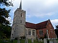
 St Dunstan's Church, Hunsdon - geograph.org.uk - 3602410.jpg 1,024 × 867; 192 KB
-
 St Dunstan's, Hunsdon - geograph.org.uk - 4779795.jpg 4,320 × 3,240; 4.69 MB
-
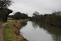
 Stort Navigation - geograph.org.uk - 3502872.jpg 640 × 430; 90 KB
-
 Stort Navigation - geograph.org.uk - 3502919.jpg 640 × 430; 81 KB
-
 Stort Navigation - geograph.org.uk - 3502934.jpg 640 × 430; 85 KB
-
 Stort Navigation - geograph.org.uk - 3503004.jpg 640 × 430; 83 KB
-
 Stort Navigation - geograph.org.uk - 3503027.jpg 640 × 430; 49 KB
-
 Stort Navigation - geograph.org.uk - 3503111.jpg 640 × 430; 59 KB
-
 Stort Navigation - geograph.org.uk - 3503115.jpg 640 × 430; 51 KB
-
 Stort Navigation - geograph.org.uk - 3503123.jpg 640 × 430; 66 KB
-
 Stort Navigation - geograph.org.uk - 3512826.jpg 640 × 430; 66 KB
-
 Stort Navigation, bridges 7A and 8 - geograph.org.uk - 2430006.jpg 1,024 × 768; 464 KB
-
 Stort Valley Path - geograph.org.uk - 3512800.jpg 640 × 430; 79 KB
-
 Swan, Stort Navigation - geograph.org.uk - 3502916.jpg 640 × 430; 67 KB
-
 The centre of Hunsdon - geograph.org.uk - 3885055.jpg 640 × 428; 95 KB
-
 The Crown Public House, Hunsdon, Hertfordshire - geograph.org.uk - 2027027.jpg 1,024 × 768; 233 KB
-
 The Crown, Hunsdon - geograph.org.uk - 6218232.jpg 800 × 578; 125 KB
-
 The Crown, Hunsdon, Hertfordshire - geograph.org.uk - 2027012.jpg 1,024 × 768; 222 KB
-
 The Fox ^ Hounds, Hunsdon - geograph.org.uk - 6218225.jpg 800 × 543; 93 KB
-
 The Old Post Cottage, Hunsdon, Hertfordshire - geograph.org.uk - 2027031.jpg 1,024 × 768; 255 KB
-

-
 Three Forest Way, Stort Navigation - geograph.org.uk - 3512819.jpg 640 × 430; 73 KB
-
 Three Forests Way at Hunsdon Mead nature reserve - geograph.org.uk - 6092725.jpg 5,202 × 3,465; 2.71 MB
-
 Towing path passing Roydon Lock - geograph.org.uk - 5129151.jpg 4,608 × 3,456; 6.64 MB
-
 Track to Bonningtons Farm - geograph.org.uk - 6218206.jpg 800 × 600; 139 KB
-
 Train, West Anglia Line - geograph.org.uk - 3502937.jpg 640 × 430; 87 KB
-
 Train, West Anglia Line - geograph.org.uk - 3502954.jpg 640 × 430; 97 KB
-
 Trees on the bank of the Stort Navigation, Roydon - geograph.org.uk - 4212385.jpg 3,582 × 2,015; 1.58 MB
-
 Village sign at Hunsdon, Herts. - geograph.org.uk - 216899.jpg 640 × 480; 97 KB
-
 Waterfall at the outlet of a small lake - geograph.org.uk - 1447092.jpg 640 × 480; 220 KB
-
 West Anglia Line - geograph.org.uk - 3502922.jpg 640 × 430; 63 KB
-
 Woodland beside the B180 - geograph.org.uk - 6218208.jpg 800 × 600; 239 KB
-
 Woodland by the Stort Navigation - geograph.org.uk - 3502923.jpg 640 × 430; 128 KB
-
 Woodland by the Stort Navigation - geograph.org.uk - 3502926.jpg 640 × 430; 126 KB
-
 Woodland by the Stort Navigation - geograph.org.uk - 3502936.jpg 640 × 430; 115 KB


_-_geograph.org.uk_-_6218200.jpg)


.jpg)


_-_geograph.org.uk_-_6218203.jpg)


