Category:Hunshelf
English: Hunshelf is a civil parish in the Metropolitan Borough of Barnsley. At the 2001 census it had a population of 324.
Nederlands: Hunshelf is een civil parish in het bestuurlijke gebied Barnsley, in het Engelse graafschap South Yorkshire. De civil parish telt
village in the United Kingdom | |||||
| Upload media | |||||
| Instance of | |||||
|---|---|---|---|---|---|
| Location | Barnsley, South Yorkshire, Yorkshire and the Humber, England | ||||
| Population |
| ||||
 | |||||
Media in category "Hunshelf"
The following 200 files are in this category, out of 324 total.
(previous page) (next page)-

-
 'Hands Off' at Green Moor, near Wortley - geograph.org.uk - 1828055.jpg 2,576 × 1,932; 1.78 MB
-

-

-
 1905 Stocksbridge Hunshelf Reservoir - geograph.org.uk - 6790864.jpg 751 × 1,024; 316 KB
-
 A fine mid 19thC house - geograph.org.uk - 2374882.jpg 3,296 × 2,472; 1.94 MB
-
 A616 towards Sheffield - geograph.org.uk - 6098772.jpg 800 × 600; 127 KB
-
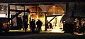
 Admiring the steam, Wortley Top Forge - geograph.org.uk - 2586702.jpg 1,024 × 768; 223 KB
-
 All lines lead to Mucky Lane - geograph.org.uk - 4881886.jpg 3,072 × 1,728; 3.72 MB
-
 An old sheep dip^ - geograph.org.uk - 4876590.jpg 800 × 600; 143 KB
-
 Approaching Green Moor - geograph.org.uk - 916679.jpg 640 × 480; 69 KB
-
 Award at Green Moor - geograph.org.uk - 6724843.jpg 1,024 × 573; 207 KB
-
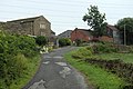
 Back Lane, Humshelf - geograph.org.uk - 6591754.jpg 2,000 × 1,327; 850 KB
-
 Benchmark on a gatepost by Tofts Lane - geograph.org.uk - 2853612.jpg 3,072 × 2,304; 1.4 MB
-
 Bend on the Black Moor bridleway, Hunshelf - geograph.org.uk - 6592887.jpg 2,000 × 1,500; 1.29 MB
-
 Between the lines - geograph.org.uk - 4883191.jpg 3,072 × 1,728; 2.71 MB
-
 Black Moor Farm - geograph.org.uk - 929151.jpg 640 × 407; 94 KB
-
 Black ^ White Squares on Thurgoland Bridge - geograph.org.uk - 2374922.jpg 3,169 × 1,854; 1.53 MB
-
 Blackmoor PSD - geograph.org.uk - 1905025.jpg 3,742 × 2,494; 4.22 MB
-
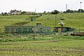
 Blackmoor PSD entrance gates - geograph.org.uk - 1904693.jpg 3,204 × 2,136; 2.98 MB
-
 Bluebell woods, Forge Rocher - geograph.org.uk - 2386101.jpg 2,448 × 3,264; 2.99 MB
-
 Bridge and stepping stones - geograph.org.uk - 3285249.jpg 1,024 × 768; 176 KB
-
 Bridge over the Don - geograph.org.uk - 3237340.jpg 1,024 × 768; 320 KB
-
 Bridge over the River Don - geograph.org.uk - 816104.jpg 640 × 462; 137 KB
-

-

-
 Bridleway leaving Sheffield Road, Hunshelf - geograph.org.uk - 6592877.jpg 2,000 × 1,497; 1.03 MB
-
 Bridleway southwards from Pond Common Lane, Hunshelf - geograph.org.uk - 6592857.jpg 2,000 × 1,500; 1.11 MB
-
 By the River Don - geograph.org.uk - 1976576.jpg 1,024 × 768; 214 KB
-
 Carr Head Farm - geograph.org.uk - 2828188.jpg 3,072 × 2,304; 1.34 MB
-
 Carr Head Farm - geograph.org.uk - 4881898.jpg 3,072 × 1,728; 3.79 MB
-

-
 Cheese Bottom Farm sign - geograph.org.uk - 2228542.jpg 640 × 473; 27 KB
-
 Children's playground Green Moor - geograph.org.uk - 916378.jpg 640 × 480; 65 KB
-

-
 Community Building, Green Moor, near Wortley - geograph.org.uk - 1828051.jpg 2,024 × 1,350; 610 KB
-
 Cottages at Dean Head Farm - geograph.org.uk - 4878352.jpg 3,072 × 1,728; 3.79 MB
-
 Cross Lane - geograph.org.uk - 4864007.jpg 640 × 480; 52 KB
-
 Cross Lane, fields and pylons - geograph.org.uk - 3580465.jpg 750 × 563; 79 KB
-

-
 Dean Head Lane - geograph.org.uk - 3580501.jpg 750 × 563; 106 KB
-
 Dean Head Lane - geograph.org.uk - 4201188.jpg 3,575 × 2,736; 2.34 MB
-
 Dean Head Lane - geograph.org.uk - 4864000.jpg 640 × 480; 70 KB
-
 Don Valley landscape - geograph.org.uk - 4202661.jpg 4,801 × 1,566; 1.44 MB
-
 Drain beside Cross Lane - geograph.org.uk - 4864005.jpg 640 × 480; 87 KB
-
 Dry stone Barnsley Pennine wall - geograph.org.uk - 4772827.jpg 1,024 × 768; 149 KB
-
 Dyson Cote Farm - geograph.org.uk - 922040.jpg 640 × 480; 67 KB
-
 Electrical Cables Crossing Mucky lane - geograph.org.uk - 2313352.jpg 3,296 × 2,472; 1.12 MB
-

-
 Elizabeth II postbox on Green Moor Road, Green Moor - geograph.org.uk - 4863116.jpg 3,648 × 2,736; 2.16 MB
-
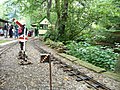 Entering the railway station, Wortley Top Forge - geograph.org.uk - 2586705.jpg 1,024 × 768; 234 KB
-
 Farm building at Hunshelf Hall - geograph.org.uk - 3580504.jpg 750 × 386; 76 KB
-
 Farm buildings at Little Black Moor - geograph.org.uk - 4201254.jpg 3,588 × 2,677; 2.14 MB
-
 Farm buildings, Well Hill - geograph.org.uk - 4862551.jpg 640 × 480; 89 KB
-

-

-

-
 Farmland north of Green Moor Road - geograph.org.uk - 4862559.jpg 640 × 480; 68 KB
-
 Field entrance off Cross Lane - geograph.org.uk - 4864004.jpg 640 × 480; 62 KB
-

-
 Fields and valley view - geograph.org.uk - 3579003.jpg 750 × 563; 82 KB
-
 Fields by Back Lane - geograph.org.uk - 3580443.jpg 750 × 563; 75 KB
-
 Fields by Back Lane - geograph.org.uk - 3580457.jpg 750 × 521; 89 KB
-
 Five year old Eucalypts at Hunshelf Hall - geograph.org.uk - 916671.jpg 640 × 480; 132 KB
-
 Footbridge over the Don - geograph.org.uk - 1952218.jpg 2,560 × 1,920; 1.86 MB
-
 Footbridge over the River Don - geograph.org.uk - 3578827.jpg 750 × 563; 193 KB
-
 Footbridge over the River Don - geograph.org.uk - 6347978.jpg 1,024 × 683; 298 KB
-
 Footpath from Back Lane - geograph.org.uk - 3580447.jpg 563 × 750; 95 KB
-

-
 Footpath off Pond Common Lane - geograph.org.uk - 6592623.jpg 2,000 × 1,500; 1.08 MB
-
 Footpath sign near Hunshelf Hall - geograph.org.uk - 3087652.jpg 1,024 × 768; 179 KB
-
 Footpath to the Reservoir - geograph.org.uk - 3274569.jpg 1,024 × 655; 194 KB
-
 Footpath towards Holly Hall - geograph.org.uk - 2828153.jpg 3,072 × 2,304; 1.09 MB
-
 For sale - To let - geograph.org.uk - 1056915.jpg 640 × 480; 55 KB
-
 Gate and dry stone wall on Hunshelf Hall Lane - geograph.org.uk - 3087658.jpg 1,024 × 648; 112 KB
-

-
 Grazing by Hunshelf Hall Lane - geograph.org.uk - 4201185.jpg 2,687 × 3,494; 2.05 MB
-
 Grazing land by Mucky Lane - geograph.org.uk - 3579006.jpg 750 × 563; 76 KB
-
 Grazing near Edgemount - geograph.org.uk - 4863999.jpg 640 × 480; 57 KB
-
 Grazing off Pond Common Lane - geograph.org.uk - 4864003.jpg 640 × 480; 72 KB
-
 Grazing, Green Moor - geograph.org.uk - 4862553.jpg 640 × 480; 61 KB
-
 Green moor church. - geograph.org.uk - 4868314.jpg 640 × 480; 55 KB
-
 Green Moor Library - geograph.org.uk - 3252193.jpg 768 × 1,024; 242 KB
-
 Green Moor Methodist Church - geograph.org.uk - 4878347.jpg 3,072 × 1,728; 2.81 MB
-
 Green Moor Pump House - geograph.org.uk - 2595769.jpg 1,600 × 1,200; 788 KB
-
 Green Moor Pump House - geograph.org.uk - 3729090.jpg 683 × 1,024; 165 KB
-
 Green Moor Road - geograph.org.uk - 3580520.jpg 750 × 563; 101 KB
-
 Green Moor Road - geograph.org.uk - 4862555.jpg 640 × 480; 61 KB
-
 Green Moor Road - geograph.org.uk - 4862557.jpg 640 × 480; 42 KB
-
 Green Moor Road, Green Moor - geograph.org.uk - 4863123.jpg 640 × 480; 70 KB
-
 Green Moor Road, looking east - geograph.org.uk - 2862809.jpg 3,072 × 2,304; 1.41 MB
-
 Green Moor Stocks - geograph.org.uk - 3252189.jpg 1,024 × 808; 272 KB
-
 Green Moor village stocks - geograph.org.uk - 4876600.jpg 800 × 600; 193 KB
-
 Green Moor Well - geograph.org.uk - 2595781.jpg 768 × 1,024; 269 KB
-
 Green Moor Well - geograph.org.uk - 2595785.jpg 768 × 1,024; 266 KB
-
 Grudgby Farm from Cross Lane - geograph.org.uk - 929499.jpg 640 × 372; 66 KB
-
 Grudgby Farm from High Well - geograph.org.uk - 4201227.jpg 2,736 × 3,648; 2.27 MB
-
 Heath Hall - geograph.org.uk - 4876578.jpg 800 × 600; 101 KB
-
 Heath Hall - geograph.org.uk - 929217.jpg 640 × 385; 61 KB
-
 Heron on the fishing pond - geograph.org.uk - 6573881.jpg 1,024 × 850; 242 KB
-
 Hexagonal Guide Stoop near Dyson Cote - geograph.org.uk - 1777323.jpg 2,464 × 3,296; 1.03 MB
-
 Hexagonal Guide-Stoop - geograph.org.uk - 3274572.jpg 622 × 1,024; 230 KB
-
 Hexagonal Guide-Stoop - geograph.org.uk - 3274578.jpg 715 × 1,024; 273 KB
-
 Hexagonal Guide-Stoop - geograph.org.uk - 3424893.jpg 1,024 × 683; 284 KB
-
 Hexagonal Guide-Stoop - geograph.org.uk - 3424897.jpg 1,024 × 683; 306 KB
-
 Holly arch near Edgecliff Farm - geograph.org.uk - 4881869.jpg 3,072 × 1,728; 4.03 MB
-
 Holly Hall Lane - geograph.org.uk - 2827278.jpg 3,072 × 2,304; 1.68 MB
-
 Holly Hall Lane - geograph.org.uk - 4881748.jpg 3,072 × 1,728; 3.8 MB
-
 House on Dean Head Lane - geograph.org.uk - 4863997.jpg 640 × 480; 72 KB
-
 House, Well Hill - geograph.org.uk - 4862546.jpg 640 × 480; 81 KB
-
 Hunshelf - Hunshelf Hall.jpg 640 × 480; 95 KB
-
 Hunshelf Bank - geograph.org.uk - 4425445.jpg 4,757 × 2,805; 1.43 MB
-
 Hunshelf bank and Underbank - geograph.org.uk - 2943635.jpg 1,600 × 541; 222 KB
-
 Hunshelf Hall - geograph.org.uk - 916661.jpg 640 × 480; 104 KB
-
 Hunshelf Hall Lane - geograph.org.uk - 4862563.jpg 640 × 480; 52 KB
-
 Hunshelf Hall Road - geograph.org.uk - 1777265.jpg 3,209 × 2,394; 910 KB
-
 Hunshelf Hall.jpg 3,532 × 2,464; 1.64 MB
-
 Hunshelf Road near Carr Head Farm - geograph.org.uk - 4201194.jpg 2,736 × 3,386; 2.26 MB
-
 Huthwaite Bank from Green Moor - geograph.org.uk - 4201166.jpg 2,626 × 3,530; 1.8 MB
-
 I was a rock - geograph.org.uk - 1056921.jpg 640 × 438; 45 KB
-
 Information sign on Romtickle Viaduct - geograph.org.uk - 3420314.jpg 1,024 × 683; 120 KB
-
-
 Ivy Millennium Green at Green Moor - geograph.org.uk - 916396.jpg 640 × 480; 70 KB
-
 Lane by Carr Head Farm - geograph.org.uk - 3579028.jpg 750 × 498; 105 KB
-
 Lane corner by the Dean Brook valley - geograph.org.uk - 3580484.jpg 750 × 563; 100 KB
-
 Leafy crop off Back Lane, Hunshelf - geograph.org.uk - 6591763.jpg 2,000 × 1,500; 1.07 MB
-
 Making a stink - geograph.org.uk - 4883189.jpg 3,072 × 1,728; 4.1 MB
-
 Medieval field layout near Oxspring - geograph.org.uk - 929153.jpg 640 × 480; 83 KB
-
 Midhope Moor panorama - geograph.org.uk - 5275666.jpg 4,166 × 2,443; 1.79 MB
-

-

-

-
 Model Engineers' Open Day, Wortley Top Forge - geograph.org.uk - 2586700.jpg 1,015 × 768; 161 KB
-

-
 Mucky by name and mucky by nature - geograph.org.uk - 4876523.jpg 800 × 600; 126 KB
-
 Mucky Lane - geograph.org.uk - 2828181.jpg 3,072 × 2,304; 1.23 MB
-
 Mucky Lane - geograph.org.uk - 4034036.jpg 640 × 480; 50 KB
-
 New Year woods - geograph.org.uk - 2752715.jpg 1,200 × 1,600; 981 KB
-
 Newly born calf at Snowden Hill - geograph.org.uk - 929258.jpg 640 × 480; 78 KB
-

-
 Old guidestone-milestone at Dyson Cote - geograph.org.uk - 6751326.jpg 1,200 × 1,600; 576 KB
-

-
 On Tenter Lane at Snowden Hill - geograph.org.uk - 4201239.jpg 3,459 × 2,696; 1.86 MB
-
 On the flat - geograph.org.uk - 2386907.jpg 2,048 × 1,536; 749 KB
-
 Ordnance Survey Cut Mark - geograph.org.uk - 3063008.jpg 3,264 × 2,448; 1.86 MB
-
 Ordnance Survey rivet on the trough at Edgemount - geograph.org.uk - 2853606.jpg 3,072 × 2,304; 1.39 MB
-
 Out of stocks in Green Moor - geograph.org.uk - 4878345.jpg 3,072 × 1,728; 4.17 MB
-
 Out ^ about around Oxspring - geograph.org.uk - 4202683.jpg 4,635 × 1,878; 1.81 MB
-
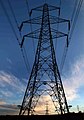 Oxsping pylons - geograph.org.uk - 1056907.jpg 448 × 640; 68 KB
-
 Peck Pond - geograph.org.uk - 4201181.jpg 3,603 × 2,629; 2.1 MB
-
 Peck Pond Farm - geograph.org.uk - 4201175.jpg 3,546 × 2,581; 1.71 MB
-
 Peck Pond, Hunshelf - geograph.org.uk - 2883836.jpg 3,264 × 2,448; 2.33 MB
-
 Pecks Pond - geograph.org.uk - 3810170.jpg 1,024 × 683; 223 KB
-
 Pecks Pond - geograph.org.uk - 3810172.jpg 1,024 × 683; 200 KB
-
 Pedalling up Back Lane - geograph.org.uk - 4772823.jpg 768 × 1,024; 210 KB
-
 Petroleum Reservoirs nr Oxspring - geograph.org.uk - 2376701.jpg 3,296 × 1,387; 787 KB
-
 Pond Common Lane - geograph.org.uk - 3580477.jpg 750 × 506; 75 KB
-
 Pond Common Lane - geograph.org.uk - 4864002.jpg 640 × 480; 47 KB
-
 Pond Common Lane, view west - geograph.org.uk - 3580480.jpg 750 × 563; 76 KB
-
 Postbox, Well Hill - geograph.org.uk - 4862547.jpg 640 × 480; 72 KB
-
 Postbox, Well Hill - geograph.org.uk - 4862548.jpg 640 × 480; 72 KB
-
 Power lines over Pond Common - geograph.org.uk - 4398207.jpg 2,798 × 1,501; 668 KB
-
 Power Transmission centre, Mucky Lane - geograph.org.uk - 1976563.jpg 1,024 × 768; 142 KB
-
 Puppies for sale at Snowden Hill - geograph.org.uk - 929267.jpg 640 × 480; 66 KB
-
 Pylon above Oakenshaw Spring Wood - geograph.org.uk - 1976554.jpg 1,024 × 768; 134 KB
-
 Quietly flows the Don - geograph.org.uk - 2386096.jpg 3,264 × 2,448; 3.38 MB
-
 Reflections in the water - geograph.org.uk - 2783485.jpg 1,200 × 1,600; 770 KB
-
 Reflections in the water - geograph.org.uk - 2783488.jpg 1,600 × 1,200; 793 KB
-
 River Don at Forge Wood - geograph.org.uk - 2763504.jpg 1,200 × 1,600; 721 KB
-
 River Don seen from footbridge - geograph.org.uk - 3578830.jpg 750 × 563; 189 KB
-
 Rock and Ruin, Green Moor, near Wortley - geograph.org.uk - 1827979.jpg 2,576 × 1,932; 1.18 MB
-
 Rock For Sale, Green Moor, near Wortley - geograph.org.uk - 1827995.jpg 2,057 × 1,372; 497 KB
-
 Rockery outside Little Dean Head Farm - geograph.org.uk - 4876584.jpg 800 × 600; 198 KB
-
 Rumtickle Viaduct - geograph.org.uk - 4037516.jpg 868 × 410; 250 KB
-
 Salter Hill House on Back Lane - geograph.org.uk - 4883184.jpg 3,072 × 1,728; 2.98 MB
-
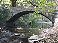 Sharp Ford Bridge - geograph.org.uk - 2374889.jpg 3,296 × 2,472; 1.86 MB
-
 Sheep at Throstle Nest Farm - geograph.org.uk - 4201216.jpg 3,339 × 1,939; 1.27 MB
-
 Sheep by Hunshelf Road - geograph.org.uk - 4201196.jpg 3,529 × 2,601; 2.04 MB
-
 Sign in Green Moor Delf - geograph.org.uk - 6724837.jpg 1,024 × 728; 198 KB
-
 Sign in Green Moor Delf - geograph.org.uk - 6724841.jpg 1,024 × 605; 280 KB
-
 Site of former oil terminal, Hunshelf - geograph.org.uk - 6592897.jpg 2,000 × 1,500; 1.25 MB
-
 Snowden Hill pylons - geograph.org.uk - 1056913.jpg 514 × 640; 75 KB
-
 Snowden Hill Water Buffalo Farm - geograph.org.uk - 4874478.jpg 3,072 × 1,728; 3.15 MB
-

-
 Stables near Pond Farm - geograph.org.uk - 4864001.jpg 640 × 480; 59 KB
-
 Start of footpath from Green Moor - geograph.org.uk - 3580514.jpg 563 × 750; 116 KB
-
 Stepping Stones - geograph.org.uk - 2783475.jpg 1,200 × 1,600; 547 KB
-
 Stepping stones across the Don - geograph.org.uk - 2386076.jpg 2,448 × 3,264; 3.22 MB
-
 Stepping stones across the Don. - geograph.org.uk - 4033998.jpg 552 × 640; 120 KB
-
 Stepping stones across the Don. - geograph.org.uk - 4873858.jpg 640 × 348; 77 KB
-
 Stepping Stones over the Don - geograph.org.uk - 2374790.jpg 3,296 × 2,472; 1.85 MB
-
 Steps in Tin Mill Rocher - geograph.org.uk - 4876502.jpg 800 × 600; 223 KB
-
 Stone stile on Roughbirchworth Common - geograph.org.uk - 3634198.jpg 1,024 × 683; 221 KB
-
 Storm clouds over Throstle Nest - geograph.org.uk - 929279.jpg 640 × 380; 50 KB
-
 Surveillance - geograph.org.uk - 4201249.jpg 3,565 × 2,502; 2.08 MB
-
 Tall winter trees in Tin Mill Rocher - geograph.org.uk - 4876501.jpg 600 × 800; 197 KB
-
 The 'Wortley Leppings' (stepping stones) - geograph.org.uk - 6788339.jpg 1,024 × 682; 284 KB
-
 The 'Wortley Leppings' - geograph.org.uk - 4717330.jpg 1,024 × 683; 300 KB
-

-


_off_Green_Moor_Road_-_geograph.org.uk_-_4862556.jpg)


_-_geograph.org.uk_-_6788339.jpg)


