Category:Hurstbourne Priors
village and civil parish in Hampshire, UK  | |||||
| Upload media | |||||
| Instance of | |||||
|---|---|---|---|---|---|
| Location | Basingstoke and Deane, Hampshire, South East England, England | ||||
 | |||||
Subcategories
This category has the following 4 subcategories, out of 4 total.
Media in category "Hurstbourne Priors"
The following 159 files are in this category, out of 159 total.
-
 A tree at Hurstbourne Priors - geograph.org.uk - 344326.jpg 640 × 612; 259 KB
-
 A34 - heading south - geograph.org.uk - 3861439.jpg 1,024 × 678; 76 KB
-
 A34 crosses Winchester Road, Tufton - geograph.org.uk - 4238144.jpg 640 × 481; 57 KB
-
 A34 junction for Tufton - geograph.org.uk - 3039712.jpg 1,000 × 750; 412 KB
-
 A34 north of Bullington Cross - geograph.org.uk - 2692981.jpg 3,189 × 2,188; 1.09 MB
-
 A34 northbound - geograph.org.uk - 5637088.jpg 640 × 428; 84 KB
-
 A34 northbound - geograph.org.uk - 5637094.jpg 640 × 428; 71 KB
-
 A34 northbound - geograph.org.uk - 5637105.jpg 640 × 428; 68 KB
-
 A34 northbound - geograph.org.uk - 5637116.jpg 640 × 428; 73 KB
-
 A34 northbound - geograph.org.uk - 5821710.jpg 640 × 452; 47 KB
-
 A34 northbound near Firgo Cottages - geograph.org.uk - 4238139.jpg 640 × 480; 35 KB
-
 A34 northbound towards Whitchurch - geograph.org.uk - 4645879.jpg 1,600 × 1,200; 722 KB
-
 A34 northbound, south of Tufton - geograph.org.uk - 4238142.jpg 640 × 480; 45 KB
-
 A34 south of Whitchurch - geograph.org.uk - 2692946.jpg 3,648 × 2,195; 1.3 MB
-

-
 A34 southwest of Whitchurch - geograph.org.uk - 2692920.jpg 640 × 480; 68 KB
-
 A34, South of Whitchurch - geograph.org.uk - 3287467.jpg 640 × 480; 377 KB
-
 Access to the A34 (southbound) - geograph.org.uk - 2823877.jpg 640 × 480; 76 KB
-
 Approaching Dirty Corner - geograph.org.uk - 3188005.jpg 640 × 495; 75 KB
-
 Approaching Tufton - geograph.org.uk - 919519.jpg 427 × 640; 84 KB
-
 Approaching Tufton - geograph.org.uk - 919524.jpg 640 × 427; 88 KB
-
 Arched bridge ahead - geograph.org.uk - 5282052.jpg 640 × 480; 156 KB
-
 B3048 - Harroway - geograph.org.uk - 3523326.jpg 640 × 429; 53 KB
-
 B3048 approaches crossroads with B3400 - geograph.org.uk - 3337979.jpg 3,512 × 2,565; 1.26 MB
-
 B3048 at Hurstbourne Priors - geograph.org.uk - 344310.jpg 640 × 427; 207 KB
-
 B3048 beside Perry's Croft - geograph.org.uk - 3338009.jpg 3,648 × 2,736; 1.71 MB
-
 B3048 crosses the Bourne Rivulet - geograph.org.uk - 3337990.jpg 3,648 × 2,736; 1.93 MB
-
 B3048 east of Derrydown Farm - geograph.org.uk - 3338041.jpg 3,648 × 2,609; 1.29 MB
-
 B3048 enters Hurstbourne Priors - geograph.org.uk - 3337945.jpg 3,105 × 2,358; 737 KB
-

-
 B3048 passes Gate 2 into Vitacress - geograph.org.uk - 3338031.jpg 3,368 × 2,520; 758 KB
-
 B3048 south of Hurstbourne Priors - geograph.org.uk - 3107672.jpg 640 × 480; 40 KB
-
 B3048 southbound - geograph.org.uk - 5821754.jpg 640 × 480; 57 KB
-
 B3048 southbound - geograph.org.uk - 5821757.jpg 640 × 480; 107 KB
-
 B3400 near Hurstbourne Park - geograph.org.uk - 3107642.jpg 640 × 480; 61 KB
-
 B3400 near Hurstbourne Priors - geograph.org.uk - 3107652.jpg 640 × 480; 91 KB
-
 B3400 road approaching Hurstbourne Priors - geograph.org.uk - 3428712.jpg 2,691 × 1,980; 1.68 MB
-
 Badly pot-holed lane - geograph.org.uk - 5282028.jpg 640 × 480; 168 KB
-
 Boatyard at the old Apsley Sawmill - geograph.org.uk - 374793.jpg 640 × 426; 128 KB
-
-
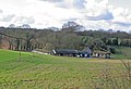 Budgett Farm, nr Hurstbourne Priors - geograph.org.uk - 344094.jpg 640 × 440; 133 KB
-
 Byway from B3400 to Longparish - geograph.org.uk - 344096.jpg 640 × 427; 154 KB
-
 Cereal crop near Cowdown - geograph.org.uk - 880612.jpg 640 × 427; 64 KB
-
 Country road - geograph.org.uk - 5821730.jpg 640 × 480; 123 KB
-
 Country road - geograph.org.uk - 5821736.jpg 640 × 480; 90 KB
-

-
 Crossroads on Newbarn Down - geograph.org.uk - 3188035.jpg 640 × 391; 40 KB
-
 Drury Close - geograph.org.uk - 5821752.jpg 640 × 480; 63 KB
-
 Entering Hurstbourne Priors on the B3048 - geograph.org.uk - 344127.jpg 640 × 427; 125 KB
-
 Entrance to Hurstbourne Priors - geograph.org.uk - 5821748.jpg 640 × 480; 85 KB
-
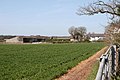
 Farmland, Hurstbourne Priors - geograph.org.uk - 425167.jpg 640 × 480; 163 KB
-
 Farmland, Hurstbourne Priors - geograph.org.uk - 6082188.jpg 1,024 × 768; 254 KB
-
 Farmland, Hurstbourne Tarrant - geograph.org.uk - 6082190.jpg 1,024 × 768; 304 KB
-

-
 Faulkner's Down Farm - geograph.org.uk - 6318073.jpg 1,024 × 683; 248 KB
-
 Field at Faulkner's Cross - geograph.org.uk - 4472619.jpg 2,560 × 1,920; 1.98 MB
-
 Field at Faulkners Cross - geograph.org.uk - 4410547.jpg 640 × 480; 84 KB
-
 Field edge south of Hurstbourne Priors - geograph.org.uk - 5865571.jpg 1,024 × 683; 277 KB
-
 Field entrance on Nuns Walk, Tufton - geograph.org.uk - 5936883.jpg 1,920 × 1,280; 896 KB
-
 Field near Dirty Corner - geograph.org.uk - 3188018.jpg 640 × 455; 78 KB
-
 Field with pylon north of Hurstbourne Viaduct - geograph.org.uk - 5865630.jpg 1,024 × 683; 206 KB
-
 Footpath, Dirty Corner - geograph.org.uk - 3187807.jpg 640 × 452; 65 KB
-
 Former railway bridge - geograph.org.uk - 5282005.jpg 640 × 480; 172 KB
-
 Harvested field south of Hurstbourne Priors - geograph.org.uk - 5865561.jpg 1,024 × 683; 225 KB
-
 Hay field with square wrapped bales - geograph.org.uk - 4068873.jpg 1,024 × 615; 132 KB
-
 Houses by the crossroads at Hurstbourne Priors - geograph.org.uk - 5865611.jpg 1,024 × 683; 186 KB
-
 Hurstbourne Priors - A Hurstbourne View - geograph.org.uk - 770256.jpg 640 × 480; 107 KB
-
 Hurstbourne Priors - Bus Stop - geograph.org.uk - 770247.jpg 640 × 480; 116 KB
-
 Hurstbourne Priors - Celtic Cross - geograph.org.uk - 770196.jpg 480 × 640; 79 KB
-
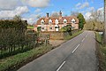
 Hurstbourne Priors - Cottages - geograph.org.uk - 770170.jpg 640 × 480; 110 KB
-
 Hurstbourne Priors - Cricket Pavilion - geograph.org.uk - 770056.jpg 640 × 480; 101 KB
-

-

-
 Hurstbourne Priors - Field Entrance - geograph.org.uk - 770152.jpg 640 × 480; 101 KB
-
 Hurstbourne Priors - geograph.org.uk - 8860.jpg 640 × 427; 290 KB
-
 Hurstbourne Priors - Storage Shed - geograph.org.uk - 770066.jpg 640 × 480; 136 KB
-

-

-
 Hurstbourne Priors - The River Bourne - geograph.org.uk - 770416.jpg 640 × 480; 122 KB
-
 Hurstbourne Priors - The River Bourne - geograph.org.uk - 770424.jpg 640 × 480; 138 KB
-
 Hurstbourne Priors - Victorian Postbox - geograph.org.uk - 770109.jpg 640 × 480; 135 KB
-
 Hurstbourne Priors - Village Hall - geograph.org.uk - 770161.jpg 640 × 480; 97 KB
-

-
 Hurstbourne Priors, Thatched bus shelter - geograph.org.uk - 2376219.jpg 3,456 × 2,304; 6.27 MB
-
 Hurstbourne Priors, The Hurstbourne Inn - geograph.org.uk - 2317338.jpg 3,456 × 2,304; 3.22 MB
-
 Hurstbourne Viaduct - geograph.org.uk - 5865621.jpg 1,024 × 683; 242 KB
-
 Hurstbourne Viaduct, bridge BAE1 E4-173 - geograph.org.uk - 5282043.jpg 640 × 428; 119 KB
-
 Junction on Nuns Walk, Testbourne - geograph.org.uk - 5936910.jpg 1,920 × 1,280; 840 KB
-
 Keeping the green green - geograph.org.uk - 5865604.jpg 1,024 × 683; 249 KB
-
 Lane on Newbarn Down - geograph.org.uk - 3188046.jpg 640 × 446; 71 KB
-
 Lane on Newbarn Down - geograph.org.uk - 3188072.jpg 640 × 474; 78 KB
-
 Lane through Ridges Plantation - geograph.org.uk - 5282015.jpg 640 × 480; 175 KB
-
 Lane to Tufton - geograph.org.uk - 2823880.jpg 640 × 480; 86 KB
-
 Lane towards Hurstbourne Priors - geograph.org.uk - 5282008.jpg 640 × 480; 160 KB
-
 Lane up Newbarn Down - geograph.org.uk - 5282058.jpg 640 × 480; 139 KB
-
 Lay-by Markings and Field - geograph.org.uk - 1160428.jpg 426 × 640; 111 KB
-
 Lay-by on A34 near Firgo Farm - geograph.org.uk - 3039697.jpg 600 × 800; 74 KB
-
 Layby on the Northbound A34 - geograph.org.uk - 3287458.jpg 640 × 480; 364 KB
-
 London Road between Hurstbourne Priors and Whitchurch - geograph.org.uk - 4473077.jpg 2,426 × 1,726; 1.16 MB
-
 London Road, Faulkner's Cross - geograph.org.uk - 4472624.jpg 2,560 × 1,920; 2.17 MB
-
 London Road, Hurstbourne Priors - geograph.org.uk - 4473492.jpg 2,486 × 1,818; 1.22 MB
-
 Looking across a field towards Mile Hurdle - geograph.org.uk - 4873170.jpg 1,500 × 1,125; 307 KB
-
 Luxury rural bus shelter - geograph.org.uk - 3523763.jpg 800 × 530; 99 KB
-
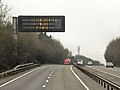 Matrix Sign, Southbound A34 - geograph.org.uk - 3415394.jpg 640 × 480; 375 KB
-

-
 Muddy track towards Faulkner's Down Farm - geograph.org.uk - 6318067.jpg 1,024 × 683; 252 KB
-
 Near Apsley Farm, Hampshire - geograph.org.uk - 2876863.jpg 3,504 × 2,336; 995 KB
-
 Near Hurstbourne Park, Hampshire - geograph.org.uk - 2710243.jpg 3,504 × 2,336; 553 KB
-
 Near Hurstbourne Priors, Hampshire - geograph.org.uk - 2877311.jpg 3,504 × 2,336; 1.32 MB
-
 Near Lower Wyke Farm, Hampshire - geograph.org.uk - 2710102.jpg 3,504 × 2,336; 576 KB
-
 Near St Mary Bourne - geograph.org.uk - 2877062.jpg 3,504 × 2,336; 1,022 KB
-
 Near St Mary Bourne, Hampshire - geograph.org.uk - 2710129.jpg 1,800 × 1,200; 510 KB
-
 Near St Mary Bourne, Hampshire - geograph.org.uk - 2877085.jpg 3,228 × 2,152; 996 KB
-
 Newbarn Down Plantation - geograph.org.uk - 3188084.jpg 640 × 438; 90 KB
-
 Northbound A34, Turnoff for Overton - geograph.org.uk - 3287476.jpg 640 × 480; 404 KB
-
 Northbound A34, Whitchurch - geograph.org.uk - 3287482.jpg 640 × 480; 437 KB
-
 Nuns Walk - geograph.org.uk - 2801257.jpg 800 × 554; 111 KB
-
 Nuns Walk at the 81 metre spot height - geograph.org.uk - 4068863.jpg 1,024 × 768; 221 KB
-
 Nuns Walk at the junction of the A34 - geograph.org.uk - 5931587.jpg 1,920 × 1,280; 1.02 MB
-
 Parking area on the A34 north of Bullington - geograph.org.uk - 5893002.jpg 1,864 × 1,192; 998 KB
-
 Part of Long Plantation - geograph.org.uk - 5282019.jpg 640 × 480; 121 KB
-
 Passing under the A34 - geograph.org.uk - 2801263.jpg 640 × 409; 52 KB
-
 Private footpath in Hurstbourne Park - geograph.org.uk - 880575.jpg 640 × 427; 100 KB
-
 Pylon near Dirty Corner - geograph.org.uk - 3188030.jpg 640 × 487; 94 KB
-
 Rabbit damage to crop - geograph.org.uk - 882082.jpg 640 × 480; 82 KB
-
 Railway bridge near New Barn Farm - geograph.org.uk - 880604.jpg 640 × 427; 86 KB
-
 River Test, Hurstbourne Priors - geograph.org.uk - 425171.jpg 640 × 480; 161 KB
-
 Road junction - geograph.org.uk - 5821719.jpg 640 × 407; 45 KB
-
 Road junction - geograph.org.uk - 5821725.jpg 640 × 480; 115 KB
-
 Road junction - geograph.org.uk - 5821750.jpg 640 × 480; 60 KB
-
 Road junction and finger post - geograph.org.uk - 5821716.jpg 640 × 480; 103 KB
-

-
 Secure gates - geograph.org.uk - 2842429.jpg 800 × 579; 125 KB
-
 Southbound A34 near Whitchurch - geograph.org.uk - 3415386.jpg 640 × 480; 394 KB
-
 Southbound A34, Layby near Whitchurch - geograph.org.uk - 3415388.jpg 640 × 480; 400 KB
-

-

-
 Straight section of the B3048 - geograph.org.uk - 5865615.jpg 1,024 × 683; 283 KB
-
 Thatched cottage at Hurstbourne Priors - geograph.org.uk - 5865608.jpg 1,024 × 683; 204 KB
-
 The A34 looking northbound - geograph.org.uk - 4873162.jpg 1,500 × 1,050; 147 KB
-
 The A34 looking southbound - geograph.org.uk - 4873158.jpg 1,500 × 1,125; 195 KB
-
 The A34 northbound - geograph.org.uk - 4646931.jpg 1,600 × 1,192; 569 KB
-
 The A34 northbound - geograph.org.uk - 4646936.jpg 1,600 × 1,200; 521 KB
-
 The A34 south of Whitchurch - geograph.org.uk - 5893004.jpg 1,886 × 1,226; 1.29 MB
-
 The A34 south of Whitchurch - geograph.org.uk - 5893005.jpg 1,920 × 1,280; 873 KB
-
 The B3048 is crossed by Harroway - geograph.org.uk - 3435416.jpg 800 × 600; 60 KB
-
 The crossroads in Hurstbourne Priors - geograph.org.uk - 4109703.jpg 640 × 480; 79 KB
-
 The road to Tufton - geograph.org.uk - 4471029.jpg 2,560 × 1,920; 2 MB
-
 Track beside Cowdown Copse - geograph.org.uk - 882022.jpg 640 × 480; 99 KB
-
 Trackbed of old railway - geograph.org.uk - 155837.jpg 640 × 480; 391 KB
-
 Turn off for Whitchurch from A34 - geograph.org.uk - 3670913.jpg 640 × 487; 39 KB
-
 View across watercress beds - geograph.org.uk - 5865680.jpg 1,024 × 683; 209 KB
-
 View from bridge BAE1 E4-177 - geograph.org.uk - 4262622.jpg 480 × 640; 126 KB
-

-
-
 Vitacress, watercress production - geograph.org.uk - 880633.jpg 640 × 427; 84 KB
-
 Watercress beds - geograph.org.uk - 5865679.jpg 1,024 × 683; 293 KB
-

-
 Bourne Rivulet, near Hurstbourne Priors - geograph.org.uk - 105375.jpg 640 × 480; 153 KB


_-_geograph.org.uk_-_2823877.jpg)


