Category:Huttenwang
 | |||||
| Upload media | |||||
| Instance of | |||||
|---|---|---|---|---|---|
| Location | Aitrang, Ostallgäu, Swabia, Bavaria, Germany | ||||
| Elevation above sea level |
| ||||
 | |||||
Subcategories
This category has the following 2 subcategories, out of 2 total.
J
P
- Pfarrhaus (Huttenwang) (4 F)
Media in category "Huttenwang"
The following 12 files are in this category, out of 12 total.
-
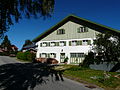 Aitrang - Huttenwang Nr 10 v S.JPG 2,048 × 1,536; 1.41 MB
-
 Aitrang - Huttenwang Nr 14 v SW.JPG 2,048 × 1,536; 1.48 MB
-
 Aitrang - Huttenwang Nr 18 u Kirche v O.jpg 2,048 × 1,536; 1.42 MB
-
 Aitrang - Umwangs - Huttenwang.JPG 1,984 × 1,488; 628 KB
-
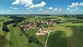
 Huttenwang - panoramio - Mayer Richard.jpg 2,816 × 2,120; 1.45 MB
-
 Huttenwang - panoramio.jpg 2,816 × 2,120; 772 KB
-
 Huttenwang Richtung Neuenried - panoramio.jpg 2,816 × 2,120; 1.47 MB
-
 Huttenwang von Westen - panoramio.jpg 2,816 × 2,120; 1.43 MB
-
 Huttenwang01 2016-08-07.jpg 2,560 × 1,440; 1.85 MB
-
 Nach Neuenried - panoramio - Mayer Richard.jpg 2,816 × 2,120; 720 KB
-
 Wegkreuz in der Nähe des Dorfplatzes von Huttenwang.jpg 2,268 × 4,032; 5.57 MB
-
 Wegkreuz in Umwangs.jpg 2,268 × 4,032; 5.84 MB


