Category:Hyde House
| Object location | | View all coordinates using: OpenStreetMap |
|---|
English: Hyde House. There has been a house on this site for hundreds of years belonging to the Gundry Family. The original house was burnt down in 1920 and rebuilt. It was sold in 1987 to be used as a care home and was subsequently taken over by Bupa. It has 24 beds.
Media in category "Hyde House"
The following 3 files are in this category, out of 3 total.
-
 Hyde House "Real Tennis" Court - geograph.org.uk - 422726.jpg 640 × 400; 95 KB
-
 Hyde House - geograph.org.uk - 1233112.jpg 640 × 428; 88 KB
-
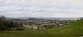 Panoramic view to Hyde House - geograph.org.uk - 406205.jpg 640 × 290; 68 KB


