Category:Hydrological maps
Subcategories
This category has the following 4 subcategories, out of 4 total.
B
- Hydrological maps of Brazil (3 F)
F
- Hydrological maps of France (1 F)
I
- Hydrological maps of Italy (17 F)
U
Media in category "Hydrological maps"
The following 18 files are in this category, out of 18 total.
-
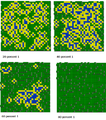 30x30fiveLevelWaterRetention.png 772 × 873; 510 KB
-
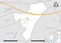 57112-Brouck-Routes-Hydro.png 3,507 × 2,480; 867 KB
-
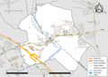 57207-Farébersviller-Routes-Hydro.png 3,507 × 2,480; 2.22 MB
-
 Atlantic-North Sea Continental Divide.png 2,118 × 1,516; 672 KB
-
 Atlantik-Nordsee-Wasserscheide.png 2,118 × 1,516; 673 KB
-
 Drainage Basins France.png 2,138 × 1,794; 1.44 MB
-
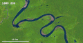
 Figure 1. Tamanrasset River. Hydrological context of Africa.jpg 926 × 630; 120 KB
-
 Gif 5.gif 1,037 × 548; 10.86 MB
-
 Hlukhania mire survey hydrology.jpg 1,554 × 1,240; 2.46 MB
-

-
 Mapa Retencji.png 796 × 758; 118 KB
-
 MSHtoutleareaedit.jpg 6,342 × 3,576; 17.8 MB
-
 Nordsee-Ostsee-Wasserscheide.png 1,605 × 1,187; 449 KB
-
 North Sea - Baltic Sea Continental Divide.png 1,573 × 1,207; 447 KB
-
 North Sea-Atlantic-Mediterranean Triple Point.png 1,923 × 1,367; 3.03 MB
-
 Ostrogiwisla.png 1,270 × 1,270; 940 KB
-
 StarițeTalmaza.png 1,193 × 1,651; 551 KB
-
 Geografja Polski zjednoczonej 1920 (86192259) (cropped).jpg 3,773 × 2,997; 2.73 MB


_(cropped).jpg)