Category:IJsselkade 62, Kampen
| Object location | | View all coordinates using: OpenStreetMap |
|---|
 | |||||
| Upload media | |||||
| Instance of | |||||
|---|---|---|---|---|---|
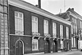
| Location | Kampen, Overijssel, Netherlands | ||||
| Heritage designation |
| ||||
 | |||||
|
This is a category about rijksmonument number 23442
|
| Address |
|
Media in category "IJsselkade 62, Kampen"
The following 3 files are in this category, out of 3 total.
-
 Kampen - IJsselkade 62.jpg 2,592 × 1,944; 1.65 MB
-
 Voorgevels (1854) - Kampen - 20123675 - RCE.jpg 1,200 × 811; 243 KB
-
 Voorgevels - Kampen - 20123676 - RCE.jpg 1,200 × 810; 227 KB
_-_Kampen_-_20123675_-_RCE.jpg)
