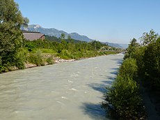
Category:Ill (Vorarlberg)
Deutsch: Ill (Vorarlberg)
river in Vorarlberg | |||||
| Upload media | |||||
| Instance of | |||||
|---|---|---|---|---|---|
| Location |
| ||||
| Length |
| ||||
| Mouth of the watercourse | |||||
| Drainage basin | |||||
| Tributary |
| ||||
| Different from | |||||
 | |||||
Subcategories
This category has the following 8 subcategories, out of 8 total.
Media in category "Ill (Vorarlberg)"
The following 48 files are in this category, out of 48 total.
-
De-Ill.ogg 1.4 s; 14 KB
-
CH-NB - Rhein und Ill, Zusammenfluss, von Nordosten - Collection Gugelmann - GS-GUGE-BLEULER-2b-28.tif 5,700 × 4,591, 2 pages; 40.17 MB
-
ChurerstrFK17 1.jpg 2,592 × 3,888; 1.53 MB
-
Dry plant at river Ill.jpg 2,976 × 3,968; 3.02 MB
-
ETH-BIB-Rüthi, Hirschensprung, Oberriet, Ill-Rheinmündung-Inlandflüge-LBS MH01-000588.tif 6,097 × 4,541; 79.34 MB
-
Feldkirch (Vorarlberg) - Marktplatz, Hochwassermarke 15.06.1910 (01-2).JPG 2,000 × 1,362; 2.18 MB
-
Feldkirch Fluss Kraftwerk Hochwuhr Ill.jpg 4,000 × 3,000; 3.91 MB
-
Feldkirch Reichenfeldgasse 7, Landeskonservatorium für Vorarlberg.jpg 7,584 × 4,277; 22.95 MB
-
Feldkirch Vorstadthäuser2 bis 22.JPG 7,053 × 4,251; 8.39 MB
-
Feldkirch-Ill-vor-Kraftwerk-06.JPG 4,592 × 2,576; 4.16 MB
-
Feldkirch-Illstrasse-Ill-Haemmerle Kraftwerk-Haemmerle Siedlung-01ASD.jpg 4,592 × 3,056; 5.47 MB
-
Feldkirch-Kleine-Ill-02.JPG 4,592 × 2,576; 8.28 MB
-
Feldkirch-Kleine-Ill-12.JPG 4,592 × 2,576; 7.72 MB
-
Fluss Ill bei Schruns - panoramio.jpg 2,304 × 3,072; 1.12 MB
-
Fritzenbach, Mündung 01.jpg 4,000 × 3,000; 6.09 MB
-
Fritzenbach, Mündung 02.jpg 4,000 × 3,000; 6.54 MB
-
Gisingen vom Veitskapf.JPG 4,173 × 2,771; 4.33 MB
-
Ill beim Milchhof-Giesingen-von der L60-1.jpg 1,836 × 3,264; 873 KB
-
Ill beim Milchhof-Giesingen-von der L60-2.jpg 3,264 × 1,836; 972 KB
-
Ill Feldkirch-Gisingen.JPG 3,168 × 2,376; 3.54 MB
-
Ill in Feldkirch.jpg 4,000 × 3,000; 10.44 MB
-
Ill in Feldkirch7.jpg 3,000 × 4,000; 12.84 MB
-
Ill kurz vor Einmündung Rhein-1.jpg 3,264 × 1,836; 729 KB
-
Ill kurz vor Einmündung Rhein-2.jpg 3,264 × 1,836; 594 KB
-
Ill Rhein catchment.png 1,200 × 1,318; 2.91 MB
-
Ill seen from the Illsteg 01.jpg 5,472 × 3,648; 10.14 MB
-
Ill seen from the Illsteg 02.jpg 5,472 × 3,648; 9.31 MB
-
Ill seen from the Illsteg 03.jpg 3,648 × 5,472; 9.87 MB
-
Ill-Ursprung vom Hohen Rad.JPG 1,600 × 1,200; 519 KB
-
Ill-Ursprung.JPG 2,048 × 1,536; 691 KB
-
Illschlucht Feldkirch.JPG 3,168 × 2,376; 3.58 MB
-
Illspitz.2008.2.JPG 2,236 × 1,055; 1.33 MB
-
Illspitz.2008.JPG 3,648 × 2,736; 4.47 MB
-
Illspitz.Ill.Neue Bruecke.2008.1.JPG 3,648 × 2,736; 4.24 MB
-
Illspitz.JPG 2,048 × 1,536; 685 KB
-
Mentha longifolia at the side of the Ill river (whole plant).jpg 3,120 × 4,160; 5.69 MB
-
Mentha longifolia found on the side of the Ill river.jpg 3,120 × 4,160; 3.56 MB
-
Montfortgasse Illseitig, Feldkirch.JPG 4,288 × 2,848; 3.63 MB
-
Mündung der Ill in den Rhein, Meiningen AT 20170805-jag9889.jpg 4,608 × 3,456; 10.8 MB
-
Ochsental - Ill und Piz Buin 01.jpg 4,592 × 3,448; 11.03 MB
-
Ochsental - Piz Buin - Gletscher 01.jpg 4,592 × 3,448; 8.3 MB
-
Ochsental16.jpg 3,000 × 4,000; 2.83 MB
-
Ochsental17.jpg 2,739 × 2,073; 3.38 MB
-
Rüthi Rhein Ill so.JPG 4,480 × 2,901; 6.03 MB
-
Rüthi Rhein so.JPG 4,592 × 2,732; 5.97 MB
-
Stella Matutina (Jesuitenpädagogium).jpg 6,334 × 4,223; 21.35 MB
-
Untere Illschluchtenge, Feldkirch im Kehr 1.JPG 4,288 × 2,848; 3.59 MB


