Category:Images by Allan Friswell

Media in category "Images by Allan Friswell"
The following 200 files are in this category, out of 244 total.
(previous page) (next page)-
 "Jinty" 0-6-0 ... - geograph.org.uk - 794605.jpg 640 × 480; 72 KB
-
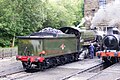
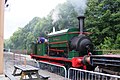
 "Taff Vale" 0-6-0 at Oxenhope... - geograph.org.uk - 794584.jpg 640 × 480; 113 KB
-
 30777 in steam at Haworth - geograph.org.uk - 863837.jpg 640 × 427; 84 KB
-
 30777 Sir Lamiel at Haworth - geograph.org.uk - 863967.jpg 640 × 427; 100 KB
-
 45212 "Black Five" at Oxenhope - geograph.org.uk - 864008.jpg 640 × 427; 81 KB
-
 45212 ready to leave Keighley station - geograph.org.uk - 863827.jpg 640 × 427; 56 KB
-
 80002 taking on water at Oxenhope - geograph.org.uk - 863911.jpg 640 × 427; 89 KB
-
 Accommodation bridge - geograph.org.uk - 1114065.jpg 640 × 480; 96 KB
-

-
 Apple Orchard north of Burghill - geograph.org.uk - 794410.jpg 480 × 640; 137 KB
-
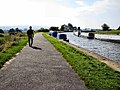 Approaching Barrowford top lock no. 45 - geograph.org.uk - 835839.jpg 640 × 480; 104 KB
-
 Approaching the foot of the Five-Rise - geograph.org.uk - 797465.jpg 640 × 480; 129 KB
-

-
 Aqueduct over the Wharfe - geograph.org.uk - 844103.jpg 640 × 480; 126 KB
-
 Autumn at Swinsty reservoir - geograph.org.uk - 878548.jpg 640 × 480; 144 KB
-

-
 Autumn glory by Swinsty reservoir - geograph.org.uk - 878543.jpg 480 × 640; 184 KB
-
 Barden Aqueduct Bridge - geograph.org.uk - 730861.jpg 640 × 480; 113 KB
-

-
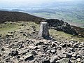 Beamsley Beacon trig point - geograph.org.uk - 726356.jpg 640 × 480; 110 KB
-

-
 Bluebells in Middleton Woods - geograph.org.uk - 1248954.jpg 640 × 480; 223 KB
-

-
 Boat winding above Old Hall Bridge - geograph.org.uk - 725238.jpg 640 × 480; 62 KB
-
 Bolton Priory - geograph.org.uk - 843977.jpg 640 × 480; 68 KB
-
 Bolton Priory - geograph.org.uk - 843981.jpg 640 × 480; 80 KB
-
 Bolton Priory - geograph.org.uk - 843984.jpg 640 × 480; 64 KB
-
 Brayshaw Scar, Arncliffe - geograph.org.uk - 866582.jpg 640 × 480; 68 KB
-
 Brockabank Bridge - geograph.org.uk - 1087584.jpg 640 × 480; 154 KB
-
 Brockabank Bridge - geograph.org.uk - 1087588.jpg 640 × 480; 119 KB
-
 Canal at Gargrave - geograph.org.uk - 1152780.jpg 480 × 640; 82 KB
-
 Canal reflections at Bingley - geograph.org.uk - 797454.jpg 640 × 480; 127 KB
-
 Christmas Special at Embsay Station - geograph.org.uk - 797442.jpg 640 × 480; 69 KB
-
 Clapper bridge at Hebble Hole - geograph.org.uk - 857738.jpg 640 × 427; 116 KB
-
 Cleared land above Swinsty reservoir - geograph.org.uk - 878552.jpg 640 × 480; 107 KB
-
 Closing the gates at Damems station - geograph.org.uk - 864740.jpg 640 × 480; 96 KB
-
 Colden Water at Hebble Hole - geograph.org.uk - 857745.jpg 640 × 427; 124 KB
-
 Cottage fronts on Keighley Road, Cowling - geograph.org.uk - 844090.jpg 480 × 640; 118 KB
-
 Cottage in Cowling - geograph.org.uk - 844081.jpg 640 × 480; 113 KB
-
 Cow and Calf Hotel - geograph.org.uk - 844062.jpg 640 × 480; 64 KB
-

-
 Damems railway station in 2007.jpg 640 × 480; 113 KB
-
 Descending into Low Bradley - geograph.org.uk - 724736.jpg 640 × 480; 74 KB
-
 Descent close to Trollers Gill - geograph.org.uk - 724756.jpg 640 × 480; 131 KB
-
 Destroyed Stile^ - geograph.org.uk - 835849.jpg 640 × 480; 131 KB
-

-

-

-

-
 Double header at Ingrow West - geograph.org.uk - 863891.jpg 640 × 427; 77 KB
-

-
 Eccup reservoir - geograph.org.uk - 1233764.jpg 640 × 427; 62 KB
-
 Eccup Reservoir - geograph.org.uk - 1233774.jpg 640 × 427; 58 KB
-
 Embsay reservoir from near Crag Nook - geograph.org.uk - 843935.jpg 640 × 480; 86 KB
-
 Entering Kildwick - geograph.org.uk - 842316.jpg 640 × 427; 86 KB
-

-

-
 Eshton Hall and parkland - geograph.org.uk - 1087647.jpg 640 × 480; 66 KB
-
 Falls en route to Cray from Hubberholme - geograph.org.uk - 797495.jpg 640 × 480; 139 KB
-
 Fenced off stiles - geograph.org.uk - 1342628.jpg 640 × 480; 101 KB
-
 Fenced off stiles - geograph.org.uk - 1342636.jpg 640 × 480; 128 KB
-
 Fewston Reservoir in early winter - geograph.org.uk - 725178.jpg 640 × 480; 70 KB
-
 Footpath decorations - geograph.org.uk - 844855.jpg 640 × 480; 84 KB
-
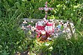
 Footstone - Buckden memorial cross - geograph.org.uk - 844033.jpg 640 × 480; 133 KB
-
 Foulridge Basin - geograph.org.uk - 835828.jpg 640 × 480; 103 KB
-
 Foulridge Basin - geograph.org.uk - 835833.jpg 640 × 480; 99 KB
-
 Foulridge Basin 2009. - geograph.org.uk - 1400848.jpg 640 × 480; 107 KB
-
 Foulridge lower reservoir - geograph.org.uk - 1400869.jpg 640 × 480; 85 KB
-
 Free Range children - geograph.org.uk - 1286930.jpg 640 × 480; 83 KB
-
 Friar's Head - geograph.org.uk - 1087655.jpg 640 × 480; 108 KB
-

-
 Gate and steps on to Shop Lane - geograph.org.uk - 844824.jpg 640 × 480; 88 KB
-
 Gate stile on the Pennine Way - geograph.org.uk - 844753.jpg 640 × 480; 121 KB
-
 Gill Beck - geograph.org.uk - 792836.jpg 640 × 480; 137 KB
-
 Gill Beck. Compare to an adjacent photo^ - geograph.org.uk - 792828.jpg 640 × 480; 133 KB
-
 Glasshouses Mill - geograph.org.uk - 1206924.jpg 640 × 427; 54 KB
-

-
 Grimwith Reservoir - geograph.org.uk - 797389.jpg 640 × 480; 92 KB
-
 Grimwith Reservoir - geograph.org.uk - 797401.jpg 640 × 480; 50 KB
-
 Grimwith Reservoir - geograph.org.uk - 797414.jpg 640 × 480; 98 KB
-
 Hagg Beck - geograph.org.uk - 797519.jpg 640 × 480; 78 KB
-
 Halfway up the Dib - geograph.org.uk - 728585.jpg 480 × 640; 87 KB
-
 Heather moorland above Arncliffe - geograph.org.uk - 866599.jpg 640 × 480; 95 KB
-
 Hellifield Beck from Hellifield Crag - geograph.org.uk - 843936.jpg 640 × 480; 134 KB
-
 Hereford Cathedral - geograph.org.uk - 724472.jpg 480 × 640; 112 KB
-
 Hereford Cathedral - geograph.org.uk - 724474.jpg 480 × 640; 83 KB
-
 Hereford Cathedral Cloisters - geograph.org.uk - 724467.jpg 480 × 640; 72 KB
-
 Hereford Cathedral Cloisters - geograph.org.uk - 724469.jpg 480 × 640; 55 KB
-
 High Mill Weir, Addingham - geograph.org.uk - 725164.jpg 640 × 480; 87 KB
-
 High on a distant hill... - geograph.org.uk - 554479.jpg 640 × 480; 82 KB
-
 Hills near Hubberholme - geograph.org.uk - 797508.jpg 640 × 480; 80 KB
-
 In steam at Keighley station - geograph.org.uk - 863817.jpg 640 × 427; 72 KB
-
 In steam at Oxenhope - geograph.org.uk - 863901.jpg 640 × 427; 84 KB
-
 In the lee of Crag Stones - geograph.org.uk - 908472.jpg 640 × 427; 88 KB
-

-

-

-
 Keighley and Worth Valley Railway - geograph.org.uk - 794527.jpg 480 × 640; 73 KB
-
 Keighley station - KWVR - geograph.org.uk - 794555.jpg 640 × 480; 91 KB
-
 Keighley Station - KWVR - geograph.org.uk - 794574.jpg 640 × 480; 53 KB
-

-
 Kildwick aqueduct in bloom - geograph.org.uk - 842303.jpg 640 × 427; 107 KB
-
 Kildwick Bridge January 2008. - geograph.org.uk - 666890.jpg 640 × 480; 76 KB
-
 Lampstandard at Damems station - geograph.org.uk - 835813.jpg 480 × 640; 124 KB
-
 Lampstandard at Damems station - geograph.org.uk - 835816.jpg 640 × 480; 114 KB
-
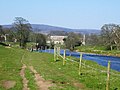
 LandL Canal and Aire meet in Leeds - geograph.org.uk - 832223.jpg 640 × 480; 79 KB
-
 Lime kiln at Brockabank Bridge - geograph.org.uk - 1087598.jpg 640 × 480; 122 KB
-

-
-
 Looking back from Long Hill Farm - geograph.org.uk - 1005623.jpg 640 × 480; 76 KB
-

-

-
 Looking down from Grimwith reservoir - geograph.org.uk - 849370.jpg 640 × 480; 80 KB
-

-

-

-

-
 Looking west from Crag Wood. - geograph.org.uk - 724893.jpg 640 × 480; 119 KB
-
 Low Hall Farm - geograph.org.uk - 1114088.jpg 640 × 480; 81 KB
-
 Lower Barden reservoir - geograph.org.uk - 845158.jpg 640 × 480; 80 KB
-
 Lych-gate at entrance to Sunnyhurst Wood - geograph.org.uk - 1248639.jpg 427 × 640; 101 KB
-
 Malham Cove - geograph.org.uk - 724873.jpg 480 × 640; 122 KB
-
 The reredos, Marsh Gibbon church - geograph.org.uk - 728549.jpg 500 × 375; 138 KB
-
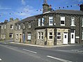
 Mawson St, Saltaire - geograph.org.uk - 864083.jpg 640 × 427; 75 KB
-

-

-

-
 New York Mill - geograph.org.uk - 1114094.jpg 640 × 480; 99 KB
-
 Newly built stile - geograph.org.uk - 844816.jpg 640 × 480; 105 KB
-
 Nidd Footbridge at SE211597 - geograph.org.uk - 1114073.jpg 640 × 480; 122 KB
-
 Noon Stone, Addingham High Moor - geograph.org.uk - 869392.jpg 640 × 480; 62 KB
-
-

-
 Old settlement terracing - geograph.org.uk - 844736.jpg 640 × 480; 56 KB
-

-
 Oxenber Wood - Spring flowers - geograph.org.uk - 842540.jpg 640 × 480; 161 KB
-

-
 Police station, Saltaire - geograph.org.uk - 864092.jpg 640 × 427; 93 KB
-
 Polish War memorial - geograph.org.uk - 849968.jpg 640 × 427; 137 KB
-
 Ponden reservoir - geograph.org.uk - 794420.jpg 640 × 480; 78 KB
-
 Ponden Reservoir - geograph.org.uk - 794426.jpg 640 × 480; 59 KB
-

-

-
 Quainton church - geograph.org.uk - 728548.jpg 561 × 382; 83 KB
-

-

-
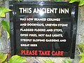
 Robin Hood PH, Clifton Reynes - geograph.org.uk - 728546.jpg 600 × 450; 28 KB
-
 Roddlesworth reservoir Autumn 2004 - geograph.org.uk - 725188.jpg 640 × 480; 56 KB
-
 Roddlesworth reservoir Autumn 2004 - geograph.org.uk - 725190.jpg 602 × 402; 64 KB
-

-
 Salt's Mill - geograph.org.uk - 864070.jpg 640 × 427; 72 KB
-

-

-
 Snowdrops in Winterburn - geograph.org.uk - 878538.jpg 640 × 480; 158 KB
-
 SS Peter and Paul, Leominster - geograph.org.uk - 724451.jpg 640 × 480; 90 KB
-

-
 Stile and signpost near Appletreewick - geograph.org.uk - 835862.jpg 640 × 480; 117 KB
-
 Stile leading from Ilkley golf course - geograph.org.uk - 849383.jpg 480 × 640; 132 KB
-
 Stile leading on to Nesfield Road - geograph.org.uk - 849378.jpg 480 × 640; 143 KB
-
 Stone step stile on the Pennine Way - geograph.org.uk - 844759.jpg 640 × 480; 105 KB
-
 Stoodley Pike Monument - geograph.org.uk - 835375.jpg 480 × 640; 56 KB
-
 Success^ - geograph.org.uk - 843457.jpg 640 × 427; 80 KB
-
 Surgill Beck on the Pennine Way - geograph.org.uk - 844785.jpg 640 × 480; 129 KB
-

-
 The "Rodley Barge" - geograph.org.uk - 832190.jpg 640 × 480; 111 KB
-
 The Arches, Bolton Abbey - geograph.org.uk - 845164.jpg 640 × 480; 109 KB
-

-
 The bridge at Yockenthwaite - geograph.org.uk - 816336.jpg 640 × 427; 94 KB
-

-

-
 The Club and Institute, Saltaire - geograph.org.uk - 864103.jpg 640 × 427; 82 KB
-

-
 The former butcher's shop in Cowling - geograph.org.uk - 844085.jpg 640 × 480; 95 KB
-
 The Grange, Carleton in Craven - geograph.org.uk - 727451.jpg 640 × 480; 98 KB
-
 The January 2008 storms - geograph.org.uk - 724696.jpg 640 × 480; 82 KB
-
 The last lap to Beamsley Beacon - geograph.org.uk - 843940.jpg 640 × 480; 90 KB
-
 The Lugg in full spate at Moreton Bridge - geograph.org.uk - 724415.jpg 640 × 480; 109 KB
-
 The Money Tree (close up) - geograph.org.uk - 849391.jpg 640 × 480; 123 KB
-

-
 The Queen's Head, Chackmore - geograph.org.uk - 730277.jpg 640 × 480; 45 KB
-
 The Railway Hotel - Calverley Bridge - geograph.org.uk - 832179.jpg 640 × 480; 110 KB
-

-
 The Tewitt Lane Memorial, Oakworth - geograph.org.uk - 794542.jpg 640 × 480; 137 KB
-

-

-

-
 The top end of Conistone Dib - geograph.org.uk - 728582.jpg 640 × 480; 104 KB
-

-

-

-

-

-
 The Wharfe upstream from Yockenthwaite - geograph.org.uk - 816344.jpg 640 × 427; 113 KB
-
 Thruscross Dam - geograph.org.uk - 842527.jpg 640 × 480; 76 KB
-
 Thruscross Reservoir - geograph.org.uk - 842533.jpg 640 × 480; 66 KB
-
 Tom Hulatt's Mile - geograph.org.uk - 794450.jpg 640 × 480; 101 KB
-
 Top of the Five Locks, Bingley - geograph.org.uk - 797460.jpg 640 × 480; 65 KB
-
 Train approaching Damems station - geograph.org.uk - 864745.jpg 480 × 640; 88 KB
-
 Tranquil waters above the Three Rise - geograph.org.uk - 797483.jpg 640 × 480; 101 KB
-


_-_geograph.org.uk_-_724910.jpg)
_-_geograph.org.uk_-_724915.jpg)
_-_geograph.org.uk_-_724918.jpg)
_-_geograph.org.uk_-_724906.jpg)


_-_geograph.org.uk_-_724463.jpg)


_-_geograph.org.uk_-_849391.jpg)


