Category:Images by Andrew Hill

Media in category "Images by Andrew Hill"
The following 200 files are in this category, out of 5,614 total.
(previous page) (next page)-
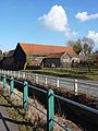
 15th century timber framed houses - geograph.org.uk - 1482193.jpg 640 × 503; 104 KB
-
 50 steps up the embankment - geograph.org.uk - 1033062.jpg 480 × 640; 164 KB
-
 A car-park with a view - geograph.org.uk - 1589970.jpg 640 × 488; 109 KB
-
 A corner of Alton Water - geograph.org.uk - 589075.jpg 640 × 480; 112 KB
-
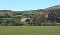
 A corner of Hallthwaites - geograph.org.uk - 540994.jpg 640 × 480; 156 KB
-
 A corner of Moats Tye - geograph.org.uk - 614011.jpg 640 × 439; 96 KB
-
 A corner of Needham Market - geograph.org.uk - 1738078.jpg 1,024 × 752; 487 KB
-
 A corner of Tupwood Scrubbs Road - geograph.org.uk - 1585441.jpg 640 × 480; 171 KB
-
 A cottage at Bank End, Duddon valley - geograph.org.uk - 687141.jpg 640 × 480; 103 KB
-

-
 A farmhouse at St Margaret South Elmham - geograph.org.uk - 863904.jpg 640 × 498; 119 KB
-
 A glimpse of Stutton church - geograph.org.uk - 1602142.jpg 640 × 497; 140 KB
-
 A goat - geograph.org.uk - 1481583.jpg 585 × 640; 160 KB
-
 A high tide at Eskmeals viaduct - geograph.org.uk - 572976.jpg 640 × 463; 77 KB
-
 A house at Grove - geograph.org.uk - 1638348.jpg 640 × 467; 102 KB
-
-
 A row of houses in Needham Market - geograph.org.uk - 1075628.jpg 640 × 472; 104 KB
-

-
 A stretch of Alton Water - geograph.org.uk - 589064.jpg 640 × 511; 113 KB
-
 A tree by Parnell Lane - geograph.org.uk - 1625640.jpg 640 × 490; 111 KB
-
 A tree near Fasbourn Hall - geograph.org.uk - 1613493.jpg 497 × 640; 116 KB
-
 A1071 at Bower House Tye - geograph.org.uk - 1474225.jpg 640 × 488; 127 KB
-
 A1071 near Hadleigh - geograph.org.uk - 1438793.jpg 640 × 460; 98 KB
-
 A1120 through Stowupland - geograph.org.uk - 1044813.jpg 640 × 461; 107 KB
-
 A1120 through Stowupland - geograph.org.uk - 1044829.jpg 640 × 425; 64 KB
-
 A1123 east of Wicken - geograph.org.uk - 581556.jpg 640 × 480; 87 KB
-
 A1123 heading west into Wilburton - geograph.org.uk - 581575.jpg 640 × 468; 104 KB
-
-
 A120 embankment near Stebbingford - geograph.org.uk - 1216755.jpg 640 × 459; 85 KB
-
 A134 curving north through Alpheton - geograph.org.uk - 971172.jpg 640 × 469; 85 KB
-
 A14 at the new junction with bridge - geograph.org.uk - 1626193.jpg 640 × 419; 95 KB
-
 A14 bridge over the river Gipping - geograph.org.uk - 1653300.jpg 640 × 400; 59 KB
-
 A14 from road bridge near Barham - geograph.org.uk - 551603.jpg 585 × 640; 88 KB
-
 A14 near Woolpit - geograph.org.uk - 1625508.jpg 640 × 440; 75 KB
-

-

-
 A5093 north of Millom, near The Hill - geograph.org.uk - 686474.jpg 640 × 446; 67 KB
-

-
 A595 near Thwaites church - geograph.org.uk - 1098411.jpg 640 × 400; 66 KB
-
 A595 towards Broadgate - geograph.org.uk - 1097986.jpg 640 × 360; 52 KB
-
 A712 lane junction - geograph.org.uk - 1255989.jpg 640 × 480; 82 KB
-
 Abbey Farm from the lane junction - geograph.org.uk - 859705.jpg 640 × 458; 103 KB
-
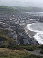 Aberystwyth from Constitution Hill - geograph.org.uk - 924481.jpg 480 × 640; 73 KB
-
 Aberystwyth seafront terraces. - geograph.org.uk - 924845.jpg 640 × 480; 81 KB
-
 Aberystwyth shore - geograph.org.uk - 924862.jpg 640 × 397; 46 KB
-
 Holy Trinity Church, Aberystwyth - geograph.org.uk - 925115.jpg 640 × 523; 91 KB
-
 About to dock at Cairnryan - geograph.org.uk - 1255948.jpg 640 × 427; 57 KB
-
 Above Lowick Green - geograph.org.uk - 1256444.jpg 640 × 480; 85 KB
-
 Above the shop front - geograph.org.uk - 1138253.jpg 640 × 499; 109 KB
-
 Access to Blakenham Woodland Garden - geograph.org.uk - 930781.jpg 640 × 480; 80 KB
-
 Across Bensham Manor Road - geograph.org.uk - 1293102.jpg 640 × 459; 120 KB
-
 Across field towards Chattisham - geograph.org.uk - 1052556.jpg 640 × 480; 71 KB
-

-
 Across the B1078 at Barking - geograph.org.uk - 1732400.jpg 768 × 1,024; 511 KB
-
 Across the field to Belstead Hall - geograph.org.uk - 1001488.jpg 640 × 462; 107 KB
-
 Across the fields to Lowick Green - geograph.org.uk - 1256064.jpg 640 × 480; 60 KB
-
-
 Across the Gipping at Sproughton - geograph.org.uk - 1655105.jpg 640 × 453; 104 KB
-

-
 Across the Ithon valley to Castle Bank - geograph.org.uk - 1590185.jpg 480 × 640; 120 KB
-
 Across the mouth of Holbrook Creek - geograph.org.uk - 1605196.jpg 420 × 640; 80 KB
-
 Across the river to Badley Mill - geograph.org.uk - 995110.jpg 640 × 429; 90 KB
-

-

-
 Airfield crash gate - geograph.org.uk - 1429266.jpg 640 × 446; 106 KB
-
 Akenham Hall Farm - geograph.org.uk - 933702.jpg 640 × 472; 72 KB
-
 Alder Carr Farm in the snow - geograph.org.uk - 1624003.jpg 640 × 490; 129 KB
-
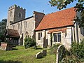
 Aldham church - geograph.org.uk - 618448.jpg 640 × 542; 109 KB
-

-

-
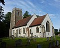
 All Saints Church, Boxted - geograph.org.uk - 971666.jpg 640 × 509; 114 KB
-
 All Saints Church, Boxted - geograph.org.uk - 971676.jpg 640 × 480; 122 KB
-
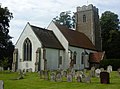
 All Saints Church, Brandeston - geograph.org.uk - 1424549.jpg 640 × 510; 91 KB
-
 All Saints Church, Brandeston - geograph.org.uk - 1424553.jpg 640 × 473; 88 KB
-
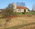
 All Saints Church, Brington - geograph.org.uk - 962017.jpg 640 × 529; 90 KB
-
 All Saints Church, Chelsworth - geograph.org.uk - 724586.jpg 640 × 489; 95 KB
-
 All Saints Church, Chelsworth - geograph.org.uk - 724590.jpg 640 × 475; 87 KB
-
 All Saints Church, Chelsworth - geograph.org.uk - 724591.jpg 640 × 417; 78 KB
-
 All Saints Church, Crowfield - geograph.org.uk - 672685.jpg 640 × 494; 102 KB
-
 All Saints Church, Fordham - geograph.org.uk - 736394.jpg 640 × 452; 122 KB
-
 All Saints Church, Hartest - geograph.org.uk - 971466.jpg 640 × 453; 105 KB
-
 All Saints Church, Hitcham - geograph.org.uk - 1600530.jpg 640 × 480; 95 KB
-
 All Saints Church, Holbrook - geograph.org.uk - 1602734.jpg 640 × 478; 90 KB
-
 All Saints Church, Knettishall - geograph.org.uk - 800483.jpg 640 × 450; 102 KB
-
 All Saints Church, Lawshall - geograph.org.uk - 1421915.jpg 640 × 480; 127 KB
-
 All Saints Church, Newmarket - geograph.org.uk - 581547.jpg 640 × 451; 75 KB
-
 All Saints Church, Old Heathfield - geograph.org.uk - 791839.jpg 434 × 640; 106 KB
-
 All Saints Church, Shelley - geograph.org.uk - 1265626.jpg 640 × 425; 74 KB
-

-
 All Saints Church, Stuston - geograph.org.uk - 1297501.jpg 640 × 446; 106 KB
-
 All Saints Church, Waldringfield - geograph.org.uk - 894261.jpg 640 × 628; 112 KB
-
 All Saints Church, Whickham St Paul - geograph.org.uk - 1463672.jpg 640 × 480; 114 KB
-
 All Saints Road at the turn for Creeting Hills - geograph.org.uk - 1746809.jpg 1,024 × 764; 432 KB
-
 All Saints Road, Creeting St Mary - geograph.org.uk - 1749244.jpg 1,024 × 768; 445 KB
-
 All Saints Road, Newmarket - geograph.org.uk - 581549.jpg 640 × 464; 79 KB
-
 Almshouses, Seckford Street - geograph.org.uk - 1183366.jpg 640 × 480; 89 KB
-
 Along Church Street in Woodbridge - geograph.org.uk - 1183684.jpg 640 × 476; 67 KB
-
 Along Fynn Lane - geograph.org.uk - 1305974.jpg 640 × 480; 131 KB
-
 Along Gipping Road - geograph.org.uk - 1279610.jpg 640 × 409; 106 KB
-
 Along Needham Lane - geograph.org.uk - 1246045.jpg 482 × 640; 148 KB
-
 Alongside Crown Street - geograph.org.uk - 1233530.jpg 476 × 640; 123 KB
-

-

-
 Alpheton church porch - geograph.org.uk - 971868.jpg 640 × 523; 114 KB
-
 Alpheton Hall - geograph.org.uk - 971859.jpg 640 × 487; 101 KB
-
 Alton Water - geograph.org.uk - 1602526.jpg 640 × 460; 98 KB
-
 Alton Water shore towards Holbrook - geograph.org.uk - 1602535.jpg 640 × 617; 117 KB
-
 Alton Water visitor centre - geograph.org.uk - 1602564.jpg 640 × 379; 69 KB
-
 Anglesea Heights nursing home - geograph.org.uk - 1233604.jpg 640 × 431; 65 KB
-
 Another field corner - geograph.org.uk - 1598181.jpg 640 × 480; 167 KB
-
 Another view of Aldham church - geograph.org.uk - 618598.jpg 640 × 503; 99 KB
-
 Another view of ewe with lambs - geograph.org.uk - 550970.jpg 640 × 458; 106 KB
-
 Apartments on Grand Avenue, Worthing - geograph.org.uk - 1138104.jpg 640 × 475; 105 KB
-

-

-
 Approaching Bildeston church - geograph.org.uk - 596191.jpg 455 × 640; 99 KB
-
 Approaching Boyton Hall farm - geograph.org.uk - 1161962.jpg 640 × 428; 78 KB
-

-
-
 Approaching Crow Hall from Willisham - geograph.org.uk - 968140.jpg 640 × 401; 80 KB
-
 Approaching Fen Farm - geograph.org.uk - 1600619.jpg 640 × 429; 85 KB
-

-

-
 Approaching junction with Marten's Lane - geograph.org.uk - 1265567.jpg 640 × 480; 114 KB
-

-
 Approaching Ogmore by Sea - geograph.org.uk - 1019463.jpg 640 × 420; 49 KB
-
-
 Approaching the A14 from Dry Drayton - geograph.org.uk - 961954.jpg 640 × 427; 65 KB
-
 Archway, St Mary's church - geograph.org.uk - 1482271.jpg 480 × 640; 90 KB
-
 Area of saltmarsh by the Orwell - geograph.org.uk - 941440.jpg 640 × 449; 75 KB
-
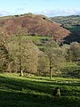
 Area of woodland - geograph.org.uk - 1265560.jpg 640 × 474; 120 KB
-
 Arrival at Cairnryan ferry terminal - geograph.org.uk - 1255954.jpg 485 × 640; 77 KB
-
-
 Ash Street from Dairy Road - geograph.org.uk - 1071082.jpg 640 × 347; 54 KB
-
 Ashbocking Road near Henley school - geograph.org.uk - 965540.jpg 640 × 426; 79 KB
-
 Ashford hospital - geograph.org.uk - 886179.jpg 640 × 438; 77 KB
-
 Asparagus^ - geograph.org.uk - 894557.jpg 640 × 444; 93 KB
-
 At the A25 - A217 junction in Reigate - geograph.org.uk - 592994.jpg 640 × 625; 121 KB
-
 At the edge of the estuary - geograph.org.uk - 1526387.jpg 640 × 480; 67 KB
-
 At the end of Alton Lane - geograph.org.uk - 1602522.jpg 428 × 640; 136 KB
-
 At the end of Old Drive - geograph.org.uk - 1654599.jpg 640 × 480; 154 KB
-
 At the junction for Hitcham Church - geograph.org.uk - 1600712.jpg 480 × 640; 146 KB
-

-

-
 Autumn above the lake at the gardens - geograph.org.uk - 1019866.jpg 640 × 480; 126 KB
-
-
 Autumn colour, Fen Lane - geograph.org.uk - 597902.jpg 640 × 446; 137 KB
-

-
 Autumn colours, Battisford - geograph.org.uk - 614055.jpg 407 × 640; 123 KB
-
 Autumn on the Downs - geograph.org.uk - 1585488.jpg 640 × 480; 186 KB
-
 Autumn trees, Tupwood Scrubbs Road - geograph.org.uk - 1585433.jpg 480 × 640; 207 KB
-
 Autumn woodland - geograph.org.uk - 1585910.jpg 480 × 640; 173 KB
-
 Autumnal Alton Water - geograph.org.uk - 589081.jpg 640 × 535; 187 KB
-
 Autumnal scene at Stowupland - geograph.org.uk - 1044726.jpg 640 × 444; 106 KB
-
 Autumnal scene by Gipping Road - geograph.org.uk - 1044758.jpg 640 × 446; 74 KB
-
 Autumnal view of drive to Tannington Hall - geograph.org.uk - 586657.jpg 640 × 480; 184 KB
-
 Avenue of pine trees - geograph.org.uk - 1282413.jpg 465 × 640; 146 KB
-
 B1022 entering Pods Wood - geograph.org.uk - 1609814.jpg 640 × 455; 132 KB
-
 B1066 entering Boxted from the north - geograph.org.uk - 971637.jpg 640 × 415; 79 KB
-
 B1066 entering Boxted from the south - geograph.org.uk - 971699.jpg 640 × 401; 69 KB
-
 B1066 passing Hartest village green - geograph.org.uk - 972097.jpg 640 × 506; 106 KB
-
-
 B1078 and the turn for Great Bricett - geograph.org.uk - 1070792.jpg 640 × 454; 96 KB
-

-
 B1078 towards Barking - geograph.org.uk - 1732365.jpg 1,024 × 728; 442 KB
-
 B1078 towards Needham Market - geograph.org.uk - 1732369.jpg 1,024 × 736; 466 KB
-
 B1093 bridge, Old Nene, Benwick - geograph.org.uk - 581579.jpg 640 × 480; 119 KB
-
-
 B1113 dual carriageway - geograph.org.uk - 930723.jpg 640 × 436; 75 KB
-
 B1113 junction, Great Blakenham - geograph.org.uk - 930708.jpg 640 × 455; 68 KB
-
 B1113 towards cottage by a corner - geograph.org.uk - 1009336.jpg 640 × 480; 99 KB
-
 B1113 towards Needham Market - geograph.org.uk - 995181.jpg 640 × 410; 82 KB
-
 B1113 towards Stowmarket - geograph.org.uk - 1715314.jpg 1,024 × 711; 513 KB
-

-
 B1115 road junction - geograph.org.uk - 724634.jpg 640 × 434; 70 KB
-
 B1115 south of Hitcham - geograph.org.uk - 1600698.jpg 640 × 480; 118 KB
-
-
 B1115 towards Stowmarket - geograph.org.uk - 1613219.jpg 640 × 426; 67 KB
-
 B1204 north of Saxby All Saints - geograph.org.uk - 1526175.jpg 640 × 459; 88 KB
-

-
 B1225 north of Beacon Hill - geograph.org.uk - 1526422.jpg 640 × 480; 118 KB
-
 B1256 dip at Stebbingford - geograph.org.uk - 1216748.jpg 640 × 415; 72 KB
-
 B1398 near Hemswell Cliff - geograph.org.uk - 1526047.jpg 640 × 480; 110 KB
-

-
 B1456 lay-by at Redgate Hard - geograph.org.uk - 941059.jpg 640 × 323; 42 KB
-
 B2542 towards Ogmore by Sea - geograph.org.uk - 1019374.jpg 640 × 478; 72 KB
-
 B3170 near the Drake Arms - geograph.org.uk - 1033006.jpg 640 × 438; 85 KB
-

-
 B4542 approaching Southerndown - geograph.org.uk - 1019538.jpg 640 × 380; 56 KB
-
 B6047 through Tur Langton - geograph.org.uk - 962032.jpg 640 × 412; 69 KB
-
 B660 north of the A14 - geograph.org.uk - 961995.jpg 640 × 407; 53 KB
-
 B660 towards Catworth - geograph.org.uk - 961987.jpg 640 × 371; 45 KB
-

-
 Back lane to Blawith - geograph.org.uk - 1256046.jpg 640 × 480; 81 KB
-
 Back Lane, Claydon - geograph.org.uk - 896403.jpg 640 × 482; 97 KB
-
 Bacton - Church of St Mary.jpg 640 × 441; 64 KB
-
 Bacton Road leaving Haughley - geograph.org.uk - 1009265.jpg 640 × 480; 96 KB
-
 Bacton village hall - geograph.org.uk - 1217152.jpg 640 × 421; 56 KB
-
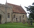
 Badley - Church of St Mary.jpg 640 × 467; 89 KB
-
 Badley Church in the snow - geograph.org.uk - 1144779.jpg 640 × 480; 76 KB


