Category:Images by Bill Nicholls

Media in category "Images by Bill Nicholls"
The following 200 files are in this category, out of 9,898 total.
(previous page) (next page)-
 1960s Houses - geograph.org.uk - 710516.jpg 640 × 480; 72 KB
-
 37 Station Road - geograph.org.uk - 677786.jpg 640 × 427; 50 KB
-
 40 years later - geograph.org.uk - 730483.jpg 640 × 399; 146 KB
-
 5 Miles to Builth - geograph.org.uk - 739037.jpg 640 × 427; 54 KB
-
 A better view - geograph.org.uk - 1718078.jpg 1,024 × 683; 256 KB
-
 A bit of a story to this part - geograph.org.uk - 1632725.jpg 640 × 495; 110 KB
-
 A blue TR - geograph.org.uk - 1516338.jpg 426 × 640; 76 KB
-
 A family tomb - geograph.org.uk - 1801495.jpg 600 × 800; 99 KB
-
 A laundry was here - geograph.org.uk - 1232185.jpg 640 × 426; 63 KB
-
 A list of works - geograph.org.uk - 1598625.jpg 640 × 480; 75 KB
-
 A little bit of history - geograph.org.uk - 2026812.jpg 600 × 800; 117 KB
-
 A look along the cut - geograph.org.uk - 1428382.jpg 640 × 426; 77 KB
-
 A look along the valley - geograph.org.uk - 1738790.jpg 1,024 × 683; 116 KB
-
 A look down the aisle - geograph.org.uk - 1555987.jpg 640 × 480; 89 KB
-
 A look down the church - geograph.org.uk - 1598336.jpg 480 × 640; 61 KB
-
 A look in the hole - geograph.org.uk - 1946724.jpg 1,024 × 768; 205 KB
-
 A look inside - geograph.org.uk - 1177601.jpg 640 × 426; 49 KB
-
 A look inside - geograph.org.uk - 1340104.jpg 640 × 480; 61 KB
-
 A road is born - geograph.org.uk - 836637.jpg 431 × 640; 68 KB
-
 A rotting tree - geograph.org.uk - 1438726.jpg 480 × 640; 129 KB
-
 A square hole - geograph.org.uk - 1746858.jpg 1,024 × 768; 343 KB
-
 A type 28 Twin - geograph.org.uk - 1713384.jpg 1,024 × 683; 247 KB
-
 A view of St Pauls - geograph.org.uk - 4267445.jpg 1,024 × 683; 176 KB
-
 A view through the fencing - geograph.org.uk - 1538532.jpg 640 × 480; 77 KB
-
 A view to the next - geograph.org.uk - 1469475.jpg 640 × 427; 90 KB
-
 A view up the valley - geograph.org.uk - 1558597.jpg 640 × 427; 79 KB
-
 A walk by the railway - geograph.org.uk - 1334531.jpg 640 × 426; 130 KB
-
 A walk on the chase. - geograph.org.uk - 1120202.jpg 426 × 640; 74 KB
-
 A walking Christmas tree - geograph.org.uk - 1596597.jpg 480 × 640; 87 KB
-
 A week after - geograph.org.uk - 1651762.jpg 640 × 480; 107 KB
-
 A word from our sponsors - geograph.org.uk - 1713550.jpg 1,066 × 800; 111 KB
-
 A year later - geograph.org.uk - 1632670.jpg 640 × 480; 100 KB
-
 A35 Peanut - geograph.org.uk - 1496424.jpg 640 × 480; 91 KB
-
 A4074 to Reading - geograph.org.uk - 1574991.jpg 640 × 427; 58 KB
-
 A4080 towards Dwyran - geograph.org.uk - 978371.jpg 640 × 426; 52 KB
-
 A44 to Radnor - geograph.org.uk - 913257.jpg 640 × 426; 80 KB
-
-
 Abandoned in the hedge - geograph.org.uk - 1639859.jpg 640 × 480; 126 KB
-
 Abba Revival - geograph.org.uk - 1596569.jpg 640 × 480; 75 KB
-
 Abbey and toll house - geograph.org.uk - 1307866.jpg 640 × 426; 78 KB
-
 Abbey gate bench mark - geograph.org.uk - 1982015.jpg 600 × 800; 194 KB
-
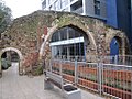 Abbey Mill, Reading.jpg 1,024 × 768; 247 KB
-
 Abbey Road - geograph.org.uk - 1408070.jpg 640 × 480; 77 KB
-
 Abbey Street direction - geograph.org.uk - 2220241.jpg 600 × 800; 145 KB
-
 Abbey Walk - geograph.org.uk - 1092936.jpg 480 × 640; 99 KB
-
 Abbots Mead - geograph.org.uk - 693924.jpg 640 × 427; 46 KB
-
 Aberedw - geograph.org.uk - 1328521.jpg 640 × 480; 71 KB
-
 Aberedw across the field - geograph.org.uk - 1327973.jpg 640 × 426; 60 KB
-
 Aberedw Church porch - geograph.org.uk - 1027499.jpg 640 × 426; 83 KB
-
 Weather vane - geograph.org.uk - 1256977.jpg 640 × 426; 19 KB
-
 Abingdon in the distance - geograph.org.uk - 1432480.jpg 640 × 426; 71 KB
-
 Above DPC - geograph.org.uk - 988140.jpg 640 × 426; 47 KB
-
 Above the campsite - geograph.org.uk - 1326628.jpg 640 × 480; 62 KB
-

-
 Access road to the estate - geograph.org.uk - 1634826.jpg 480 × 640; 76 KB
-
 Across Clifton Hampden Bridge - geograph.org.uk - 1569683.jpg 640 × 427; 66 KB
-
 Across Sutton Bridge - geograph.org.uk - 1436845.jpg 640 × 426; 71 KB
-
 Across the allotment - geograph.org.uk - 1470865.jpg 640 × 427; 74 KB
-
 Across the back - geograph.org.uk - 887087.jpg 427 × 640; 103 KB
-
 Across the bridge - geograph.org.uk - 1550078.jpg 640 × 480; 151 KB
-
 Across the car park - geograph.org.uk - 1559797.jpg 640 × 427; 74 KB
-
 Across the cricket pitch - geograph.org.uk - 1129336.jpg 640 × 426; 101 KB
-
 Across the crop to the footpath - geograph.org.uk - 1744770.jpg 533 × 800; 71 KB
-
 Across the cutting - geograph.org.uk - 1657408.jpg 640 × 427; 60 KB
-
 Across the dam - geograph.org.uk - 886761.jpg 640 × 480; 115 KB
-
 Across the dam - geograph.org.uk - 888245.jpg 640 × 480; 115 KB
-
 Across the field - geograph.org.uk - 1629391.jpg 640 × 427; 73 KB
-
 Across the field - geograph.org.uk - 894529.jpg 480 × 640; 55 KB
-
 Across the field to Brook house - geograph.org.uk - 939134.jpg 640 × 426; 43 KB
-
 Across the field to Chilton - geograph.org.uk - 1703958.jpg 1,024 × 683; 98 KB
-
 Across the field to Duxford - geograph.org.uk - 1462436.jpg 640 × 427; 56 KB
-
 Across the field to Sulham - geograph.org.uk - 1739277.jpg 1,024 × 683; 153 KB
-
 Across the field to Sulham brook - geograph.org.uk - 1755221.jpg 1,024 × 683; 92 KB
-
 Across the field to the bridge - geograph.org.uk - 1275458.jpg 640 × 426; 82 KB
-
 Across the field to the canal - geograph.org.uk - 1638808.jpg 640 × 480; 73 KB
-
 Across the field to the Church - geograph.org.uk - 1160129.jpg 640 × 415; 33 KB
-
 Across the field to the Waterloo - geograph.org.uk - 1080672.jpg 640 × 426; 37 KB
-
 Across the fields - geograph.org.uk - 965886.jpg 640 × 426; 46 KB
-
 Across the fields to Didcot - geograph.org.uk - 1056004.jpg 640 × 426; 77 KB
-
 Across the frozen fields - geograph.org.uk - 1109696.jpg 640 × 426; 42 KB
-
 Across the graves to the school - geograph.org.uk - 1602588.jpg 640 × 427; 88 KB
-
 Across the graveyard - geograph.org.uk - 1573623.jpg 640 × 427; 98 KB
-
 Across the graveyard - geograph.org.uk - 939221.jpg 640 × 426; 57 KB
-
 Across the green - geograph.org.uk - 1521899.jpg 640 × 480; 46 KB
-
 Across the green - geograph.org.uk - 1551042.jpg 640 × 427; 79 KB
-
 Across the green - geograph.org.uk - 1601253.jpg 640 × 427; 93 KB
-
 Across the hills - geograph.org.uk - 852267.jpg 640 × 426; 61 KB
-
 Across the link bridge - geograph.org.uk - 888260.jpg 427 × 640; 82 KB
-
 Across the marsh - geograph.org.uk - 1736421.jpg 1,024 × 683; 125 KB
-
 Across the pews - geograph.org.uk - 1555994.jpg 480 × 640; 75 KB
-
 Across the Radnor Valley - geograph.org.uk - 1557357.jpg 640 × 427; 53 KB
-
 Across the rec - geograph.org.uk - 988132.jpg 640 × 426; 55 KB
-
 Across the river - geograph.org.uk - 1167350.jpg 640 × 426; 48 KB
-
 Across the river - geograph.org.uk - 1451967.jpg 640 × 480; 86 KB
-
 Across the river - geograph.org.uk - 1464134.jpg 640 × 427; 83 KB
-
 Across the river - geograph.org.uk - 1567351.jpg 640 × 480; 92 KB
-
 Across the river - geograph.org.uk - 1582328.jpg 640 × 480; 54 KB
-
 Across the river - geograph.org.uk - 1629381.jpg 640 × 427; 78 KB
-
 Across the road - geograph.org.uk - 1461253.jpg 480 × 640; 117 KB
-
 Across the road - geograph.org.uk - 1617975.jpg 640 × 427; 69 KB
-
 Across the road from the school - geograph.org.uk - 886113.jpg 640 × 426; 61 KB
-
 Across the sections - geograph.org.uk - 832744.jpg 640 × 432; 62 KB
-
 Across the stream - geograph.org.uk - 965935.jpg 640 × 426; 111 KB
-
 Across the street - geograph.org.uk - 981003.jpg 640 × 426; 64 KB
-
 Across the Thames - geograph.org.uk - 1167346.jpg 640 × 426; 75 KB
-
 Across the Thames - geograph.org.uk - 1186974.jpg 640 × 426; 45 KB
-
 Across the top of the pillbox - geograph.org.uk - 1739631.jpg 1,024 × 683; 245 KB
-
 Across the weir - geograph.org.uk - 1179125.jpg 640 × 426; 69 KB
-
 Across to South Street - geograph.org.uk - 1358936.jpg 640 × 426; 114 KB
-
 Across to the gate - geograph.org.uk - 1574555.jpg 426 × 640; 103 KB
-
 Across to the hall - geograph.org.uk - 1511408.jpg 640 × 480; 102 KB
-
 Across to the Hall - geograph.org.uk - 1621920.jpg 426 × 640; 132 KB
-
 Across to the hall - geograph.org.uk - 1671100.jpg 1,024 × 683; 122 KB
-
 Afon Braint - geograph.org.uk - 967209.jpg 426 × 640; 83 KB
-
 Afon Braint - geograph.org.uk - 976924.jpg 426 × 640; 84 KB
-
 Afon Braint - geograph.org.uk - 978402.jpg 426 × 640; 119 KB
-
 Afon Claerwen - geograph.org.uk - 982629.jpg 640 × 426; 53 KB
-
 Afon Claerwen - geograph.org.uk - 982985.jpg 640 × 426; 92 KB
-
 After the flood - geograph.org.uk - 979736.jpg 640 × 426; 54 KB
-
 After the pipe was laid - geograph.org.uk - 1313031.jpg 640 × 426; 103 KB
-
 Aftermath - geograph.org.uk - 700646.jpg 640 × 480; 58 KB
-
 Agatha in the snow - geograph.org.uk - 1631913.jpg 426 × 640; 107 KB
-
 Airfield in the distance - geograph.org.uk - 1264910.jpg 640 × 426; 57 KB
-
 Alcove by the corner - geograph.org.uk - 1654247.jpg 640 × 480; 52 KB
-
 Alcove in the chapel - geograph.org.uk - 1655276.jpg 480 × 640; 37 KB
-
 Alcove in the church - geograph.org.uk - 1561500.jpg 480 × 640; 40 KB
-
 Alcove in the wall - geograph.org.uk - 1103479.jpg 640 × 480; 97 KB
-
 Alcove in the wall - geograph.org.uk - 1157244.jpg 400 × 600; 44 KB
-
 Alcove in the wall - geograph.org.uk - 1605718.jpg 480 × 640; 74 KB
-
 Alcove over the door - geograph.org.uk - 1476582.jpg 480 × 640; 51 KB
-
 Alfresco eating - geograph.org.uk - 959455.jpg 426 × 640; 77 KB
-
 Alice Duchess of Suffolk - geograph.org.uk - 1605677.jpg 640 × 480; 80 KB
-
 Alice Duchess of Suffolk - geograph.org.uk - 1605684.jpg 480 × 640; 87 KB
-
 Alice in the Tomb - geograph.org.uk - 1605701.jpg 640 × 480; 62 KB
-
 Alison's Seat - geograph.org.uk - 742007.jpg 640 × 427; 83 KB
-
 Alison's View - geograph.org.uk - 742010.jpg 640 × 427; 67 KB
-
 All boarded up - geograph.org.uk - 1116372.jpg 640 × 426; 62 KB
-
 All boarded up - geograph.org.uk - 1235441.jpg 640 × 426; 52 KB
-
 All boarded up - geograph.org.uk - 1348446.jpg 640 × 480; 103 KB
-
 All cleaned up - geograph.org.uk - 1279783.jpg 400 × 600; 69 KB
-
 All cleaned up - geograph.org.uk - 738972.jpg 640 × 427; 118 KB
-
 All dried up - geograph.org.uk - 1253495.jpg 400 × 600; 77 KB
-
 All fallen down - geograph.org.uk - 1345377.jpg 640 × 480; 125 KB
-
 All fenced off - geograph.org.uk - 1568620.jpg 640 × 480; 86 KB
-
 All in a row - geograph.org.uk - 1552878.jpg 640 × 427; 99 KB
-
 All lined up - geograph.org.uk - 1552847.jpg 640 × 427; 74 KB
-
 All locked up - geograph.org.uk - 1407030.jpg 640 × 480; 69 KB
-
 All ready for the tarmac - geograph.org.uk - 837943.jpg 640 × 434; 50 KB
-
 All Saints Aston Upthorpe - geograph.org.uk - 1560548.jpg 640 × 427; 50 KB
-
 All Saints Church Marcham - geograph.org.uk - 1266051.jpg 640 × 426; 57 KB
-
 All Saints Church Marcham - geograph.org.uk - 1266197.jpg 640 × 426; 70 KB
-
 All Saints from the Bridleway - geograph.org.uk - 1562884.jpg 640 × 480; 76 KB
-
 All shut up - geograph.org.uk - 1710412.jpg 1,024 × 683; 116 KB
-
 All that remains - geograph.org.uk - 1194031.jpg 400 × 600; 90 KB
-
 All that remains - geograph.org.uk - 1194178.jpg 400 × 600; 115 KB
-
 All that's left are the posts - geograph.org.uk - 960354.jpg 640 × 426; 77 KB
-
 All the way along - geograph.org.uk - 1447041.jpg 325 × 640; 60 KB
-
 All together now - geograph.org.uk - 1117509.jpg 640 × 426; 91 KB
-
 Alley to Brentford close - geograph.org.uk - 868941.jpg 427 × 640; 68 KB
-
 Alley to the river - geograph.org.uk - 1103023.jpg 640 × 480; 58 KB
-
 Alley to West End - geograph.org.uk - 709715.jpg 427 × 640; 126 KB
-
 Alley way to the market place - geograph.org.uk - 791868.jpg 427 × 640; 75 KB
-
 Alleyway to the school - geograph.org.uk - 773968.jpg 427 × 640; 114 KB
-
 Allotments in the snow - geograph.org.uk - 1629940.jpg 640 × 427; 97 KB
-
 Almost complete - geograph.org.uk - 838103.jpg 640 × 435; 50 KB
-
 Almost done - geograph.org.uk - 836685.jpg 456 × 640; 43 KB
-
 Almost finished - geograph.org.uk - 832164.jpg 640 × 444; 53 KB
-
 Almost hidden - geograph.org.uk - 1186809.jpg 640 × 426; 117 KB
-
 Almost hidden - geograph.org.uk - 1594105.jpg 640 × 480; 160 KB
-
 Almost hidden - geograph.org.uk - 939112.jpg 640 × 426; 96 KB
-
 Almost on top - geograph.org.uk - 1595348.jpg 640 × 427; 58 KB
-
 Almshouses along Castle Street - geograph.org.uk - 2083821.jpg 600 × 800; 128 KB
-
 Almshouses along Castle Street 2 - geograph.org.uk - 2083853.jpg 1,024 × 768; 175 KB
-
 Almshouses along castle street 3 - geograph.org.uk - 2083932.jpg 1,024 × 768; 172 KB
-
 Alone by the altar - geograph.org.uk - 1511531.jpg 480 × 640; 71 KB
-
 Along a path - geograph.org.uk - 1433828.jpg 640 × 426; 70 KB
-
 Along by the graveyard - geograph.org.uk - 1603441.jpg 426 × 640; 61 KB
-
 Along by the line - geograph.org.uk - 1330595.jpg 640 × 426; 124 KB
-
 Along from The Grotto - geograph.org.uk - 1451937.jpg 640 × 427; 69 KB
-
 Along platform Four - geograph.org.uk - 4942757.jpg 1,024 × 768; 167 KB
-
 Along Sutton bridge - geograph.org.uk - 1433848.jpg 640 × 426; 100 KB
-
-
 Along the back - geograph.org.uk - 1433536.jpg 480 × 640; 125 KB
-
 Along the back - geograph.org.uk - 1573629.jpg 426 × 640; 109 KB
-
 Along the back wall - geograph.org.uk - 1603351.jpg 426 × 640; 95 KB
-
 Along the bridge - geograph.org.uk - 1059441.jpg 640 × 426; 60 KB
-
 Along the bridge - geograph.org.uk - 1116479.jpg 426 × 640; 53 KB
-
 Along the bridge - geograph.org.uk - 1222318.jpg 400 × 600; 64 KB
-
 Along the bridge - geograph.org.uk - 1465820.jpg 640 × 427; 86 KB
-
 Along the chamber - geograph.org.uk - 1622189.jpg 640 × 427; 78 KB
-
 Along the concrete - geograph.org.uk - 1564599.jpg 640 × 480; 92 KB
-
 Along the cut - geograph.org.uk - 1417710.jpg 640 × 426; 120 KB
-
 Along the cut - geograph.org.uk - 1571087.jpg 640 × 427; 100 KB
-
 Along the dam - geograph.org.uk - 983715.jpg 426 × 640; 51 KB
-
 Along the ditch - geograph.org.uk - 1299622.jpg 400 × 600; 78 KB
-
 Along the edge - geograph.org.uk - 852271.jpg 427 × 640; 92 KB
-
 Along the edge - geograph.org.uk - 887378.jpg 427 × 640; 100 KB
-
 Along the fence - geograph.org.uk - 1946730.jpg 1,024 × 768; 179 KB
-
 Along the hedge - geograph.org.uk - 1085984.jpg 640 × 426; 48 KB
-
 Along the hedge - geograph.org.uk - 868837.jpg 640 × 426; 65 KB


