Category:Images by David Quinn

Media in category "Images by David Quinn"
The following 200 files are in this category, out of 890 total.
(previous page) (next page)-
 19 Arches Bridge, Arklow - geograph.org.uk - 599475.jpg 640 × 480; 43 KB
-
 2 Stiles and a Footbridge. - geograph.org.uk - 537123.jpg 480 × 640; 156 KB
-

-
 Abbey of St. Peter - Paul, Clones. - geograph.org.uk - 692349.jpg 640 × 480; 97 KB
-
 Abbot's Quay Offices - geograph.org.uk - 888493.jpg 640 × 480; 73 KB
-
 Access Road to Quarry - geograph.org.uk - 725433.jpg 480 × 640; 118 KB
-
 Achill Sound Hotel - geograph.org.uk - 919845.jpg 640 × 480; 65 KB
-
 Achill Sound Library - geograph.org.uk - 919853.jpg 640 × 480; 53 KB
-
 Adams Butcher, Oxton - geograph.org.uk - 1124547.jpg 480 × 640; 69 KB
-
 All Heading South-by-David-Quinn.jpg 640 × 480; 99 KB
-
 Alvanley Hall - geograph.org.uk - 1995941 cropped.jpg 2,980 × 2,032; 529 KB
-
 Alvanley Hall - geograph.org.uk - 1995941.jpg 4,416 × 3,312; 2.83 MB
-

-
 Arklow Library - geograph.org.uk - 692209.jpg 480 × 640; 45 KB
-
 Arklow Post Office. - geograph.org.uk - 692201.jpg 640 × 480; 69 KB
-
 Arklow railway station in 2008.jpg 640 × 480; 67 KB
-
 Arrowe Brook - geograph.org.uk - 725493.jpg 480 × 640; 75 KB
-
 Arrowe Brook Bridge - geograph.org.uk - 619777.jpg 640 × 480; 128 KB
-
 Arrowe Brook near Greasby. - geograph.org.uk - 619776.jpg 640 × 480; 158 KB
-
 Arrowebrook Bus Depot - geograph.org.uk - 1433645.jpg 640 × 480; 88 KB
-
 Art and Tourist Shop, Doogort - geograph.org.uk - 919290.jpg 640 × 480; 59 KB
-
 Ash Brook - geograph.org.uk - 537080.jpg 640 × 480; 169 KB
-
 Ash Brook near Pool Head Farm. - geograph.org.uk - 537149.jpg 640 × 480; 108 KB
-
 Avonmore River - geograph.org.uk - 1171763.jpg 640 × 480; 111 KB
-
 Ballymoyle Forestry Plantation - geograph.org.uk - 917625.jpg 480 × 640; 138 KB
-
 Ballymoyle Plantation - geograph.org.uk - 917709.jpg 480 × 640; 129 KB
-
 Beach near Cahore. - geograph.org.uk - 917578.jpg 640 × 480; 54 KB
-
 Beech House. - geograph.org.uk - 537153.jpg 640 × 480; 80 KB
-
 Beechwood Library. - geograph.org.uk - 667895.jpg 640 × 480; 58 KB
-
 Belle Monte Hotel, Frodsham - geograph.org.uk - 1388497.jpg 640 × 480; 101 KB
-
 Benty Heath Lane - geograph.org.uk - 1415554.jpg 640 × 480; 121 KB
-
 Bethel Baptist Church, Shotton - geograph.org.uk - 1388167.jpg 480 × 640; 60 KB
-
 Bickley Road - geograph.org.uk - 1195394.jpg 640 × 480; 76 KB
-
 Bidston Moss Nature Reserve-by-David-Quinn.jpg 480 × 640; 130 KB
-
 Bidston Moss Recycling Facility-by-David-Quinn.jpg 640 × 480; 43 KB
-
 Bidston railway station in 2007.jpg 640 × 480; 70 KB
-
 Birkenhead Road - geograph.org.uk - 1415485.jpg 640 × 480; 66 KB
-
 Blackheath Medical Centre.-by-David-Quinn.jpg 640 × 511; 69 KB
-
 Bluebell Lane Bridleway - geograph.org.uk - 1415473.jpg 640 × 480; 127 KB
-
 Bluebell Lane Bridleway - geograph.org.uk - 1415482.jpg 640 × 480; 137 KB
-
 Borderlands Line - geograph.org.uk - 892385.jpg 640 × 480; 120 KB
-
 Borderlands Line. - geograph.org.uk - 734768.jpg 480 × 640; 78 KB
-
 Bray Railway Station - geograph.org.uk - 917339.jpg 640 × 480; 94 KB
-
 Bray Railway Station - geograph.org.uk - 917344.jpg 640 × 480; 78 KB
-

-

-

-
 Bridge and Dam - geograph.org.uk - 918258.jpg 640 × 480; 88 KB
-
 Bridleway across Burton Meadows - geograph.org.uk - 1380327.jpg 640 × 480; 61 KB
-
 Bridleway and Private Drive - geograph.org.uk - 1433579.jpg 640 × 480; 133 KB
-
-
 Bridleway between Greasby and Arrowe Park - geograph.org.uk - 619774.jpg 640 × 480; 137 KB
-
 Bridleway between Haddon and Burton Woods - geograph.org.uk - 892486.jpg 480 × 640; 153 KB
-
 Bridleway between Haddon Wood and Burton - geograph.org.uk - 892479.jpg 480 × 640; 128 KB
-

-

-
 Bridleway from Moel Famau - geograph.org.uk - 710820.jpg 480 × 640; 74 KB
-
 Bridleway near Garth Farm - geograph.org.uk - 1171799.jpg 640 × 480; 134 KB
-
 Bridleway near Loggerheads - geograph.org.uk - 1327980.jpg 480 × 640; 161 KB
-
 Bridleway near Moel Famau - geograph.org.uk - 484154.jpg 640 × 480; 118 KB
-
 Bridleway near New Rocklands. - geograph.org.uk - 681509.jpg 640 × 480; 139 KB
-
 Bridleway near Shotton - geograph.org.uk - 507151.jpg 640 × 480; 161 KB
-
 Bridleway near Strawberry Roundabout - geograph.org.uk - 1433538.jpg 480 × 640; 152 KB
-
 Bridleway near Willaston - geograph.org.uk - 1383371.jpg 480 × 640; 131 KB
-
 Bridleway north of Street Hey Lane - geograph.org.uk - 1383369.jpg 480 × 640; 131 KB
-
 Bridleway off Heath Lane. - geograph.org.uk - 532409.jpg 640 × 480; 148 KB
-
 Bridleway on slopes of Hope Mountain - geograph.org.uk - 833426.jpg 640 × 480; 99 KB
-
 Bridleway on slopes of Hope Mountain. - geograph.org.uk - 833422.jpg 480 × 640; 95 KB
-
 Bridleway to Cilcain - geograph.org.uk - 1171794.jpg 640 × 480; 124 KB
-
 Bridleway to England - geograph.org.uk - 1380323.jpg 480 × 640; 65 KB
-
 Bridleway to Haddon Wood - geograph.org.uk - 892407.jpg 640 × 480; 147 KB
-
 Bridleway to Loggerheads - geograph.org.uk - 1327935.jpg 480 × 640; 150 KB
-
 Bridleway to Moel Famau - geograph.org.uk - 710814.jpg 480 × 640; 73 KB
-
 Bridleway to Noctorum Lane. - geograph.org.uk - 1124576.jpg 480 × 640; 139 KB
-
 Brimstage Telephone Box. - geograph.org.uk - 681472.jpg 480 × 640; 132 KB
-
 Brimstage Village - geograph.org.uk - 681470.jpg 640 × 480; 95 KB
-
 Bromborough Golf Club - geograph.org.uk - 1415589.jpg 640 × 480; 60 KB
-
 Bryn Alyn - geograph.org.uk - 1327844.jpg 640 × 480; 81 KB
-

-
 Byway to Moorhead Farm - geograph.org.uk - 1195355.jpg 640 × 480; 90 KB
-
 Byway to Quarry Works - geograph.org.uk - 1327881.jpg 480 × 640; 158 KB
-
 Byway-Access Road to Quarry - geograph.org.uk - 1327806.jpg 480 × 640; 92 KB
-
 Caergwrle Methodist Church. - geograph.org.uk - 530740.jpg 480 × 640; 64 KB
-
 Caergwrle Railway Station.jpg 640 × 480; 91 KB
-
 Cahore Lifeboat House - geograph.org.uk - 917593.jpg 480 × 640; 62 KB
-
 Cahore Pier - geograph.org.uk - 917558.jpg 640 × 480; 71 KB
-
 Car-park near Cilcain - geograph.org.uk - 1171862.jpg 640 × 480; 70 KB
-
 Carpenters Solicitors - geograph.org.uk - 888496.jpg 640 × 480; 59 KB
-
 Cefn-y-Bedd railway station in 2008.jpg 640 × 480; 100 KB
-
 Chester High Road - geograph.org.uk - 718086.jpg 480 × 640; 79 KB
-
 Church of Ireland in Clones. - geograph.org.uk - 523825.jpg 480 × 640; 116 KB
-
 Clara Bridge - geograph.org.uk - 599577.jpg 640 × 480; 99 KB
-
 Claughton Village - geograph.org.uk - 466834.jpg 640 × 480; 88 KB
-
 Clones Montessori School - geograph.org.uk - 692337.jpg 480 × 640; 78 KB
-
 Clones Round Tower - geograph.org.uk - 692357.jpg 480 × 640; 55 KB
-
 Clwydian Way - geograph.org.uk - 1327761.jpg 640 × 480; 69 KB
-
 Clwydian Way - geograph.org.uk - 710791.jpg 480 × 640; 115 KB
-
 Clwydian Way Ascending Bryn Alyn - geograph.org.uk - 1327814.jpg 640 × 480; 71 KB
-
 Clwydian Way at edge of Coed y Fedw - geograph.org.uk - 1327688.jpg 640 × 480; 146 KB
-
 Clwydian Way crossing Bryn Alyn - geograph.org.uk - 1327825.jpg 640 × 480; 58 KB
-
 Clwydian Way near Colomendy - geograph.org.uk - 1327679.jpg 640 × 480; 84 KB
-
 Clwydian Way north of Aberduna - geograph.org.uk - 1327690.jpg 480 × 640; 138 KB
-
 Clwydian Way north of Maeshafn - geograph.org.uk - 1327696.jpg 480 × 640; 126 KB
-
 Clwydian Way south of Maeshafn - geograph.org.uk - 1327699.jpg 480 × 640; 145 KB
-
 Clywdian Way north of Bryn Alyn - geograph.org.uk - 1327774.jpg 640 × 480; 76 KB
-
 Co-op Late Shop on Manor Drive. - geograph.org.uk - 643441.jpg 640 × 480; 63 KB
-
 Co-op Shop, Kingsley - geograph.org.uk - 1388356.jpg 640 × 480; 83 KB
-
 Colourful Fields near Llanfynydd. - geograph.org.uk - 833460.jpg 640 × 480; 115 KB
-
 Community Woodland at Bidston Moss-by-David-Quinn.jpg 480 × 640; 56 KB
-

-
 Confluence of The Birket and the River Fender-by-David-Quinn.jpg 640 × 480; 90 KB
-
 Conway Park Railway Station - geograph.org.uk - 888497.jpg 640 × 480; 73 KB
-
 Coronation Park, Greasby - geograph.org.uk - 889667.jpg 640 × 480; 97 KB
-
 Corrie above Acorrymore - geograph.org.uk - 918249.jpg 640 × 480; 79 KB
-
 Cow and Weaver - geograph.org.uk - 1388188.jpg 640 × 480; 88 KB
-
 Cow Hey Covert - geograph.org.uk - 674986.jpg 640 × 480; 76 KB
-
 Croughton Hamlet Centre - geograph.org.uk - 1433623.jpg 640 × 480; 65 KB
-
 Current Lighthouse, Wicklow Head - geograph.org.uk - 692447.jpg 480 × 640; 44 KB
-
 Cycle-path to Wallasey-by-David-Quinn.jpg 640 × 480; 93 KB
-
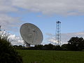 Darnhall - Radio Telescope.jpg 640 × 480; 53 KB
-
 Dee Marsh Junction Box - geograph.org.uk - 542122.jpg 640 × 480; 79 KB
-
 Denhall Lane - geograph.org.uk - 892371.jpg 640 × 480; 76 KB
-
 Denhall Lane along the Coast - geograph.org.uk - 892380.jpg 640 × 480; 97 KB
-
 Dension's Bridge - geograph.org.uk - 1433673.jpg 640 × 480; 86 KB
-
 Depmore Lane, Kingsley - geograph.org.uk - 1388363.jpg 640 × 480; 97 KB
-
 Derby Pool Harvester-by-David-Quinn.jpg 640 × 480; 50 KB
-

-

-
 Diverging Footpaths - geograph.org.uk - 1327740.jpg 640 × 480; 93 KB
-
 Djouce Mountain Summit. - geograph.org.uk - 523805.jpg 480 × 640; 96 KB
-
 Dol-Gam Campsite - geograph.org.uk - 861226.jpg 640 × 480; 55 KB
-
 Doogort Pier - geograph.org.uk - 919339.jpg 640 × 480; 64 KB
-
 Doogort Sewerage Scheme - geograph.org.uk - 919344.jpg 640 × 480; 80 KB
-
 Doogort Shop - geograph.org.uk - 919282.jpg 640 × 480; 54 KB
-
 Dopers Lane - geograph.org.uk - 1388450.jpg 640 × 480; 79 KB
-
 Driveway to St. Thomas Church - geograph.org.uk - 919333.jpg 480 × 640; 147 KB
-
 Drumsnat Church - geograph.org.uk - 918104.jpg 640 × 480; 58 KB
-
 Dumping Ground. - geograph.org.uk - 681516.jpg 640 × 480; 159 KB
-
 Eddisbury Way - geograph.org.uk - 507192.jpg 640 × 480; 94 KB
-
 Eddisbury Way just south of Frodsham - geograph.org.uk - 566361.jpg 640 × 480; 186 KB
-
 Farm - Common - Public Land near Irby - geograph.org.uk - 824367.jpg 480 × 640; 119 KB
-

-
 Farm Road and Footpath - geograph.org.uk - 1411789.jpg 640 × 480; 77 KB
-
 Farm Road and Footpath - geograph.org.uk - 1415445.jpg 640 × 480; 94 KB
-
 Farm Road in Thornton Hough - geograph.org.uk - 1029162.jpg 640 × 480; 77 KB
-
 Farm Road on the Footpath - geograph.org.uk - 1411859.jpg 640 × 480; 121 KB
-
 Farmland and Hope Hall Farm - geograph.org.uk - 1379958.jpg 640 × 480; 68 KB
-
 Farmland and view into Cheshire - geograph.org.uk - 1379983.jpg 640 × 480; 68 KB
-
 Farmland in Newton - geograph.org.uk - 1388406.jpg 640 × 480; 49 KB
-
 Farmland near Burton - geograph.org.uk - 892464.jpg 640 × 480; 94 KB
-
 Farmland near Catton Hall - geograph.org.uk - 1388248.jpg 640 × 480; 64 KB
-
 Farmland near Cilcain - geograph.org.uk - 1171791.jpg 640 × 480; 74 KB
-
 Farmland near Croughton - geograph.org.uk - 1433634.jpg 640 × 480; 73 KB
-
 Farmland near Honkley - geograph.org.uk - 1379985.jpg 480 × 640; 85 KB
-
 Farmland near Hope - geograph.org.uk - 1379956.jpg 640 × 480; 69 KB
-
 Farmland near Hope - geograph.org.uk - 1379974.jpg 640 × 480; 73 KB
-
 Farmland near Hope - geograph.org.uk - 1379978.jpg 640 × 480; 107 KB
-
 Farmland near Hope - geograph.org.uk - 833397.jpg 640 × 480; 101 KB
-
 Farmland near Hope-Caergwrle. - geograph.org.uk - 833387.jpg 640 × 480; 66 KB
-
 Farmland near Horeb - geograph.org.uk - 833377.jpg 640 × 480; 76 KB
-
 Farmland near Llanferres - geograph.org.uk - 1327916.jpg 480 × 640; 96 KB
-
 Farmland near Llanfynydd. - geograph.org.uk - 833433.jpg 640 × 480; 89 KB
-
 Farmland near Llanfynydd. - geograph.org.uk - 833449.jpg 640 × 480; 86 KB
-
 Farmland near Lower Kinnerton - geograph.org.uk - 1380395.jpg 480 × 640; 65 KB
-
 Farmland near Maeshafn - geograph.org.uk - 1327757.jpg 640 × 480; 88 KB
-
 Farmland near Meols - geograph.org.uk - 1411784.jpg 640 × 480; 73 KB
-
 Farmland near Mickledale - geograph.org.uk - 1388469.jpg 640 × 480; 57 KB
-
 Farmland near Newton - geograph.org.uk - 1388424.jpg 640 × 480; 60 KB
-
 Farmland near Newton - geograph.org.uk - 1388431.jpg 640 × 480; 71 KB
-
 Farmland near Newton - geograph.org.uk - 1388441.jpg 640 × 480; 81 KB
-
 Farmland near Raby - geograph.org.uk - 1029201.jpg 640 × 480; 47 KB
-
 Farmland near Raby - geograph.org.uk - 1415397.jpg 640 × 480; 80 KB
-
 Farmland near Storeton. - geograph.org.uk - 734763.jpg 640 × 480; 63 KB
-
 Farmland near Thornton Hough - geograph.org.uk - 1029190.jpg 640 × 480; 83 KB
-
 Farmland near Whitby - geograph.org.uk - 1433547.jpg 640 × 480; 95 KB
-
 Farmland near Willaston - geograph.org.uk - 1415506.jpg 640 × 480; 85 KB
-
 Farmland near Willaston - geograph.org.uk - 1415541.jpg 640 × 480; 83 KB
-
 Farmland north of Caergwrle - geograph.org.uk - 833366.jpg 640 × 480; 65 KB
-
 Farmland north of Greystones - geograph.org.uk - 917288.jpg 640 × 480; 82 KB
-
 Farmland north of Greystones - geograph.org.uk - 917296.jpg 640 × 480; 56 KB
-
 Farmland of Pentre Farm - geograph.org.uk - 833511.jpg 640 × 480; 80 KB
-
 Farmland off Dopers Lane - geograph.org.uk - 1388457.jpg 640 × 480; 93 KB
-
 Farmland on side of Hope Mountain. - geograph.org.uk - 833418.jpg 640 × 480; 56 KB
-
 Farmland south of Maeshafn - geograph.org.uk - 1327703.jpg 640 × 480; 82 KB
-
 Farmland south of Maeshafn - geograph.org.uk - 1327733.jpg 640 × 480; 89 KB
-
 Fender Lane Dual Carriageway-by-David-Quinn.jpg 640 × 480; 51 KB
-
 Fender Way footpath - geograph.org.uk - 503676.jpg 640 × 480; 128 KB
-
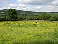
 Field of Buttercups - geograph.org.uk - 1327926.jpg 640 × 480; 153 KB
-
 Field of Peas - geograph.org.uk - 1380303.jpg 480 × 640; 84 KB
-
 Field of Peas near Honkley - geograph.org.uk - 1380296.jpg 640 × 480; 86 KB
-

-
 Fields of Horses near Frankby - geograph.org.uk - 1411861.jpg 640 × 480; 64 KB
-
 Flash near Wettenhall - geograph.org.uk - 537135.jpg 640 × 480; 75 KB
-
 Foel Fenlli from Offa's Dyke Path.jpg 640 × 480; 70 KB
-
 Footbridge and Footpath to Frodsham - geograph.org.uk - 1388184.jpg 480 × 640; 121 KB
-
 Footbridge over a small Stream. - geograph.org.uk - 833382.jpg 480 × 640; 135 KB
-
 Footbridge over Prenton Brook. - geograph.org.uk - 734798.jpg 640 × 480; 141 KB
-
 Footbridge over small Brook. - geograph.org.uk - 734746.jpg 480 × 640; 141 KB
-
 Footbridge over The Birket-by-David-Quinn.jpg 640 × 480; 64 KB
-
 Footbridge over the River Gowy - geograph.org.uk - 1433724.jpg 640 × 480; 83 KB


