Category:Images by Jeremy Bolwell

Media in category "Images by Jeremy Bolwell"
The following 200 files are in this category, out of 543 total.
(previous page) (next page)-
-

-

-

-
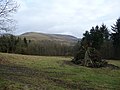 A bonfire in Plowden Woods - geograph.org.uk - 1712397.jpg 640 × 480; 76 KB
-
 A bull in the field - geograph.org.uk - 1303181.jpg 640 × 480; 77 KB
-

-

-
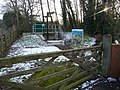 A sewage pumping station - geograph.org.uk - 1712106.jpg 640 × 480; 123 KB
-
 A Shropshire hill farm - geograph.org.uk - 1712242.jpg 640 × 480; 64 KB
-
 A Welsh hill farm - geograph.org.uk - 1752071.jpg 640 × 480; 86 KB
-
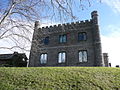 Abergavenny Castle 1.jpg 640 × 480; 128 KB
-
 Abergavenny Castle 2.jpg 640 × 480; 77 KB
-
 Abergavenny Castle curtain wall - geograph.org.uk - 710252.jpg 480 × 640; 98 KB
-
 Abergynolwyn village - geograph.org.uk - 1730437.jpg 640 × 480; 94 KB
-

-

-
 Afan Forest Park Visitor Centre.jpg 640 × 480; 99 KB
-
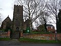 All Saints church, Harborough Magna - geograph.org.uk - 1605207.jpg 640 × 480; 111 KB
-
 Anne Hathaway's cottage, Shottery - geograph.org.uk - 1711965.jpg 640 × 480; 87 KB
-

-

-

-
 Arable land near Hanwood, Shropshire - geograph.org.uk - 1712534.jpg 640 × 480; 93 KB
-
 Architectural variety in Ludlow - geograph.org.uk - 1248582.jpg 640 × 480; 75 KB
-

-
 Autumn ploughsoil south of Peaton - geograph.org.uk - 1562262.jpg 640 × 480; 81 KB
-
 Baptist chapel in Aston on Clun - geograph.org.uk - 1712323.jpg 640 × 480; 105 KB
-

-
-
 Beside the River Clun near Broome - geograph.org.uk - 1712278.jpg 640 × 480; 109 KB
-
 Beside the track above Daneway - geograph.org.uk - 1776177.jpg 640 × 480; 75 KB
-

-

-
 Bishop's Castle main street - geograph.org.uk - 1730400.jpg 640 × 480; 77 KB
-
 Bootham Bar, York - geograph.org.uk - 2521717.jpg 640 × 480; 79 KB
-
 Bootham Bar, York - geograph.org.uk - 2521736.jpg 640 × 480; 81 KB
-

-

-

-
 Boxing Day hunt meet, Ludlow - geograph.org.uk - 1091461.jpg 640 × 480; 76 KB
-
 Boyce Court near Dymock - geograph.org.uk - 1343471.jpg 640 × 480; 100 KB
-

-

-
 Bridge 42 on the Oxford Canal - geograph.org.uk - 1605225.jpg 640 × 480; 78 KB
-
 Bridge over the Grwyne Fawr near Llangenny.jpg 640 × 480; 141 KB
-
 Bridge over the River Alun - geograph.org.uk - 1635655.jpg 640 × 480; 106 KB
-
 Bridleway on Alderton Hill - geograph.org.uk - 1613595.jpg 640 × 480; 71 KB
-
 Broad Street, Ludlow. - geograph.org.uk - 1350004.jpg 640 × 480; 84 KB
-

-
 Bronllys Castle motte and tower - geograph.org.uk - 2469137.jpg 640 × 480; 144 KB
-
 Builth Road Railway Bridge.jpg 640 × 480; 140 KB
-
 Burford High Street in August - geograph.org.uk - 1446366.jpg 640 × 480; 73 KB
-

-
 Burrington Bridge on the River Teme - geograph.org.uk - 1438707.jpg 640 × 480; 103 KB
-

-

-
 Caerberllan Farmhouse - geograph.org.uk - 1730517.jpg 640 × 480; 61 KB
-
 Cairn on Pen y Fan. - geograph.org.uk - 1235083.jpg 640 × 480; 52 KB
-
 Cambridge Doubletree Hilton hotel - geograph.org.uk - 1184530.jpg 640 × 480; 92 KB
-

-
 Canal footbridge - geograph.org.uk - 1161643.jpg 640 × 480; 89 KB
-
 Cardiff cityscape - geograph.org.uk - 1541752.jpg 640 × 480; 86 KB
-
 Carn Gyfwry and Carn Menyn behind - geograph.org.uk - 1303275.jpg 640 × 480; 68 KB
-

-
 Castell Coch on St. David's Day 2009 - geograph.org.uk - 1184563.jpg 640 × 480; 116 KB
-

-
 Castell y Bere entrance way today - geograph.org.uk - 1730481.jpg 640 × 480; 112 KB
-
 Castell y Bere looking east - geograph.org.uk - 1730490.jpg 640 × 480; 72 KB
-

-
 Castle Gardens, Ludlow - geograph.org.uk - 1248590.jpg 640 × 480; 114 KB
-
 Castle Inn, Pengenffordd - geograph.org.uk - 1742060.jpg 640 × 480; 56 KB
-

-
 Castle Lodge, Castle Square, Ludlow - geograph.org.uk - 1054079.jpg 640 × 480; 81 KB
-
 Castle Square, Ludlow - geograph.org.uk - 1337418.jpg 640 × 480; 86 KB
-

-
 Chapter House Street, York - geograph.org.uk - 4887108.jpg 640 × 480; 98 KB
-

-

-
-
 Clifford's Tower, York - geograph.org.uk - 2521837.jpg 640 × 480; 52 KB
-

-

-
 Collector's items. - geograph.org.uk - 1204627.jpg 640 × 480; 128 KB
-
-
-

-
 Cotswold smallholding - geograph.org.uk - 1776244.jpg 640 × 480; 96 KB
-
 Cottage at Bromfield - geograph.org.uk - 1435871.jpg 640 × 480; 119 KB
-

-
 Coventry Canal, Polesworth - geograph.org.uk - 1134647.jpg 640 × 480; 121 KB
-
 Blitz ravaged Coventry Cathedral - geograph.org.uk - 1190746.jpg 640 × 480; 61 KB
-

-

-

-
 Cwm Gwesyn - geograph.org.uk - 1329929.jpg 640 × 480; 92 KB
-
 Cwm Idwal slabs - geograph.org.uk - 1764931.jpg 640 × 480; 122 KB
-

-
 Exterior of Odda's chapel, Deerhurst - geograph.org.uk - 1260233.jpg 640 × 480; 112 KB
-
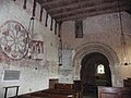
 Interior of Odda's chapel, Deerhurst - geograph.org.uk - 1260208.jpg 640 × 480; 78 KB
-

-
 Descent from Whernside. - geograph.org.uk - 1456017.jpg 640 × 480; 62 KB
-
 Descent to Idwal Cottage car park - geograph.org.uk - 1765023.jpg 640 × 480; 90 KB
-

-

-

-

-
 Doll shop window - geograph.org.uk - 4882771.jpg 640 × 480; 86 KB
-
 Dover's Hill toposcope - geograph.org.uk - 1608515.jpg 640 × 480; 55 KB
-

-
 Draycote Water visitor centre - geograph.org.uk - 1605236.jpg 640 × 480; 66 KB
-

-
 Dry stone walling above Cwm Nantcol - geograph.org.uk - 1752077.jpg 640 × 480; 63 KB
-
 Dunwich Beach - geograph.org.uk - 1618469.jpg 640 × 480; 55 KB
-
 Dunwich Heath - geograph.org.uk - 1618493.jpg 640 × 480; 53 KB
-
 Dunwich village from the northwest - geograph.org.uk - 1618483.jpg 640 × 480; 71 KB
-
 Dymock church tower from the east. - geograph.org.uk - 1343496.jpg 640 × 480; 78 KB
-
 Earl's Hill trig point - geograph.org.uk - 1491532.jpg 640 × 480; 59 KB
-

-
 Easter Saturday on Pen y Fan - geograph.org.uk - 1247657.jpg 640 × 480; 99 KB
-
 Edgton village, Shropshire - geograph.org.uk - 1712388.jpg 640 × 480; 73 KB
-
 Elan Aqueduct near Ludlow - geograph.org.uk - 1550047.jpg 640 × 480; 109 KB
-

-
 Entering the Gwesyn valley - geograph.org.uk - 1329913.jpg 640 × 480; 113 KB
-

-

-
 Fan Fawr in the early sunshine. - geograph.org.uk - 1235117.jpg 640 × 480; 45 KB
-
 Farm access road, Naunton Farm - geograph.org.uk - 1613544.jpg 640 × 480; 64 KB
-
 Farm track near Castell y Bere - geograph.org.uk - 1730508.jpg 640 × 480; 64 KB
-
 Farmyard set aside - geograph.org.uk - 1260296.jpg 640 × 480; 84 KB
-
 Fencote - geograph-5360340-by-Jeremy-Bolwell.jpg 640 × 480; 136 KB
-
 Fields north of Hanwood, Shropshire - geograph.org.uk - 1562243.jpg 640 × 480; 105 KB
-

-
 Footbridge on the Shropshire Way - geograph.org.uk - 1712485.jpg 640 × 480; 137 KB
-
 Footpath above Talybont Reservoir - geograph.org.uk - 1741844.jpg 640 × 480; 50 KB
-
 Footpath across Cotswolds ploughsoil - geograph.org.uk - 1776235.jpg 640 × 480; 116 KB
-

-

-

-

-
 Footpath on the east shore of Llyn Idwal - geograph.org.uk - 1764912.jpg 640 × 480; 100 KB
-
-
 Forest trails below Breidden Hill - geograph.org.uk - 1600215.jpg 640 × 480; 114 KB
-
 Forestry track on Hopton Titterhill - geograph.org.uk - 1628255.jpg 640 × 480; 116 KB
-
-

-
 Frozen pool near The Wrekin - geograph.org.uk - 1658131.jpg 640 × 480; 45 KB
-

-
 Future Cardiff^ - geograph.org.uk - 1541779.jpg 640 × 480; 77 KB
-

-
 Gelli Bridge (Geograph 2501792 by Jeremy Bolwell).jpg 640 × 480; 107 KB
-
 Gellifelin - geograph-3210704-by-Jeremy-Bolwell.jpg 640 × 480; 65 KB
-
 Grwyne Fawr dam - geograph.org.uk - 1072222.jpg 640 × 480; 77 KB
-
 Hafod Quarry (geograph 2800300).jpg 640 × 480; 90 KB
-
 Halesowen Golf Club Clubhouse - geograph.org.uk - 1569323.jpg 640 × 480; 72 KB
-
 Hanwood, Shropshire - geograph.org.uk - 1712533.jpg 640 × 480; 110 KB
-
 Hasfield Court and village, Glos - geograph.org.uk - 1260280.jpg 640 × 480; 93 KB
-
 Heather moorland on the Long Mynd - geograph.org.uk - 1712435.jpg 640 × 480; 97 KB
-

-

-
 High ladder stile in Loton Park - geograph.org.uk - 1520732.jpg 640 × 480; 112 KB
-
 Hill grazing near Basford - geograph.org.uk - 1712382.jpg 640 × 480; 50 KB
-
 Hillside above Rhiwlas - geograph.org.uk - 1730553.jpg 640 × 480; 67 KB
-
 Hillside track on Aston Hill - geograph.org.uk - 1712344.jpg 640 × 480; 63 KB
-
 Holy Trinity church, Stratford upon Avon - geograph.org.uk - 1711987.jpg 640 × 480; 119 KB
-
 Hopton Castle village and castle - geograph.org.uk - 1628264.jpg 640 × 480; 61 KB
-
 Icy Llyn Hywel - geograph.org.uk - 1752112.jpg 640 × 480; 80 KB
-

-
 Impressive Creigiau Eglwyseg - geograph.org.uk - 1573938.jpg 640 × 480; 53 KB
-
 Inside Castell Dinas - geograph.org.uk - 1742051.jpg 640 × 480; 105 KB
-
 Inside York minster - geograph.org.uk - 4887128.jpg 640 × 480; 79 KB
-
 Interesting old yard - geograph.org.uk - 1247794.jpg 640 × 480; 84 KB
-
 Interior of part of YHA York - geograph.org.uk - 4866545.jpg 640 × 480; 57 KB
-
-

-
 Italian restaurant in York - geograph.org.uk - 2522122.jpg 640 × 480; 79 KB
-
-

-

-
 Kenilworth castle ruins - geograph.org.uk - 1094039.jpg 640 × 480; 67 KB
-
 Kenilworth castle ruins - geograph.org.uk - 1094041.jpg 640 × 480; 46 KB
-
 King's College Chapel - geograph.org.uk - 1184514.jpg 640 × 480; 61 KB
-
 Lake of Serenity - Llyn Tegid - geograph.org.uk - 1476950.jpg 640 × 480; 60 KB
-
-
 Lane between Pengenffordd and Dinas Farm - geograph.org.uk - 1741882.jpg 640 × 480; 103 KB
-
 Lane into Oakridge - geograph.org.uk - 1776195.jpg 640 × 480; 98 KB
-
 Lane near Goat Hill - geograph.org.uk - 1712251.jpg 640 × 480; 77 KB
-
 Llanerchayron - geograph-2566811-by-Jeremy-Bolwell.jpg 640 × 480; 95 KB
-
 Llanidloes - geograph-3086522-by-Jeremy-Bolwell.jpg 640 × 480; 79 KB
-

-
 Llyn Aled - geograph.org.uk - 1805145.jpg 640 × 480; 62 KB
-
 Llyn Cwm Llwch from Pen y Fan. - geograph.org.uk - 1214409.jpg 640 × 480; 33 KB
-
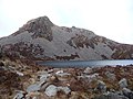
 Llyn Hywel - geograph.org.uk - 1752097.jpg 640 × 480; 56 KB
-
 Llyn Hywel and rocky Rhinog Fach - geograph.org.uk - 1752120.jpg 640 × 480; 82 KB
-
 Llyn Hywel from the top of the Slabs - geograph.org.uk - 1752104.jpg 640 × 480; 89 KB
-

-
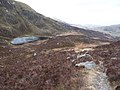
 Llyn Idwal in the drizzle - geograph.org.uk - 1765006.jpg 640 × 480; 62 KB
-
 Llyn Perfeddau - geograph.org.uk - 1752126.jpg 640 × 480; 94 KB
-
 Llyn y Cwn from the path up Y Garn - geograph.org.uk - 1764982.jpg 640 × 480; 96 KB
-
 Long walk on the Long Mynd - geograph.org.uk - 1712424.jpg 640 × 480; 61 KB


.jpg)


.jpg)


.jpg)


.jpg)


.jpg)


