Category:Images by Jim Barton

Media in category "Images by Jim Barton"
The following 200 files are in this category, out of 1,770 total.
(previous page) (next page)-
 'Dead Wife' gatepost - geograph.org.uk - 1392568.jpg 640 × 424; 102 KB
-
-
-

-

-
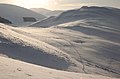
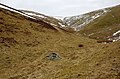
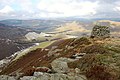
 392m top on ridge to Patie's Hill - geograph.org.uk - 1177972.jpg 640 × 480; 94 KB
-
 A bend in the River Tweed - geograph.org.uk - 1538286.jpg 640 × 424; 165 KB
-
 A cascade on the Allt Abhagaith - geograph.org.uk - 1575131.jpg 640 × 424; 176 KB
-
 A fall on the Black Water, Little Garve - geograph.org.uk - 1575176.jpg 640 × 424; 149 KB
-
 A fine clump of cotton grass - geograph.org.uk - 875161.jpg 640 × 480; 114 KB
-
 A frozen Bowscale Tarn - geograph.org.uk - 1749220.jpg 800 × 530; 215 KB
-
 A frozen Loch Etchachan - geograph.org.uk - 1717586.jpg 800 × 532; 103 KB
-
-
 A narrow stretch of Glen Feshie - geograph.org.uk - 1564745.jpg 640 × 424; 62 KB
-
 A patchwork of fields in the Wye Valley - geograph.org.uk - 1502742.jpg 640 × 424; 125 KB
-
 A patchwork of pastel colours on Newby Kipps - geograph.org.uk - 1722169.jpg 1,600 × 1,061; 581 KB
-
 A plantation in The Glen - geograph.org.uk - 1691370.jpg 800 × 530; 219 KB
-
 A power station and its waste ash - geograph.org.uk - 1569105.jpg 640 × 424; 49 KB
-
 A pub sign that rhymes, Clun - geograph.org.uk - 1502929.jpg 640 × 424; 55 KB
-
 A quieter stretch of the Black Water - geograph.org.uk - 1575383.jpg 640 × 424; 178 KB
-
 A rock outcrop on the River North Esk - geograph.org.uk - 1589884.jpg 640 × 424; 164 KB
-
 A rough shelter - geograph.org.uk - 1253070.jpg 640 × 424; 108 KB
-
 A Scots pine by the River Feshie - geograph.org.uk - 1564581.jpg 640 × 424; 99 KB
-

-
 A tranquil day at Gladhouse Reservoir - geograph.org.uk - 1713019.jpg 800 × 530; 137 KB
-
 A variety of road signs, Kirkton - geograph.org.uk - 1540841.jpg 640 × 424; 117 KB
-
 A view back down Kirkton Glen - geograph.org.uk - 1432935.jpg 640 × 424; 130 KB
-
 A view up the valley from Clun Castle - geograph.org.uk - 1502911.jpg 640 × 424; 103 KB
-

-
 A welcome sign near Broughton - geograph.org.uk - 1714605.jpg 1,024 × 679; 353 KB
-
 A winter day at Megget Reservoir - geograph.org.uk - 1615425.jpg 640 × 424; 98 KB
-
-
 A winter view of Cademuir - geograph.org.uk - 1656928.jpg 640 × 424; 65 KB
-
-
 A1 viaduct across the Tyne - geograph.org.uk - 1354683.jpg 640 × 480; 64 KB
-

-
 A68 road bridge over the River Esk - geograph.org.uk - 1589918.jpg 640 × 424; 92 KB
-
 A701 from Annanhead Hill - geograph.org.uk - 1737133.jpg 800 × 530; 212 KB
-
 Above Damhead Wood - geograph.org.uk - 1291905.jpg 640 × 424; 73 KB
-

-
 Afternoon sun in the Newlands Valley - geograph.org.uk - 1750853.jpg 1,024 × 679; 258 KB
-

-
-
 Allt a Mharcaidh - geograph.org.uk - 1774938.jpg 800 × 530; 236 KB
-
 Allt a' Chalda Mor and lochan - geograph.org.uk - 1253357.jpg 640 × 424; 90 KB
-

-
 Allt Bad an t-Seabhaig - geograph.org.uk - 1251852.jpg 640 × 480; 91 KB
-

-
 Allt Coire Ghaidheil - geograph.org.uk - 1319150.jpg 424 × 640; 101 KB
-
 Allt Coulavie above the Sputan Ban falls - geograph.org.uk - 976101.jpg 640 × 480; 125 KB
-
 Allt Grannda waterfall - geograph.org.uk - 1765376.jpg 533 × 800; 173 KB
-
 Allt Mor - geograph.org.uk - 1454642.jpg 640 × 424; 134 KB
-
 Allt Scheicheachan bothy in 1978 - geograph.org.uk - 1765941.jpg 800 × 533; 70 KB
-
 Allt Tarsuinn - geograph.org.uk - 1253100.jpg 640 × 424; 105 KB
-
 Almshouses, Hay-on-Wye - geograph.org.uk - 1502787.jpg 640 × 424; 93 KB
-
 An arch of the Tweed Bridge, Peebles - geograph.org.uk - 1632524.jpg 640 × 424; 102 KB
-
-
 Ancient and modern - geograph.org.uk - 892223.jpg 640 × 480; 68 KB
-
 Ancient settlement site on Cademuir - geograph.org.uk - 1703346.jpg 640 × 424; 105 KB
-
 Ancient settlement site, Manor Valley - geograph.org.uk - 1741666.jpg 800 × 530; 236 KB
-
 Annandale from Great Hill - geograph.org.uk - 1737505.jpg 1,024 × 679; 297 KB
-
 Another 2 years' worth of erosion - geograph.org.uk - 1320088.jpg 640 × 424; 107 KB
-
 Aonach Beag and Beinn Eibhinn - geograph.org.uk - 1719545.jpg 800 × 533; 74 KB
-
 Approaching Cardrona Village - geograph.org.uk - 1639153.jpg 640 × 424; 65 KB
-
 Approaching Glen Tilt - geograph.org.uk - 1725800.jpg 1,024 × 683; 121 KB
-
 Approaching Mungrisdale from the north - geograph.org.uk - 1749294.jpg 800 × 530; 149 KB
-
 Approaching Portmore Reservoir - geograph.org.uk - 1426337.jpg 640 × 480; 74 KB
-
 Approaching site of former Maxton station (geograph 3902855).jpg 1,024 × 678; 234 KB
-

-
 Arched passageway, Drochil Castle (1) - geograph.org.uk - 1703470.jpg 530 × 800; 154 KB
-
 Arched passageway, Drochil Castle (2) - geograph.org.uk - 1703483.jpg 800 × 530; 178 KB
-
 Arm of Megget Reservoir - geograph.org.uk - 1230741.jpg 640 × 480; 78 KB
-
 Ash lagoon with bird life - geograph.org.uk - 1569102.jpg 640 × 408; 67 KB
-
 Askival from Hallival - geograph.org.uk - 1759091.jpg 800 × 533; 75 KB
-
 Askival N ridge - geograph.org.uk - 1759108.jpg 533 × 800; 75 KB
-
 Askival summit - geograph.org.uk - 1759133.jpg 800 × 533; 57 KB
-
-
 At the Bealach Coire Ghaidheil - geograph.org.uk - 1319290.jpg 640 × 424; 113 KB
-
 Auchendinny station - Geograph-2732561-by-Jim-Barton.jpg 800 × 530; 279 KB
-

-
-
-
 Back Burn - geograph.org.uk - 1371972.jpg 640 × 480; 92 KB
-
 Back Burn below Crumley Hill - geograph.org.uk - 1615468.jpg 640 × 424; 142 KB
-
 Back down to valley level - geograph.org.uk - 994673.jpg 640 × 480; 130 KB
-
 Back to work - geograph.org.uk - 916152.jpg 640 × 480; 117 KB
-
 Band of crags, Beinn Udlaidh - geograph.org.uk - 1301876.jpg 640 × 480; 97 KB
-
 Bannerdale Crags and East Ridge - geograph.org.uk - 1749118.jpg 800 × 530; 177 KB
-
 Bannerdale Crags from the NW - geograph.org.uk - 1749175.jpg 800 × 530; 193 KB
-
 Barns House - geograph.org.uk - 1540793.jpg 640 × 424; 114 KB
-
 Bass Rock and Tyninghame woods - geograph.org.uk - 1603133.jpg 640 × 424; 48 KB
-
 Be careful^ - geograph.org.uk - 979497.jpg 640 × 480; 88 KB
-

-
 Bealach na h-Uidhe - geograph.org.uk - 1253305.jpg 640 × 424; 104 KB
-
 Bearnais Bothy in 1978 - geograph.org.uk - 1766831.jpg 800 × 533; 100 KB
-
 Bedford Memorial Bridge, Tarf Water - geograph.org.uk - 1725832.jpg 1,024 × 683; 135 KB
-
 Before and after felling - geograph.org.uk - 1283794.jpg 640 × 424; 126 KB
-
 Beinn na Stac from Glen Dibidil - geograph.org.uk - 1759313.jpg 800 × 533; 79 KB
-
-
 Bellanrig in winter - geograph.org.uk - 1656840.jpg 640 × 424; 71 KB
-

-
 Ben Alder cliffs and cornice - geograph.org.uk - 1711478.jpg 640 × 423; 43 KB
-
 Ben Alder from Allt a' Chaol-reidhe - geograph.org.uk - 1711437.jpg 640 × 425; 59 KB
-
 Ben Alder from Aonach Beag - geograph.org.uk - 1719588.jpg 800 × 533; 76 KB
-
 Ben Alder summit plateau - geograph.org.uk - 1711486.jpg 640 × 425; 50 KB
-
 Beneath the Forth Bridge - geograph.org.uk - 1332395.jpg 640 × 424; 118 KB
-
 Between Huntly Cot and Mauldslie - geograph.org.uk - 1712957.jpg 800 × 530; 138 KB
-
 Big boulders below Creag nan Cuaran - geograph.org.uk - 1301858.jpg 640 × 480; 110 KB
-
 Biggar Gasworks Museum - geograph.org.uk - 1395352.jpg 640 × 480; 75 KB
-
 Biggar Water joins the Tweed - geograph.org.uk - 1714766.jpg 1,600 × 1,061; 646 KB
-

-
 Birnock Water from Greygill Head - geograph.org.uk - 1379205.jpg 640 × 480; 74 KB
-
 Bitch Cleuch and Manor valley - geograph.org.uk - 994607.jpg 640 × 480; 127 KB
-
 Black Law summit trig point - geograph.org.uk - 1033631.jpg 640 × 480; 88 KB
-
 Black Sike - geograph.org.uk - 1291763.jpg 640 × 424; 129 KB
-
 Blea Beck, Shap Wells - geograph.org.uk - 1531328.jpg 640 × 424; 192 KB
-
 Blencathra from Troutbeck - geograph.org.uk - 1749462.jpg 800 × 530; 165 KB
-
 Bloodhope Burn - geograph.org.uk - 1425084.jpg 640 × 424; 121 KB
-
-
 Blue plaque for a Nobel prize winner - geograph.org.uk - 903255.jpg 640 × 480; 110 KB
-
 Boathouse, Loch Eddy - geograph.org.uk - 889946.jpg 640 × 424; 121 KB
-
 Bodesbeck Track crosses the ridge fence - geograph.org.uk - 1326707.jpg 640 × 480; 109 KB
-
 Bog and heather moor - geograph.org.uk - 1596582.jpg 640 × 424; 80 KB
-
 Bog woodland, Allt a Mharcaidh - geograph.org.uk - 1776238.jpg 800 × 530; 169 KB
-
 Boggy ground and boulder field - geograph.org.uk - 1510755.jpg 640 × 424; 106 KB
-
 Boggy path - geograph.org.uk - 1456291.jpg 640 × 424; 113 KB
-
 Bonar Bridge - geograph.org.uk - 1455794.jpg 640 × 424; 98 KB
-
 Bonnington Iron Bridge, Falls of Clyde - geograph.org.uk - 862375.jpg 640 × 480; 162 KB
-
 Borders Wood pasture planting - geograph.org.uk - 1291805.jpg 640 × 424; 97 KB
-
 Boulders in the Black Water - geograph.org.uk - 1575168.jpg 640 × 424; 158 KB
-
-
 Boxing Day near Bonnington - geograph.org.uk - 1633461.jpg 640 × 424; 77 KB
-
 Bracken on the hillside - geograph.org.uk - 1379116.jpg 640 × 480; 109 KB
-
 Braeruthven ruin above Kingussie - geograph.org.uk - 1777208.jpg 800 × 530; 165 KB
-
 Braided channels in the Manor Water - geograph.org.uk - 1740877.jpg 800 × 530; 129 KB
-
 Braithwaite from above - geograph.org.uk - 1749502.jpg 1,024 × 679; 358 KB
-
 Bridge and platform, former Rosslyn Castle Station (geograph 6088962).jpg 1,600 × 999; 615 KB
-
 Bridge at Haystoun Estate - geograph.org.uk - 1007308.jpg 640 × 424; 133 KB
-
 Bridge over Allt Ceann Loch Luichart - geograph.org.uk - 1365742.jpg 640 × 424; 125 KB
-
 Bridge over Allt Coire Follais - geograph.org.uk - 1774872.jpg 800 × 530; 228 KB
-
 Bridge over Allt Garbh - geograph.org.uk - 976049.jpg 640 × 480; 117 KB
-
 Bridge over Boredale Beck - geograph.org.uk - 1171960.jpg 640 × 480; 143 KB
-
 Bridge over Garbh Uisge - geograph.org.uk - 1319035.jpg 640 × 424; 97 KB
-
 Bridge over Longlands Beck - geograph.org.uk - 1752172.jpg 800 × 530; 218 KB
-
 Bridge over Peebles - Broughton railway - geograph.org.uk - 1612016.jpg 640 × 424; 124 KB
-
 Bridge over the Fairliehope Burn - geograph.org.uk - 1178008.jpg 640 × 480; 102 KB
-
 Bridge over the Walker Burn - geograph.org.uk - 1338148.jpg 640 × 424; 114 KB
-
 Bridge over the Wirral Way path - geograph.org.uk - 1737049.jpg 800 × 530; 221 KB
-
 Bridge over West Water - geograph.org.uk - 1761177.jpg 800 × 530; 189 KB
-

-
 Bridleway above Garreg-ddu Reservoir - geograph.org.uk - 1501923.jpg 640 × 424; 141 KB
-
 Brocken spectre, Beinn na Cille - geograph.org.uk - 1779469.jpg 800 × 533; 64 KB
-
 Brockhope Rig - geograph.org.uk - 1326511.jpg 640 × 480; 97 KB
-
 Broken Cleuch and Moffat Water - geograph.org.uk - 1326593.jpg 640 × 480; 112 KB
-
 Broom Hill from Stob Law - geograph.org.uk - 1371985.jpg 640 × 480; 65 KB
-
 Broughton from Helm End - geograph.org.uk - 1714265.jpg 1,024 × 679; 190 KB
-
 Building work at Cardrona (2) (geograph 6031303).jpg 1,600 × 1,060; 380 KB
-
 Building work at Cardrona (4) (geograph 6151825).jpg 1,600 × 1,060; 376 KB
-
 Building work at Cardrona (geograph 5916920).jpg 1,600 × 1,060; 360 KB
-
 Buildings at Martindale - geograph.org.uk - 1171959.jpg 640 × 480; 108 KB
-

-
 Burn and forestry edge - geograph.org.uk - 1251777.jpg 640 × 480; 114 KB
-
 Burn and rough ground - geograph.org.uk - 901109.jpg 640 × 480; 119 KB
-

-
 Burn draining from Sgoran Dubh Beag - geograph.org.uk - 1775733.jpg 800 × 530; 166 KB
-
 Burn from Loch an Claonaite - geograph.org.uk - 1252773.jpg 640 × 480; 120 KB
-
 Burn on west side of Kailzie Hill - geograph.org.uk - 1534758.jpg 640 × 424; 128 KB
-
 Burn west of Creag Ghlas - geograph.org.uk - 942553.jpg 640 × 480; 114 KB
-
 Burn, Shielhope Hill - geograph.org.uk - 1543894.jpg 640 × 424; 127 KB
-
 Butter Knowe and Black Hill - geograph.org.uk - 1395258.jpg 640 × 480; 71 KB
-
 Bynack Lodge in snow - geograph.org.uk - 1725746.jpg 1,024 × 683; 94 KB
-
 Cademuir col under snow - geograph.org.uk - 1656864.jpg 640 × 424; 70 KB
-
 Cademuir forest road under snow - geograph.org.uk - 1653290.jpg 640 × 424; 126 KB
-
 Cademuir Forest under snow - geograph.org.uk - 1633428.jpg 640 × 424; 141 KB
-
 Cafe at the RSPB Reserve, Conwy - geograph.org.uk - 1093290.jpg 640 × 424; 72 KB
-
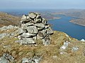
 Cairn about 450m, Greygill Head - geograph.org.uk - 1379182.jpg 640 × 480; 64 KB
-
-
 Cairn approx. 350m, Greygill Head - geograph.org.uk - 1379133.jpg 640 × 480; 80 KB
-
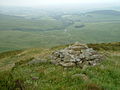
 Cairn at 367m - geograph.org.uk - 1226266.jpg 640 × 480; 107 KB
-
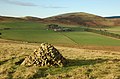
 Cairn at Hare Law hill fort - geograph.org.uk - 1274433.jpg 640 × 424; 94 KB
-
 Cairn at path junction - geograph.org.uk - 1365250.jpg 640 × 424; 115 KB
-
 Cairn at point 291 m Manor Hill - geograph.org.uk - 1757943.jpg 800 × 530; 222 KB
-
 Cairn at point 482m - geograph.org.uk - 1501957.jpg 640 × 424; 108 KB
-

-
 Cairn marking the pass in Trusmadoor - geograph.org.uk - 1753278.jpg 800 × 530; 210 KB
-
 Cairn NE of Cnoc na Creige - geograph.org.uk - 1254247.jpg 640 × 480; 105 KB
-
 Cairn near 400m, Greygill Head - geograph.org.uk - 1379158.jpg 640 × 480; 82 KB
-
 Cairn on Cauldstane Rig - geograph.org.uk - 1230699.jpg 640 × 480; 92 KB
-
 Cairn on Gool Knowe - geograph.org.uk - 1543915.jpg 640 × 424; 104 KB
-
 Cairn on Hamilton Hill, Peebles - geograph.org.uk - 1602325.jpg 640 × 424; 85 KB
-
 Cairn on Juniper Craigs - geograph.org.uk - 1722151.jpg 1,600 × 1,061; 666 KB
-
 Cairn on Mid Hill - geograph.org.uk - 1066178.jpg 640 × 480; 113 KB
-
 Cairn on Mid Rig - geograph.org.uk - 1326540.jpg 640 × 480; 85 KB
-
 Cairn on Mid Rig - geograph.org.uk - 1326654.jpg 640 × 480; 65 KB
-
 Cairn on Talla East Side - geograph.org.uk - 1615607.jpg 640 × 424; 97 KB
-
 Cairn on White Craig Hill - geograph.org.uk - 1209206.jpg 640 × 480; 97 KB
-
 Cairn on White Knott - geograph.org.uk - 1171671.jpg 640 × 480; 89 KB
-
 Cairn on Whitelaw Hill - geograph.org.uk - 1392528.jpg 640 × 424; 102 KB
-
 Cairn, Glenrath Hill - geograph.org.uk - 1371999.jpg 640 × 480; 75 KB
-
 Cairn, Pikes Knowe - geograph.org.uk - 1227466.jpg 640 × 480; 72 KB


.jpg)

_-_geograph.org.uk_-_1703470.jpg)
_-_geograph.org.uk_-_1703483.jpg)


.jpg)


_(geograph_6031303).jpg)
_(geograph_6151825).jpg)
.jpg)


