Category:Images by John Firth

Media in category "Images by John Firth"
The following 200 files are in this category, out of 2,736 total.
(previous page) (next page)-
 'Talyllyn' at Tywyn Station - geograph.org.uk - 774666.jpg 640 × 407; 75 KB
-
 10 am to Welshpool - geograph.org.uk - 1333537.jpg 640 × 426; 95 KB
-
 117 Foregate Street, Chester.jpeg 640 × 480; 75 KB
-
 12-30 To Ravenglass - geograph.org.uk - 881218.jpg 640 × 426; 87 KB
-
 12.20 for Tywyn - geograph.org.uk - 801340.jpg 640 × 426; 81 KB
-
 13-50 to Dalegarth - geograph.org.uk - 881236.jpg 640 × 480; 115 KB
-
 1913 Town at Beamish - geograph.org.uk - 1395054.jpg 640 × 426; 77 KB
-
 5572 at Didcot Railway Centre - geograph.org.uk - 775537.jpg 640 × 413; 59 KB
-
 66422 in York station - geograph.org.uk - 3990816.jpg 640 × 426; 70 KB
-
 A Straight Line - geograph.org.uk - 1333612.jpg 640 × 426; 106 KB
-

-

-
 A458 at Bank Farm Caravan site - geograph.org.uk - 1712981.jpg 640 × 480; 82 KB
-
 A458 looking back towards Buttington - geograph.org.uk - 1566667.jpg 640 × 480; 84 KB
-

-
 A490 and A495 junction - geograph.org.uk - 1570253.jpg 640 × 480; 66 KB
-
 A490 junction - geograph.org.uk - 1328207.jpg 640 × 480; 64 KB
-
 A490 looking back to Y Dolydd - geograph.org.uk - 1574445.jpg 640 × 480; 68 KB
-

-
 A490 near Dingle Bridge - geograph.org.uk - 1709770.jpg 640 × 480; 90 KB
-
 A490 near to The Lane Farm - geograph.org.uk - 1328227.jpg 640 × 480; 65 KB
-

-
 A496 road into Barmouth - geograph.org.uk - 1555124.jpg 640 × 480; 112 KB
-
 A5 looking west from roundabout - geograph.org.uk - 1393365.jpg 640 × 480; 77 KB
-
 Abbey Tree Nursery entrance - geograph.org.uk - 1635914.jpg 640 × 480; 97 KB
-
 Aberaeron Harbour - geograph.org.uk - 792088.jpg 640 × 419; 80 KB
-
 Aberdyfi Car park - geograph.org.uk - 800290.jpg 640 × 426; 71 KB
-
 Abereistedd Hotel - geograph.org.uk - 1307687.jpg 640 × 426; 68 KB
-
 Aberglaslyn Pass - geograph.org.uk - 1307627.jpg 640 × 426; 97 KB
-
 Aberglaslyn Pass - geograph.org.uk - 1307631.jpg 640 × 426; 102 KB
-
 Abergynolwyn station sign - geograph.org.uk - 801244.jpg 640 × 426; 105 KB
-
 Abermule Hotel - geograph.org.uk - 1368611.jpg 640 × 426; 65 KB
-
 Abermule level crossing - geograph.org.uk - 1368616.jpg 640 × 426; 87 KB
-
 Abersoch garden centre entrance - geograph.org.uk - 1309667.jpg 640 × 426; 87 KB
-
 Aberystwyth Main line station - geograph.org.uk - 775535.jpg 640 × 415; 63 KB
-
 Aberystwyth main line station - geograph.org.uk - 778742.jpg 640 × 410; 86 KB
-

-
 Above the Banwy - geograph.org.uk - 1333557.jpg 640 × 426; 97 KB
-
 Across fields to Caravan Site - geograph.org.uk - 1570198.jpg 640 × 480; 74 KB
-
 Across South Haven towards The Neck - geograph.org.uk - 1575011.jpg 640 × 415; 73 KB
-
 Across the fields from Bwlch Coch - geograph.org.uk - 1562247.jpg 640 × 480; 61 KB
-
 Afon Banwy - geograph.org.uk - 1334340.jpg 640 × 426; 96 KB
-

-
 Afon Banwy by the railway - geograph.org.uk - 1560662.jpg 640 × 426; 95 KB
-
 Afon Banwy from Banwy bridge - geograph.org.uk - 1333577.jpg 640 × 426; 105 KB
-
 Afon Banwy from Banwy bridge - geograph.org.uk - 1559795.jpg 640 × 426; 78 KB
-
 Afon Banwy from footbridge looking west - geograph.org.uk - 1334385.jpg 640 × 426; 107 KB
-
 Afon Banwy in autumn - geograph.org.uk - 1559793.jpg 640 × 426; 90 KB
-
 Afon Banwy in September - geograph.org.uk - 1480248.jpg 640 × 426; 104 KB
-
 Afon Banwy looking East - geograph.org.uk - 1334389.jpg 640 × 426; 132 KB
-

-

-
 Afon Glaslyn and mountains beyond - geograph.org.uk - 1306275.jpg 640 × 480; 58 KB
-
 Afon Glaslyn at Pont Croesor - geograph.org.uk - 1307612.jpg 640 × 426; 108 KB
-
 Afon Henwy close to Clenenney - geograph.org.uk - 1554216.jpg 640 × 480; 114 KB
-
 Afon Ogau at Felin Newydd - geograph.org.uk - 1723113.jpg 640 × 480; 94 KB
-
 Afon Ogau stream at B4380 bridge - geograph.org.uk - 1723116.jpg 640 × 480; 118 KB
-
 Afon Vyrnwy from Meifod Bridge - geograph.org.uk - 1331552.jpg 640 × 426; 118 KB
-
 Afon Vyrnwy from Meifod Bridge - geograph.org.uk - 1331553.jpg 640 × 426; 84 KB
-
 Afon Vyrnwy from Pontrobert Bridge - geograph.org.uk - 1339079.jpg 640 × 426; 121 KB
-
 Alberbury Autumn Colours - geograph.org.uk - 744052.jpg 640 × 480; 77 KB
-
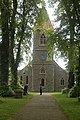
 Alberbury Church - geograph.org.uk - 793026.jpg 640 × 426; 75 KB
-
 Alberbury Village Hall - geograph.org.uk - 793025.jpg 640 × 426; 54 KB
-
 Alberbury Village Hall from B4393 - geograph.org.uk - 793023.jpg 640 × 426; 87 KB
-
 Alberbury war memorial. - geograph.org.uk - 793036.jpg 640 × 426; 65 KB
-
 Alderton Hall entrance - geograph.org.uk - 1507877.jpg 640 × 480; 104 KB
-
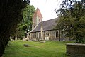
 All Saints church Trefonen - geograph.org.uk - 780401.jpg 640 × 426; 62 KB
-
 Alleyway leading up to Broad Street - geograph.org.uk - 1560802.jpg 480 × 640; 97 KB
-
 Alnwick Castle from walkway - geograph.org.uk - 1398080.jpg 640 × 426; 70 KB
-
 Alnwick Castle walls - geograph.org.uk - 1398082.jpg 640 × 426; 57 KB
-
 Anchor Inn Sidmouth - geograph.org.uk - 1505689.jpg 640 × 480; 72 KB
-
 Andover Junction Station - geograph.org.uk - 774674.jpg 640 × 413; 76 KB
-
 Angel of The North - geograph.org.uk - 1399846.jpg 640 × 426; 51 KB
-
 Angel of The North information board - geograph.org.uk - 1399876.jpg 426 × 640; 77 KB
-
 Angel of The North worms eye view - geograph.org.uk - 1399872.jpg 640 × 426; 38 KB
-
 Ann Griffiths memorial stone - geograph.org.uk - 1574234.jpg 640 × 480; 102 KB
-
 Ann Griffiths walk memorial - geograph.org.uk - 1574268.jpg 640 × 480; 101 KB
-

-
 Ann Griffiths walk signs - geograph.org.uk - 1574236.jpg 640 × 480; 82 KB
-
 Another Hare - geograph.org.uk - 1474047.jpg 480 × 640; 111 KB
-
 Appledore gardens entrance - geograph.org.uk - 1394708.jpg 640 × 480; 109 KB
-

-
 Approaching Cruckton - geograph.org.uk - 1338047.jpg 640 × 480; 52 KB
-
-
 Archway over Pepper street. - geograph.org.uk - 802568.jpg 640 × 480; 81 KB
-

-
 Arrival at Goathland Station - geograph.org.uk - 779476.jpg 640 × 402; 74 KB
-
 Arrival at Ravenglass - geograph.org.uk - 881232.jpg 640 × 426; 98 KB
-

-

-
 ASDA Supermarket Shrewsbury - geograph.org.uk - 773372.jpg 640 × 480; 62 KB
-
 Autumn at Castle Caereinion - geograph.org.uk - 1559927.jpg 640 × 426; 95 KB
-
 Autumn avenue along track - geograph.org.uk - 1559916.jpg 640 × 426; 103 KB
-
 Autumn Coloured Lane near Colfryn - geograph.org.uk - 1558137.jpg 640 × 480; 90 KB
-
 Autumn Colours at Shade Oak - geograph.org.uk - 755416.jpg 640 × 426; 78 KB
-
-
 Autumn colours view - geograph.org.uk - 1556610.jpg 640 × 480; 82 KB
-
 Autumn Lane above Nant y Criggion - geograph.org.uk - 1572851.jpg 640 × 480; 93 KB
-
 Autumn Lane Scene - geograph.org.uk - 651516.jpg 640 × 480; 128 KB
-
 Autumn mists by Plas Dolanog - geograph.org.uk - 1574210.jpg 640 × 480; 60 KB
-
 Autumn scene near Cwm Lane - geograph.org.uk - 1560208.jpg 640 × 426; 66 KB
-
 Autumn trees above Llanwddyn - geograph.org.uk - 1574330.jpg 640 × 480; 79 KB
-
 Autumn trees near Cwm Lane - geograph.org.uk - 1560185.jpg 640 × 426; 89 KB
-
 Autumnal departure - geograph.org.uk - 1559491.jpg 640 × 426; 96 KB
-
 Aylsham station - geograph.org.uk - 797324.jpg 640 × 410; 81 KB
-
 B4382 at Dolwar Fach - geograph.org.uk - 1574239.jpg 640 × 480; 70 KB
-
 B4382 at Dolwar Hall entrance - geograph.org.uk - 1574241.jpg 640 × 480; 69 KB
-
 B4382 from near Dolwar Hall - geograph.org.uk - 1574219.jpg 640 × 480; 57 KB
-
 B4382 near Ty'n-y-cyl - geograph.org.uk - 1574250.jpg 640 × 480; 89 KB
-
 B4385 Cwm Golau - geograph.org.uk - 1559413.jpg 640 × 480; 54 KB
-
 B4388 junction at Forden - geograph.org.uk - 1368523.jpg 640 × 426; 96 KB
-
 B4390 into Berriew - geograph.org.uk - 1565148.jpg 640 × 480; 68 KB
-
 B4391 road looking towards Bala. - geograph.org.uk - 799817.jpg 640 × 426; 60 KB
-
 B4392 at Cefn du uchaf. - geograph.org.uk - 790415.jpg 640 × 426; 45 KB
-
 B4392 at Llanfair wood - geograph.org.uk - 1562231.jpg 640 × 480; 98 KB
-
 B4392 leaving Cyfronydd - geograph.org.uk - 1562225.jpg 640 × 480; 106 KB
-
 B4392 looking west - geograph.org.uk - 1507107.jpg 640 × 480; 73 KB
-
 B4393 entering Llandrinio - geograph.org.uk - 1316827.jpg 640 × 480; 79 KB
-
 B4393 looking east - geograph.org.uk - 1316835.jpg 640 × 480; 104 KB
-
 B4393 looking towards Pont Ysgadan - geograph.org.uk - 1574372.jpg 640 × 480; 78 KB
-
 B4393 looking towards Tycrwyn - geograph.org.uk - 1574374.jpg 640 × 480; 71 KB
-
 B4393 looking west - geograph.org.uk - 1316839.jpg 640 × 480; 113 KB
-
 B4393 under Bodran looking east - geograph.org.uk - 1574397.jpg 640 × 480; 61 KB
-
 B4393 under Bodran looking west - geograph.org.uk - 1574393.jpg 640 × 480; 52 KB
-
 B4396 towards Llangedwynn - geograph.org.uk - 1723201.jpg 640 × 480; 80 KB
-
 B4580 into Rhydycroesau - geograph.org.uk - 1722658.jpg 640 × 480; 76 KB
-
 B5069 heading towards Morda - geograph.org.uk - 1802332.jpg 640 × 480; 62 KB
-
 Bakewell Bridge - geograph.org.uk - 885121.jpg 640 × 426; 86 KB
-
 Bakewell Pudding Factory - geograph.org.uk - 885089.jpg 640 × 426; 106 KB
-
 Ballard's Old Garage - geograph.org.uk - 1321266.jpg 640 × 480; 71 KB
-
 Bamburgh castle - geograph.org.uk - 1396583.jpg 640 × 426; 65 KB
-
 Bamburgh Castle Inn from Harbour - geograph.org.uk - 1396567.jpg 640 × 426; 76 KB
-
 Bandstand at Watermead. - geograph.org.uk - 904488.jpg 640 × 426; 65 KB
-

-
 Bank Farm Caravan site Middletown - geograph.org.uk - 1712979.jpg 640 × 480; 88 KB
-
 Bank Lock - geograph.org.uk - 1510416.jpg 640 × 480; 105 KB
-
 Bank of wildflowers outside Craft Centre - geograph.org.uk - 795877.jpg 640 × 422; 123 KB
-
 Banwy bridge - geograph.org.uk - 1334330.jpg 640 × 426; 124 KB
-
 Banwy bridge looking east - geograph.org.uk - 1560657.jpg 640 × 426; 118 KB
-
 Banwy Bridge Sign - geograph.org.uk - 1560656.jpg 640 × 426; 122 KB
-
 Banwy railway bridge - geograph.org.uk - 1333580.jpg 640 × 426; 127 KB
-
 Banwy river looking upstream - geograph.org.uk - 1331522.jpg 640 × 426; 140 KB
-
 Bare tree in snowy landscape - geograph.org.uk - 1659913.jpg 640 × 480; 49 KB
-
 Barfrestone Church - geograph.org.uk - 776616.jpg 640 × 408; 95 KB
-
 Barkinbeck in Barbondale - geograph.org.uk - 771759.jpg 640 × 420; 77 KB
-
 Barmouth Bridge from the A496 - geograph.org.uk - 1555122.jpg 640 × 480; 56 KB
-
 Barmouth Church - geograph.org.uk - 1555111.jpg 640 × 480; 105 KB
-
 Barmouth railway station - geograph.org.uk - 1555120.jpg 640 × 480; 69 KB
-
 Barn at entrance to Bro Gwynfa - geograph.org.uk - 1574264.jpg 640 × 480; 55 KB
-
 Barn at Nellie Andrews Green - geograph.org.uk - 1712985.jpg 640 × 480; 79 KB
-
 Base of Lake Vyrnwy dam from the road - geograph.org.uk - 755353.jpg 632 × 420; 98 KB
-
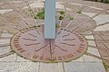 Base of sundial - geograph.org.uk - 1396530.jpg 640 × 426; 77 KB
-
 Beamish 1913 Colliery Village - geograph.org.uk - 1394765.jpg 640 × 426; 77 KB
-
 Beamish Entrance - geograph.org.uk - 1396491.jpg 640 × 426; 59 KB
-
 Beamish Museum B-Type replica bus B1349 (DET 720D), 6 July 2009.jpg 370 × 299; 53 KB
-
 Beamish Museum railway station - geograph.org.uk - 1394786.jpg 640 × 426; 83 KB
-
 Beaulieu River from Bucklers Hard - geograph.org.uk - 765030.jpg 426 × 640; 58 KB
-
 Beaumaris Castle - geograph.org.uk - 1552071.jpg 640 × 480; 73 KB
-
 Beaumaris Castle in Autumn - geograph.org.uk - 1552072.jpg 640 × 480; 78 KB
-
 Beaumaris Castle Walls - geograph.org.uk - 1552078.jpg 640 × 480; 78 KB
-
 Beaumaris Lifeboat station - geograph.org.uk - 1552082.jpg 640 × 480; 57 KB
-
 Beechmoor Farm and shop - geograph.org.uk - 1635926.jpg 640 × 480; 87 KB
-
 Beehive Inn - geograph.org.uk - 1339042.jpg 640 × 426; 73 KB
-
 Beggar's Bridge Glaisdale - geograph.org.uk - 776551.jpg 640 × 431; 116 KB
-
 Beggar's Bridge Glaisdale - geograph.org.uk - 793208.jpg 640 × 424; 102 KB
-
 Belgrave Road - geograph.org.uk - 1510461.jpg 640 × 480; 69 KB
-
 Bempton Cliffs - geograph.org.uk - 776559.jpg 640 × 403; 90 KB
-
 Ben Nevis from Corpach - geograph.org.uk - 747744.jpg 640 × 480; 48 KB
-
 Bend in road above Tynrhos - geograph.org.uk - 1574156.jpg 640 × 437; 100 KB
-
 Bend in road east of Rhydycroesau - geograph.org.uk - 1722649.jpg 640 × 480; 100 KB
-
 Bend in road on A490 - geograph.org.uk - 1570252.jpg 640 × 480; 53 KB
-
 Bend in the line - geograph.org.uk - 1333555.jpg 640 × 426; 91 KB
-
 Bend in the Woods - geograph.org.uk - 1333621.jpg 640 × 426; 110 KB
-
 Bend in Trederwen Road - geograph.org.uk - 1511211.jpg 640 × 480; 112 KB
-
 Bend near Coed Cothion - geograph.org.uk - 1555203.jpg 640 × 480; 83 KB
-
 Bend near Golfa Farm - geograph.org.uk - 1560215.jpg 640 × 426; 112 KB
-
 Bend on Road - geograph.org.uk - 1396485.jpg 640 × 426; 86 KB
-
 Berriew Church - geograph.org.uk - 1339013.jpg 426 × 640; 103 KB
-
 Berriew Church side view - geograph.org.uk - 1339017.jpg 640 × 426; 85 KB
-
 Bethania Capel Pistyll - geograph.org.uk - 1553775.jpg 640 × 480; 63 KB
-
 Bettys Tea Rooms in Davygate - geograph.org.uk - 2567370.jpg 640 × 427; 87 KB
-
 Betws Y Coed church on the A5 - geograph.org.uk - 798781.jpg 426 × 640; 103 KB
-
 Betws Y Coed station buildings. - geograph.org.uk - 798803.jpg 640 × 426; 88 KB
-
 Betws Y Coed station. - geograph.org.uk - 798762.jpg 640 × 426; 62 KB
-
 Bewdley Railway Station - geograph.org.uk - 767376.jpg 640 × 480; 113 KB
-
 Big Red Rooster - geograph.org.uk - 798769.jpg 640 × 426; 80 KB
-
 Bike for sale - geograph.org.uk - 1552060.jpg 640 × 480; 106 KB
-
 Birch Services Eastbound - geograph.org.uk - 1393495.jpg 640 × 480; 69 KB
-
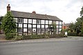 Black and White Cottage at Chirbury - geograph.org.uk - 1376684.jpg 640 × 426; 73 KB
-
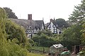
 Black and White House - geograph.org.uk - 1334265.jpg 640 × 426; 116 KB
-
 Black and White houses - geograph.org.uk - 1339010.jpg 640 × 426; 84 KB
-
 Black and White Tandoori restaurant - geograph.org.uk - 1525662.jpg 640 × 480; 78 KB
-
 Black Bull Wetherby - geograph.org.uk - 1393849.jpg 640 × 480; 85 KB
-
 Black Horse Inn at Maesbrook - geograph.org.uk - 1336340.jpg 640 × 480; 84 KB
-
 Black Prince at Liverpool Garden Festival - geograph.org.uk - 777006.jpg 640 × 407; 102 KB
-
 Blackpool Bridge - geograph.org.uk - 777795.jpg 640 × 411; 86 KB
-
 Blackpool Tower from the beach - geograph.org.uk - 771744.jpg 465 × 640; 57 KB
-
 Blacksmith's shop - geograph.org.uk - 1565151.jpg 640 × 480; 57 KB
-
 Blaenau Ffestiniog station - geograph.org.uk - 1553337.jpg 640 × 480; 95 KB
-
 Bloomers Bakewell Pudding shop. - geograph.org.uk - 885093.jpg 640 × 426; 95 KB


,_6_July_2009.jpg)


