Category:Images by John Holmes

Media in category "Images by John Holmes"
The following 200 files are in this category, out of 1,194 total.
(previous page) (next page)-
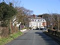
 "Newby East" - geograph.org.uk - 128109.jpg 640 × 338; 52 KB
-
 "Sunny Corner" Pardshaw. - geograph.org.uk - 80434.jpg 640 × 480; 86 KB
-
 "The How" entrance. - geograph.org.uk - 80588.jpg 640 × 480; 105 KB
-
-
 2 exits from Bridekirk. - geograph.org.uk - 80882.jpg 640 × 480; 119 KB
-
 2nd in series left to right. - geograph.org.uk - 98329.jpg 640 × 443; 59 KB
-
 4th in the series here. - geograph.org.uk - 98339.jpg 640 × 418; 84 KB
-

-
 A Covered Reservoir. - geograph.org.uk - 96713.jpg 640 × 480; 45 KB
-
 A feedr for Rannerdale beck. - geograph.org.uk - 116108.jpg 640 × 480; 47 KB
-
 A Frosty Sale Fell Track. - geograph.org.uk - 95439.jpg 640 × 439; 46 KB
-
 A gloomy Hannah Hall. - geograph.org.uk - 101486.jpg 640 × 422; 52 KB
-
 A granite wall. - geograph.org.uk - 92249.jpg 640 × 480; 101 KB
-
 A high motorway junction. - geograph.org.uk - 88767.jpg 640 × 445; 71 KB
-
 A Lodge or Toll at Cardew. - geograph.org.uk - 95536.jpg 640 × 448; 81 KB
-
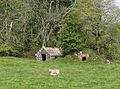
 A mixture of farming. - geograph.org.uk - 98706.jpg 640 × 446; 70 KB
-
 A pair of motorway bridges - geograph.org.uk - 92604.jpg 640 × 360; 52 KB
-
 A path to the top of Sale Fell. - geograph.org.uk - 95442.jpg 640 × 480; 73 KB
-

-
 A recently flooded roadway. - geograph.org.uk - 79496.jpg 640 × 480; 80 KB
-
 A road maze. - geograph.org.uk - 88732.jpg 640 × 344; 45 KB
-
 A seven barred gate. - geograph.org.uk - 97786.jpg 640 × 454; 62 KB
-
 A Shap Granite Limekiln. - geograph.org.uk - 92618.jpg 640 × 337; 53 KB
-
 A Sheep breeding centre. - geograph.org.uk - 101073.jpg 640 × 379; 54 KB
-
 A Sign of the times. - geograph.org.uk - 124603.jpg 640 × 543; 109 KB
-
 A Stone built sheep pen. - geograph.org.uk - 105996.jpg 640 × 480; 80 KB
-
 A Straight Road. - geograph.org.uk - 88689.jpg 640 × 480; 79 KB
-
 A tall sign. - geograph.org.uk - 88697.jpg 640 × 515; 85 KB
-
-
 A429 - A3400 Roundabout. - geograph.org.uk - 88721.jpg 640 × 442; 62 KB
-
 A429 Sub Station. - geograph.org.uk - 88712.jpg 640 × 480; 74 KB
-
 A594 to Dearham junction. - geograph.org.uk - 81995.jpg 640 × 480; 55 KB
-
 A6 into Penrith. - geograph.org.uk - 101093.jpg 640 × 304; 33 KB
-
 A6 to Cliburn Junction. - geograph.org.uk - 88877.jpg 640 × 417; 60 KB
-
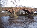 A6071 river bridge. - geograph.org.uk - 128086.jpg 640 × 480; 109 KB
-
 A66 over Lorton Road - geograph.org.uk - 78476.jpg 640 × 480; 53 KB
-
 A66 Road Bridge over the river Marron - geograph.org.uk - 78415.jpg 640 × 480; 67 KB
-
 A66 Trunk road looking north west - geograph.org.uk - 79958.jpg 640 × 480; 98 KB
-
 A66T crossover point. - geograph.org.uk - 101063.jpg 640 × 480; 52 KB
-
 Acre Walls Farmland - geograph.org.uk - 79424.jpg 640 × 480; 92 KB
-
 Across the estuary to Eskmeals - geograph.org.uk - 156835.jpg 640 × 480; 21 KB
-
 Across the estuary towards Saltcoats - geograph.org.uk - 156839.jpg 640 × 480; 28 KB
-
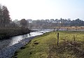 Across the rivers to Kentrigg. - geograph.org.uk - 143159.jpg 640 × 444; 65 KB
-
 Activity centre Broats Moss. - geograph.org.uk - 143071.jpg 640 × 480; 97 KB
-
 Aikbank Mill - geograph.org.uk - 80601.jpg 640 × 480; 78 KB
-
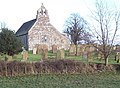 Aikton Church. - geograph.org.uk - 119914.jpg 640 × 471; 64 KB
-
 Airport Building. - geograph.org.uk - 142990.jpg 640 × 480; 41 KB
-
 Allerdale Ramble. - geograph.org.uk - 86904.jpg 640 × 480; 116 KB
-
 An old ford. - geograph.org.uk - 92591.jpg 640 × 480; 110 KB
-
 An unnamed farm - geograph.org.uk - 89991.jpg 640 × 480; 85 KB
-
 Ancient Woodland Strip. - geograph.org.uk - 114563.jpg 640 × 435; 49 KB
-
 Anns Hill Farm - geograph.org.uk - 78513.jpg 640 × 480; 68 KB
-
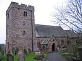
 Arlecdon Church - geograph.org.uk - 79460.jpg 640 × 480; 81 KB
-
 Armaside - geograph.org.uk - 80555 B.jpg 614 × 424; 85 KB
-
 Armaside. - geograph.org.uk - 80555.jpg 640 × 480; 103 KB
-
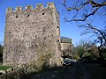
 Armathwaite Hall entrance. - geograph.org.uk - 81004.jpg 640 × 480; 109 KB
-
 Around the corner please. - geograph.org.uk - 80925.jpg 640 × 480; 95 KB
-
 Asby Moor Farmhouse. - geograph.org.uk - 84577.jpg 640 × 480; 69 KB
-
 Bankhouse Farm. - geograph.org.uk - 97821.jpg 640 × 408; 55 KB
-
 Barred gate. - geograph.org.uk - 138977.jpg 640 × 480; 92 KB
-
 Barrow from Catbells - geograph.org.uk - 77311.jpg 600 × 407; 49 KB
-
 Bass Beck Bridge. - geograph.org.uk - 86666.jpg 640 × 480; 126 KB
-
 Bassenthwaite 1.jpg 640 × 372; 37 KB
-
 Bassenthwaite from Sale Fell - geograph.org.uk - 95450.jpg 640 × 400; 58 KB
-
 Bassenthwaite Lake in Winter - geograph.org.uk - 79588.jpg 500 × 332; 35 KB
-
 Beach and sandunes at Drigg. - geograph.org.uk - 156829.jpg 640 × 409; 30 KB
-
 Beach at Drigg Point. - geograph.org.uk - 156831.jpg 640 × 430; 22 KB
-
 Bell House Farm. - geograph.org.uk - 96262.jpg 640 × 352; 47 KB
-
 Berrier End Farmhouse. - geograph.org.uk - 114387.jpg 640 × 480; 66 KB
-
 Berrier. - geograph.org.uk - 101035.jpg 640 × 480; 37 KB
-
 Bewaldeth. - geograph.org.uk - 80975.jpg 640 × 480; 84 KB
-
 Birks Farm. - geograph.org.uk - 89915.jpg 640 × 480; 62 KB
-
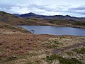 Blea Tarn. - geograph.org.uk - 145573.jpg 640 × 480; 57 KB
-
 Blue Roller. - geograph.org.uk - 118803.jpg 640 × 480; 68 KB
-
 Bootle Fire Station. - geograph.org.uk - 160390.jpg 640 × 480; 50 KB
-
 Branthwaite Hall. - geograph.org.uk - 80423.jpg 640 × 480; 123 KB
-
 Braystones beach. - geograph.org.uk - 97378.jpg 640 × 337; 53 KB
-
 Braystones wet beach. - geograph.org.uk - 97390.jpg 640 × 480; 30 KB
-
 Bridge over clearway. - geograph.org.uk - 97342.jpg 640 × 480; 73 KB
-
 Bridge over the river keekle - geograph.org.uk - 79416.jpg 640 × 480; 144 KB
-
 Bridge over Windergill Beck. - geograph.org.uk - 89856.jpg 640 × 480; 129 KB
-
 Brockleymoor. - geograph.org.uk - 146570.jpg 640 × 480; 52 KB
-
 Bullgill from the railway bridge. - geograph.org.uk - 98652.jpg 640 × 402; 64 KB
-
 Bullgill houses. - geograph.org.uk - 98669.jpg 640 × 480; 63 KB
-
 Bullgill. - geograph.org.uk - 88951.jpg 640 × 480; 79 KB
-
 Calder Abbey Ice House. - geograph.org.uk - 84174.jpg 640 × 472; 112 KB
-
 Cardew House Farm. - geograph.org.uk - 145020.jpg 640 × 386; 54 KB
-
 Carleton Hall. - geograph.org.uk - 146542.jpg 640 × 407; 44 KB
-
 Catterlen with pennines background. - geograph.org.uk - 143772.jpg 640 × 381; 70 KB
-
 Chapel Wood. - geograph.org.uk - 95451.jpg 640 × 480; 122 KB
-
 Civic Trust Award. - geograph.org.uk - 92564.jpg 640 × 480; 67 KB
-
 Cleator Moor with Backdrop. - geograph.org.uk - 96724 (cropped).jpg 640 × 141; 22 KB
-
 Cleator Moor with Backdrop. - geograph.org.uk - 96724.jpg 640 × 360; 49 KB
-
 Coming in to land. - geograph.org.uk - 128066.jpg 640 × 422; 50 KB
-
 Crofton Grain Store. - geograph.org.uk - 119485.jpg 640 × 417; 42 KB
-
 Crookdake Hall. - geograph.org.uk - 138988.jpg 640 × 457; 69 KB
-
 Crookdake. - geograph.org.uk - 138978.jpg 640 × 373; 67 KB
-

-
 Cycle track bridge. - geograph.org.uk - 88976.jpg 640 × 480; 121 KB
-
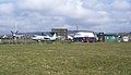 D and G Aviation Museum. - geograph.org.uk - 142994.jpg 640 × 370; 48 KB
-
 Dalston Railway Station.jpg 640 × 480; 80 KB
-
 Daw Bank. - geograph.org.uk - 92584.jpg 640 × 480; 115 KB
-
 Dead Muck spreader. - geograph.org.uk - 138990.jpg 640 × 480; 95 KB
-
 Dearham Church. - geograph.org.uk - 88889.jpg 640 × 480; 103 KB
-
 Derwent View. - geograph.org.uk - 81010.jpg 640 × 480; 50 KB
-
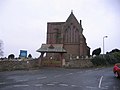 Distington Church. - geograph.org.uk - 88993.jpg 640 × 480; 50 KB
-
 Distington Crematorium. - geograph.org.uk - 88994.jpg 640 × 480; 59 KB
-
 Dovenby Craggs Farm - geograph.org.uk - 78514.jpg 640 × 480; 72 KB
-
 Dower House Scarness. - geograph.org.uk - 86642.jpg 640 × 480; 117 KB
-
 Down the line at sunset. - geograph.org.uk - 98697.jpg 640 × 417; 61 KB
-
 Drigg beach. - geograph.org.uk - 156852.jpg 640 × 456; 16 KB
-
 Dry stone wall in the winter sunlight. - geograph.org.uk - 95443.jpg 640 × 377; 62 KB
-
 Dub Bridge. - geograph.org.uk - 89881.jpg 640 × 480; 114 KB
-
 Dubwath - geograph.org.uk - 79952.jpg 640 × 480; 116 KB
-
 Dukes Meadow Caravan Park. - geograph.org.uk - 114483.jpg 640 × 475; 47 KB
-
 East House Farm. - geograph.org.uk - 80534.jpg 640 × 480; 109 KB
-
 East Town End Wind Farm. - geograph.org.uk - 96733.jpg 640 × 408; 35 KB
-
 Elva Plain Farmstead. - geograph.org.uk - 79947.jpg 640 × 480; 79 KB
-
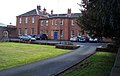
 Entrance lodge houses at Orton Park, Cumbria, England.jpg 640 × 480; 63 KB
-
 Entrance to Broughton Moor. - geograph.org.uk - 81751.jpg 640 × 388; 39 KB
-
 Entrance to Irton House Farm. - geograph.org.uk - 80931.jpg 640 × 480; 60 KB
-
 Estuary at Ravenglass. - geograph.org.uk - 156836.jpg 640 × 480; 27 KB
-
 Ettington Church. - geograph.org.uk - 86752.jpg 640 × 480; 79 KB
-
 Farm track and footpath. - geograph.org.uk - 118804.jpg 640 × 383; 61 KB
-
 Farmers ford near Scout Green - geograph.org.uk - 92596.jpg 640 × 480; 103 KB
-
 Field fenced off area - geograph.org.uk - 105545.jpg 640 × 303; 53 KB
-
 Field slope to wood and on. - geograph.org.uk - 95445.jpg 640 × 480; 53 KB
-
 Flag Pole Base. - geograph.org.uk - 96286.jpg 640 × 415; 48 KB
-
 Folly Bridge. - geograph.org.uk - 81792.jpg 640 × 480; 83 KB
-
 Folly. - geograph.org.uk - 119496.jpg 640 × 530; 71 KB
-
 Footbridge and Sheep pens. - geograph.org.uk - 116115.jpg 640 × 480; 62 KB
-
 Footpath and field gate. - geograph.org.uk - 144707.jpg 640 × 480; 73 KB
-
 Footpath goes either way. - geograph.org.uk - 119892.jpg 640 × 480; 72 KB
-
 Footpath to Black How. - geograph.org.uk - 156218.jpg 640 × 344; 23 KB
-
 Footpath to Micklethwaite. - geograph.org.uk - 119420.jpg 640 × 480; 95 KB
-
 Footpath to Newtown. - geograph.org.uk - 128075.jpg 640 × 399; 67 KB
-
 Forestry at Clargillheadon A686 - geograph.org.uk - 80120.jpg 600 × 401; 90 KB
-
 Four Shire Stone. - geograph.org.uk - 88659.jpg 640 × 480; 108 KB
-
 Fox House Farm. - geograph.org.uk - 81821.jpg 640 × 480; 96 KB
-
 From the Mid Tarn Farm Turnoff. - geograph.org.uk - 98363.jpg 640 × 390; 33 KB
-
 Gated track to Orton Moss. - geograph.org.uk - 144697.jpg 640 × 480; 67 KB
-
 Gilgarran farm. - geograph.org.uk - 88997.jpg 640 × 480; 58 KB
-
 Goat Craggs and Reecastle Cragg - geograph.org.uk - 80016.jpg 640 × 480; 80 KB
-
 Great Clifton - Old School.jpg 640 × 480; 85 KB
-
 Great Wolford Church. - geograph.org.uk - 88684.jpg 625 × 640; 66 KB
-
 Greyrigg shooting range. - geograph.org.uk - 92558.jpg 640 × 480; 91 KB
-
 Greystoke Roman Road. - geograph.org.uk - 101053.jpg 640 × 480; 56 KB
-
 Hackthorpe Hall. - geograph.org.uk - 88870.jpg 640 × 480; 69 KB
-
 St Mary's Church Halford. - geograph.org.uk - 88723.jpg 640 × 480; 108 KB
-
 Harker Marsh. - geograph.org.uk - 81832.jpg 640 × 480; 72 KB
-
 Harrot. - geograph.org.uk - 98723.jpg 640 × 426; 46 KB
-
 Harthopeburn Cottages. - geograph.org.uk - 84332.jpg 600 × 428; 88 KB
-
 Hewthwaite Hall. - geograph.org.uk - 80908.jpg 640 × 480; 79 KB
-
 High Ireby. - geograph.org.uk - 86919.jpg 640 × 480; 65 KB
-
 Higham Hall - geograph.org.uk - 79950.jpg 640 × 480; 90 KB
-
 Hursthole Point Car Park - geograph.org.uk - 79970.jpg 640 × 480; 163 KB
-
 Hutton End Crossroads. - geograph.org.uk - 143793.jpg 640 × 480; 44 KB
-
 Hutton in the Forest Parkland - geograph.org.uk - 143789.jpg 640 × 480; 87 KB
-
 Inn "The Fox and Hounds" - geograph.org.uk - 88682.jpg 640 × 480; 66 KB
-
 The church at Irthington. - geograph.org.uk - 128070.jpg 640 × 480; 71 KB
-
 Isel Bridge over the river Derwent. - geograph.org.uk - 80919.jpg 640 × 480; 113 KB
-
 Isel Old Park Crossroads. - geograph.org.uk - 80929.jpg 640 × 480; 99 KB
-
 Jenkin's Cross Farm. - geograph.org.uk - 95507.jpg 640 × 312; 38 KB
-
 Johnby Hall. - geograph.org.uk - 114445.jpg 640 × 480; 50 KB
-
 Kale crop. - geograph.org.uk - 119435.jpg 640 × 541; 66 KB
-
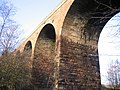 Keekle Viaduct. - geograph.org.uk - 96236.jpg 640 × 480; 95 KB
-
 Keekle Viaduct. - geograph.org.uk - 96239.jpg 640 × 480; 121 KB
-
 Keekle Viaduct. - geograph.org.uk - 96246.jpg 640 × 319; 52 KB
-
 Keekle Viaduct. - geograph.org.uk - 96249.jpg 640 × 361; 35 KB
-
 Church at Kells Whitehaven. - geograph.org.uk - 89978.jpg 640 × 480; 70 KB
-
 Kirkland Hall Farm. - geograph.org.uk - 119403.jpg 640 × 424; 49 KB
-
 Kirkstone Pass. - geograph.org.uk - 105609.jpg 640 × 387; 68 KB
-
 Lake District National Park Sign. - geograph.org.uk - 101130.jpg 640 × 480; 75 KB
-
 Lamplugh Church. - geograph.org.uk - 89335.jpg 640 × 480; 61 KB
-
 Lane beside rugby clubhouse - geograph.org.uk - 79413.jpg 640 × 480; 64 KB
-
 Latter Barrow Beck. - geograph.org.uk - 124573.jpg 640 × 350; 67 KB
-
 Limekilns at the old quarries. - geograph.org.uk - 113447.jpg 640 × 384; 42 KB
-
 Little Building at Flusco Pike - geograph.org.uk - 80047.jpg 640 × 480; 42 KB
-
 Looking towards Beckermet. - geograph.org.uk - 97352.jpg 640 × 480; 65 KB
-
 Lower flanks of Maiden Moor and Black Crag - geograph.org.uk - 79997.jpg 640 × 480; 104 KB
-
 Lowther Farm. - geograph.org.uk - 124642.jpg 640 × 343; 84 KB
-
 Lowthwaite and Longlands. - geograph.org.uk - 106023.jpg 640 × 480; 37 KB
-
 Lowthwaite Fell from the footpath. - geograph.org.uk - 105991.jpg 640 × 429; 42 KB
-
 Lowthwaite Fell. - geograph.org.uk - 106019.jpg 640 × 480; 40 KB
-
 M6 Northbound Congestion. - geograph.org.uk - 86786.jpg 640 × 480; 62 KB
-
 M6 under the A6. - geograph.org.uk - 88873.jpg 640 × 498; 74 KB
-

-
 Marsh Channel to the estuary. - geograph.org.uk - 146170.jpg 640 × 480; 62 KB
-
 Maryport Cottage Hospital. - geograph.org.uk - 82027.jpg 640 × 480; 86 KB
-
 Middletown. - geograph.org.uk - 98353.jpg 640 × 480; 44 KB
-
 Midtown Farm Great Orton. - geograph.org.uk - 144693.jpg 640 × 480; 48 KB
-
 Midtown Farm, Aughertree - geograph.org.uk - 86684.jpg 640 × 480; 69 KB
-
 Milestone House. - geograph.org.uk - 146547.jpg 640 × 480; 46 KB
-
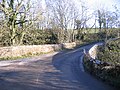
 Modern road through old village. - geograph.org.uk - 78430.jpg 640 × 480; 57 KB
-
 Moorland Powerlines. - geograph.org.uk - 88986.jpg 640 × 480; 50 KB
-
 Moota Inn and the old road. - geograph.org.uk - 80893.jpg 640 × 480; 85 KB
-
 Mosser Mains. - geograph.org.uk - 80599.jpg 640 × 480; 83 KB
-
 Mouth of the river Calder. - geograph.org.uk - 98376.jpg 640 × 402; 59 KB
-
 Mouth of the rivers Calder and Ehen. - geograph.org.uk - 98378.jpg 640 × 480; 43 KB
-
 Mowbray Farm. - geograph.org.uk - 96461.jpg 640 × 422; 53 KB


.jpg)