Category:Images by John Myers

Media in category "Images by John Myers"
The following 200 files are in this category, out of 773 total.
(previous page) (next page)-

-
 "Cut through", Rayleigh - geograph.org.uk - 490915.jpg 473 × 640; 94 KB
-
 "Dual Carriageway", Hunston - geograph.org.uk - 409694.jpg 640 × 480; 101 KB
-
 "Ferry Steps", South Fambridge - geograph.org.uk - 322738.jpg 640 × 475; 43 KB
-
 "New" wetland, Wallasea - Low tide - geograph.org.uk - 337283.jpg 640 × 424; 61 KB
-

-
 "Witches Butter" - geograph.org.uk - 219135.jpg 640 × 480; 73 KB
-

-
 A127 - Southend bound carriageway - geograph.org.uk - 166134.jpg 480 × 640; 55 KB
-
 A127 approaching Rayleigh Weir - geograph.org.uk - 623038.jpg 640 × 495; 93 KB
-
 Across the Roach - geograph.org.uk - 169524.jpg 640 × 480; 43 KB
-
 Adnam's Brewery - geograph.org.uk - 1422183.jpg 640 × 426; 70 KB
-
 All Saints , South Fambridge - geograph.org.uk - 160897.jpg 480 × 640; 94 KB
-
 All Saints from the A128 - geograph.org.uk - 1701909.jpg 1,522 × 1,179; 360 KB
-
 Allotments - Edwards Hall Park - geograph.org.uk - 211925.jpg 640 × 480; 87 KB
-
 Ancient wood boundary, Beaches Wood - geograph.org.uk - 267350.jpg 488 × 640; 149 KB
-
 Anubis at the O2 - geograph.org.uk - 650335.jpg 500 × 640; 74 KB
-
 St. Andrew's - Ashingdon - geograph.org.uk - 151691.jpg 640 × 480; 60 KB
-
 St. Andrew's - Revisited - geograph.org.uk - 236602.jpg 640 × 476; 60 KB
-
 Aviation Graveyard - geograph.org.uk - 1106165.jpg 640 × 410; 87 KB
-
 Avon Road allotments - geograph.org.uk - 816910.jpg 492 × 640; 132 KB
-
 Badwell "chippy" - geograph.org.uk - 867550.jpg 640 × 479; 82 KB
-
 Baltic Wharf - Gate - geograph.org.uk - 150967.jpg 480 × 640; 96 KB
-
 Baltic Wharf Jetty - geograph.org.uk - 166093.jpg 640 × 480; 98 KB
-
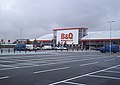 BandQ Southend - geograph.org.uk - 913829.jpg 640 × 456; 57 KB
-
 Barge aground - Wallasea Ness - geograph.org.uk - 152164.jpg 640 × 480; 63 KB
-
 Bathtubs in repose - geograph.org.uk - 828087.jpg 482 × 640; 163 KB
-
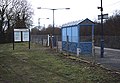 Battlesbridge Railway Station.jpg 640 × 445; 83 KB
-
 Beach east of Burnham Wick sluice - geograph.org.uk - 214504.jpg 640 × 480; 98 KB
-
 Beach huts, Shoebury Common - geograph.org.uk - 228923.jpg 640 × 414; 45 KB
-
 Beaches Wood - geograph.org.uk - 608804.jpg 487 × 640; 127 KB
-
 Beckney Wood - Bluebells - geograph.org.uk - 160903.jpg 640 × 480; 169 KB
-
 Beckney Wood - Footpath near S.W. Corner - geograph.org.uk - 151695.jpg 480 × 640; 143 KB
-
 Beefsteak Fungus - geograph.org.uk - 537151.jpg 640 × 538; 113 KB
-
 Beeleigh Falls - geograph.org.uk - 230832.jpg 640 × 480; 111 KB
-
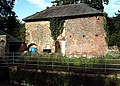 Beeleigh Mill - geograph.org.uk - 332291.jpg 640 × 458; 114 KB
-
 Bell Tower - St. James', Dengie - geograph.org.uk - 221017.jpg 480 × 640; 99 KB
-
 Bell Tower, St. Mary, Langham - geograph.org.uk - 867493.jpg 439 × 640; 72 KB
-
 Below Beeleigh Falls - geograph.org.uk - 230821.jpg 640 × 480; 94 KB
-

-
 Birch Polypore - Thundersley Great Common - geograph.org.uk - 537087.jpg 490 × 640; 169 KB
-
 Birch standards, Beaches Wood - geograph.org.uk - 280515.jpg 456 × 640; 72 KB
-
 Birches on the Borrow Dyke - geograph.org.uk - 1093325.jpg 640 × 448; 64 KB
-
 Blackthorn Tunnel - geograph.org.uk - 370978.jpg 486 × 640; 131 KB
-
 Blount's Wood - geograph.org.uk - 219069.jpg 480 × 640; 145 KB
-
 Blounts Farm - geograph.org.uk - 1656473.jpg 480 × 640; 43 KB
-
 Blountswood Crossing - geograph.org.uk - 1656429.jpg 480 × 640; 51 KB
-
 Blue Footbridge - geograph.org.uk - 1200499.jpg 640 × 426; 86 KB
-
 Blue plaque, Woodham Mortimer Hall - geograph.org.uk - 230499.jpg 572 × 640; 104 KB
-
 Boardwalk, Elgin Coppice - geograph.org.uk - 541318.jpg 489 × 640; 87 KB
-
 Boat on saltings - geograph.org.uk - 169375.jpg 640 × 480; 55 KB
-
 Bog Wood, Maldon - geograph.org.uk - 230687.jpg 640 × 480; 91 KB
-
 Book day in Westleton - geograph.org.uk - 1363213.jpg 640 × 480; 82 KB
-
 Borrow dyke - Heybridge - geograph.org.uk - 534039.jpg 503 × 640; 98 KB
-
 St. Margaret of Antioch - geograph.org.uk - 369207.jpg 640 × 436; 69 KB
-
 Bradley Way Culvert - geograph.org.uk - 851201.jpg 488 × 640; 105 KB
-
 Brandy Hole Marshes - geograph.org.uk - 1093343.jpg 640 × 426; 53 KB
-
 Brandy Hole Marshes - geograph.org.uk - 1691583.jpg 1,812 × 1,265; 646 KB
-
 Brankfleet Spit - geograph.org.uk - 152172.jpg 640 × 480; 87 KB
-
 Bridge on the Duckery - geograph.org.uk - 228363.jpg 640 × 419; 96 KB
-
 Bridge, Savill Gardens - geograph.org.uk - 1582279.jpg 640 × 426; 87 KB
-
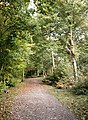
 Bridle path - geograph.org.uk - 1124920.jpg 454 × 640; 124 KB
-
 Bridleway - geograph.org.uk - 1701878.jpg 2,640 × 1,980; 1.15 MB
-
 Bridleway birches - geograph.org.uk - 583218.jpg 470 × 640; 151 KB
-
 Bridleway with horses - geograph.org.uk - 1555427.jpg 640 × 426; 153 KB
-
 British Legion, Rayleigh - geograph.org.uk - 490935.jpg 640 × 479; 112 KB
-
 Brittons Hall Farm - geograph.org.uk - 817079.jpg 640 × 491; 71 KB
-
 Broad Parade, Hockley - geograph.org.uk - 333585.jpg 640 × 446; 85 KB
-
 Lych gate and spire, St.Mary's - geograph.org.uk - 364130.jpg 516 × 640; 112 KB
-
 Bull's head and horns, Hornchurch - geograph.org.uk - 471130.jpg 424 × 640; 56 KB
-
 Burnham Wick Sluice sign - geograph.org.uk - 214511.jpg 640 × 480; 95 KB
-
 Burnham-on-Crouch railway station 1.jpg 640 × 480; 120 KB
-
 Bus shelter - Badwell Ash - geograph.org.uk - 195579.jpg 480 × 640; 119 KB
-
 Bushy Wood - geograph.org.uk - 784869.jpg 640 × 499; 77 KB
-
 Button Toadstool - geograph.org.uk - 1555416.jpg 408 × 640; 51 KB
-

-
 C2c railway through Old Leigh - geograph.org.uk - 1523412.jpg 640 × 480; 88 KB
-

-
 Cantilever pillbox.jpg 640 × 426; 138 KB
-
 Canvey seawall - geograph.org.uk - 536914.jpg 640 × 452; 84 KB
-
 Cattle Trough, Rayleigh High Street - geograph.org.uk - 333201.jpg 640 × 433; 98 KB
-
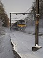
 Central line train - geograph.org.uk - 1603144.jpg 640 × 456; 135 KB
-
 Central reservation, Thorpe Hall Avenue - geograph.org.uk - 228961.jpg 480 × 640; 130 KB
-
 Chalkwell Beach - geograph.org.uk - 976543.jpg 480 × 640; 55 KB
-
 Chalkwell railway station in 2006.jpg 516 × 640; 80 KB
-
 Charcoal burner, Pound Wood - geograph.org.uk - 267792.jpg 480 × 640; 166 KB
-
 Charter Avenue, Ilford - geograph.org.uk - 1212543.jpg 640 × 438; 78 KB
-
 Chelmer backwater - geograph.org.uk - 800103.jpg 469 × 640; 138 KB
-
 Chelmer portage - geograph.org.uk - 795717.jpg 477 × 640; 125 KB
-
 Chelmsford towerblocks - geograph.org.uk - 785017.jpg 480 × 640; 76 KB
-
 Christmas at the O2 - geograph.org.uk - 650392.jpg 488 × 640; 73 KB
-
 Church Street, Maldon - geograph.org.uk - 537040.jpg 480 × 640; 103 KB
-
 Church Street, Windsor - geograph.org.uk - 1450294.jpg 480 × 640; 85 KB
-
 Clandon House - geograph.org.uk - 931979.jpg 640 × 470; 83 KB
-
 Clements Hall Leisure Centre - geograph.org.uk - 164863.jpg 640 × 480; 77 KB
-
-
 Clock Tower from Shore Road - geograph.org.uk - 214554.jpg 480 × 640; 62 KB
-

-
 Clocktower - geograph.org.uk - 214551.jpg 480 × 640; 62 KB
-
 Clouded Agaric - geograph.org.uk - 608760.jpg 640 × 482; 101 KB
-
 Congregational Church, Hockley - geograph.org.uk - 333334.jpg 640 × 441; 72 KB
-
 Connaught Road, Rayleigh - geograph.org.uk - 1631433.jpg 425 × 640; 119 KB
-
 Connaught Road, Rayleigh - geograph.org.uk - 531798.jpg 462 × 640; 103 KB
-
 Cotton's Wood from the lake - geograph.org.uk - 1172235.jpg 640 × 424; 67 KB
-
 Country road - geograph.org.uk - 784956.jpg 490 × 640; 84 KB
-
 Covered walkway to the Dome - geograph.org.uk - 650540.jpg 496 × 640; 83 KB
-
 Creek east of Brandy Hole Marshes - geograph.org.uk - 161897.jpg 640 × 480; 93 KB
-
 Crowstone Plaque - TQ8585 1785590.jpg 3,264 × 2,448; 2.82 MB
-
 Curling Tye Green - geograph.org.uk - 230649.jpg 640 × 427; 96 KB
-
 Daldinia concentrica - geograph.org.uk - 655932.jpg 640 × 488; 154 KB
-
 Danger Sign - geograph.org.uk - 1160985.jpg 640 × 477; 85 KB
-
 Dark Wood boundary oaks - geograph.org.uk - 1144102.jpg 640 × 408; 85 KB
-
 Dark Wood Oaks, Summer - geograph.org.uk - 1463264.jpg 480 × 640; 106 KB
-
-
 Daws Heath Road, Rayleigh - geograph.org.uk - 297510.jpg 468 × 640; 125 KB
-

-
 Delph Ditch, Promenade Park - geograph.org.uk - 507024.jpg 476 × 640; 119 KB
-
 Derelict building on Bradwell Marshes - geograph.org.uk - 240611.jpg 640 × 390; 69 KB
-
 Dismantled rail bridge - Purleigh - geograph.org.uk - 220868.jpg 480 × 640; 128 KB
-
 Dodds Grove - Prittle Brook - geograph.org.uk - 166098.jpg 480 × 640; 159 KB
-
 Downstream of Battlesbridge Mill - geograph.org.uk - 1719244.jpg 1,760 × 1,320; 242 KB
-
 Drain and sluice - geograph.org.uk - 214479.jpg 640 × 480; 84 KB
-
 Dry pond off Ironwell Lane - geograph.org.uk - 299192.jpg 480 × 640; 137 KB
-
 Dutch Cottage Museum, Canvey Island - geograph.org.uk - 246513.jpg 640 × 526; 71 KB
-
 Dutch cottage, Canvey Island - geograph.org.uk - 246532.jpg 640 × 548; 62 KB
-
 East Entrance, Broomfield Hospital - geograph.org.uk - 364172.jpg 640 × 480; 69 KB
-
 East towards Battlesbridge - geograph.org.uk - 1718879.jpg 1,980 × 2,640; 1.06 MB
-
 Eastwood Brook - geograph.org.uk - 525345.jpg 491 × 640; 156 KB
-
 Eastwood Brook, Rayleigh - geograph.org.uk - 395716.jpg 489 × 640; 161 KB
-

-
 Euonymus europaeus - Fruit - geograph.org.uk - 569287.jpg 454 × 640; 124 KB
-
 False Death Cap, Great Bull Wood - geograph.org.uk - 267368.jpg 456 × 640; 75 KB
-
 Farm track from Jotmans Hall - geograph.org.uk - 369222.jpg 640 × 431; 80 KB
-
 Felled Oaks - geograph.org.uk - 166096.jpg 480 × 640; 102 KB
-
 Fire Station , Hadleigh - geograph.org.uk - 333652.jpg 640 × 499; 83 KB
-
 Flatford - Lock and "Automatic Gate" - geograph.org.uk - 450781.jpg 541 × 640; 116 KB
-
 Flooded pit - geograph.org.uk - 809005.jpg 640 × 506; 76 KB
-
 Footbridge over the A13, Queensway - geograph.org.uk - 1690966.jpg 1,200 × 1,600; 391 KB
-
 Footbridge over the River Can - geograph.org.uk - 816871.jpg 640 × 494; 134 KB
-
 Footpath to Badwell Ash - geograph.org.uk - 867484.jpg 500 × 640; 106 KB
-
 Footpath to Badwell Ash - Winter - geograph.org.uk - 1598491.jpg 431 × 640; 98 KB
-
 Footpath to Dome - geograph.org.uk - 165491.jpg 509 × 640; 98 KB
-
 Footpath to nowhere in particular - geograph.org.uk - 220984.jpg 640 × 480; 86 KB
-
 Footpath, Chignall St. James - geograph.org.uk - 784804.jpg 479 × 640; 136 KB
-

-
 Fuel Tank - Wallasea Island - geograph.org.uk - 336573.jpg 640 × 501; 70 KB
-
 Garrison Cottages, Shoebury - geograph.org.uk - 291256.jpg 640 × 448; 92 KB
-
 Gates at end of new sea wall - geograph.org.uk - 151210.jpg 640 × 480; 63 KB
-

-
 Gravel Pit - Hunston - geograph.org.uk - 509393.jpg 640 × 476; 123 KB
-
 Great Ashfield - Church of All Saints.jpg 483 × 640; 75 KB
-
 Green Tunnel - geograph.org.uk - 1462097.jpg 480 × 640; 132 KB
-
 Grove Schools, Rayleigh - geograph.org.uk - 341128.jpg 640 × 383; 57 KB
-
 Gusted Hall Woods - Revisited - geograph.org.uk - 659926.jpg 480 × 640; 113 KB
-
 Gusted Hall Woods - Winter - geograph.org.uk - 671567.jpg 496 × 640; 139 KB
-
 St. James the Less, Hadleigh - geograph.org.uk - 761653.jpg 640 × 471; 95 KB
-
 Hadleigh Castle - geograph.org.uk - 386690.jpg 480 × 640; 97 KB
-
 Hadleigh Castle - geograph.org.uk - 386709.jpg 640 × 517; 107 KB
-
 Hadleigh Ray - geograph.org.uk - 761684.jpg 640 × 480; 49 KB
-
 Half Moon and High Street, Rayleigh - geograph.org.uk - 227371.jpg 640 × 431; 75 KB
-
 Hatchlands - geograph.org.uk - 932002.jpg 640 × 453; 79 KB
-
 High House, Badwell Green - geograph.org.uk - 260746.jpg 560 × 640; 103 KB
-
-
-
 Hockley Woods - geograph.org.uk - 544872.jpg 640 × 470; 98 KB
-
 Holy Trinity, Rayleigh - geograph.org.uk - 211126.jpg 640 × 480; 98 KB
-
 Holy Trinity, Rayleigh - Tower - geograph.org.uk - 211408.jpg 480 × 640; 118 KB
-
 Hornchurch Cemetery - geograph.org.uk - 471134.jpg 640 × 410; 88 KB
-

-
 Howe Outfall - Landward side - geograph.org.uk - 240750.jpg 510 × 640; 107 KB
-
 Inkcaps, Great Hawkwell Wood - geograph.org.uk - 267821.jpg 640 × 480; 135 KB
-
 Invasion of the Mutant Jelly Babies - geograph.org.uk - 1475514.jpg 640 × 480; 120 KB
-
 Joggers in the snow - geograph.org.uk - 1633080.jpg 426 × 640; 89 KB
-
 Kensington Road, Southchurch - geograph.org.uk - 229011.jpg 640 × 625; 114 KB
-
 Laetiporus sulphureus - geograph.org.uk - 219102.jpg 640 × 480; 83 KB
-
 Lakeside stump - geograph.org.uk - 541315.jpg 640 × 478; 91 KB
-
 Langford Cut - geograph.org.uk - 230869.jpg 640 × 480; 91 KB
-
 Lavenham Village Sign - geograph.org.uk - 450814.jpg 489 × 640; 128 KB
-
 Leeds Castle from the Pavilion Lawn - geograph.org.uk - 445597.jpg 640 × 528; 90 KB
-
 Leigh Creek - geograph.org.uk - 1523484.jpg 480 × 640; 138 KB
-
 Leigh Library - geograph.org.uk - 284649.jpg 640 × 447; 91 KB
-
 Leiston Fire Station - geograph.org.uk - 1420952.jpg 640 × 432; 67 KB
-
 Lime pollards, Blatches Farm - geograph.org.uk - 503662.jpg 483 × 640; 126 KB
-
 Little Haven footpath - geograph.org.uk - 643689.jpg 492 × 640; 126 KB
-
 Lloyds TSB, Rayleigh - geograph.org.uk - 341105.jpg 640 × 554; 83 KB
-
 Lloyds TSB, Thorpe Bay - geograph.org.uk - 322429.jpg 553 × 640; 99 KB
-
 Loftmans Sluice - Paglesham. - geograph.org.uk - 172639.jpg 640 × 480; 84 KB
-
 London Hill , Rayleigh - geograph.org.uk - 490938.jpg 451 × 640; 68 KB
-
 Magpie Fungus, Great Hawkwell Wood - geograph.org.uk - 267419.jpg 527 × 640; 76 KB
-
 Main track, the Scrubs - Winter - geograph.org.uk - 638621.jpg 499 × 640; 128 KB
-
 Marshhouse Outfall - Seaward side - geograph.org.uk - 240785.jpg 640 × 480; 96 KB
-
 Martyr's Monument, Rayleigh - geograph.org.uk - 333228.jpg 430 × 640; 86 KB
-
 Meare backwater - geograph.org.uk - 1353006.jpg 640 × 426; 132 KB
-
 Methodist Church, Hockley - geograph.org.uk - 333319.jpg 610 × 640; 96 KB
-
 Mill Hill - geograph.org.uk - 837420.jpg 469 × 640; 40 KB
-

-
 Moorings at Fambridge - geograph.org.uk - 1093303.jpg 640 × 465; 60 KB
-
 New England Wood - geograph.org.uk - 1155320.jpg 640 × 431; 152 KB
-
 New planting - geograph.org.uk - 503729.jpg 433 × 640; 133 KB
-
 New reservoir - view west - geograph.org.uk - 504415.jpg 489 × 640; 81 KB


