Category:Images by Kate Jewell

Media in category "Images by Kate Jewell"
The following 200 files are in this category, out of 6,078 total.
(previous page) (next page)-

-
 "Now, why isn't this working" - geograph.org.uk - 253800.jpg 640 × 480; 119 KB
-

-

-

-
 1, Hoby Road, Thrussington - geograph.org.uk - 1560594.jpg 640 × 480; 100 KB
-
 15th century window - geograph.org.uk - 1461460.jpg 427 × 640; 91 KB
-
 1970s housing, Grantham - geograph.org.uk - 269318.jpg 640 × 427; 70 KB
-

-

-
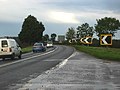
 A bend in the road - geograph.org.uk - 1279385.jpg 640 × 427; 106 KB
-
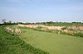
 A blot on the landscape - geograph.org.uk - 537985.jpg 640 × 427; 113 KB
-
 A choice of public right of way - geograph.org.uk - 809502.jpg 640 × 427; 113 KB
-
 A circular walk from Redmile, (10) - geograph.org.uk - 792493.jpg 640 × 427; 113 KB
-
 A circular walk from Redmile, (19) - geograph.org.uk - 792551.jpg 640 × 427; 120 KB
-
 A circular walk from Redmile, (27) - geograph.org.uk - 793344.jpg 639 × 640; 195 KB
-
 A circular walk from Redmile, (28) - geograph.org.uk - 793351.jpg 640 × 480; 173 KB
-
 A circular walk from Redmile, (32) - geograph.org.uk - 793483.jpg 640 × 427; 118 KB
-
 A circular walk from Redmile, (43) - geograph.org.uk - 794880.jpg 640 × 427; 102 KB
-
 A circular walk from Redmile, (46) - geograph.org.uk - 794936.jpg 640 × 427; 93 KB
-
 A circular walk from Redmile, (47) - geograph.org.uk - 794940.jpg 640 × 600; 135 KB
-
 A circular walk from Redmile, (5) - geograph.org.uk - 791170.jpg 640 × 427; 87 KB
-
 A circular walk from Redmile, (7) - geograph.org.uk - 791183.jpg 640 × 427; 94 KB
-
 A circular walk from Redmile, (8) - geograph.org.uk - 791198.jpg 640 × 418; 76 KB
-
 A circular walk from Redmile, (9) - geograph.org.uk - 792460.jpg 640 × 588; 118 KB
-
 A cold foggy morning at Cold Harbour - geograph.org.uk - 340344.jpg 640 × 427; 90 KB
-
 A cottage for railway fanatics - geograph.org.uk - 281434.jpg 640 × 427; 90 KB
-
 A different view^ - geograph.org.uk - 63567.jpg 480 × 640; 131 KB
-
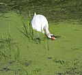
 A foreign visitor - geograph.org.uk - 913258.jpg 640 × 427; 81 KB
-
 A glimpse of the hill by Grange Wood - geograph.org.uk - 809732.jpg 640 × 427; 118 KB
-
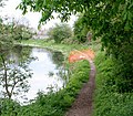
 A loop in the brook - geograph.org.uk - 775292.jpg 640 × 427; 115 KB
-
 A seat with a view - geograph.org.uk - 890317.jpg 640 × 427; 123 KB
-

-
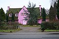 A very pink house^ - geograph.org.uk - 108313.jpg 640 × 427; 126 KB
-
 A very wet road - geograph.org.uk - 337091.jpg 640 × 427; 85 KB
-
 A walk round Martin's Pond (1) - geograph.org.uk - 728315.jpg 640 × 427; 105 KB
-
 A walk round Martin's Pond (10) - geograph.org.uk - 728476.jpg 640 × 427; 145 KB
-
 A walk round Martin's Pond (11) - geograph.org.uk - 728490.jpg 640 × 427; 119 KB
-
 A walk round Martin's Pond (12) - geograph.org.uk - 728499.jpg 640 × 427; 151 KB
-
 A walk round Martin's Pond (13) - geograph.org.uk - 728501.jpg 640 × 427; 138 KB
-
 A walk round Martin's Pond (14) - geograph.org.uk - 728505.jpg 640 × 427; 141 KB
-
 A walk round Martin's Pond (2) - geograph.org.uk - 728347.jpg 640 × 427; 147 KB
-
 A walk round Martin's Pond (3) - geograph.org.uk - 728375.jpg 640 × 427; 112 KB
-
 A walk round Martin's Pond (4) - geograph.org.uk - 728394.jpg 640 × 427; 133 KB
-
 A walk round Martin's Pond (5) - geograph.org.uk - 728406.jpg 640 × 427; 112 KB
-
 A walk round Martin's Pond (6) - geograph.org.uk - 728418.jpg 640 × 427; 143 KB
-
 A walk round Martin's Pond (7) - geograph.org.uk - 728431.jpg 640 × 427; 156 KB
-
 A walk round Martin's Pond (8) - geograph.org.uk - 728443.jpg 640 × 607; 158 KB
-
 A walk round Martin's Pond (9) - geograph.org.uk - 728465.jpg 640 × 427; 107 KB
-
 A walk through Harrison's Plantation (2) - geograph.org.uk - 722427.jpg 640 × 427; 144 KB
-
 A walk through Harrison's Plantation (3) - geograph.org.uk - 727286.jpg 640 × 427; 128 KB
-
 A walk through Harrison's Plantation (8) - geograph.org.uk - 727333.jpg 640 × 427; 132 KB
-
 A walk through Twyford Wood, No 1 - geograph.org.uk - 272030.jpg 640 × 427; 90 KB
-
 A walk through Twyford Wood, No 10 - geograph.org.uk - 272128.jpg 640 × 427; 139 KB
-
 A walk through Twyford Wood, No 11 - geograph.org.uk - 272133.jpg 640 × 427; 127 KB
-
 A walk through Twyford Wood, No 12 - geograph.org.uk - 272136.jpg 640 × 427; 111 KB
-
 A walk through Twyford Wood, No 2 - geograph.org.uk - 272038.jpg 640 × 427; 93 KB
-
 A walk through Twyford Wood, No 3a - geograph.org.uk - 272041.jpg 640 × 480; 79 KB
-
 A walk through Twyford Wood, No 3b - geograph.org.uk - 272045.jpg 640 × 427; 66 KB
-
 A walk through Twyford Wood, No 4 - geograph.org.uk - 272055.jpg 640 × 427; 118 KB
-
 A walk through Twyford Wood, No 5 - geograph.org.uk - 272076.jpg 640 × 427; 133 KB
-
 A walk through Twyford Wood, No 6 - geograph.org.uk - 272081.jpg 640 × 427; 136 KB
-
 A walk through Twyford Wood, No 7 - geograph.org.uk - 272089.jpg 640 × 427; 123 KB
-
 A walk through Twyford Wood, No 8 - geograph.org.uk - 272102.jpg 640 × 427; 101 KB
-
 A walk through Twyford Wood, No 9 - geograph.org.uk - 272121.jpg 640 × 427; 160 KB
-
 A woodland bench with views of the sea - geograph.org.uk - 928007.jpg 640 × 537; 205 KB
-
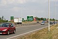
 A1 at Gonerby Moor - geograph.org.uk - 215766.jpg 640 × 427; 72 KB
-
 A151, Bourne Road - geograph.org.uk - 312124.jpg 640 × 427; 122 KB
-
 A46 Fosse Way at Six Hills - geograph.org.uk - 148174.jpg 640 × 427; 120 KB
-

-

-
 A46, Fosse Way 2½ years on - geograph.org.uk - 1300597.jpg 640 × 427; 111 KB
-
 A47 at Skeffington Gap, Leicestershire - geograph.org.uk - 213071.jpg 640 × 427; 101 KB
-
 A47 near Uppingham - geograph.org.uk - 45181.jpg 480 × 640; 95 KB
-
 A50, Groby bypass - geograph.org.uk - 205720.jpg 640 × 427; 89 KB
-
 A5199, Welford Road - geograph.org.uk - 209285.jpg 640 × 427; 134 KB
-
 A52 at Elton - geograph.org.uk - 256832.jpg 640 × 427; 94 KB
-
 A563 outer ring road, Leicester - geograph.org.uk - 75356.jpg 640 × 427; 178 KB
-
 A606 at Nether Broughton, Leicestershire - geograph.org.uk - 159700.jpg 640 × 420; 115 KB
-
 A606 near Langham - geograph.org.uk - 149022.jpg 640 × 427; 130 KB
-
 A606 on Broughton Hill - geograph.org.uk - 134450.jpg 640 × 427; 113 KB
-
 A607 - geograph.org.uk - 142804.jpg 640 × 427; 101 KB
-
 A607 at Thorpe Arnold - geograph.org.uk - 79666.jpg 640 × 427; 74 KB
-
 A607 at Thorpe Arnold - geograph.org.uk - 79679.jpg 640 × 427; 126 KB
-

-
 A607 near Croxton Kerrial - geograph.org.uk - 67715.jpg 640 × 480; 122 KB
-
 A607 near Waltham on the Wolds - geograph.org.uk - 79543.jpg 640 × 427; 163 KB
-
 A607, Melton Road near Rearsby - geograph.org.uk - 144380.jpg 640 × 427; 98 KB
-
 A607, near Croxton Kerrial - geograph.org.uk - 104599.jpg 640 × 427; 83 KB
-
 Abandoned house on Ullyatts Drove - geograph.org.uk - 782138.jpg 640 × 427; 80 KB
-
 Abandoned Stilton dairy in Harby - geograph.org.uk - 1314680.jpg 640 × 427; 91 KB
-
 Abandoned track, Croxton Kerrial - geograph.org.uk - 30069.jpg 640 × 480; 135 KB
-
 Abandoned^ - geograph.org.uk - 205768.jpg 640 × 427; 160 KB
-
 Abbey Hill, near Winterburn - geograph.org.uk - 205393.jpg 640 × 427; 119 KB
-
 Abbey Park Campus, Leicester College - geograph.org.uk - 46627.jpg 480 × 640; 110 KB
-
 Abbey Park Campus, Leicester College - geograph.org.uk - 46639.jpg 640 × 480; 98 KB
-
 Abney Wood on Welby Heath - geograph.org.uk - 155089.jpg 640 × 427; 80 KB
-
 Above Trent Lock on the Grantham Canal - geograph.org.uk - 785802.jpg 640 × 561; 171 KB
-
 Access point to the Country Park - geograph.org.uk - 1273982.jpg 640 × 427; 122 KB
-
 Access to Martinshaw Wood - geograph.org.uk - 205779.jpg 640 × 427; 113 KB
-
 After the snow^ Eaton, Leicestershire - geograph.org.uk - 97050.jpg 640 × 427; 100 KB
-
 Aikman Avenue, New Parks, Leicester - geograph.org.uk - 75346.jpg 640 × 427; 107 KB
-
 Airton - geograph.org.uk - 205388.jpg 640 × 427; 117 KB
-
 Algarkirk Fen - geograph.org.uk - 782110.jpg 640 × 427; 93 KB
-
 Algarkirk Fen - geograph.org.uk - 782117.jpg 640 × 479; 103 KB
-
 Alkarkirk Fen - geograph.org.uk - 782195.jpg 640 × 427; 99 KB
-
 All Hallows Church, Lady Bay - geograph.org.uk - 785129.jpg 640 × 427; 103 KB
-
 All Saints Church, Eaton - geograph.org.uk - 1764479.jpg 480 × 640; 108 KB
-
 All Saints Church, Knipton - geograph.org.uk - 999070.jpg 640 × 427; 92 KB
-
 All Saints Church, Knipton - geograph.org.uk - 999079.jpg 427 × 640; 86 KB
-
 All Saints Church, Knipton - geograph.org.uk - 999102.jpg 455 × 640; 155 KB
-
 All Saints Church, Knipton - geograph.org.uk - 999158.jpg 401 × 640; 82 KB
-
 All Saints Church, Knipton - geograph.org.uk - 999176.jpg 479 × 640; 163 KB
-
 All Saints Church, Knipton - geograph.org.uk - 999187.jpg 640 × 581; 149 KB
-
 All Saints Church, Knipton - geograph.org.uk - 999220.jpg 640 × 427; 105 KB
-
 All Saints Church, Knipton - geograph.org.uk - 999237.jpg 640 × 496; 110 KB
-

-
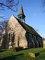
 All Saints, Stroxton - geograph.org.uk - 38719.jpg 640 × 480; 148 KB
-
 Allamere Laithe - geograph.org.uk - 205385.jpg 640 × 427; 144 KB
-
 Allington Gauging Station - geograph.org.uk - 180216.jpg 640 × 427; 198 KB
-
 Allington Lane, near Grantham - geograph.org.uk - 281390.jpg 640 × 427; 91 KB
-

-
 Allotments in Lady Bay - geograph.org.uk - 785964.jpg 640 × 427; 108 KB
-

-

-
 Along the Nottingham Canal bridleway - geograph.org.uk - 804499.jpg 640 × 427; 133 KB
-

-

-
 Ancient sea defences - geograph.org.uk - 537995.jpg 640 × 427; 128 KB
-
 Anglers beware - geograph.org.uk - 30102.jpg 480 × 640; 125 KB
-
 Another drain near Seas End - geograph.org.uk - 537968.jpg 640 × 427; 130 KB
-
 Another gate into another field - geograph.org.uk - 405388.jpg 640 × 427; 122 KB
-
 Another mining remnant - geograph.org.uk - 1655713.jpg 640 × 427; 116 KB
-
 Another view across North Drove Drain - geograph.org.uk - 589844.jpg 640 × 427; 86 KB
-
 Another view from the churchyard - geograph.org.uk - 1657053.jpg 640 × 427; 67 KB
-
 Another view of Eaton - geograph.org.uk - 1650316.jpg 640 × 427; 116 KB
-
 Another view of Far Street, Bradmore - geograph.org.uk - 667870.jpg 640 × 427; 93 KB
-
 Another view of houses in Ayston - geograph.org.uk - 209882.jpg 640 × 427; 82 KB
-
 Any one for chips^ - geograph.org.uk - 184174.jpg 640 × 427; 124 KB
-
 Any one for Tennis^ - geograph.org.uk - 142824.jpg 640 × 427; 161 KB
-
 Anywhere will do^ - geograph.org.uk - 231793.jpg 640 × 480; 114 KB
-
 Approaching Grange Wood - geograph.org.uk - 804492.jpg 640 × 427; 126 KB
-
 Approaching Groby Road Roundabout - geograph.org.uk - 75359.jpg 640 × 427; 111 KB
-
 Approaching Lady Bay Bridge - geograph.org.uk - 785284.jpg 640 × 427; 104 KB
-
 Approaching the Cossall Road lay-by - geograph.org.uk - 1194607.jpg 640 × 427; 105 KB
-

-
 Approaching the Fosse Way. - geograph.org.uk - 148193.jpg 640 × 427; 124 KB
-
 Approaching the Serpentine Dam - geograph.org.uk - 889415.jpg 480 × 640; 163 KB
-

-
 Arable farmland near Denton, Lincolnshire - geograph.org.uk - 30141.jpg 640 × 480; 127 KB
-
 Arboretum, Evington - geograph.org.uk - 107608.jpg 640 × 427; 133 KB
-
 Armada Way, Plymouth - geograph.org.uk - 83458.jpg 640 × 427; 117 KB
-
 Ash in Temple Wood - geograph.org.uk - 405824.jpg 640 × 427; 151 KB
-
 Ashby Folville, Leicestershire - geograph.org.uk - 42218.jpg 640 × 480; 130 KB
-
 Ashby Folville, Leicestershire - geograph.org.uk - 42232.jpg 640 × 480; 135 KB
-
 St Mary the Virgin parish church, Ashwell, Rutland by-Kate-Jewell.jpg 480 × 640; 192 KB
-
 Ashwell Road near Langham - geograph.org.uk - 146285.jpg 640 × 427; 89 KB
-
 Ashwell, Rutland - geograph.org.uk - 41124.jpg 640 × 480; 126 KB
-
 Aslackby Fen - geograph.org.uk - 420315.jpg 640 × 427; 106 KB
-
 Aslockton sewage works - geograph.org.uk - 237181.jpg 640 × 427; 76 KB
-
 At Gamston Bridge - geograph.org.uk - 1801582.jpg 640 × 427; 75 KB
-
 At Pilling Sands - geograph.org.uk - 1758108.jpg 640 × 418; 71 KB
-
 At Rutland Railway Musem - geograph.org.uk - 1587650.jpg 640 × 480; 102 KB
-
 At St German's Quay - geograph.org.uk - 1713182.jpg 640 × 427; 101 KB
-
 At the Cumberland Pencil Museum - geograph.org.uk - 503343.jpg 640 × 422; 96 KB
-
 At the end of the day - geograph.org.uk - 238732.jpg 640 × 427; 60 KB
-
 At the end of the footpath - geograph.org.uk - 809952.jpg 640 × 427; 121 KB
-
 At the top of Gorse Hill - geograph.org.uk - 256864.jpg 640 × 427; 152 KB
-
 At the top of the hill - geograph.org.uk - 238651.jpg 640 × 427; 60 KB
-
 At the White Cross - geograph.org.uk - 1007596.jpg 480 × 640; 119 KB
-
 Austen Dike - geograph.org.uk - 458150.jpg 427 × 587; 109 KB
-
 Autumn colour - geograph.org.uk - 64018.jpg 640 × 480; 142 KB
-
 Autumn hedgerow - geograph.org.uk - 281522.jpg 640 × 427; 108 KB
-
 St Mary the Virgin, Ayston, Rutland by-Kate-Jewell.jpg 640 × 480; 117 KB
-
-
 Back Sands Lane - geograph.org.uk - 1757987.jpg 640 × 427; 90 KB
-
 Bailey-Sim Wood - geograph.org.uk - 205797.jpg 640 × 427; 150 KB
-
 Balderton level crossing - geograph.org.uk - 389572.jpg 640 × 480; 98 KB
-
 Baldock Services on the A1 - geograph.org.uk - 1743654.jpg 640 × 427; 87 KB
-
 Bales at the top of the hill - geograph.org.uk - 603554.jpg 640 × 427; 109 KB
-
 Barkby Brook - geograph.org.uk - 1760102.jpg 480 × 640; 151 KB
-
 Barkby Grange, Leicester - geograph.org.uk - 108319.jpg 640 × 427; 125 KB
-

-
 Barkby, near Leicester - geograph.org.uk - 42131.jpg 640 × 480; 135 KB
-
 Barkestone Wood, Belvoir Estate - geograph.org.uk - 64011.jpg 480 × 640; 190 KB
-
 Barkestone Wood, Leicestershire - geograph.org.uk - 64008.jpg 640 × 480; 144 KB
-
 Barkston Gorse Farm - geograph.org.uk - 257103.jpg 640 × 427; 79 KB
-
 Barlings Eau from Scothern Bridge - geograph.org.uk - 186944.jpg 640 × 427; 137 KB
-
 Barlings Eau near Reasby Grange - geograph.org.uk - 186960.jpg 640 × 427; 135 KB
-
 Barlingseau.jpg 640 × 427; 128 KB
-
 Barn at Crowmarsh Farm - geograph.org.uk - 537237.jpg 640 × 427; 132 KB
-
 Barn at Crowmarsh Farm - geograph.org.uk - 537387.jpg 640 × 427; 103 KB
-
 Barn at Fawfieldhead - geograph.org.uk - 168571.jpg 640 × 427; 142 KB
-
 Barn at Mill Leys Farm - geograph.org.uk - 314002.jpg 640 × 427; 83 KB
-
 Barn off Cow Gate - geograph.org.uk - 420719.jpg 640 × 427; 109 KB
-
 Barns on Harby Lane, Stathern - geograph.org.uk - 592445.jpg 640 × 427; 95 KB
-
 Barns on Main Street, Dry Doddington - geograph.org.uk - 302082.jpg 640 × 427; 81 KB
-
 Barns, Aslackby Fen - geograph.org.uk - 420286.jpg 640 × 427; 99 KB
-
 Barnstone Old House - geograph.org.uk - 611704.jpg 640 × 427; 91 KB
-


_-_geograph.org.uk_-_792493.jpg)
_-_geograph.org.uk_-_792551.jpg)
_-_geograph.org.uk_-_793344.jpg)
_-_geograph.org.uk_-_793351.jpg)
_-_geograph.org.uk_-_793483.jpg)
_-_geograph.org.uk_-_794880.jpg)
_-_geograph.org.uk_-_794936.jpg)
_-_geograph.org.uk_-_794940.jpg)
_-_geograph.org.uk_-_791170.jpg)
_-_geograph.org.uk_-_791183.jpg)
_-_geograph.org.uk_-_791198.jpg)
_-_geograph.org.uk_-_792460.jpg)


_-_geograph.org.uk_-_728315.jpg)
_-_geograph.org.uk_-_728476.jpg)
_-_geograph.org.uk_-_728490.jpg)
_-_geograph.org.uk_-_728499.jpg)
_-_geograph.org.uk_-_728501.jpg)
_-_geograph.org.uk_-_728505.jpg)
_-_geograph.org.uk_-_728347.jpg)
_-_geograph.org.uk_-_728375.jpg)
_-_geograph.org.uk_-_728394.jpg)
_-_geograph.org.uk_-_728406.jpg)
_-_geograph.org.uk_-_728418.jpg)
_-_geograph.org.uk_-_728431.jpg)
_-_geograph.org.uk_-_728443.jpg)
_-_geograph.org.uk_-_728465.jpg)
_-_geograph.org.uk_-_722427.jpg)
_-_geograph.org.uk_-_727286.jpg)
_-_geograph.org.uk_-_727333.jpg)


