Category:Images by Mark
This category contains images created by Mark.
Media in category "Images by Mark"
The following 113 files are in this category, out of 113 total.
-
 BankWest Tower.jpg 1,042 × 2,736; 2.97 MB
-
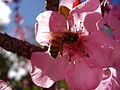 Bee with flower.jpg 2,560 × 1,920; 2.67 MB
-
 Canning dam panorama 4.jpg 10,814 × 1,844; 16 MB
-
 Canning Dam panorama.jpg 6,345 × 2,314; 11.22 MB
-
 Canning Dam, Perth (1).jpg 2,560 × 1,920; 3.13 MB
-
 Canning Dam, Perth (2).jpg 1,790 × 2,465; 3.57 MB
-
 Canning Dam, Perth (3).jpg 1,920 × 2,560; 3.06 MB
-
 Canning Dam, Perth (4).jpg 2,560 × 1,920; 3.29 MB
-
 Central Park.jpg 1,042 × 2,736; 2.88 MB
-
 His Majesty's Theatre, Perth entrance.jpg 2,382 × 3,648; 5.44 MB
-
 His Majesty's Theatre, Perth.jpg 3,648 × 2,736; 2.95 MB
-
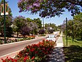 Kalamunda Road, Kalamunda.jpg 1,600 × 1,200; 539 KB
-
 Kings Park War Memorial Sunrise 2.jpg 2,560 × 1,920; 2.54 MB
-
 Kings Park War Memorial Sunrise.jpg 1,886 × 2,560; 3.32 MB
-
 Major islands off Perth, Western Australia.svg 2,218 × 2,495; 54 KB
-
 Map of Australia.png 328 × 352; 20 KB
-
 Narrows Bridge supports.jpg 3,648 × 2,736; 6.04 MB
-
 P2250090.jpg 2,560 × 1,920; 1.05 MB
-
 Perth CBD Banner.jpg 2,560 × 366; 830 KB
-
 Perth CBD.jpg 2,644 × 999; 2.54 MB
-
 Perth Concert Hall exterior detail.jpg 2,736 × 3,648; 2.52 MB
-
 Perth Concert Hall interior detail 1.jpg 2,736 × 3,648; 2.52 MB
-
 Perth Concert Hall interior detail 2.jpg 2,736 × 3,648; 3.08 MB
-
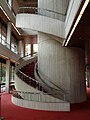
 Perth Concert Hall interior.jpg 3,735 × 2,757; 6.6 MB
-
 Perth skyline 2.jpg 4,554 × 2,058; 3.43 MB
-
 Perth skyline and Narrows Bridge panorama.jpg 1,708 × 223; 169 KB
-
 Perth skyline at night.jpg 2,560 × 1,920; 3.21 MB
-
 Perth sunrise.jpg 2,560 × 1,920; 3.51 MB
-
 Pink and grey galahs on power lines.jpg 2,560 × 1,920; 904 KB
-
 Redcliffe Bridge, Perth 1.jpg 2,868 × 2,234; 3.89 MB
-
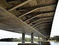
 Redcliffe Bridge, Perth 2.jpg 3,642 × 2,727; 6.58 MB
-
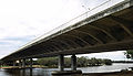 Redcliffe Bridge, Perth 3.jpg 3,475 × 1,989; 3.76 MB
-
 Rottnest - Thomson Bay rainbow.jpg 6,039 × 2,866; 14.58 MB
-
 Rottnest aerial photo 2 (cropped for Pink Lake).jpg 1,827 × 1,053; 2.08 MB
-
 Rottnest aerial photo 2.jpg 2,560 × 1,920; 5.29 MB
-
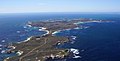 Rottnest aerial photo.jpg 2,286 × 1,165; 2.86 MB
-
 Rottnest Bathurst Lighthouse sunset.jpg 2,526 × 1,875; 2.73 MB
-
 Rottnest Geordie & Longreach settlements.jpg 2,560 × 1,512; 4.71 MB
-
 Rottnest Thomson Bay.jpg 1,433 × 1,655; 1.75 MB
-
 Rottnest Wadjemup Lighthouse.jpg 2,560 × 1,920; 2.29 MB
-
 Swan View Tunnel long exposure.jpg 3,648 × 2,736; 8.3 MB
-
 Swan View Tunnel panorama.jpg 3,500 × 1,907; 9.35 MB
-
 The Whampoa.jpg 2,560 × 1,920; 2.14 MB
-
 Vatican Museum - Gallery of Maps.jpg 1,920 × 2,560; 3.1 MB
-
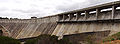
 Victoria Dam, Perth (1).jpg 2,560 × 1,920; 3.23 MB
-
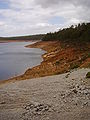
 Victoria Dam, Perth (2).jpg 1,920 × 2,560; 3.15 MB
-
 Victoria Dam, Perth (3).jpg 2,560 × 1,920; 3.53 MB
-
 Victoria Dam, Perth (4).jpg 2,560 × 1,920; 3.3 MB
-
 West Coast Eagles 2006 Premiers.jpg 1,020 × 618; 347 KB
-
 Western Australia dot map - Albany.svg 1,185 × 1,797; 20 KB
-
 Western Australia dot map - Augusta.svg 1,185 × 1,797; 20 KB
-
 Western Australia dot map - Broome.svg 1,185 × 1,797; 20 KB
-
 Western Australia dot map - Bunbury.svg 1,185 × 1,797; 20 KB
-
 Western Australia dot map - Busselton.svg 1,185 × 1,797; 20 KB
-
 Western Australia dot map - Carnarvon.svg 1,185 × 1,797; 20 KB
-
 Western Australia dot map - Collie.svg 1,185 × 1,797; 20 KB
-
 Western Australia dot map - Coolgardie.svg 1,185 × 1,797; 20 KB
-
 Western Australia dot map - Coral Bay.svg 1,185 × 1,797; 20 KB
-
 Western Australia dot map - Cue.svg 1,185 × 1,797; 20 KB
-
 Western Australia dot map - Denham.svg 1,185 × 1,797; 20 KB
-
 Western Australia dot map - Derby.svg 1,185 × 1,797; 20 KB
-
 Western Australia dot map - Esperance.svg 1,185 × 1,797; 20 KB
-
 Western Australia dot map - Eucla.svg 1,185 × 1,797; 20 KB
-
 Western Australia dot map - Exmouth.svg 1,185 × 1,797; 20 KB
-
 Western Australia dot map - Fitzroy Crossing.svg 1,185 × 1,797; 20 KB
-
 Western Australia dot map - Gascoyne Junction.svg 1,185 × 1,797; 20 KB
-
 Western Australia dot map - Geraldton.svg 1,185 × 1,797; 20 KB
-
 Western Australia dot map - Halls Creek.svg 1,185 × 1,797; 20 KB
-
 Western Australia dot map - Jerramungup.svg 1,185 × 1,797; 20 KB
-
 Western Australia dot map - Jurien Bay.svg 1,185 × 1,797; 20 KB
-
 Western Australia dot map - Kalbarri.svg 1,185 × 1,797; 20 KB
-
 Western Australia dot map - Kalgoorlie.svg 1,183 × 1,797; 21 KB
-
 Western Australia dot map - Kalumburu.svg 1,185 × 1,797; 20 KB
-
 Western Australia dot map - Karratha.svg 1,185 × 1,797; 20 KB
-
 Western Australia dot map - Kojonup.svg 1,185 × 1,797; 20 KB
-
 Western Australia dot map - Kununurra.svg 1,185 × 1,797; 20 KB
-
 Western Australia dot map - Lancelin.svg 1,185 × 1,797; 20 KB
-
 Western Australia dot map - Laverton.svg 1,610 × 1,813; 20 KB
-
 Western Australia dot map - Leinster.svg 1,185 × 1,797; 21 KB
-
 Western Australia dot map - Leonora.svg 1,185 × 1,797; 20 KB
-
 Western Australia dot map - Mandurah.svg 1,185 × 1,797; 20 KB
-
 Western Australia dot map - Manjimup.svg 1,185 × 1,797; 20 KB
-
 Western Australia dot map - Marble Bar.svg 1,185 × 1,797; 20 KB
-
 Western Australia dot map - Margaret River.svg 1,185 × 1,797; 20 KB
-
 Western Australia dot map - Meekatharra.svg 1,185 × 1,797; 20 KB
-
 Western Australia dot map - Menzies.svg 1,185 × 1,797; 20 KB
-
 Western Australia dot map - Merredin.svg 1,185 × 1,797; 20 KB
-
 Western Australia dot map - Moora.svg 1,185 × 1,797; 20 KB
-
 Western Australia dot map - Morawa.svg 1,185 × 1,797; 20 KB
-
 Western Australia dot map - Mount Barker.svg 1,185 × 1,797; 20 KB
-
 Western Australia dot map - Mount Magnet.svg 1,185 × 1,797; 20 KB
-
 Western Australia dot map - Mullewa.svg 1,185 × 1,797; 20 KB
-
 Western Australia dot map - Murchison.svg 1,185 × 1,797; 20 KB
-
 Western Australia dot map - Newman.svg 1,185 × 1,797; 20 KB
-
 Western Australia dot map - Norseman.svg 1,185 × 1,797; 20 KB
-
 Western Australia dot map - Northam.svg 1,185 × 1,797; 20 KB
-
 Western Australia dot map - Northampton.svg 1,185 × 1,797; 20 KB
-
 Western Australia dot map - Onslow.svg 1,185 × 1,797; 20 KB
-
 Western Australia dot map - Pannawonica.svg 1,185 × 1,797; 20 KB
-
 Western Australia dot map - Paraburdoo.svg 1,185 × 1,797; 20 KB
-
 Western Australia dot map - Paynes Find.svg 1,185 × 1,797; 20 KB
-
 Western Australia dot map - Perth.svg 1,185 × 1,797; 19 KB
-
 Western Australia dot map - Port Hedland.svg 1,185 × 1,797; 20 KB
-
 Western Australia dot map - Telfer.svg 1,185 × 1,797; 20 KB
-
 Western Australia dot map - Tom Price.svg 1,185 × 1,797; 20 KB
-
 Western Australia dot map - Walpole.svg 1,185 × 1,803; 20 KB
-
 Western Australia dot map - Williams.svg 1,185 × 1,797; 20 KB
-
 Western Australia dot map - Wiluna.svg 1,185 × 1,797; 20 KB
-
 Western Australia dot map - Wubin.svg 1,185 × 1,797; 20 KB
-
 Western Australia dot map - Wyndham.svg 1,185 × 1,797; 20 KB
-
 Western Australia dot map - Yalgoo.svg 1,185 × 1,797; 20 KB
-
 Western Australia.svg 1,262 × 1,813; 291 KB
-
 Window cleaners Hong Kong.jpg 1,781 × 1,920; 2.92 MB

.jpg)
.jpg)
.jpg)
.jpg)


.jpg)


.jpg)
.jpg)
.jpg)
.jpg)


