Category:Images by Mike Bardill

Media in category "Images by Mike Bardill"
The following 200 files are in this category, out of 336 total.
(previous page) (next page)-
 A1 Bridge Over the Nene at Wansford - geograph.org.uk - 255904.jpg 640 × 480; 115 KB
-
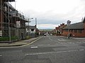
 A38 near South Normanton - geograph.org.uk - 145708.jpg 640 × 480; 97 KB
-
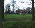
 Ailsworth Village Green - geograph.org.uk - 162305.jpg 640 × 480; 90 KB
-
 Alfreton Fire Station - geograph.org.uk - 145694.jpg 640 × 480; 61 KB
-
 Anchor Church Ingleby.jpg 640 × 480; 126 KB
-

-
 Ashe Hall 180435 d0492e63.jpg 640 × 449; 75 KB
-
 B587 near Melbourne - geograph.org.uk - 251028.jpg 640 × 480; 77 KB
-
 Bearwardcote 180470 8cb68528.jpg 640 × 480; 109 KB
-
 Bearwardcote Hall - geograph.org.uk - 291258.jpg 640 × 480; 116 KB
-
 Bearwoodcote Crossing.jpg 640 × 416; 271 KB
-
 Blackwell Church - geograph.org.uk - 145718.jpg 640 × 480; 75 KB
-
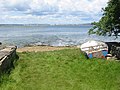
 Boat Repairs in Westhay Wood - geograph.org.uk - 255985.jpg 640 × 480; 97 KB
-
 Brailsford village.jpg 640 × 480; 81 KB
-
 Bridleway near Great Gate - geograph.org.uk - 458844.jpg 640 × 480; 49 KB
-
 Bridleway near to Denstone College - geograph.org.uk - 458839.jpg 640 × 480; 64 KB
-
 Butterley Grange 134404 d0a51acf.jpg 640 × 480; 122 KB
-
 Capio Fitzwilliam Hospital - geograph.org.uk - 163139.jpg 640 × 480; 82 KB
-
 Castor Church - geograph.org.uk - 162294.jpg 480 × 640; 95 KB
-
 Castor Mill Bridge - Nene Valley Railway - geograph.org.uk - 162282.jpg 640 × 480; 102 KB
-
 Castor Station (site of) - geograph.org.uk - 162312.jpg 640 × 480; 133 KB
-
 Cauldon Lowe - geograph.org.uk - 458970.jpg 640 × 480; 33 KB
-
 Centenary Way - geograph.org.uk - 276419.jpg 640 × 480; 84 KB
-
 Chapel at Winnothdale - geograph.org.uk - 458876.jpg 640 × 480; 33 KB
-
 Clay Pit near Arne - geograph.org.uk - 493781.jpg 640 × 480; 90 KB
-
 Cliffe Park - geograph.org.uk - 153927.jpg 640 × 480; 136 KB
-
 Closed Road Across Croxden Quarry - geograph.org.uk - 458895.jpg 640 × 480; 46 KB
-
 Coldwall Bridge - geograph.org.uk - 116700.jpg 640 × 480; 129 KB
-
 Collapsed Pillbox - geograph.org.uk - 551068.jpg 640 × 480; 81 KB
-
 Constitution Hill - geograph.org.uk - 116905.jpg 640 × 480; 102 KB
-
 Cote Farm and Wooton Park - geograph.org.uk - 458941.jpg 640 × 480; 38 KB
-
 Cottage Farm at Breaston - geograph.org.uk - 117810.jpg 640 × 480; 87 KB
-
 Cottages near Fotheringhay Lodge - geograph.org.uk - 256034.jpg 640 × 480; 93 KB
-
 Crossroads at Threelows - geograph.org.uk - 458967.jpg 640 × 480; 42 KB
-
 Crossroads Farm at Blackbrook, Derbyshire (geograph 265210).jpg 640 × 480; 76 KB
-
 Cunnery Pond - geograph.org.uk - 291148.jpg 640 × 480; 103 KB
-
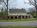
 Cutler Showground - geograph.org.uk - 180377.jpg 640 × 480; 87 KB
-
 Dalbury Church - geograph.org.uk - 291253.jpg 640 × 480; 80 KB
-
 Danes' Dyke and Dykes Plantation - geograph.org.uk - 551036.jpg 640 × 480; 93 KB
-

-
 Duffield Castle 225335 a19c01e6.jpg 640 × 480; 140 KB
-
 Duffield Parish Church - geograph.org.uk - 225318.jpg 480 × 640; 60 KB
-
 Dykes End - geograph.org.uk - 551020.jpg 640 × 480; 76 KB
-
 Eaton Hall Clay Pigeon Butts - geograph.org.uk - 458826.jpg 640 × 480; 32 KB
-
 Ecclesbourne Valley Railway - geograph.org.uk - 225382.jpg 640 × 480; 116 KB
-
 Ecclesbourne Valley Railway Station - geograph.org.uk - 225328.jpg 640 × 480; 103 KB
-
 Ednaston Manor - geograph.org.uk - 180403.jpg 640 × 480; 136 KB
-
 Entrance to Quarndon Village - geograph.org.uk - 180322.jpg 640 × 480; 97 KB
-
 Entrance to Sibson Aerodrome - geograph.org.uk - 256059.jpg 640 × 480; 64 KB
-
 Farm Buildings near Peterborough - geograph.org.uk - 165234.jpg 640 × 480; 65 KB
-
 Farm Track near Yaxley Lakes - geograph.org.uk - 165228.jpg 640 × 480; 118 KB
-
 Farmland on Fitzworth Heath - geograph.org.uk - 493811.jpg 640 × 480; 97 KB
-
 Fergiland - geograph.org.uk - 251032.jpg 640 × 480; 74 KB
-
 Fletton Branch - Nene Valley Railway - geograph.org.uk - 164752.jpg 640 × 480; 114 KB
-
 Fletton Branch Junction - geograph.org.uk - 165219.jpg 640 × 480; 97 KB
-
 Fletton Branch Railway Bridge - geograph.org.uk - 164915.jpg 640 × 480; 72 KB
-
 Foxfields Farm - geograph.org.uk - 291149.jpg 640 × 480; 71 KB
-
 Gothic Temple near Kedleston Park - geograph.org.uk - 276402.jpg 640 × 453; 123 KB
-
 Green Island from Ower Quay - geograph.org.uk - 493825.jpg 640 × 480; 84 KB
-
 Hallfield Gate - geograph.org.uk - 153138.jpg 640 × 480; 77 KB
-
 Higham Greyhound pub 153142 9f80c0fd.jpg 640 × 480; 90 KB
-
 Hopwell Hall - geograph.org.uk - 116911.jpg 640 × 480; 95 KB
-
 Idridgehay Station - geograph.org.uk - 265189.jpg 640 × 480; 95 KB
-

-
 Jackfield Level Crossing - geograph.org.uk - 177191.jpg 640 × 480; 159 KB
-
 Jackfield Tile Works - geograph.org.uk - 177198.jpg 640 × 480; 80 KB
-
 JCB Lake at Rocester - geograph.org.uk - 458833.jpg 640 × 480; 56 KB
-
 Jesse Farm near Stanley - geograph.org.uk - 134420.jpg 640 × 480; 70 KB
-
 Junction near Woodcroft Castle - geograph.org.uk - 162373.jpg 640 × 480; 82 KB
-
 Junction of Track to Woodcroft Lodge - geograph.org.uk - 162367.jpg 640 × 480; 78 KB
-
 Junction of Tracks Near Kings Cliffe - geograph.org.uk - 255965.jpg 640 × 480; 118 KB
-
 Lane Between Radbourne and Lees - geograph.org.uk - 291155.jpg 640 × 480; 69 KB
-
 Lane Head Farm - geograph.org.uk - 458974.jpg 640 × 480; 36 KB
-
 Larch Tree Farm - geograph.org.uk - 225374.jpg 640 × 480; 74 KB
-
 Lner1306nvr.jpg 640 × 480; 98 KB
-
 Lodge next to JCB Lake at Rocester - geograph.org.uk - 458836.jpg 640 × 480; 59 KB
-
 Love's Hill Bridge over the A47 - geograph.org.uk - 162333.jpg 640 × 480; 76 KB
-
 Lower Vicarwood Farm - geograph.org.uk - 291103.jpg 640 × 480; 78 KB
-

-
 Marholm Village Centre - geograph.org.uk - 162348.jpg 640 × 480; 86 KB
-
 Markeaton Island Petrol Station - geograph.org.uk - 180319.jpg 640 × 480; 91 KB
-

-
 Memorial at Kings Cliffe Airfield - geograph.org.uk - 255932.jpg 640 × 480; 114 KB
-
 Memorial at Kings Cliffe AIrfield - geograph.org.uk - 255934.jpg 480 × 640; 95 KB
-
 Memorial Wood near Hollington - geograph.org.uk - 180406.jpg 640 × 480; 154 KB
-
 Mickleover School - geograph.org.uk - 180475.jpg 640 × 480; 83 KB
-
 Micklin Farm - geograph.org.uk - 458853.jpg 640 × 480; 42 KB
-
 Midland Railway near Little Eaton - geograph.org.uk - 145018.jpg 640 × 480; 160 KB
-
 Mill at Woodnewton - geograph.org.uk - 256002.jpg 640 × 480; 120 KB
-
 Moneystone - geograph.org.uk - 458927.jpg 640 × 480; 44 KB
-
 Morley Churchyard - geograph.org.uk - 145061.jpg 640 × 480; 158 KB
-
 Muggington Church - geograph.org.uk - 180376.jpg 640 × 480; 94 KB
-
 Nene Bridge in Wansford - geograph.org.uk - 255908.jpg 640 × 480; 90 KB
-
 North Rode Church - geograph.org.uk - 153870.jpg 640 × 480; 94 KB
-
 North Rode Viaduct - geograph.org.uk - 153885.jpg 640 × 480; 86 KB
-
 North York Moors Railway - North Dale - geograph.org.uk - 116952.jpg 640 × 416; 76 KB
-
 Oakamoor Church - geograph.org.uk - 458930.jpg 640 × 480; 54 KB
-
 Oakamoor Village Centre - geograph.org.uk - 458933.jpg 640 × 480; 38 KB
-
 Oakerthorpe - geograph.org.uk - 153118.jpg 640 × 480; 92 KB
-
 Offices in Longthorpe - geograph.org.uk - 163141.jpg 640 × 480; 63 KB
-
 Old AA Road Sign - geograph.org.uk - 255960.jpg 640 × 480; 101 KB
-
 Open Farmland near Sibson Aerodrome - geograph.org.uk - 256041.jpg 640 × 480; 138 KB
-
 Ower Bay - geograph.org.uk - 493817.jpg 640 × 480; 90 KB
-
 Peckwash Paper Mill on the Derwent - geograph.org.uk - 145027.jpg 640 × 480; 106 KB
-
 Pentrich church 153101 2e33864c.jpg 640 × 480; 93 KB
-
 Peterborough Corporation Water Works - geograph.org.uk - 162394.jpg 640 × 480; 94 KB
-
 Peterborough Crematorium - geograph.org.uk - 163123.jpg 640 × 480; 94 KB
-
 Plaque Inside Spring Well - geograph.org.uk - 180328.jpg 640 × 480; 101 KB
-
 Potlocks Farm - geograph.org.uk - 291137.jpg 640 × 480; 67 KB
-
 Pub at Gallows Green near Alton - geograph.org.uk - 458860.jpg 640 × 480; 32 KB
-
 Quarndon 180327 4f2a74fb.jpg 640 × 480; 103 KB
-
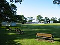 Quarndon Cricket Ground - geograph.org.uk - 180332.jpg 640 × 480; 94 KB
-
 Radbourne hall 291269 51a0c31b.jpg 640 × 515; 81 KB
-
 Railway Bridge at Kings Cliffe - geograph.org.uk - 255955.jpg 640 × 480; 128 KB
-
 Railway Bridge near Idridgehay - geograph.org.uk - 265197.jpg 640 × 480; 117 KB
-

-
 Ring Haw Wood in Old Sulehay Forest - geograph.org.uk - 255916.jpg 640 × 480; 138 KB
-
 Ripley 153085 f3bd6263.jpg 640 × 480; 70 KB
-
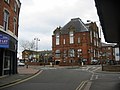 Ripley Town Hall - geograph.org.uk - 153076.jpg 640 × 480; 75 KB
-
 River Derwent at Ambaston - geograph.org.uk - 117837.jpg 640 × 480; 93 KB
-
 River Ecclesbourne - geograph.org.uk - 225386.jpg 640 × 480; 122 KB
-
 Rock House Farm - geograph.org.uk - 291241.jpg 640 × 480; 50 KB
-
 Rudyard Lake Station - geograph.org.uk - 153900.jpg 640 × 550; 118 KB
-
 Russel Quay near Arne - geograph.org.uk - 493774.jpg 640 × 480; 68 KB
-
 Shirley Common - geograph.org.uk - 180399.jpg 640 × 480; 110 KB
-
 Sibson Aerodrome - geograph.org.uk - 256052.jpg 640 × 480; 61 KB
-
 Silverhill Farm - geograph.org.uk - 291142.jpg 640 × 480; 84 KB
-
 Site of Former Sawley Station - geograph.org.uk - 117793.jpg 640 × 419; 62 KB
-
 Smerills Farm - geograph.org.uk - 291264.jpg 640 × 480; 57 KB
-
 South Normanton 145686 833ec66d.jpg 640 × 480; 144 KB
-
 South Normanton churchyard - geograph.org.uk - 145721.jpg 640 × 480; 139 KB
-
 Spice 52 - geograph.org.uk - 291117.jpg 640 × 480; 48 KB
-
 Spondon Railway Station.jpg 640 × 480; 85 KB
-
 Spondon's Nuclear Bunker - geograph.org.uk - 316690.jpg 640 × 480; 122 KB
-
 Spondonwood Farm - geograph.org.uk - 153006.jpg 640 × 480; 78 KB
-
 St James church at Riddings - geograph.org.uk - 134408.jpg 480 × 640; 154 KB
-
 Stamford Lodge - Milton Park - geograph.org.uk - 162343.jpg 640 × 480; 78 KB
-
 Statfold Barn Narrow Gauge Railway - geograph.org.uk - 564861.jpg 640 × 480; 91 KB
-
 Statfold Barn narrow gauge railway by Mike Bardill.jpg 640 × 480; 64 KB
-
 Stibbington Church - geograph.org.uk - 255884.jpg 640 × 480; 80 KB
-
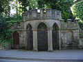
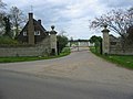
 Stibbington Hall gates.jpg 640 × 480; 126 KB
-
 Sutton on the Hill Village Hall - geograph.org.uk - 180421.jpg 640 × 480; 162 KB
-
 St Andrew's Church in Swanwick - geograph.org.uk - 145691.jpg 640 × 480; 77 KB
-
 Tarmac Works - geograph.org.uk - 180370.jpg 640 × 480; 78 KB
-
 The Bulls Head at Breaston - geograph.org.uk - 117828.jpg 640 × 480; 71 KB
-
 The Hanging Gate at Shottlegate - geograph.org.uk - 265207.jpg 640 × 480; 77 KB
-
 The Hollybush at Marehay - geograph.org.uk - 153071.jpg 640 × 480; 112 KB
-
 The Markeaton - geograph.org.uk - 180321.jpg 640 × 480; 80 KB
-
 The Navigation at Breaston - geograph.org.uk - 117826.jpg 640 × 480; 116 KB
-
 The Old Man of Calke - geograph.org.uk - 251044.jpg 640 × 480; 155 KB
-
 The Ostrich Inn - geograph.org.uk - 180413.jpg 640 × 480; 69 KB
-
 The Yew Tree Pub - geograph.org.uk - 180405.jpg 640 × 480; 90 KB
-
 Thoresby Park - geograph.org.uk - 556108.jpg 640 × 480; 91 KB
-
 Thornbury Hall - geograph.org.uk - 458904.jpg 640 × 480; 56 KB
-
 Ticknall to Stanton-by-Bridge Road - geograph.org.uk - 251019.jpg 640 × 480; 73 KB
-
 Toll Cottage at Swarkestone Lock - geograph.org.uk - 251016.jpg 640 × 480; 61 KB
-
 Town Head - geograph.org.uk - 458975.jpg 640 × 480; 48 KB
-
 Track Leading to Cave Cottage - geograph.org.uk - 458805.jpg 640 × 480; 37 KB
-
 Track near Tickencote Warren - geograph.org.uk - 476466.jpg 640 × 480; 67 KB
-
 Track to Broomyshaw - geograph.org.uk - 458980.jpg 640 × 480; 31 KB
-
 Track to Vitower House - geograph.org.uk - 493808.jpg 640 × 480; 136 KB
-
 Traditional Caravans at Gorsty - geograph.org.uk - 458887.jpg 640 × 480; 30 KB
-
 Twelve Acres Farm - geograph.org.uk - 458815.jpg 640 × 480; 43 KB
-
 Veteran Trees - geograph.org.uk - 251038.jpg 640 × 480; 97 KB
-

-
 Wansford Tunnel - geograph.org.uk - 162328.jpg 480 × 640; 115 KB
-
 Weir on the Nene Way - geograph.org.uk - 116706.jpg 640 × 413; 163 KB
-
 Welbeck Park - geograph.org.uk - 556039.jpg 640 × 480; 96 KB
-
 Welbeck Park - geograph.org.uk - 556042.jpg 640 × 480; 59 KB
-
 Weston Underwood - cropped 225941.jpg 250 × 181; 69 KB
-
 Weston Underwood - geograph.org.uk - 225941.jpg 640 × 480; 110 KB
-
 Windywaycross - geograph.org.uk - 458977.jpg 640 × 480; 36 KB
-
 Woodside Road Junction - geograph.org.uk - 153048.jpg 640 × 480; 73 KB
-
 Woodston Church - geograph.org.uk - 164909.jpg 640 × 480; 92 KB
-
 Woolfox Lodge Airfield (disused) - geograph.org.uk - 476485.jpg 640 × 480; 71 KB
-
 Wytch Farm Oil Wells - geograph.org.uk - 493803.jpg 640 × 480; 89 KB
-
 Wytch Farm Oil Wells - geograph.org.uk - 493820.jpg 640 × 480; 70 KB
-
 A1M Bridge - geograph.org.uk - 165235.jpg 640 × 480; 74 KB
-
 A52 at Kingsley - geograph.org.uk - 458910.jpg 640 × 480; 35 KB
-
 A52 at Mackworth - geograph.org.uk - 291110.jpg 640 × 480; 49 KB
-
 Above The Clouds - geograph.org.uk - 180362.jpg 640 × 480; 96 KB
-
 Ashefields Nursing Home - geograph.org.uk - 180428.jpg 640 × 480; 108 KB
-
 Asherfields Farm and Barn - geograph.org.uk - 153097.jpg 640 × 480; 141 KB
-
 Barns Lee Farm - geograph.org.uk - 153930.jpg 640 × 480; 70 KB
-
 Bartlewood Farm - geograph.org.uk - 153012.jpg 640 × 480; 70 KB
-
 Beech Trees in Wood Barn Plantation - geograph.org.uk - 556061.jpg 480 × 640; 98 KB
-
 Belsize Farm - geograph.org.uk - 162341.jpg 640 × 480; 83 KB
-
 Brackely Gate Road Junction - geograph.org.uk - 153030.jpg 640 × 480; 73 KB
-
 Bradley Nook Farm - geograph.org.uk - 180389.jpg 640 × 480; 97 KB
-
 Bradley Pastures - geograph.org.uk - 180390.jpg 640 × 480; 120 KB
-
 Bradley Smithy - geograph.org.uk - 180393.jpg 640 × 480; 80 KB
-
 Brailsford Common - geograph.org.uk - 180379.jpg 640 × 480; 90 KB
-
 Bretton Shopping Centre - geograph.org.uk - 163136.jpg 640 × 480; 110 KB
-
 Brook Farm - geograph.org.uk - 153122.jpg 640 × 480; 102 KB
-
 Brun Farm Cottages - geograph.org.uk - 291134.jpg 640 × 480; 44 KB
-
 Burtonshutts Farm - geograph.org.uk - 180384.jpg 640 × 480; 89 KB
-
 Carr Farm - geograph.org.uk - 153059.jpg 640 × 480; 76 KB
-

-
 Champion Farm - geograph.org.uk - 180342.jpg 640 × 480; 101 KB
-
 Chevinend - geograph.org.uk - 225345.jpg 640 × 480; 84 KB


_-_geograph.org.uk_-_162312.jpg)


.jpg)


_-_geograph.org.uk_-_476485.jpg)


