Category:Images by Neil Owen

Media in category "Images by Neil Owen"
The following 200 files are in this category, out of 470 total.
(previous page) (next page)-
 'Ello, 'ello, 'ello. What's all this then? (geograph 3533189).jpg 1,704 × 2,304; 1.76 MB
-
 23 to Cirencester, 13 to Tetbury and 10 to Bath (geograph 5936677).jpg 1,704 × 2,304; 1.59 MB
-
 87 miles from London (geograph 4232143).jpg 1,704 × 2,304; 1.79 MB
-
 A door within a door (geograph 3572587).jpg 1,024 × 1,385; 874 KB
-
 A figure above the flowers (geograph 4054822).jpg 2,304 × 1,704; 1.17 MB
-
 A finger reaching to the water (geograph 3417944).jpg 2,304 × 1,704; 1.52 MB
-
 A former court (geograph 3738974).jpg 2,304 × 1,704; 1.11 MB
-
 A gentle swell (geograph 3542141).jpg 2,304 × 1,704; 1.06 MB
-
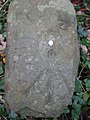
 A hairy milestone (geograph 6332368).jpg 2,472 × 3,296; 3.46 MB
-
 A Honddu scene (geograph 3086621).jpg 1,704 × 2,304; 1.78 MB
-
 A house of many guises (geograph 3968396).jpg 1,704 × 2,304; 1.37 MB
-
 A lion at the house (geograph 3719625).jpg 2,304 × 1,704; 1.08 MB
-
 A long way from London, less to Bath (geograph 4232217).jpg 1,704 × 2,304; 1.56 MB
-
 A long way from the Corner (geograph 6813073).jpg 2,472 × 3,296; 3.38 MB
-
 A long way to Gloster (geograph 5209232).jpg 1,704 × 2,304; 1.69 MB
-
 A milestone in need of a trim (geograph 6332377).jpg 2,472 × 3,296; 4.15 MB
-
 A milestone with no measurement (geograph 6816769).jpg 2,472 × 3,296; 3.25 MB
-
 A milestone without a stone (geograph 5963438).jpg 2,304 × 1,704; 1.54 MB
-
 A mix of styles for St Mary's church, Henbury (geograph 7448538).jpg 4,000 × 3,000; 4.38 MB
-
 A new milestone in Beckington (geograph 6785405).jpg 3,296 × 2,472; 3.59 MB
-
 A noted form of rock (geograph 5682452).jpg 2,304 × 1,704; 1.71 MB
-
 A pair of watery eyes (geograph 6699032).jpg 3,296 × 2,472; 1.76 MB
-
 A poppy seat by The Fox (geograph 6679806).jpg 2,472 × 3,296; 1.78 MB
-
 A rural resting place (geograph 5130419).jpg 2,304 × 1,704; 1.78 MB
-
 A small yard (geograph 3899473).jpg 2,304 × 1,704; 1.75 MB
-
 A sturdy base (geograph 3753032).jpg 2,304 × 1,704; 1.8 MB
-
 A waiting room waiting for help (geograph 6781673).jpg 3,296 × 2,472; 3.48 MB
-
 A warm welcome (geograph 3257125).jpg 1,704 × 2,304; 1.37 MB
-
 A younger monarch (geograph 3732646).jpg 2,304 × 1,704; 1.7 MB
-
 Ah, this is the life.... (geograph 3680238).jpg 2,304 × 1,704; 1.39 MB
-
 An angel appears (geograph 3719583).jpg 1,704 × 2,304; 1.61 MB
-
 An angels back (geograph 3719599).jpg 2,304 × 1,704; 1.49 MB
-
 An embattled roadside sentinel, surrounded by the undergrowth (geograph 5678963).jpg 1,704 × 2,304; 2.02 MB
-
 An old and rather forgotten milestone on the A38 (geograph 6711160).jpg 2,472 × 3,296; 1.76 MB
-
 An uncomfortable bed (geograph 3739017).jpg 2,304 × 1,704; 1.54 MB
-
 Approach to the Pepperbox - geograph.org.uk - 1902884.jpg 2,304 × 1,704; 869 KB
-
 At the top (geograph 3542134).jpg 1,704 × 2,304; 1.21 MB
-
 Aude, Vide, Tace (geograph 3719637).jpg 2,304 × 1,704; 1.79 MB
-
 Autumn colour in Castle Park (geograph 7336500).jpg 4,000 × 3,000; 4.49 MB
-
 Avoid all unnecessary travel! (geograph 6449573).jpg 3,296 × 2,472; 1.83 MB
-
 Axbridge Town Hall (geograph 4772108).jpg 1,704 × 2,304; 1.38 MB
-
 Back of the cone (geograph 3753027).jpg 2,304 × 1,704; 1.69 MB
-
 Barnfield Theatre (geograph 4203993).jpg 2,304 × 1,704; 1.72 MB
-
 Barry Road (geograph 4649929).jpg 2,304 × 1,704; 2.19 MB
-
 Bath Abbey, western roof section-geograph-2918446-by-Neil-Owen.jpg 2,304 × 1,704; 1.71 MB
-
 Bath bus station rear - geograph.org.uk - 2657272.jpg 2,304 × 1,704; 1.12 MB
-
 Beckington Castle and Wool Hall (geograph 6785479).jpg 3,296 × 2,472; 3.53 MB
-
 Beckington war memorial (geograph 6785631).jpg 2,472 × 3,296; 3.38 MB
-
 Beckington water pump - geograph.org.uk - 6785628.jpg 3,296 × 2,472; 3.38 MB
-
 Bedminster library (geograph 2704189).jpg 2,304 × 1,704; 1.49 MB
-
 Benchmark on St Lawrence (geograph 5128678).jpg 2,304 × 1,704; 1.7 MB
-
 Benchmark on the Colston Hall (geograph 2658524).jpg 1,704 × 2,304; 1.74 MB
-
 Benchmark on the old Christ Church (geograph 5186489).jpg 1,704 × 2,304; 1.23 MB
-
 Benchmark on the Portcullis Gate - geograph.org.uk - 2475453.jpg 1,704 × 2,304; 1.72 MB
-
 Benchmark on the Tun Bridge (geograph 2808635).jpg 1,704 × 2,304; 2.25 MB
-
 Berkeley Town Hall (geograph 6595262).jpg 2,472 × 3,296; 1.74 MB
-
 Berkeley Town Hall (geograph 6626712).jpg 3,296 × 2,472; 1.8 MB
-
 Beware of tall dogs (geograph 3147600).jpg 1,704 × 2,304; 1.69 MB
-
 Bill and Bob go swimming (geograph 3704992).jpg 2,304 × 1,704; 1.74 MB
-
 Bishop Sutton Post Office (geograph 4867791).jpg 2,304 × 1,704; 1.3 MB
-
 Bishop Sutton village hall (geograph 4867776).jpg 2,304 × 1,704; 1.41 MB
-
 Bishops Gate, Salisbury (geograph 2981624).jpg 2,304 × 1,638; 1.45 MB
-
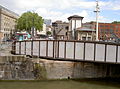
 Black Bridge - a telescopic bridge (geograph 4057234).jpg 2,304 × 1,704; 1.74 MB
-
 Blakes statue (geograph 3221206).jpg 1,704 × 2,304; 1.24 MB
-
 Bournemouth Carlton Hotel (geograph 6650653).jpg 2,472 × 3,296; 1.74 MB
-
 Box church and the first blossom (geograph 2833539).jpg 1,704 × 2,304; 1.86 MB
-
 Bradenstoke cross and war memorial (geograph 7198046).jpg 3,000 × 4,000; 4.48 MB
-
 Brean Down trig point (geograph 1902122).jpg 2,304 × 1,704; 836 KB
-
 Brick and stone (geograph 3147667).jpg 1,704 × 2,304; 1.68 MB
-
 Bridge over the Tone (geograph 4004368).jpg 2,304 × 1,704; 1.71 MB
-
 Bridge Swing! (geograph 2460171).jpg 2,304 × 1,704; 1.56 MB
-
 Bridge Swing! (geograph 2460172).jpg 2,304 × 1,704; 1.58 MB
-
 Bridgwater Road milestone benchmark (geograph 6711165).jpg 2,472 × 3,296; 1.77 MB
-
 Brislington St Luke eastward GeoUK 7340564.jpg 4,000 × 3,000; 4.5 MB
-
 Brislington St Luke from W GeoUK 6456116.jpg 2,472 × 3,296; 1.79 MB
-
 Bristol city centre Youth Hostel (geograph 3775331).jpg 1,704 × 2,304; 1.47 MB
-
 Bristol St Michael o t Mount aisle fire traces GeoUK 6277231.jpg 2,472 × 3,296; 3.29 MB
-
 Bristol St Michael o t Mount nave roof skeleton GeoUK 6277237.jpg 2,472 × 3,296; 2.97 MB
-
 Bristol St Michael o t Mount south aisle westward GeoUK6277264.jpg 2,472 × 3,296; 3.3 MB
-
 Bristol-Ferry-Boat-Geograph-3080161-Neil-Owen.jpg 2,304 × 1,704; 1.66 MB
-
 Bronze statue - geograph.org.uk - 1916874.jpg 1,600 × 1,200; 451 KB
-
 Buddha in Batsford Arboretum-geograph-2479872-by-Neil-Owen.jpg 1,704 × 2,304; 2.17 MB
-
 Built like the aircraft (geograph 6278221).jpg 3,296 × 2,472; 3.51 MB
-
 Bungalow tram station - geograph.org.uk - 1925920.jpg 1,600 × 1,200; 456 KB
-
 Burnham BMX track (geograph 3680153).jpg 2,304 × 1,704; 1.41 MB
-
 Burrow Mump church ruin (geograph 1906041).jpg 2,304 × 1,704; 919 KB
-
 Cathedral figures (geograph 4124353).jpg 2,304 × 1,704; 1.68 MB
-
 Chambers of Bristol (geograph 2081216).jpg 2,304 × 1,704; 1.35 MB
-
 Chandos and Clifford shields at Greyfriars.jpg 2,304 × 1,704; 1.82 MB
-
 Changed for 2022 (geograph 7211796).jpg 4,000 × 3,000; 4.59 MB
-
 Charfields old railway station (geograph 6127615).jpg 3,296 × 2,472; 3.59 MB
-
 Charity run around Holyrood Palace (geograph 2485438).jpg 2,304 × 1,704; 1.61 MB
-
 Chimneys of Vicars Close (geograph 2559387).jpg 2,304 × 1,704; 1.62 MB
-
 Christ Church pinnacles (geograph 5186459).jpg 1,704 × 2,304; 1.43 MB
-
 Church Lane, Sherborne-geograph-3990383-by-Neil-Owen.jpg 1,704 × 2,304; 1.58 MB
-
 Church Street Milepost (geograph 5156984).jpg 1,704 × 2,304; 1.85 MB
-
 Church time (geograph 4678946).jpg 1,704 × 2,304; 1.66 MB
-
 City crest in the Guildhall (geograph 3732627).jpg 1,704 × 2,304; 1.58 MB
-
 Classical and rural (geograph 3083044).jpg 1,704 × 2,304; 1.32 MB
-
 Clevedon St John war memorial (geograph 6614886).jpg 2,472 × 3,296; 1.83 MB
-
 Clevedon Town Council Offices (geograph 6605293).jpg 3,296 × 2,472; 1.93 MB
-
 Cleveland Bridge (geograph 3808880).jpg 2,304 × 1,704; 1.68 MB
-
 Coated lychgate (geograph 3900327).jpg 2,304 × 1,704; 1.57 MB
-
 Colston Hall, Bristol (geograph 2658529).jpg 1,704 × 2,304; 1.41 MB
-
 Commerce and Industry, Cardiff Crown Court - geograph-4139219-by-Neil-Owen.jpg 2,304 × 1,704; 1.65 MB
-
 Control room on Redcliffe Bridge (geograph 5278785).jpg 2,304 × 1,704; 1.47 MB
-
 Corner of Brunswick Square and Upper York Street - geograph.org.uk - 2739834.jpg 2,304 × 1,704; 1.58 MB
-
 Corner of Kings Square (geograph 3221149).jpg 1,704 × 2,304; 1.79 MB
-
 Cotley Hill (geograph 1900204).jpg 2,304 × 1,704; 1.75 MB
-
 County Hall, Taunton (geograph 4248868).jpg 2,304 × 1,704; 1.78 MB
-
 Covered with lichens (geograph 4678950).jpg 1,704 × 2,304; 2.18 MB
-
 Coxwell Street (geograph 4194848).jpg 1,704 × 2,304; 1.5 MB
-
 Cross and Terrace (geograph 2902134).jpg 1,704 × 2,304; 1.68 MB
-
 Culverhay Bridge (geograph 3614375).jpg 2,304 × 1,704; 1.76 MB
-
 Cutmark on the castle wall - geograph.org.uk - 2474256.jpg 1,704 × 2,304; 1.34 MB
-
 Cycling marker in Woollard (geograph 7123308).jpg 3,000 × 4,000; 4.19 MB
-
 Damaged milestone on Clanage Road (geograph 6355232).jpg 2,472 × 3,296; 1.78 MB
-
 Dashing across - geograph.org.uk - 4063602.jpg 2,304 × 1,704; 1.3 MB
-
 Dec' the (town) hall! (geograph 6711445).jpg 3,296 × 2,472; 1.79 MB
-
 Designer advertising (geograph 3135462).jpg 1,704 × 2,304; 1.87 MB
-
 Designs on nature (geograph 3147683).jpg 2,304 × 1,704; 1.62 MB
-
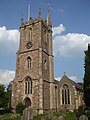
 St Andrews church, Devizes (geograph 4262785).jpg 1,704 × 2,304; 1.52 MB
-
 Directing travellers down the ages (geograph 6145601).jpg 2,472 × 3,296; 3.41 MB
-
 Dogs allowed in April (geograph 4915678).jpg 2,304 × 1,704; 1.13 MB
-
 Down Harptree Hill (geograph 4905719).jpg 2,304 × 1,704; 1.64 MB
-
 Dragon on Japanese Rest House, Batsford Arboretum-geograph-2479867-by-Neil-Owen.jpg 2,304 × 1,704; 1.8 MB
-
 Dundry cross (geograph 3369183).jpg 1,704 × 2,304; 1.62 MB
-
 East Harptree phone kiosk.jpg 1,704 × 2,304; 1.71 MB
-
 Edford Wood (geograph 4797680).jpg 1,704 × 2,304; 2.21 MB
-
 Eleven miles to Bristol (geograph 4905714).jpg 2,304 × 1,704; 1.76 MB
-
 Entrance to St Columbas church, Johnstone Terrace (geograph 2475522).jpg 1,704 × 2,304; 1.77 MB
-
 Erased school sign (geograph 6605295).jpg 3,296 × 2,472; 1.79 MB
-
 Eric Gill lettering (geograph 4054832).jpg 1,704 × 2,304; 1.81 MB
-
 Evening on Welsh Back (geograph 5479042).jpg 2,304 × 1,704; 1.56 MB
-
 Evercreech milepost (geograph 6209617).jpg 2,472 × 3,296; 3.37 MB
-
 External Accumulator (geograph 3515307).jpg 1,704 × 2,304; 1.36 MB
-
 Facing out on Rode Hill (geograph 5186462).jpg 2,304 × 1,704; 1.19 MB
-
 Feeling light-headed? (geograph 4915689).jpg 1,704 × 2,304; 1.1 MB
-
 Five miles from Bristol (geograph 6433881).jpg 3,296 × 2,472; 1.84 MB
-
 Five miles to Bristol (geograph 5319076).jpg 2,304 × 1,704; 1.69 MB
-
 Flag and monument (geograph 2803897).jpg 2,304 × 1,704; 1.77 MB
-

-
 Flower beds of St James' church, Charfield - geograph.org.uk - 6127961.jpg 3,296 × 2,472; 3.73 MB
-
 Folly Lane's faceless stone (geograph 6934053).jpg 3,000 × 4,000; 4.17 MB
-
 Fore Street on a busy afternoon (geograph 3233818).jpg 1,704 × 2,304; 1.65 MB
-
 Former Unitarian church in Lewins Mead (geograph 2680093).jpg 2,304 × 1,704; 1.56 MB
-
 Foundations of original buildings (geograph 1920444).jpg 2,304 × 1,704; 899 KB
-
 From planes to fans? (geograph 6278235).jpg 2,472 × 3,296; 3.3 MB
-
 From the battlefields of France (geograph 4054856) (cropped).jpg 762 × 985; 270 KB
-
 From the battlefields of France (geograph 4054856).jpg 1,704 × 2,304; 1.13 MB
-
 From the public galleries to the open galleries (geograph 3732638).jpg 1,704 × 2,304; 1.21 MB
-
 From the tower of St Michael on the Mount Without (geograph 6277321).jpg 2,472 × 3,296; 3.28 MB
-
 Frome Drill Hall, Keyford Street (geograph 4235225).jpg 2,304 × 1,704; 1.72 MB
-
 Frome Road milepost (geograph 6785465).jpg 2,472 × 3,296; 3.29 MB
-
 Garnet Court, Park Street, Weymouth, 2022.jpg 2,802 × 2,094; 4.88 MB
-
 Gentle Street (geograph 3081938).jpg 2,304 × 1,704; 1.76 MB
-
 Geograph 2391374 Entrance to Sydney Gardens.jpg 1,704 × 2,304; 2.03 MB
-
 Geograph 2591507 Bathwick Hill House.jpg 1,704 × 2,304; 2.01 MB
-
 Geograph 2809174 Entrance to Chew Court.jpg 2,304 × 1,704; 1.76 MB
-
 Geograph 2809204 Old School Room Chew Magna.jpg 2,304 × 1,704; 1.66 MB
-
 Geograph 3226077 Unitarian Church in Dampiet Street.jpg 1,704 × 2,304; 1.71 MB
-
 Geograph 3340542 Council Offices Midsommer Norton.jpg 2,304 × 1,704; 1.58 MB
-
 Geograph 3566159 Gloucester Prison.jpg 2,304 × 1,704; 1.63 MB
-
 George Watson Memorial Hall, Tewkesbury, Gloucestershire-geograph-3884963-by-Neil-Owen.jpg 2,304 × 1,704; 1.55 MB
-
 Glass and stone (geograph 3899489).jpg 1,704 × 2,304; 1.59 MB
-
 Glastonbury Town Hall (geograph 3139799).jpg 2,304 × 1,704; 1.57 MB
-
 St John's church, Northgate-geograph.org.uk-3563570.jpg 473 × 640; 124 KB
-
 Gnarly beech (geograph 3976195).jpg 1,704 × 2,304; 2.04 MB
-
 Guildhall entrance (geograph 2544871).jpg 1,704 × 2,304; 1.75 MB
-
 Guildhall tower (geograph 3732617).jpg 1,704 × 2,304; 1.5 MB
-
 Hanham Lock from the big bridge (geograph 6439516).jpg 3,296 × 2,472; 1.86 MB
-
 St Nicholas church, Hardenhuish (geograph 2826330).jpg 1,704 × 2,304; 1.43 MB
-
 Harrington House, Bourton-on-the-Water Geograph-4175359-by-Neil-Owen.jpg 2,304 × 1,704; 1.57 MB
-
 Haunt of the sailors? (geograph 3578046).jpg 1,024 × 1,385; 731 KB
-
 Hay Street milepost (geograph 5161336).jpg 1,704 × 2,304; 1.75 MB
-
 He hath out outsoared the shadow of our night (geograph 4054892) (cropped).jpg 1,353 × 1,489; 853 KB
-
 He hath out outsoared the shadow of our night (geograph 4054892).jpg 1,704 × 2,304; 1.31 MB
-
 Heading for the shiny ball (geograph 3705006).jpg 1,704 × 2,304; 1.82 MB
-
 Henbury St Mary from NW GeoUK 7448538.jpg 2,048 × 1,548; 349 KB
-
 Here he fell (geograph 2803928).jpg 1,704 × 2,304; 2.01 MB
-
 Hewetson Memorial Plaque.jpg 2,304 × 1,704; 1.71 MB
-
 Hiding in the weeds, hidden to the travellers (geograph 6498001).jpg 2,472 × 3,296; 2.54 MB
-
 High rigging (geograph 4532134).jpg 2,304 × 1,704; 1.38 MB
-
 High time (geograph 3607411).jpg 1,704 × 2,304; 1.44 MB
-
 Highway to Heaven (geograph 3976178).jpg 2,304 × 1,704; 1.75 MB
-
 Hollow and with a weed growing (geograph 6877937).jpg 3,000 × 4,000; 4.46 MB
-
 Holy Trinity, Bishop Sutton (geograph 4870971).jpg 1,704 × 2,304; 1.75 MB
-
 Holy Trinity, Hotwells (geograph 4426705).jpg 2,304 × 1,704; 1.62 MB
-
 Honiton Inn (geograph 4203006).jpg 2,304 × 1,704; 1.57 MB
-
 How far? (geograph 3553959).jpg 1,024 × 1,385; 791 KB
-
 Hydraulic engineering (geograph 3515295).jpg 2,304 × 1,704; 1.74 MB
-
 Imperial Brands offices, Bristol.jpg 2,304 × 1,704; 1.46 MB
-
 In between the hills (geograph 3920699).jpg 2,304 × 1,704; 889 KB
-
 In the use of man and beast (geograph 7011944).jpg 4,000 × 3,000; 4.26 MB
-
 Inside the Brabazon Hangar (geograph 6278217).jpg 3,296 × 2,472; 3.54 MB
-
 Interior of the Colston Hall (geograph 2658679).jpg 1,704 × 2,304; 1.31 MB
-
 Iron milepost on the Beckington roundabout (geograph 6785884).jpg 2,472 × 3,296; 3.34 MB
-
 It wouldnt be a village (geograph 3330966).jpg 1,704 × 2,304; 1.34 MB
-
 It's been a tough old road (geograph 6511210).jpg 2,472 × 3,296; 1.82 MB
-
 Italian Garden (geograph 3457465).jpg 2,304 × 1,704; 1.81 MB
.jpg)
.jpg)
.jpg)
.jpg)
.jpg)
.jpg)
.jpg)
.jpg)
.jpg)
.jpg)
.jpg)
.jpg)
.jpg)
.jpg)
.jpg)
.jpg)
.jpg)
.jpg)
.jpg)
.jpg)
.jpg)
.jpg)
.jpg)
.jpg)
.jpg)
.jpg)
.jpg)
.jpg)
.jpg)
.jpg)
.jpg)
.jpg)
.jpg)
.jpg)
.jpg)

.jpg)
.jpg)
.jpg)
.jpg)
.jpg)
.jpg)
.jpg)
.jpg)


.jpg)
.jpg)

.jpg)
.jpg)
.jpg)
.jpg)

.jpg)
.jpg)
.jpg)
.jpg)
.jpg)
.jpg)
.jpg)
.jpg)
.jpg)
.jpg)
.jpg)
.jpg)
.jpg)
.jpg)
.jpg)
.jpg)
.jpg)
.jpg)
.jpg)


.jpg)


.jpg)

.jpg)
.jpg)
.jpg)
.jpg)

.jpg)
.jpg)
.jpg)
.jpg)
.jpg)

.jpg)
.jpg)
.jpg)
.jpg)
.jpg)
.jpg)
.jpg)
.jpg)
.jpg)

.jpg)

.jpg)
.jpg)
.jpg)
.jpg)
.jpg)
.jpg)
.jpg)

.jpg)
.jpg)

_hall!_(geograph_6711445).jpg)
.jpg)
.jpg)
.jpg)
.jpg)
.jpg)
.jpg)

.jpg)

.jpg)
.jpg)
.jpg)
.jpg)
.jpg)
.jpg)
.jpg)
.jpg)
.jpg)
.jpg)
.jpg)
.jpg)
.jpg)


.jpg)
.jpg)
.jpg)
.jpg)
.jpg)
_(cropped).jpg)
.jpg)
.jpg)
.jpg)
.jpg)
.jpg)

.jpg)


.jpg)
.jpg)

.jpg)
.jpg)
.jpg)
.jpg)
.jpg)

.jpg)
.jpg)
_(cropped).jpg)
.jpg)
.jpg)

.jpg)

.jpg)
.jpg)
.jpg)
.jpg)
.jpg)
.jpg)
.jpg)
.jpg)
.jpg)
.jpg)

.jpg)
.jpg)
.jpg)
.jpg)
.jpg)
.jpg)
.jpg)
.jpg)