Category:Images by Neil Theasby

Media in category "Images by Neil Theasby"
The following 200 files are in this category, out of 352 total.
(previous page) (next page)-
 "Moggie Thou" in Minting (geograph 4375155).jpg 3,745 × 4,995; 5.38 MB
-
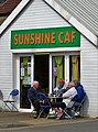 "Sunshine Caf" in Withernsea (geograph 4988004).jpg 3,170 × 4,275; 2.77 MB
-
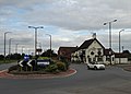 "The Bluebell Inn" and roundabout in Blaxton (geograph 5106310).jpg 4,953 × 3,566; 2.57 MB
-
 "The Coach and Horses" at Dunswell (geograph 4506539).jpg 4,435 × 3,558; 3.77 MB
-
 "The Cross Keys", Fletchergate, Nottingham (geograph 2239918).jpg 2,375 × 1,775; 1.55 MB
-
 "The Duke of York" at Pomeroy - geograph.org.uk - 3665029.jpg 3,551 × 2,537; 1.97 MB
-
 "The Hope and Anchor", Pontefract (geograph 4401637).jpg 4,754 × 3,610; 4.14 MB
-
 "The Liquorice Bush" public house, Pontefract (geograph 4401405).jpg 3,733 × 4,983; 4.49 MB
-
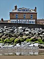 "The Marine Hotel", North Promenade, Withernsea (geograph 4986190).jpg 3,617 × 4,850; 4.17 MB
-
 "The Sebastopol" pub-restaurant, Minting (geograph 4375145).jpg 3,790 × 5,050; 5.26 MB
-
 "Tom Foolery" in Boston Spa (geograph 5883419).jpg 5,090 × 3,706; 3.92 MB
-
 "Where Have You Been?", River Witham, Lincoln (geograph 7002267).jpg 4,961 × 3,687; 3.76 MB
-
 -2016-01-30 Chadwick's Black Pudding Stall, Bury Market.jpg 5,064 × 3,888; 6.01 MB
-
 158 Squadron Memorial at Lissett (geograph 7206938).jpg 4,711 × 3,322; 3.38 MB
-
 A distant view of Beverley Minster (geograph 6196162).jpg 4,957 × 3,637; 4.63 MB
-
 A field drain - Asselby Marsh (geograph 3921816).jpg 1,944 × 2,592; 2.8 MB
-
 A glimpse of Hooton Pagnell Hall.jpg 3,561 × 4,638; 3.97 MB
-
 A view of Abdy Farm (geograph 3249891).jpg 4,473 × 2,684; 2.79 MB
-
 A view of Darlington Clock Tower (geograph 6221321).jpg 957 × 1,213; 275 KB
-
 Abington Church, County Limerick (geograph 2544670).jpg 1,952 × 2,608; 1.37 MB
-
 Agden Reservoir from Bailey Hill - geograph.org.uk - 1735724.jpg 2,608 × 1,952; 1.31 MB
-
 Albert Road, Goldthorpe (geograph 4588589).jpg 4,958 × 3,608; 4.51 MB
-
 All Saints Church, Kilnwick (geograph 7166883).jpg 5,089 × 3,670; 3.87 MB
-
 All Saints Church, Pontefract (geograph 4401653).jpg 5,053 × 3,716; 4.72 MB
-
 Allison Lane, Ulrome (geograph 7206948).jpg 5,035 × 3,623; 4.57 MB
-
 An old milestone by Houndkirk Road (geograph 6440396).jpg 3,597 × 4,838; 4.75 MB
-
 Anglesboro Village Hall (geograph 2544084).jpg 2,393 × 1,795; 939 KB
-
 Approaching Beverley Pastures - The Westwood (geograph 4322285).jpg 5,121 × 3,596; 4.4 MB
-
 At Agden Reservoir, Bradfield - geograph.org.uk - 1735694.jpg 2,608 × 1,952; 1.88 MB
-
 At Beverley Grammar School (geograph 3210604).jpg 4,311 × 2,587; 2.91 MB
-
 At Dowlow Limestone Works (geograph 3665073).jpg 3,648 × 2,736; 2.54 MB
-
 At Loftsome Bridge (geograph 3921798).jpg 2,509 × 1,882; 2.22 MB
-
 At the entrance of Moat Farm, Welwick (geograph 4987991).jpg 3,888 × 5,184; 5.79 MB
-
 At the Royal Station in Wolferton (geograph 5537742).jpg 3,652 × 5,082; 3.37 MB
-
 At Wolferton Station looking to St Peters Church (geograph 5545953).jpg 3,301 × 2,379; 1.69 MB
-
 Barkly News, Beeston, Leeds (geograph 5800784).jpg 3,791 × 4,497; 3.28 MB
-
 Barlborough Hall.jpg 640 × 427; 99 KB
-
 Barley Mow Kirk Ireton Geograph-3554037-by-Neil-Theasby.jpg 3,286 × 2,629; 1.61 MB
-
 Barley ripening on Ella Hill, Yorkshire Wolds (geograph 7227892).jpg 5,049 × 3,787; 4.81 MB
-
 Barlow Woodseats Geograph-2940205-by-Neil-Theasby.jpg 4,267 × 2,845; 2.56 MB
-
 Barncliff Stoop (geograph 6115536).jpg 3,560 × 4,776; 4.32 MB
-
 Barsalloch Fort (geograph 5833723).jpg 5,184 × 3,888; 5.81 MB
-
 Battersea Town Hall (clipped).jpg 4,409 × 2,558; 2.5 MB
-
 Battersea Town Hall - geograph-6170992.jpg 4,834 × 3,522; 3.39 MB
-

-
 Beck Road-Hartley Brook Road junction, Shiregreen (geograph 2662627).jpg 2,365 × 1,774; 940 KB
-
 Bennett's Cross, Dartmoor (geograph 4548087).jpg 3,888 × 5,184; 6.52 MB
-
 Beverley Grammar School (geograph 3210599).jpg 4,075 × 2,911; 2.67 MB
-
 Billy Bremner statue outside Leeds Uniteds stadium (geograph 5801013).jpg 4,805 × 3,623; 2.68 MB
-
 Boulder clay cliffs at Highlands (geograph 7206984).jpg 5,129 × 3,540; 4.13 MB
-
 Bradbourne Brook - The Ford (geograph 4520412).jpg 3,888 × 5,184; 6.37 MB
-
 Branton Mill - seen across the M18 motorway (geograph 6823535).jpg 4,858 × 3,510; 3.33 MB
-
 Bridge over The River Tees (geograph 6272110).jpg 4,851 × 3,585; 4.35 MB
-
 Bridlington Road, Skipsea (geograph 7207221).jpg 4,835 × 3,549; 3.21 MB
-
 Brincliffe Towers in Chelsea Park, Sheffield (geograph 2873405).jpg 4,130 × 2,754; 2.44 MB
-
 Broadway - Not New York City - Brinsworth, Rotherham - geograph.org.uk - 2620609.jpg 1,952 × 2,608; 1.21 MB
-
 Bullock scratching itself - Hathersage Moor (geograph 5466353).jpg 4,662 × 3,458; 4.49 MB
-
 By Rainsbutt Road looking north (geograph 6936740).jpg 3,732 × 4,965; 4.98 MB
-
 By the Methodist Chapel in Brough Sowerby, Westmorland - geograph-5502709.jpg 4,932 × 3,587; 3.59 MB
-
 Caravan perched on the clifftop (geograph 7206969).jpg 5,026 × 3,522; 4.19 MB
-
 Cardiff International Athletics Stadium (geograph 3859170).jpg 5,055 × 3,371; 3.33 MB
-
 Carlton in Lindrick Parish Church (geograph 4615084).jpg 3,888 × 4,989; 5.53 MB
-
 Cattle on the earthworks of Skipsea Castle (geograph 7207082).jpg 4,828 × 3,462; 3.78 MB
-
 Cavendish coat of arms on western facade of Chatsworth House.jpg 3,888 × 4,750; 4.89 MB
-
 Chaloner Street, Guisborough (geograph 5429850).jpg 5,184 × 3,888; 7 MB
-
 Chapel Street, Longnor-geograph-2861017-by-Neil-Theasby.jpg 2,832 × 4,248; 2.73 MB
-
 Chesterfield Parish Church geograph-5215067-by-Neil-Theasby.jpg 3,569 × 4,692; 4.11 MB
-
 Christ Church in Stannington (geograph 4391795).jpg 4,828 × 3,649; 4.61 MB
-
 Christ Church, seen from the lychgate (geograph 6390515).jpg 3,655 × 4,813; 3 MB
-
 Church of Mary, Mother of God, Ballygarvan, County Cork (geograph 2566466).jpg 2,437 × 1,828; 868 KB
-
 Church of The Immaculate Conception, Spinkhill by Neil Theasby Geograph 3182878.jpg 4,282 × 2,855; 2.43 MB
-
 Church Path Cottage and St Johns Church, Kenn (geograph 1966382).jpg 2,608 × 1,952; 1.38 MB
-

-
 Clifford's Tower, York in 1959 - geograph.org.uk - 3219038.jpg 640 × 427; 64 KB
-
 Clifftop vegetation above Barmston Sands (geograph 7206998).jpg 5,012 × 3,519; 4.15 MB
-
 Coalpit Bridge over River Lathkill.jpg 2,608 × 1,952; 1.81 MB
-
 Come on England! (geograph 5800721).jpg 5,183 × 3,762; 4.94 MB
-
 Coronavirus closure notice (geograph 6428511).jpg 4,590 × 3,568; 2.48 MB
-
 Cottage garden in Midhopestones (geograph 3686807).jpg 3,506 × 2,505; 1.87 MB
-
 Cottage in the hamlet of Belph (geograph 5990414).jpg 4,957 × 3,483; 2.98 MB
-

-
 Cowburn Tunnel Air Shaft No 2 sign (geograph 4187773).jpg 2,592 × 1,944; 2.01 MB
-
 Cowburn Tunnel Air Shaft Number 2 (geograph 4187767).jpg 2,488 × 1,659; 579 KB
-
 Crosby Hall, Little Crosby (geograph 4072617).jpg 2,462 × 1,759; 1.35 MB
-
 Dale Dyke Reservoir from the south - geograph.org.uk - 1743850.jpg 2,608 × 1,952; 1.5 MB
-
 Deer Park Flats, Stannington (geograph 5259050).jpg 4,831 × 3,603; 3.46 MB
-
 Derelict church on Cork Road, Ballylanders (geograph 2544263).jpg 1,952 × 2,608; 1.12 MB
-
 Derwent Woodlands War Memorial (geograph 4741876).jpg 3,751 × 5,013; 5.86 MB
-
 Detail of the 158 Squadron Memorial at Lissett (geograph 7211044).jpg 2,539 × 3,349; 1.63 MB
-

-
 Distinctive milestone in Aldeburgh (geograph 5892991).jpg 4,886 × 3,655; 4.06 MB
-
 Drain west of Willingham by Stow - geograph.org.uk - 1701635.jpg 2,608 × 1,952; 1.44 MB
-
 Dunflat Road near Risby (geograph 7160673).jpg 4,921 × 3,465; 3.7 MB
-
 East of Graythorp Industrial Estate (geograph 5432358).jpg 4,914 × 3,742; 4.13 MB
-
 Eighteenth century milepost by Houndkirk Road (geograph 5993341).jpg 4,942 × 3,553; 5.45 MB
-
 Eighteenth century milestone by Houndkirk Road (geograph 5994529).jpg 3,742 × 5,038; 4.86 MB
-
 Eldon Hole, a Wonder of the Peak - geograph-3462326.jpg 2,636 × 3,514; 1.89 MB
-
 Elvington Village Green with Maypole - geograph.org.uk - 5850452.jpg 663 × 446; 119 KB
-
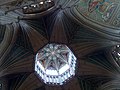 Ely's "lantern". Interior view. - geograph.org.uk - 1709404.jpg 2,608 × 1,952; 1.44 MB
-
 Entrance of Robin Hood's Cave on Stanage Edge, Derbyshire - geograph-3466490.jpg 3,229 × 2,583; 1.82 MB
-
 Entrance to Peak Cavern, Castleton - geograph.org.uk - 1652866.jpg 640 × 479; 81 KB
-
 Evidence of old mine workings west of Middleton (geograph 4563276).jpg 3,888 × 5,184; 6.79 MB
-
 Fairfield Church - geograph.org.uk - 1484754.jpg 640 × 479; 49 KB
-
 Farm buildings north of Penistone Road, Bradfield - geograph.org.uk - 1735681.jpg 2,608 × 1,952; 1.13 MB
-
 Farm track on Asselby Marsh (geograph 3921808).jpg 2,592 × 1,944; 2.32 MB
-
 Farm track west of Littlewood Farm (geograph 7227910).jpg 3,888 × 5,184; 4.08 MB
-
 Farming land north of Clay Farm - geograph.org.uk - 1701622.jpg 2,608 × 1,952; 1.15 MB
-
 February in Roughton churchyard (geograph 4831128).jpg 3,888 × 5,184; 6.38 MB
-
 Fenny Bentley church south face GeoUK 4855067.jpg 991 × 877; 129 KB
-
 Fields south of Springthorpe Grange - geograph.org.uk - 1701647.jpg 2,608 × 1,952; 1.35 MB
-
 Fisherman In Repose (geograph 4267035).jpg 5,184 × 3,888; 6.36 MB
-
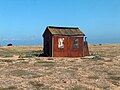 Fisherman's Hut at Dungeness - geograph.org.uk - 1483767.jpg 640 × 479; 84 KB
-
 Footbridge over Barmston Main Drain (geograph 7207061).jpg 5,049 × 3,596; 5.83 MB
-
 Footpath sign with Lose Hill beyond it (geograph 6751996).jpg 5,002 × 3,694; 4.16 MB
-
 Forever Bury (geograph 4810541).jpg 4,950 × 3,104; 3.63 MB
-
 Formby railway station from the south (geograph 5115833).jpg 5,184 × 3,888; 6.68 MB
-
 Former coastguard cottages at Ulrome (geograph 7206965).jpg 5,184 × 3,888; 5.42 MB
-
 Fountains Abbey from the East - geograph.org.uk - 1622330.jpg 640 × 479; 58 KB
-
-
 Gatehouse at Four Lane Ends, Sandbeck Park.jpg 5,027 × 3,714; 4.48 MB
-
 Gatepost (1672) in field south west of Rocher Edge - geograph.org.uk - 1735707.jpg 2,608 × 1,952; 2.17 MB
-
 Gatepost with box plant (geograph 5805060).jpg 3,782 × 4,908; 3.96 MB
-
 Gates to Kilnwick Old Hall (geograph 7166878).jpg 4,998 × 3,367; 4.08 MB
-
 Gateway to Ballylanders Gaelic A.A. playingfield (geograph 2544253).jpg 2,608 × 1,952; 916 KB
-
 Gisborough Hall east of Guisborough (geograph 5429857).jpg 5,053 × 3,699; 5.15 MB
-
 Goal kick at Gigg Lane (geograph 4810543).jpg 4,876 × 3,519; 3.4 MB
-

-
 The Church of St Michael and All Angels (geograph 4486359).jpg 640 × 480; 55 KB
-
 Grimethorpe Hall in September 2016 (geograph 5127290) (cropped).jpg 2,256 × 1,544; 1,009 KB
-
 Grimethorpe Hall in September 2016 (geograph 5127290).jpg 4,889 × 3,579; 4.45 MB
-

-
 Gritstone wall in Malcoff (geograph 3703840).jpg 3,570 × 4,997; 5.11 MB
-
 Groudle Station - Manx Electric Railway (geograph 4879874).jpg 4,204 × 3,309; 4.99 MB
-
 Guardian of the Path (geograph 6442559).jpg 4,956 × 3,545; 5.89 MB
-
 Has there been a flood? (geograph 6279837).jpg 4,900 × 3,278; 2.96 MB
-
 Hassop Hall Hotel (Geograph-3560912 by Neil Theasby).jpg 3,521 × 2,641; 1.8 MB
-
 Head of a suburban fox (geograph 4602920).jpg 4,335 × 3,691; 5.13 MB
-
 High Bradfield viewed from Agden Dam - geograph.org.uk - 1735711.jpg 2,608 × 1,952; 1.23 MB
-
 High Hazels House, High Hazels Park, Sheffield - geograph.org.uk - 2620538.jpg 2,413 × 1,810; 1.21 MB
-
 Hillsborough - the transport interchange (geograph 5239783).jpg 3,714 × 5,096; 3.72 MB
-
 Hillsborough Barracks (geograph 5239781).jpg 4,984 × 3,554; 2.52 MB
-
 Hodgson Tower Birmingham.jpg 2,316 × 3,165; 6.39 MB
-
 Hodgson Tower in Newtown, Birmingham (geograph 4685585).jpg 3,696 × 5,050; 5.23 MB
-
 Holmesfield - Church, Pub-Restaurant and Coronation Garden - geograph.org.uk - 1756617.jpg 1,952 × 2,608; 1.49 MB
-
 Holmgate House, Holmgate (geograph 3959706).jpg 2,322 × 1,858; 2.16 MB
-
 Horse riders on York Lane, Morthen (geograph 3487071).jpg 3,544 × 2,532; 2.1 MB
-
 House on Main Street, Ulrome (geograph 7206959).jpg 4,847 × 3,457; 3.32 MB
-
 Houses in the Broadgate development near Walkington (geograph 4266920).jpg 5,077 × 3,627; 4.05 MB
-
 Houses on Fore Street, Silverton (geograph 4549349).jpg 5,184 × 3,888; 7.03 MB
-
 Houses on Main Street, Asselby (geograph 3921825).jpg 2,590 × 1,850; 1.66 MB
-
 Humberston North Sea Lane Station - geograph.org.uk - 4224012.jpg 3,458 × 2,501; 1.8 MB
-
 Ilam Church from Ilam Hall-geograph-3542149-by-Neil-Theasby.jpg 3,322 × 2,658; 1.51 MB
-
-
 Inside John Smith's Stadium (geograph 4900417).jpg 5,011 × 3,498; 4.8 MB
-
 Inside St Mary's Church, Welwick (geograph 4987996).jpg 3,825 × 5,101; 4.57 MB
-
 Interior of St Annes Church Ellerker.jpg 4,402 × 2,935; 2.54 MB
-
 Kelso Town Hall (geograph 3632691).jpg 2,642 × 3,522; 1.92 MB
-
 Kilnwick Beck (geograph 7166881).jpg 5,184 × 3,888; 6.45 MB
-
 Knedlington Old Hall (Grade II* listed) (geograph 3921839).jpg 2,592 × 1,944; 2.34 MB
-
 Leader, High Bradfield - geograph.org.uk - 4059201.jpg 2,282 × 1,826; 2.02 MB
-
 Leeds 62 Miles (geograph 4238933).jpg 3,536 × 2,655; 2.29 MB
-
 Lewes seen from its eastern down - geograph.org.uk - 1656832.jpg 640 × 479; 87 KB
-
 Lincolnshire countryside south of Tiger Holt wood - geograph.org.uk - 1701614.jpg 2,608 × 1,952; 1.98 MB
-
 Littlewood Road (geograph 7227906).jpg 3,787 × 5,049; 4.12 MB
-
 Littlewood Road at a farm junction (geograph 7227915).jpg 5,108 × 3,860; 4.73 MB
-
-

-
 Low Field Lane (geograph 7157797).jpg 4,928 × 3,436; 3.96 MB
-
 Low to High Bradfield - geograph.org.uk - 4059203.jpg 1,942 × 2,428; 1.69 MB
-
 Lunchtime drinker in "The Old Red Cow" (geograph 4934786).jpg 4,504 × 3,587; 2.81 MB
-
 Lych Gate and Cemetery, Hooton Pagnell.jpg 4,962 × 3,593; 5.11 MB
-
 Main Tower - Fountains Abbey - geograph.org.uk - 1622324.jpg 479 × 640; 58 KB
-
 Megalithic Tomb, Duntryleague (geograph 2544297).jpg 1,753 × 2,337; 1,013 KB
-
 Memorial fountain on Welton Green (geograph 6279829).jpg 5,144 × 3,752; 5.04 MB
-
 Memorial Plaque, Beverley Grammar School (geograph 3210611).jpg 2,760 × 3,864; 2.9 MB
-
 Mersea Barrow, Mersea Island, Essex - geograph-4422803.jpg 5,184 × 3,888; 6.34 MB
-
 Mid summer vegetation by Thievesdale Wood (geograph 4616179).jpg 3,888 × 5,184; 6.82 MB
-
 Middlehowe Road near Walkington (geograph 7227904).jpg 3,888 × 5,184; 4.92 MB
-
 Milepost at Clough Green (geograph 5056762).jpg 3,279 × 4,591; 3.61 MB
-
 Milepost in High Ackworth (geograph 4408847).jpg 5,015 × 3,727; 5.29 MB
-
 Milepost north of High Bradfield (geograph 5664761).jpg 3,888 × 5,184; 4.98 MB
-
 Milestone at Bramhope near Leeds (geograph 2569298).jpg 2,608 × 1,952; 1.4 MB
-
 Milestone by Derby Road south of Wirksworth (geograph 6991948).jpg 5,184 × 3,758; 6.08 MB
-
 Milestone Number 5, Wyming Brook Farm (geograph 6115539).jpg 5,184 × 3,888; 5.53 MB
-
 Model aeroplane at Stanage (geograph 3819646).jpg 4,541 × 3,243; 2.65 MB
-
 Monk Bretton Priory - A view of The Gatehouse (geograph 4448005).jpg 3,596 × 4,960; 4.89 MB
-
 Mountain hare above Far Fork Grain (geograph 5822336).jpg 3,444 × 4,740; 2.83 MB
-
 Neglected iron milepost at Windy Knoll (geograph 7050096).jpg 3,888 × 5,184; 4.91 MB
-
 Neglected old wing at Bassetlaw Hospital (geograph 4821335).jpg 5,034 × 3,665; 4.95 MB
-
 New York Scrapyard, Rotherham - geograph.org.uk - 3084651.jpg 4,232 × 3,023; 2.73 MB
-
 Newark marketplace from the town hall (geograph 2589501).jpg 2,452 × 1,835; 994 KB
-
 North Field, Ulrome (geograph 7207045).jpg 5,067 × 3,801; 5.6 MB
-
 North gate to Renishaw Hall-geograph-3163501-by-Neil-Theasby.jpg 4,488 × 2,693; 3.39 MB
-
 North of Linacre Wood (geograph 5925947).jpg 5,023 × 3,692; 5.52 MB
-
 Noster View, Beeston (geograph 5800736).jpg 4,950 × 3,673; 3.39 MB
-
 Old Cragg Hall (geograph 5708914).jpg 4,992 × 3,667; 5.54 MB
-
 Old guide post at the head of Burnt Hill Lane (geograph 5914430).jpg 4,838 × 3,535; 4.37 MB
-
 Old guide post on Onesmoor Road (geograph 5914444).jpg 4,884 × 3,562; 4.85 MB
-
 Old guidestone above Swan Cottage (geograph 6762843).jpg 3,648 × 4,953; 4.72 MB
-
 Old guidestone by Peat Pits Farm (geograph 6762835).jpg 3,580 × 4,905; 4.14 MB
.jpg)
.jpg)
.jpg)
.jpg)
.jpg)

.jpg)
.jpg)
.jpg)
.jpg)
.jpg)
.jpg)

.jpg)
.jpg)
.jpg)

.jpg)
.jpg)
.jpg)

.jpg)
.jpg)
.jpg)
.jpg)
.jpg)
.jpg)
.jpg)

.jpg)
.jpg)
.jpg)
.jpg)
.jpg)
.jpg)
.jpg)


.jpg)

.jpg)
.jpg)
.jpg)


.jpg)
.jpg)
.jpg)
.jpg)
.jpg)
.jpg)
.jpg)
.jpg)
.jpg)
.jpg)

.jpg)
.jpg)

.jpg)
.jpg)
.jpg)
.jpg)

.jpg)


.jpg)
.jpg)
.jpg)

.jpg)


.jpg)

.jpg)
.jpg)
.jpg)
.jpg)

.jpg)
.jpg)
.jpg)

.jpg)
.jpg)
.jpg)
.jpg)

.jpg)

.jpg)
.jpg)
.jpg)
.jpg)


.jpg)


.jpg)
.jpg)

.jpg)


.jpg)

.jpg)
.jpg)
.jpg)
.jpg)
.jpg)


_in_field_south_west_of_Rocher_Edge_-_geograph.org.uk_-_1735707.jpg)
.jpg)
.jpg)
.jpg)
.jpg)
.jpg)

.jpg)
_(cropped).jpg)
.jpg)

.jpg)
.jpg)
.jpg)
.jpg)
.jpg)
.jpg)


.jpg)

.jpg)

.jpg)
.jpg)
.jpg)
.jpg)
.jpg)
.jpg)


.jpg)
.jpg)

.jpg)
.jpg)
_(geograph_3921839).jpg)

.jpg)


.jpg)
.jpg)


.jpg)

.jpg)


.jpg)
.jpg)
.jpg)

.jpg)
.jpg)
.jpg)
.jpg)
.jpg)
.jpg)
.jpg)
.jpg)
.jpg)
.jpg)
.jpg)
.jpg)
.jpg)

.jpg)
.jpg)

.jpg)
.jpg)
.jpg)
.jpg)
.jpg)
.jpg)
.jpg)
.jpg)