Category:Images by Oxana Maher

Media in category "Images by Oxana Maher"
The following 93 files are in this category, out of 93 total.
-
 A peaceful oasis - geograph.org.uk - 400861.jpg 640 × 480; 86 KB
-
 A quick dip in the brook - geograph.org.uk - 406385.jpg 640 × 480; 168 KB
-
 A walk in the woods - geograph.org.uk - 405478.jpg 480 × 640; 116 KB
-
 Atwick Beach.jpg 640 × 472; 40 KB
-
 Baa baa black sheep - geograph.org.uk - 447805.jpg 640 × 475; 101 KB
-
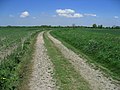
 Barnsley boundary walk - geograph.org.uk - 405412.jpg 480 × 640; 145 KB
-
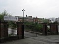
 Batley Grammar School - geograph.org.uk - 414334.jpg 640 × 480; 85 KB
-
 Bats at Batley - geograph.org.uk - 413208.jpg 480 × 640; 86 KB
-
 Birkdale High School - geograph.org.uk - 410951.jpg 640 × 480; 65 KB
-
 Bluebells - geograph.org.uk - 426401.jpg 480 × 640; 120 KB
-
 Cat Lane - geograph.org.uk - 426427.jpg 640 × 480; 83 KB
-
 Cat Lane - geograph.org.uk - 426458.jpg 640 × 480; 112 KB
-
 Cave in the cliffs, Atwick - geograph.org.uk - 406624.jpg 480 × 640; 114 KB
-
 Clough Lane - geograph.org.uk - 420170.jpg 640 × 480; 103 KB
-
 Crookhill Park Golf Course - geograph.org.uk - 447742.jpg 640 × 480; 101 KB
-
 Cross Riding, Sandall Beat Wood - geograph.org.uk - 449066.jpg 463 × 640; 114 KB
-
 Daisy or Buttercup^ - geograph.org.uk - 426469.jpg 640 × 480; 91 KB
-
 Derelict mill - geograph.org.uk - 413187.jpg 640 × 480; 114 KB
-
 Parish Church of St Edwin - geograph.org.uk - 428407.jpg 640 × 480; 70 KB
-
 Dutch River - geograph.org.uk - 426476.jpg 640 × 480; 90 KB
-
 Earlsheaton Cemetery - geograph.org.uk - 415484.jpg 640 × 480; 86 KB
-
 Elliot Lane - geograph.org.uk - 401207.jpg 640 × 480; 137 KB
-
 Entrance to Oxford Park Estate - geograph.org.uk - 412058.jpg 640 × 480; 78 KB
-
 Eroded cliff path, Barmston - geograph.org.uk - 406605.jpg 640 × 480; 74 KB
-
 Field at end of Haggs Lane - geograph.org.uk - 420318.jpg 640 × 480; 99 KB
-

-
 Former Batley Hospital - geograph.org.uk - 414357.jpg 640 × 480; 91 KB
-
 Greenland Farm - geograph.org.uk - 426463.jpg 640 × 476; 86 KB
-
 Heath Cottage Hotel - geograph.org.uk - 415522.jpg 640 × 480; 123 KB
-
 Hollywood......Batley - geograph.org.uk - 413024.jpg 640 × 480; 103 KB
-
 Howley Hall Golf Course - geograph.org.uk - 414384.jpg 640 × 474; 64 KB
-
 Mill conversion, Bradford Rd - geograph.org.uk - 412160.jpg 640 × 480; 80 KB
-
 Moorlands Ave allotments - geograph.org.uk - 412022.jpg 640 × 480; 150 KB
-
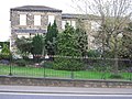
 Mormon Church - geograph.org.uk - 410910.jpg 640 × 480; 108 KB
-
 Nice view^ - geograph.org.uk - 412958.jpg 640 × 480; 88 KB
-
 Old and New... - geograph.org.uk - 412144.jpg 640 × 480; 83 KB
-
 One man and his dog - geograph.org.uk - 406614.jpg 640 × 478; 49 KB
-
 Ouch^ - geograph.org.uk - 426365.jpg 480 × 640; 110 KB
-

-
 Railway tracks, Thwaites - geograph.org.uk - 427453.jpg 640 × 476; 91 KB
-
 Rape field, Dunscroft - geograph.org.uk - 428420.jpg 640 × 480; 126 KB
-

-
 Recreation field, Calder and Hebble canal - geograph.org.uk - 386521.jpg 640 × 427; 110 KB
-
 Redbrick Mill - geograph.org.uk - 412115.jpg 640 × 480; 78 KB
-
 River Don near More Hall - geograph.org.uk - 407449.jpg 480 × 640; 176 KB
-
 River Went - geograph.org.uk - 434688.jpg 480 × 640; 110 KB
-
 Sailing on Southfield Reservoir - geograph.org.uk - 427412.jpg 640 × 478; 78 KB
-
 South End Lane - geograph.org.uk - 426288.jpg 480 × 640; 122 KB
-
 Spooky tree Newmillerdam - geograph.org.uk - 400078.jpg 429 × 640; 112 KB
-
 Stocksbridge water treatment plant - geograph.org.uk - 406573.jpg 640 × 480; 156 KB
-
 The Batley Frontier - geograph.org.uk - 413091.jpg 640 × 480; 65 KB
-
 The Gorge, Roundhay Park - geograph.org.uk - 386600.jpg 480 × 640; 135 KB
-
 The Mad Mile - geograph.org.uk - 409966.jpg 480 × 640; 68 KB
-
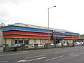
 The Mill Shopping Centre - geograph.org.uk - 413120.jpg 640 × 480; 102 KB
-
 The way to knowledge^ - geograph.org.uk - 429245.jpg 640 × 480; 133 KB
-
 Vacant - geograph.org.uk - 429218.jpg 640 × 480; 93 KB
-
 View from Redmires wood - geograph.org.uk - 407520.jpg 640 × 480; 113 KB
-
 Watery Junction - geograph.org.uk - 427432.jpg 640 × 480; 87 KB
-
 Weir on the River Calder - geograph.org.uk - 375537.jpg 640 × 429; 134 KB
-
 Wheatfield - geograph.org.uk - 426334.jpg 640 × 480; 63 KB
-
 Windy Bank Lane - geograph.org.uk - 386577.jpg 480 × 640; 54 KB
-
 Across the cow field - geograph.org.uk - 447995.jpg 640 × 480; 78 KB
-
 Birkdale Road - geograph.org.uk - 410898.jpg 480 × 640; 85 KB
-
 Bridleway - geograph.org.uk - 448036.jpg 640 × 480; 99 KB
-
 Bridleway, Rainstorth - geograph.org.uk - 401097.jpg 480 × 640; 118 KB
-
 Common Lane - geograph.org.uk - 447780.jpg 480 × 640; 119 KB
-

-
 Dodgy crossroads. - geograph.org.uk - 429157.jpg 640 × 468; 68 KB
-
 Drain alongside Clough Lane - geograph.org.uk - 420261.jpg 480 × 640; 149 KB
-
 Fenwick Lane - geograph.org.uk - 420289.jpg 640 × 480; 108 KB
-
 Field by Clough Lane - geograph.org.uk - 420220.jpg 640 × 480; 119 KB
-
 Field by Elliot Lane - geograph.org.uk - 403390.jpg 640 × 480; 86 KB
-
 Fields by Elliot Lane - geograph.org.uk - 403447.jpg 640 × 480; 137 KB
-
 Firsby reservoir - geograph.org.uk - 447964.jpg 640 × 472; 77 KB
-
 Fishing by the garden centre - geograph.org.uk - 407483.jpg 640 × 480; 145 KB
-
 Footbridge over A18 - geograph.org.uk - 449309.jpg 640 × 480; 77 KB
-
 Green green grass... - geograph.org.uk - 434657.jpg 640 × 480; 68 KB
-
 Howley Park Farm - geograph.org.uk - 415406.jpg 640 × 480; 92 KB
-
 Howley Park Quarry Farm - geograph.org.uk - 414394.jpg 640 × 471; 82 KB
-
 Leeds Country Way - geograph.org.uk - 414404.jpg 480 × 640; 92 KB
-
 Manchester Road, A6102 - geograph.org.uk - 405356.jpg 480 × 640; 114 KB
-
 Motorway countryside - geograph.org.uk - 429188.jpg 640 × 480; 108 KB
-
 Orchard Grove - geograph.org.uk - 428417.jpg 640 × 480; 78 KB
-
 Park Lane - geograph.org.uk - 447879.jpg 480 × 640; 113 KB
-
 Plover Primary School - geograph.org.uk - 449277.jpg 640 × 475; 76 KB
-
 Reservoir at Firsby - geograph.org.uk - 447945.jpg 640 × 462; 81 KB
-
 Shiregreen cemetery - geograph.org.uk - 401199.jpg 640 × 480; 128 KB
-
 Slay Pit Lane - geograph.org.uk - 427460.jpg 640 × 472; 70 KB
-

-
 Wharncliffe chase - geograph.org.uk - 405452.jpg 640 × 480; 80 KB
-
 Windmill Hill Primary School, Burncross - geograph.org.uk - 402352.jpg 640 × 480; 156 KB
-
 Woodland bordering M1 - geograph.org.uk - 400934.jpg 640 × 480; 166 KB
-
 Young willows - geograph.org.uk - 447855.jpg 640 × 480; 80 KB


