Category:Images by P Glenwright

Media in category "Images by P Glenwright"
The following 200 files are in this category, out of 444 total.
(previous page) (next page)-

-
 Aged Miners' homes Hetton Le Hole - geograph.org.uk - 259840.jpg 640 × 480; 88 KB
-
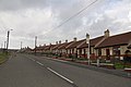 Aged mineworkers homes Chopwell - geograph.org.uk - 346474.jpg 640 × 426; 114 KB
-

-
 Allotment sheds Perkinsville - geograph.org.uk - 256349.jpg 640 × 480; 135 KB
-
 Alnwick Playhouse (rear view) - geograph.org.uk - 249490.jpg 640 × 480; 72 KB
-
 Back lane on washing day - geograph.org.uk - 398863.jpg 426 × 640; 88 KB
-
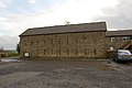
 Barn Edmondsley County Durham - geograph.org.uk - 245740.jpg 640 × 480; 60 KB
-
 Barn High House Brewery near Wall Houses - geograph.org.uk - 345982.jpg 640 × 426; 131 KB
-
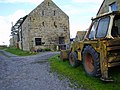 Barn Kirkheaton Northumberland - geograph.org.uk - 251551.jpg 640 × 480; 107 KB
-
 Beamish Mary Inn - geograph.org.uk - 245754.jpg 640 × 480; 94 KB
-
 Beaufront Castle - geograph.org.uk - 242897.jpg 640 × 480; 46 KB
-
 Beech Terrace Blackhouse - geograph.org.uk - 245749.jpg 640 × 480; 81 KB
-
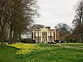 Biddick Hall - geograph.org.uk - 236937.jpg 640 × 480; 114 KB
-
 Black Hall Hexhamshire - geograph.org.uk - 242886.jpg 640 × 480; 120 KB
-
 Black Hall near Juniper Hexhamshire - geograph.org.uk - 242882.jpg 640 × 480; 91 KB
-
 Black horse Cornsay - geograph.org.uk - 398277.jpg 640 × 426; 118 KB
-

-

-

-
 Burdon moor below Birklands Lane - geograph.org.uk - 302711.jpg 640 × 426; 147 KB
-
 Burdon Moor near Sunniside - geograph.org.uk - 302708.jpg 640 × 426; 118 KB
-
 Burnhope to Lanchester road - geograph.org.uk - 397306.jpg 640 × 426; 178 KB
-
 Callendar House Falkirk - geograph.org.uk - 248321.jpg 640 × 480; 88 KB
-
 Cenotaph at crossroads Bingfield - geograph.org.uk - 254306.jpg 480 × 640; 89 KB
-
 Chapel in Chipchase Castle grounds - geograph.org.uk - 255472.jpg 640 × 480; 81 KB
-
 Chimney Shildonhill - geograph.org.uk - 345732.jpg 640 × 426; 126 KB
-
 Chollerton Mill - geograph.org.uk - 255540.jpg 640 × 480; 63 KB
-
 Chollerton St GilesChurch Porch - geograph.org.uk - 255573.jpg 480 × 640; 94 KB
-
 Coal Chauldrons and pit wheel sculpture at Burnhope.jpg 640 × 480; 67 KB
-
 Container depot Plenmeller - geograph.org.uk - 302663.jpg 640 × 426; 110 KB
-
 Control Tower, RAF Topcliffe - geograph.org.uk - 265072.jpg 640 × 480; 60 KB
-

-
 Corneyside near Matfen - geograph.org.uk - 251518.jpg 640 × 480; 68 KB
-
 Craster Harbour Northumberland - geograph.org.uk - 248402.jpg 640 × 480; 73 KB
-
 Daffodils at Biddick Hall - geograph.org.uk - 236926.jpg 640 × 480; 170 KB
-
 Daffodils at Mollersteads - geograph.org.uk - 236912.jpg 640 × 480; 129 KB
-
 Deer at Studley Royal - geograph.org.uk - 256370.jpg 640 × 480; 142 KB
-

-
 Derwentcote Steel Furnace - geograph.org.uk - 242956.jpg 640 × 480; 93 KB
-

-
 Downhill Quarry (disused).jpg 640 × 480; 95 KB
-

-
 Memorial Easington Lane - geograph.org.uk - 259801.jpg 640 × 480; 88 KB
-
-
 East Stanley - geograph.org.uk - 265058.jpg 640 × 480; 73 KB
-

-
 Edge of quarry Craster - geograph.org.uk - 248406.jpg 640 × 480; 77 KB
-
 Elvet Bridge - geograph.org.uk - 256534.jpg 640 × 480; 100 KB
-
 Entrance Finchale College - geograph.org.uk - 246612.jpg 640 × 480; 80 KB
-
 Entrance to Barrasford Caravan Park - geograph.org.uk - 255443.jpg 640 × 480; 113 KB
-

-

-
 Eroding river bank Newburn riverside - geograph.org.uk - 302697.jpg 640 × 426; 142 KB
-
 Fallowfield from the road - geograph.org.uk - 237063.jpg 640 × 423; 113 KB
-
 Fence Charlaw Moor - geograph.org.uk - 277551.jpg 640 × 480; 66 KB
-

-
 Fields above Ridley Gill - geograph.org.uk - 256396.jpg 640 × 480; 96 KB
-

-
 Fields between Gilsland and Greenhead - geograph.org.uk - 302308.jpg 640 × 426; 113 KB
-
 Foghorn at Souter Lighthouse - geograph.org.uk - 236823.jpg 640 × 480; 46 KB
-

-
-
 Gazebo Stanhope - geograph.org.uk - 398811.jpg 640 × 426; 180 KB
-
 Gilsland Post Office - geograph.org.uk - 302298.jpg 640 × 426; 134 KB
-
 Grange Terrace, Pelton Fell - geograph.org.uk - 242812.jpg 640 × 480; 69 KB
-
 Green's Fell near Gunnerton - geograph.org.uk - 255452.jpg 640 × 480; 52 KB
-
 Greenhead railway bridge - geograph.org.uk - 302338.jpg 640 × 426; 164 KB
-
 Gunnerton water treatment works - geograph.org.uk - 255450.jpg 640 × 480; 110 KB
-
 Halls of Heddon Garden Centre - geograph.org.uk - 345700.jpg 640 × 426; 161 KB
-
 Hamsteels Hall near Lanchester - geograph.org.uk - 397373.jpg 640 × 426; 157 KB
-
 Converted chapel Hamsterley - geograph.org.uk - 346461.jpg 640 × 426; 147 KB
-
 Hangars at Duxford Air Museum - geograph.org.uk - 260120.jpg 640 × 480; 54 KB
-
 Haughton Castle - geograph.org.uk - 255522.jpg 640 × 480; 148 KB
-
 Haughton Castle - geograph.org.uk - 255529.jpg 640 × 480; 80 KB
-
 Haughton Castle gate - geograph.org.uk - 255576.jpg 480 × 640; 87 KB
-
 High Burnfoot - geograph.org.uk - 302406.jpg 640 × 426; 132 KB
-
 High Westwood - geograph.org.uk - 346407.jpg 640 × 426; 110 KB
-

-
 Ingoe Northumberland - geograph.org.uk - 251532.jpg 640 × 480; 72 KB
-
 Ingoe Northumberland - geograph.org.uk - 251534.jpg 640 × 480; 103 KB
-
-
 Kimblesworth Church - geograph.org.uk - 246647.jpg 640 × 480; 71 KB
-
 Kirkharle manor - geograph.org.uk - 256403.jpg 640 × 480; 70 KB
-
 Bell tower Kirkheaton church - geograph.org.uk - 251581.jpg 640 × 480; 97 KB
-
 Kirkheaton church - geograph.org.uk - 251577.jpg 640 × 480; 118 KB
-
 Kirkheaton manor Northumberland - geograph.org.uk - 251574.jpg 640 × 480; 137 KB
-
 Kirkwhelpington churchyard in snow - geograph.org.uk - 236797.jpg 640 × 480; 90 KB
-

-
 Lake at Callendar House Falkirk - geograph.org.uk - 248323.jpg 640 × 480; 127 KB
-
 Lambs in Thockrington churchyard - geograph.org.uk - 256422.jpg 640 × 480; 122 KB
-

-
 Lamesley - Spring Lambs.jpg 640 × 480; 111 KB
-
-
 Lintzgarth Rookhope - geograph.org.uk - 398885.jpg 640 × 426; 119 KB
-
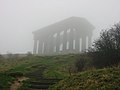 Low cloud over Penshaw Monument - geograph.org.uk - 236976.jpg 640 × 480; 47 KB
-
 Lumley Park Burn under the A1 M - geograph.org.uk - 259827.jpg 640 × 480; 98 KB
-
 Lych gate Simonburn - geograph.org.uk - 255508.jpg 640 × 480; 138 KB
-
 Main Road through Murton - geograph.org.uk - 259836.jpg 640 × 425; 108 KB
-
 Marina Sunderland - geograph.org.uk - 260139.jpg 640 × 480; 91 KB
-
 St Cuthbert's Marley Hill - geograph.org.uk - 265043.jpg 640 × 480; 104 KB
-
 Marsden Rock from the south - geograph.org.uk - 282428.jpg 640 × 480; 90 KB
-
 Memorial to Robert Loraine - geograph.org.uk - 256411.jpg 640 × 480; 68 KB
-
 Methodist Chapel Witton Gilbert - geograph.org.uk - 246825.jpg 640 × 480; 115 KB
-

-
 Mill Bridge, Fountains Abbey - geograph.org.uk - 256359.jpg 640 × 480; 137 KB
-

-
 Newburn - geograph.org.uk - 302701.jpg 640 × 426; 125 KB
-
 Newburn Bridge - geograph.org.uk - 302705.jpg 640 × 426; 110 KB
-
 Sailor's Bethel Newcastle - geograph.org.uk - 248347.jpg 640 × 480; 54 KB
-
 Newfield Inn - geograph.org.uk - 242784.jpg 640 × 480; 94 KB
-
 Newton Hall, Northumberland - geograph.org.uk - 345966.jpg 640 × 426; 124 KB
-
 Oak Tree Inn Copt Hewick near Ripon - geograph.org.uk - 242852.jpg 640 × 480; 61 KB
-
 Old Coanwood Station - geograph.org.uk - 302436.jpg 640 × 426; 151 KB
-

-
 Outbuildings near Thornham Hill Farm - geograph.org.uk - 345986.jpg 640 × 426; 119 KB
-
 Pillbox above Lanchester - geograph.org.uk - 397381.jpg 640 × 426; 166 KB
-

-
 Playing Fields Barrasford - geograph.org.uk - 255554.jpg 640 × 480; 91 KB
-

-
 Pump behind Durham Cathedral - geograph.org.uk - 256528.jpg 640 × 480; 101 KB
-
 Pump house Durham Cathedral - geograph.org.uk - 256516.jpg 640 × 480; 107 KB
-
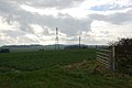 Pylons near Laker Hall - geograph.org.uk - 345724.jpg 640 × 426; 116 KB
-
 Queen Elizabeth II Country Park - geograph.org.uk - 268863.jpg 640 × 480; 128 KB
-
 Queen Elizabeth II Country Park - geograph.org.uk - 268864.jpg 640 × 480; 66 KB
-

-
 Railway Bridge near Brasside Durham - geograph.org.uk - 246605.jpg 640 × 480; 120 KB
-

-
 Ravensworth Estate Lamesley - geograph.org.uk - 265025.jpg 640 × 480; 86 KB
-
 Red kites at Barlow - geograph.org.uk - 260145.jpg 640 × 480; 54 KB
-
 Rhododendrons Callendar Park Falkirk - geograph.org.uk - 248325.jpg 640 × 480; 150 KB
-

-

-
 River Derwent Blackhall Mill - geograph.org.uk - 346483.jpg 640 × 426; 150 KB
-

-
 River South Tyne across from Lambley - geograph.org.uk - 302486.jpg 640 × 426; 115 KB
-
 River Team from Urpeth Grange - geograph.org.uk - 256335.jpg 640 × 480; 76 KB
-
 River Tyne across from Ryton golf course - geograph.org.uk - 302690.jpg 640 × 426; 108 KB
-
 River Tyne from South Shields - geograph.org.uk - 260134.jpg 640 × 480; 62 KB
-
 River Tyne west of Corbridge - geograph.org.uk - 248420.jpg 640 × 480; 52 KB
-
 Riverside at Durham - geograph.org.uk - 261318.jpg 640 × 480; 62 KB
-
 Road above the church Lanchester - geograph.org.uk - 397300.jpg 640 × 426; 142 KB
-
 Road to Byermoor from High Marley Hill - geograph.org.uk - 265054.jpg 640 × 501; 119 KB
-
 Road to Langley West House - geograph.org.uk - 397333.jpg 640 × 426; 153 KB
-
 Road to Wark from Birtley - geograph.org.uk - 255497.jpg 640 × 480; 78 KB
-

-
 Ryal Church Northumberland - geograph.org.uk - 251596.jpg 640 × 480; 80 KB
-

-
 School Copt Hewick near Ripon - geograph.org.uk - 242863.jpg 640 × 480; 92 KB
-

-
 Scout Hut Ouston - geograph.org.uk - 241234.jpg 640 × 480; 72 KB
-
 Sculpture of miner Craghead near Stanley - geograph.org.uk - 245752.jpg 640 × 480; 125 KB
-
 Seat at Craghead County Durham - geograph.org.uk - 245753.jpg 640 × 480; 110 KB
-

-
 Sign in car park Waldridge Fell - geograph.org.uk - 245736.jpg 640 × 480; 103 KB
-

-
 Slag heap near Coanwood - geograph.org.uk - 302528.jpg 640 × 426; 112 KB
-
 Smith's Arms Castle Dene - geograph.org.uk - 259830.jpg 640 × 573; 109 KB
-
 Spoil heap near Heddon Hall - geograph.org.uk - 302688.jpg 640 × 426; 146 KB
-
 St Aidan's Thockrington in Spring - geograph.org.uk - 256417.jpg 640 × 480; 110 KB
-
 St Andrews Cemetery Jesmond - geograph.org.uk - 242828.jpg 640 × 480; 150 KB
-
 St Bartholomew Kirkwhelpington in Spring - geograph.org.uk - 256431.jpg 640 × 480; 116 KB
-
 St Bede's School Lanchester - geograph.org.uk - 397273.jpg 640 × 426; 139 KB
-
 St James Newton Hall - geograph.org.uk - 345738.jpg 640 × 426; 150 KB
-
 Stanhope Castle - geograph.org.uk - 398857.jpg 640 × 426; 139 KB
-

-
 Start of Newburn Riverside walk - geograph.org.uk - 256320.jpg 640 × 480; 44 KB
-
 Steward's House Chipchase Castle - geograph.org.uk - 255475.jpg 640 × 480; 80 KB
-
 Strange postbox - geograph.org.uk - 398282.jpg 640 × 417; 52 KB
-
 Swans at Far Pasture pond - geograph.org.uk - 270946.jpg 640 × 480; 139 KB
-

-
 Tanfield Railway pic 9.jpg 640 × 480; 141 KB
-

-
 The Bat Cave Easington Lane - geograph.org.uk - 259794.jpg 640 × 480; 51 KB
-
 The Black Bull Nettlesworth - geograph.org.uk - 246655.jpg 640 × 480; 69 KB
-
 The Percy Arms Birtley - geograph.org.uk - 255483.jpg 640 × 480; 107 KB
-
 The river Breamish near Ingram - geograph.org.uk - 256321.jpg 640 × 480; 56 KB
-

-
 The Whitehills pub Waldridge Road - geograph.org.uk - 277481.jpg 640 × 480; 101 KB
-
 Thirlwall Castle - geograph.org.uk - 302336.jpg 640 × 426; 134 KB
-
 Town moor Newcastle - geograph.org.uk - 256377.jpg 640 × 480; 90 KB
-

-

-

-
 Treehouse in the Alnwick Garden - geograph.org.uk - 249486.jpg 640 × 480; 129 KB
-
 Trees Old Moor - geograph.org.uk - 268965.jpg 640 × 480; 88 KB
-
 Victorian postbox Kirkhaton - geograph.org.uk - 251567.jpg 640 × 480; 141 KB
-

-
 Village Hall and play area Birtley - geograph.org.uk - 255485.jpg 640 × 480; 152 KB
-
 Waldridge Village - geograph.org.uk - 245737.jpg 640 × 480; 91 KB
-
 Waldridge Village - geograph.org.uk - 245739.jpg 640 × 480; 89 KB
-
 War memorial Featherstone Common - geograph.org.uk - 302401.jpg 426 × 640; 119 KB
-
 War memorial on village green Simonburn - geograph.org.uk - 255510.jpg 640 × 480; 116 KB
-
 Wardles Bridge Inn Holmside - geograph.org.uk - 277555.jpg 640 × 480; 100 KB
-
 Water pump Copt Hewick - geograph.org.uk - 242859.jpg 640 × 480; 140 KB
-

-
 West Harle - geograph.org.uk - 256398.jpg 640 × 409; 32 KB
-
 Whitchester Northumberland - geograph.org.uk - 251463.jpg 640 × 480; 137 KB
-
 Whitfield Church Northumberland - geograph.org.uk - 256317.jpg 640 × 421; 74 KB
-
 Woodland Ravensworth - geograph.org.uk - 265030.jpg 640 × 480; 171 KB


_-_geograph.org.uk_-_249490.jpg)


.jpg)


