Category:Images by Tony Kirwan

Media in category "Images by Tony Kirwan"
The following 35 files are in this category, out of 35 total.
-
 Booth Nooking Lane - geograph.org.uk - 1006558.jpg 640 × 426; 180 KB
-
 Bullrushes on Stone Carr - geograph.org.uk - 1014850.jpg 640 × 451; 267 KB
-
 Cave at Cwmtydu - geograph.org.uk - 953399.jpg 640 × 426; 73 KB
-
 Doorway near Troedyrhiw - geograph.org.uk - 953534.jpg 640 × 426; 115 KB
-
 Drain near Carr Plantation - geograph.org.uk - 1013399.jpg 640 × 426; 162 KB
-
 Farmland and woodland - geograph.org.uk - 938442.jpg 640 × 426; 55 KB
-
 Footbridge and steps - geograph.org.uk - 952272.jpg 426 × 640; 141 KB
-
 Footpath above Thrope Edge - geograph.org.uk - 910173.jpg 640 × 426; 69 KB
-

-
 Footpath from Llangrannog to Eisteddfa - geograph.org.uk - 953444.jpg 426 × 640; 128 KB
-
 Gate and farmland - geograph.org.uk - 938465.jpg 640 × 426; 70 KB
-

-
 Gate on coastal footpath - geograph.org.uk - 952258.jpg 640 × 426; 52 KB
-
 Graveyard at Middlesmoor Church - geograph.org.uk - 909852.jpg 640 × 426; 60 KB
-
 Llangrannog beach and houses - geograph.org.uk - 952284.jpg 640 × 426; 71 KB
-
 Rainbow over Aberaeron rooftops - geograph.org.uk - 952196.jpg 640 × 426; 35 KB
-
 Red kite at Nant yr Arian - geograph.org.uk - 956506.jpg 640 × 480; 256 KB
-
 Red kite at Nant yr Arian - geograph.org.uk - 956510.jpg 640 × 480; 152 KB
-
 Red kites feeding at Nant yr Arian - geograph.org.uk - 956508.jpg 640 × 480; 256 KB
-
 Rotten Sykes Lane - geograph.org.uk - 1006554.jpg 640 × 426; 203 KB
-
 Royal Air Force Memorial, Runnymede - geograph.org.uk - 1058908.jpg 640 × 418; 153 KB
-
 Scar House Dam - geograph.org.uk - 910110.jpg 640 × 426; 73 KB
-
 Scar House Dam overflow channels - geograph.org.uk - 910114.jpg 426 × 640; 102 KB
-
 Scar House Reservoir - geograph.org.uk - 910120.jpg 640 × 426; 56 KB
-
 Shooting House above Thrope Edge - geograph.org.uk - 910189.jpg 640 × 426; 66 KB
-
 Shooting House near Bull Brae - geograph.org.uk - 910158.jpg 640 × 426; 54 KB
-
 Signpost and ploughed field - geograph.org.uk - 1006566.jpg 640 × 426; 163 KB
-

-
 Our Lady of the Rosary Church, Staines - geograph.org.uk - 1058877.jpg 640 × 427; 141 KB
-
 Stone stile near Penmorfa - geograph.org.uk - 953484.jpg 640 × 426; 135 KB
-
 Thrope Farm - geograph.org.uk - 910196.jpg 640 × 426; 64 KB
-
 Thrope Farm - geograph.org.uk - 910199.jpg 640 × 426; 111 KB
-

-
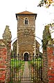 Whitton Church - geograph.org.uk - 1009544.jpg 419 × 640; 221 KB
-
 Winteringham Church - geograph.org.uk - 1006578.jpg 640 × 426; 241 KB


