Category:Images from Geograph Britain and Ireland with broken templates
These images have an incorrect {{Geograph}} or {{Also geograph}} tag which needs correction.
Media in category "Images from Geograph Britain and Ireland with broken templates"
The following 157 files are in this category, out of 157 total.
-
 486 bus on Shooters Hill - geograph.org.uk - 5287205 (cropped).jpg 387 × 290; 82 KB
-
 A circular walk from Bratton (5) - geograph.org.uk - 6477033.jpg 4,320 × 3,240; 5.9 MB
-

-
 Aerial view of Islip, Oxfordshire - geograph.org.uk - 3892478 (cropped).jpg 2,848 × 2,848; 4.59 MB
-
 Airbus at Heathrow Airport - geograph.org.uk - 4795657 (cropped).jpg 473 × 346; 36 KB
-
 Alan Turing Statue Surrey Wikivoyage Banner.jpg 2,560 × 366; 401 KB
-
 Albert Gardens, Stepney - geograph.org.uk - 2311226 (cropped).jpg 274 × 365; 94 KB
-
 All Saints' church, Appleton le Street - geograph.org.uk - 6472523.jpg 703 × 1,024; 185 KB
-
 All Saints, Church Street, Edmonton - Memorial.jpg 726 × 745; 274 KB
-

-
 Amroth, banner.jpg 2,576 × 368; 228 KB
-

-
 An Emblings coach on Lynch Wood Road - geograph.org.uk - 4053747 (cropped).jpg 1,610 × 1,125; 806 KB
-
 Anne Boleyn in wood, Carshalton (cropped).jpg 317 × 422; 92 KB
-
 Araf-Slow on the B4302 - geograph.org.uk - 2395618 (cropped).jpg 306 × 229; 19 KB
-

-
 BBC Scotland - geograph.org.uk - 3851363 (cropped).jpg 1,085 × 733; 321 KB
-
 Bedlam Theatre - geograph.org.uk - 3529565 (cropped).jpg 767 × 958; 248 KB
-
 Beehive doocot at Old Waughton - geograph.org.uk - 2747074 (cropped).jpg 1,360 × 1,360; 786 KB
-
 Bo'ness banner 'Easter Egg Special' steam train.jpg 3,374 × 482; 1.77 MB
-
 Boats in Harefield Marina - geograph.org.uk - 6431585.jpg 1,024 × 768; 266 KB
-
 Brains Cardiff Brewery - geograph.org.uk - 2981130.jpg 659 × 441; 367 KB
-
 Bruntlands Farm - geograph.org.uk - 6447278.jpg 640 × 393; 293 KB
-
 BT Tower - geograph.org.uk - 2791557 (cropped).jpg 1,888 × 4,092; 2.69 MB
-

-
-
 Cadbury World - geograph.org.uk - 3108976 (cropped).jpg 1,346 × 896; 453 KB
-

-
 Canning Town from the air - geograph.org.uk - 6281449.jpg 1,024 × 744; 486 KB
-
 Castell Dinas Bran above the mist - geograph.org.uk - 4979180 (cropped).jpg 2,592 × 1,573; 415 KB
-
 Cycleworks and Tai Tong - closed for the duration - geograph.org.uk - 6447288.jpg 4,288 × 3,216; 4.25 MB
-
 DAF Lorry - geograph.org.uk - 3900939 (cropped).jpg 424 × 464; 58 KB
-

-
 Dartmoor Banner.jpg 4,608 × 658; 916 KB
-
 Dol-gamlyn farm - geograph.org.uk - 6433095.jpg 800 × 598; 639 KB
-
 Drumduff Road, Derroar - geograph.org.uk - 6465663.jpg 1,024 × 685; 265 KB
-

-
 Edwinstowe Banner.jpg 3,246 × 464; 1.14 MB
-
 Eynsford banner Inside Eynsford Castle.jpg 6,537 × 934; 2.91 MB
-
 Farm equipment and bales - geograph.org.uk - 6380393.jpg 640 × 381; 56 KB
-
 Felsite quarry, Highside Hill - geograph.org.uk - 6376710.jpg 1,024 × 576; 274 KB
-
 Flats on Briton Street - geograph.org.uk - 6438043.jpg 1,111 × 1,600; 235 KB
-
 Flooded track - geograph.org.uk - 6419834.jpg 683 × 1,024; 742 KB
-
 Flooding near Newgate Street - Tylers Causeway footpath - geograph.org.uk - 6414552.jpg 1,600 × 1,067; 580 KB
-
 Footbridge on Bains Beck - geograph.org.uk - 6431799.jpg 1,024 × 768; 313 KB
-
 Forestry, Achnashellach - Achadh na Seileach - geograph.org.uk - 6457346.jpg 651 × 1,024; 207 KB
-
 Former Northern Counties District Lunatic Asylum - geograph.org.uk - 6434315.jpg 1,024 × 683; 176 KB
-
 Freight train pulling in to Tan-y-Bwlch - geograph.org.uk - 6294556.jpg 1,280 × 960; 1.05 MB
-
 Gallions Reach Docklands Light Railway Station - geograph.org.uk - 2273478 (cropped).jpg 2,350 × 1,566; 651 KB
-

-
 Gateside Road - geograph.org.uk - 6462411.jpg 1,024 × 683; 344 KB
-
 Gloucester Cathedral - geograph.org.uk - 4144766 (cropped).jpg 3,257 × 4,489; 1.75 MB
-
 Goal scoring in the Kassam Stadium - geograph.org.uk - 5653358 (cropped).jpg 2,563 × 2,501; 1.11 MB
-
 Goldthorn Avenue in Penn, Wolverhampton - geograph.org.uk - 6431424.jpg 1,440 × 960; 1.56 MB
-

-
-
 Grosvenor Lodge, Wrexham - geograph.org.uk - 5673626 (cropped).jpg 750 × 500; 82 KB
-

-

-
-
 Houses of Hale Barns (16) - geograph.org.uk - 6435806.jpg 4,887 × 3,258; 5.41 MB
-
 Interdiction^ - geograph.org.uk - 6440732.jpg 4,896 × 3,264; 5.49 MB
-
 Island stores and Post Office, Ardminish - geograph.org.uk - 6468512.jpg 1,799 × 1,199; 243 KB
-

-
 Ladies Tee View - geograph.org.uk - 6440456.jpg 800 × 600; 134 KB
-
 Lady Margaret Willoughby - geograph.org.uk - 3340718 (cropped).jpg 506 × 585; 73 KB
-
 Leigh from the air - geograph.org.uk - 3948317 (cropped).jpg 617 × 339; 138 KB
-
 Llanfair Caereinion - 2013 - geograph.org.uk - 4100375 (cropped B17).jpg 2,181 × 1,635; 580 KB
-
 M602 Eastbound After Junction 2 - geograph.org.uk - 6351587.jpg 2,784 × 1,568; 2.01 MB
-
 Maidenkirk Flat - geograph.org.uk - 6318644.jpg 640 × 427; 87 KB
-
 Manor House Road, Jesmond - geograph.org.uk - 6477766.jpg 2,000 × 1,500; 1.95 MB
-
 Margaret, Maid of Norway in the Lerwick Town Hall (cropped).jpg 438 × 687; 126 KB
-
 Maserati Gran Turismo - geograph.org.uk - 4723412 (cropped).jpg 1,362 × 651; 319 KB
-
-
 Memorial to the King's Royal Rifles (geograph 2408504 cropped).jpg 1,541 × 1,540; 1.15 MB
-
 Millstone Edge Master's Edge E7 6c.jpeg 874 × 1,231; 359 KB
-
 Milton Abbas - main village street - geograph.org.uk - 6404517.jpg 1,797 × 1,198; 455 KB
-
 Mountain road dropping into the Elan valley - geograph.org.uk - 6316597.jpg 1,024 × 681; 937 KB
-
 Mynydd Drumau - geograph.org.uk - 6369712.jpg 1,024 × 768; 225 KB
-
 Nairn banner Harbour.jpg 2,560 × 366; 615 KB
-
 New houses on Plough Lane ^ Farm Drive - geograph.org.uk - 6433091.jpg 6,016 × 4,000; 6.37 MB
-
 North Ronaldsay banner Old mills at Nesstoun.jpg 2,272 × 325; 207 KB
-
 Nottingham Council House - geograph.org.uk - 2943238 (cropped).jpg 1,028 × 735; 301 KB
-
 NS3322 - New Plaza at Ayr.jpg 1,023 × 604; 126 KB
-
 O'Donovon Rossa Bridge - geograph.org.uk - 6422952.jpg 1,024 × 681; 131 KB
-
 Oaks, Pendomer Road - geograph.org.uk - 6305096.jpg 2,848 × 4,288; 2.84 MB
-
 Old Bridge House, Bangor-on-Dee.jpeg 500 × 400; 399 KB
-

-
 P-SCO Alone on Traigh Scarasta Pano.jpg 3,072 × 439; 252 KB
-
 P-SCO Alone on Traigh Scarasta.jpg 2,765 × 395; 212 KB
-
 Parked Truck, Great Cliff - geograph.org.uk - 2324038 (cropped).jpg 251 × 326; 53 KB
-

-

-
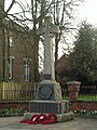 Penge War Memorial (geograph 2303458 cropped).jpg 436 × 581; 169 KB
-
 Pettycur Harbour and Bay - geograph.org.uk - 6420908.jpg 800 × 541; 132 KB
-
 Pine trees in Roseisle Forest - geograph.org.uk - 6405350.jpg 1,024 × 768; 622 KB
-
 Police Car on Western Lawns Eastbourne - geograph.org.uk - 4080224 (cropped).jpg 3,091 × 2,318; 2.39 MB
-

-

-
 Prestwick page banner.jpg 2,592 × 371; 509 KB
-
 Quarry at the National Stone Centre - geograph.org.uk - 6461391.jpg 4,608 × 3,456; 4.68 MB
-
 RAMSAR wetland banner.jpg 1,280 × 183; 99 KB
-
-
 Ronay Street, Milton - geograph.org.uk - 2942379 (cropped).jpg 539 × 324; 125 KB
-
 Royal Wootton Bassett banner Town Hall.jpg 2,170 × 310; 363 KB
-
 Salford City Stadium - geograph.org.uk - 3076639 (cropped).jpg 1,977 × 1,318; 494 KB
-
 School sign in Altrincham - geograph.org.uk - 3735565 (closer crop).jpg 1,708 × 1,708; 1.03 MB
-
 School sign in Altrincham - geograph.org.uk - 3735565 (cropped).jpg 2,020 × 2,020; 1.51 MB
-
 Seafront sculpture at Prestatyn - geograph.org.uk - 1839335 (cropped).jpg 685 × 1,052; 81 KB
-
 Shalom - detail of steel globe on Peace Cairn - geograph.org.uk - 3454625 (cropped).jpg 3,110 × 3,456; 3.68 MB
-

-
 Shelter in Greenwich Park - geograph.org.uk - 2337855 (cropped in).jpg 1,045 × 735; 251 KB
-

-
 South Street - geograph.org.uk - 6414266.jpg 683 × 1,024; 390 KB
-
 Southview Farm - geograph.org.uk - 6478583.jpg 1,024 × 683; 299 KB
-
 St Andrew's Church, Covehithe - geograph.org.uk - 6438837.jpg 1,802 × 1,201; 463 KB
-
 St Edith, Eaton - Effigy - geograph.org.uk - 2246215 (cropped).jpg 996 × 573; 219 KB
-
 St Ellyw, Llanelieu (cropped).jpg 2,084 × 1,563; 2.26 MB
-

-
 St. John the Baptist church in Newton (geograph 3566097 cropped).jpg 2,652 × 1,990; 2.38 MB
-
 St. Mary's Church (Organ ^ King's Pyon) - geograph.org.uk - 6369778.jpg 2,736 × 3,648; 2.76 MB
-
 St.James Church, Pyle (geograph 4985861 cropped).jpg 1,608 × 1,206; 846 KB
-
-
 Stamford DOTM banner Stamford from Town Bridge.jpg 4,000 × 1,333; 2.23 MB
-
 Statue of William Chambers - geograph.org.uk - 3652412 (cropped).jpg 576 × 768; 234 KB
-
 Statue probably of Queen Charlotte, Bloomsbury, London.jpg 997 × 1,435; 494 KB
-
 Stonebridge Common War Memorial.jpg 609 × 609; 108 KB
-
 Straight line missions Banner.jpg 4,221 × 603; 652 KB
-
 Stronsay banner Vat of Kirbister.jpg 3,534 × 505; 520 KB
-
 The A78 coast road - geograph.org.uk - 6431187.jpg 1,024 × 768; 339 KB
-
 The Afon Goedol looking downstream - geograph.org.uk - 6436203.jpg 4,032 × 3,024; 3.58 MB
-

-
 The Church of St John the Baptist, oil painting - geograph.org.uk - 6357327.jpg 4,160 × 6,240; 4.47 MB
-
 The Church of St John the Baptist, oil painting - geograph.org.uk - 6358055.jpg 3,872 × 5,147; 5.34 MB
-
 The Good Shepherd, 60 Paddington Street W1.jpg 522 × 696; 85 KB
-
 The Livingstone Tower - geograph.org.uk - 4861081 (cropped).jpg 393 × 494; 109 KB
-
 The Mansion House, Cardiff - geograph.org.uk - 2175138 (cropped).jpg 2,627 × 1,970; 1.84 MB
-
 The Rigg above Yoke Burn - geograph.org.uk - 6366769.jpg 1,024 × 766; 292 KB
-
 The River Irwell near HMP Forest Bank - geograph.org.uk - 2780202 (cropped).jpg 3,098 × 1,741; 1.96 MB
-

-
 The White House, Craigmillar - geograph.org.uk - 2625048 (cropped).jpg 2,727 × 1,848; 1.59 MB
-
 Timber Lorry - geograph.org.uk - 4897164 (cropped).jpg 822 × 549; 265 KB
-
 Tooting (All Saints) War Memorial.jpg 496 × 729; 127 KB
-
 Trucks at Truckfest - geograph.org.uk - 3965927 (cropped).jpg 254 × 425; 100 KB
-
 Twisted Chimney - geograph.org.uk - 5295162 (cropped).jpg 650 × 850; 142 KB
-

-
 View from Cribyn to Pen Y Fan - geograph.org.uk - 3447271 (cropped).jpg 1,758 × 1,061; 1.37 MB
-
 View from sluice at Longbridge End - geograph.org.uk - 6396378.jpg 5,120 × 2,448; 4.49 MB
-

-
 View through Oakhill Wood from Fosbury Camp - geograph.org.uk - 6442883.jpg 1,799 × 1,199; 334 KB
-

-
 Waste Lorry - geograph.org.uk - 4100600 (cropped).jpg 1,717 × 1,701; 1.1 MB
-
 Water of Ken - geograph.org.uk - 6440665.jpg 2,000 × 1,333; 2.07 MB
-
 Weak Bridge - geograph.org.uk - 6428352.jpg 1,600 × 1,200; 416 KB
-

-
 West View - geograph.org.uk - 6416438.jpg 1,024 × 681; 223 KB
-
 Wv Eton banner.jpg 3,537 × 505; 774 KB
.jpg)
_-_geograph.org.uk_-_6477033.jpg)
.jpg)
.jpg)
.jpg)
.jpg)


.jpg)
.jpg)
.jpg)
.jpg)
.jpg)
.jpg)
.jpg)
.jpg)
.jpg)


.jpg)
.jpg)
.jpg)
.jpg)


.jpg)

.jpg)
.jpg)


.jpg)


.jpg)
.jpg)

.jpg)
.jpg)

.jpg)
.jpg)
.jpg)

.jpg)
.jpg)
_-_geograph.org.uk_-_6435806.jpg)


.jpg)

.jpg)
.jpg)
.jpg)


.jpg)
.jpg)
.jpg)
.jpg)


.jpg)


.jpg)
.jpg)

.jpg)
.jpg)


.jpg)
.jpg)
.jpg)

.jpg)
.jpg)
.jpg)
.jpg)
.jpg)
.jpg)
.jpg)
.jpg)
.jpg)
.jpg)


.jpg)
.jpg)
.jpg)
.jpg)
_-_geograph.org.uk_-_6369778.jpg)
.jpg)
.jpg)
.jpg)


.jpg)
.jpg)

.jpg)
.jpg)
.jpg)
.jpg)
_War_Memorial.jpg)
.jpg)
.jpg)
.jpg)
.jpg)

.jpg)

.jpg)
.jpg)


.jpg)
