Category:Images from Wiki Loves Earth 2016 in Austria not for prejury
Deutsch: Mit dieser Kategorie können Bilder von deren Fotografen gekennzeichnet werden, wenn diese nicht der Vorjury von Wiki Loves Earth 2016 in Austria vorgelegt werden sollen. Dies dient der Entlastung der Vorjury - genauere Informationen und Antworten auf Fragen findet ihr hier.
Media in category "Images from Wiki Loves Earth 2016 in Austria not for prejury"
The following 195 files are in this category, out of 195 total.
-
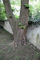
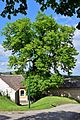
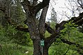
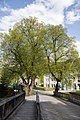
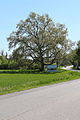
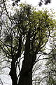
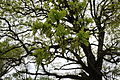
 Bergahorn, Rodaun 01.JPG 3,456 × 5,184; 10.64 MB
-
 Bergahorn, Rodaun 02.JPG 3,456 × 5,184; 10.28 MB
-
 Bergahorn, Rodaun 03.JPG 3,456 × 5,184; 9.13 MB
-
 Bergahorn, Rodaun 04.JPG 3,456 × 5,184; 10.03 MB
-
 Bergahorn, Rodaun 05.JPG 3,456 × 5,184; 10.34 MB
-
 Bergahorngruppe in Ottenschlag 2016-04 NDM ZT-160.jpg 4,414 × 3,188; 6.63 MB
-
 Braune Randwanze Gonocerus acuteangulatus Nationalpark Donau-Auen Lobau Mai 2016 02.jpg 3,200 × 4,800; 6.76 MB
-
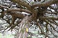
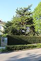
 Breite Föhre II, Mödling 01.JPG 3,456 × 5,184; 11.19 MB
-
 Breite Föhre II, Mödling 02.JPG 3,456 × 5,184; 12.09 MB
-
 Breite Föhre II, Mödling 03.JPG 3,456 × 5,184; 4.88 MB
-
 Breite Föhre II, Mödling 04.JPG 3,456 × 5,184; 10.69 MB
-
 Breite Föhre II, Mödling 05.JPG 5,184 × 3,456; 10.55 MB
-
 Breite Föhre II, Mödling 06.JPG 3,456 × 5,184; 10.94 MB
-
 Breite Föhre II, Mödling 07.JPG 5,184 × 3,456; 9.95 MB
-
 Breite Föhre II, Mödling 08.JPG 3,456 × 5,184; 11.52 MB
-
 Breite Föhre II, Mödling 09.JPG 5,184 × 3,456; 10.72 MB
-
 Buntspecht Dendrocopos major Nationalpark Donau-Auen Lobau Mai 2016 01.jpg 4,500 × 3,000; 6.82 MB
-
 Buntspecht Dendrocopos major Nationalpark Donau-Auen Lobau Mai 2016 02.jpg 4,500 × 3,000; 5.06 MB
-
 Buntspecht Dendrocopos major Nationalpark Donau-Auen Lobau Mai 2016 04.jpg 4,800 × 3,200; 5.21 MB
-
 Buntspecht Dendrocopos major Nationalpark Donau-Auen Lobau Mai 2016 06.jpg 5,100 × 3,400; 7.47 MB
-
 Buntspecht Dendrocopos major Nationalpark Donau-Auen Lobau Mai 2016 07.jpg 5,400 × 3,600; 9.05 MB
-
 Eibe BN-082.png 2,489 × 3,734; 12.88 MB
-
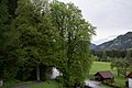
 Erlenauwald am Attenreither Bach 01 2016-04 NDM KR-086.jpg 4,800 × 3,200; 5.8 MB
-
 Erlenauwald am Attenreither Bach 02 2016-04 NDM KR-086.jpg 4,800 × 3,200; 6.42 MB
-
 Esche in Ottenschlag 2016-04 NDM ZT-140.jpg 3,000 × 4,500; 7.14 MB
-
 Feldahorn bei Purk 03 2016-04 NDM ZT-152.jpg 3,000 × 4,500; 5.98 MB
-
 Gletschereishöhle 0032.jpg 3,500 × 2,333; 3.51 MB
-
 GLT 1268 Gröbming.jpg 3,000 × 2,000; 2.62 MB
-
 GLT 205 Zirbenreihe bei Teufenbach 0003.jpg 2,333 × 3,500; 1.65 MB
-
 GLT 205 Zirbenreihe bei Teufenbach 0008.jpg 3,500 × 2,333; 2.74 MB
-
 GLT 205 Zirbenreihe bei Teufenbach 0021.jpg 2,333 × 3,500; 2.63 MB
-
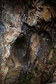
 GLT 209 Puxerloch 0004.jpg 3,500 × 2,333; 2.85 MB
-
 Hollabrunn - Enzersdorf im Thale - ND HL-018 - Winterlinde - 1.jpg 3,485 × 4,647; 9.46 MB
-
 Hollabrunn - Enzersdorf im Thale - ND HL-018 - Winterlinde - 2.jpg 3,624 × 5,437; 9.73 MB
-
 Hollabrunn - Enzersdorf im Thale - ND HL-019 - Winterlinden am Friedhof - 2.jpg 4,000 × 6,000; 13.45 MB
-
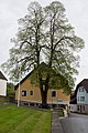
 Hollabrunn - Kammersdorf - ND HL-052 - Linde.jpg 5,459 × 3,639; 10.04 MB
-
 Hollabrunn - Oberstinkenbrunn - ND HL-008 - Winterlinde - 1.jpg 5,217 × 3,478; 8.2 MB
-
 Hollabrunn - Oberstinkenbrunn - ND HL-008 - Winterlinde - 2.jpg 3,817 × 5,725; 11.68 MB
-
 Hollabrunn - Oberstinkenbrunn - ND HL-046 - Galgen am Galgenberg.jpg 3,852 × 5,778; 9.14 MB
-
 Hollabrunn - Oberstinkenbrunn - ND HL-046 - Galgenberg - Ansicht von Süden - 16-9.jpg 6,000 × 3,375; 8.52 MB
-
 Hollabrunn - Oberstinkenbrunn - ND HL-046 - Galgenberg - Ansicht von Süden - 3-2.jpg 6,000 × 4,000; 9.87 MB
-

-
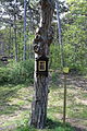
 Hollabrunn - Oberstinkenbrunn - ND HL-046 - Galgenberg - Infotafel.jpg 5,735 × 3,824; 7.78 MB
-

-

-
 Hollabrunn-Mariathal - ND HL-021 - Winterlinden (Tilia cordata) mit Marterl - 1.jpg 5,267 × 3,511; 8.81 MB
-
 Hollabrunn-Mariathal - ND HL-021 - Winterlinden (Tilia cordata) mit Marterl - 2.jpg 4,862 × 3,647; 9.01 MB
-
 Hollabrunn-Mariathal - ND HL-021 - Winterlinden (Tilia cordata) mit Marterl - 3.jpg 5,308 × 3,539; 10.38 MB
-
 ID 1031 Linde in St. Georgen 0003.jpg 2,333 × 3,500; 2.75 MB
-
 ID 1035 Gletschertöpfe Turracherhöhe 0033.jpg 3,500 × 2,333; 3.14 MB
-
 ID 1035 Gletschertöpfe Turracherhöhe 0036.jpg 2,333 × 3,500; 2.88 MB
-
 ID 1035 Gletschertöpfe Turracherhöhe 0049.jpg 2,333 × 3,500; 2.89 MB
-
 ID 1037 Linde bei Laßnitzbach 0006.jpg 3,500 × 2,333; 2.73 MB
-
 ID 1038 Hoher Steg Predlitz 0009.jpg 2,333 × 3,500; 3.3 MB
-
 ID 1038 Hoher Steg Predlitz 0012.jpg 3,500 × 2,333; 2.31 MB
-
 ID 1044 Linde in St. Lambrecht 0014.jpg 3,500 × 2,333; 3.42 MB
-
 ID 1044 Linde in St. Lambrecht 0016.jpg 2,333 × 3,500; 3.46 MB
-
 ID 1047 Linde in St. Blasen 0004.jpg 3,500 × 2,332; 2.51 MB
-
 ID 1047 Linde in St. Blasen 0010.jpg 2,333 × 3,500; 3.46 MB
-
 ID 1052 Klamm in St. Lambrecht 0003.jpg 3,500 × 2,333; 2.12 MB
-
 ID 1052 Klamm in St. Lambrecht 0045.jpg 2,333 × 3,500; 2.82 MB
-
 ID 1059 Nußbaum in Pux 0003.jpg 3,500 × 2,333; 3.15 MB
-
 ID 1059 Nußbaum in Pux 0006.jpg 2,333 × 3,500; 3.14 MB
-
 ID 1059 Nußbaum in Pux 0012.jpg 2,333 × 3,500; 3.41 MB
-
 ID 1062 Linde in St. Lorenzen 0002.jpg 2,624 × 3,500; 2.63 MB
-
 ID 800 Linde bei Öblarn 0010.jpg 2,333 × 3,500; 3.34 MB
-
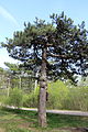
 ID 928 Zirbe auf der Riedleralm 0006.jpg 3,500 × 2,333; 1.91 MB
-
 ID 928 Zirbe auf der Riedleralm 0011.jpg 3,500 × 2,333; 1.85 MB
-
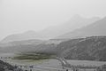
 ID 958 Gesäuseeingang 0005.jpg 3,500 × 2,333; 2.37 MB
-
 Lobau Anschlussstrecke Ölhafenbahn Mai 2016 a.jpg 2,400 × 3,600; 3.82 MB
-
 Lobau Anschlussstrecke Ölhafenbahn Mai 2016 b.jpg 4,200 × 2,800; 9.08 MB
-
 Lobau Anschlussstrecke Ölhafenbahn Mai 2016 c.jpg 3,400 × 5,100; 7.93 MB
-
 Mammutbaum BN-057.png 2,592 × 3,888; 12.5 MB
-
 Nationalpark Donau-Auen Lobau Biberhaufen Mai 2016 04.jpg 4,500 × 3,000; 5.56 MB
-
 Nationalpark Donau-Auen Lobau Biberhaufen Mai 2016 05.jpg 3,600 × 5,400; 8.3 MB
-
 Nationalpark Donau-Auen Lobau Fasangarten Mai 2016 rundumadum.jpg 4,500 × 3,000; 4.22 MB
-
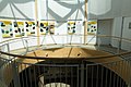
 Nationalpark Donau-Auen Lobau Nationalparkhaus Mai 2016 02.jpg 5,500 × 3,666; 16.6 MB
-
 Nationalpark Donau-Auen Lobau Nationalparkhaus Mai 2016 06.jpg 5,100 × 3,400; 9.94 MB
-
 Nationalpark Donau-Auen Lobau Nationalparkhaus Mai 2016 07.jpg 5,700 × 3,800; 13.15 MB
-
 Nationalpark Donau-Auen Lobau Nationalparkhaus Teich Mai 2016 01.jpg 5,400 × 3,600; 20.64 MB
-
 Nationalpark Donau-Auen Lobau Nationalparkhaus Teich Mai 2016 02.jpg 5,700 × 3,800; 21.84 MB
-
 Nationalpark Donau-Auen Lobau Tischwasser Mai 2016 01.jpg 5,700 × 3,800; 13.5 MB
-
 Nationalpark Donau-Auen Lobau Tischwasser Mai 2016 02.jpg 5,700 × 3,800; 13.59 MB
-
 Nationalpark Donau-Auen Lobau Tischwasser Mai 2016 04.jpg 3,800 × 5,700; 22.79 MB
-
 Nationalpark Donau-Auen Lobau Tischwasser Mai 2016 06.jpg 3,800 × 5,700; 13.95 MB
-
 Naturschutzgebiet Rottalmoos - Schild.jpg 4,500 × 3,000; 6.57 MB
-
 NDM0003 Wildes Frauenloch bei Radstadt 0002.jpg 3,500 × 2,333; 3.01 MB
-
 NDM0003 Wildes Frauenloch bei Radstadt 0006.jpg 2,333 × 3,500; 2.98 MB
-
 NDM00048 Kugellärche Foetschlleiten 0005.jpg 2,333 × 3,500; 3.3 MB
-
 NDM00056 Linden St. Augustin 0002.jpg 2,333 × 3,500; 3.38 MB
-
 NDM00056 Linden St. Augustin 0005.jpg 2,333 × 3,500; 3.06 MB
-
 NDM00072 Bergahorn bei St. Michael 0001.jpg 3,500 × 2,333; 2.57 MB
-
 NDM00072 Bergahorn bei St. Michael 0004.jpg 2,333 × 3,500; 3.67 MB
-
 NDM00072 Bergahorn bei St. Michael 0011.jpg 2,333 × 3,500; 2.68 MB
-
 NDM00105 Gletschermuehlen bei Mauterndorf 0013.jpg 3,500 × 2,333; 2.76 MB
-
 NDM00105 Gletschermuehlen bei Mauterndorf 0018.jpg 3,500 × 2,333; 3.42 MB
-
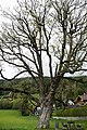
 NDM00109 Rotbuche in Hammer 0002.jpg 2,333 × 3,500; 3.73 MB
-
 NDM00191 Moertelerlinde 0001.jpg 2,333 × 3,500; 2.92 MB
-
 NSG 44c Ennsaltarm bei Stein 0001.jpg 3,500 × 2,333; 979 KB
-
 NSG 49c Moor Turracherhöhe 0001.jpg 3,500 × 2,333; 2.96 MB
-
 NSG 49c Moor Turracherhöhe 0003.jpg 3,500 × 2,333; 3.32 MB
-
 NSG 49c Moor Turracherhöhe 0004.jpg 3,500 × 2,333; 1.59 MB
-
 NSG 93c 0007.jpg 3,500 × 2,333; 3.11 MB
-
 NSG 93c 0017.jpg 3,500 × 2,333; 3.12 MB
-
 NSG 94c Enzianwiese Masenberg 0002.jpg 3,500 × 2,333; 1.53 MB
-
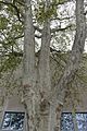
 Platane BN-113.png 2,592 × 3,888; 16.84 MB
-
 Platane, Leopoldsdorf 01.JPG 3,456 × 5,184; 10.9 MB
-
 Platane, Leopoldsdorf 02.JPG 3,456 × 5,184; 10.75 MB
-
 Platane, Leopoldsdorf 03.JPG 5,184 × 3,456; 10.17 MB
-
 Platane, Leopoldsdorf 04.JPG 5,184 × 3,456; 9.81 MB
-
 Platane, Leopoldsdorf 05.JPG 3,456 × 5,184; 12.47 MB
-
 Platanengruppe, Schönau an der Triesting 01.JPG 3,456 × 5,184; 8.57 MB
-
 Platanengruppe, Schönau an der Triesting 02.JPG 3,456 × 5,184; 9.95 MB
-
 Platanengruppe, Schönau an der Triesting 03.JPG 3,456 × 5,184; 9.48 MB
-
 Platanengruppe, Schönau an der Triesting 04.JPG 3,456 × 5,184; 10.11 MB
-
 Platanengruppe, Schönau an der Triesting 05.JPG 3,456 × 5,184; 6.1 MB
-
 Platanengruppe, Schönau an der Triesting 06.JPG 5,184 × 3,456; 9.6 MB
-
 Platanengruppe, Schönau an der Triesting 07.JPG 3,456 × 5,184; 10.34 MB
-
 Platanengruppe, Schönau an der Triesting 08.JPG 3,456 × 5,184; 8.63 MB
-
 Platanengruppe, Schönau an der Triesting 09.JPG 3,456 × 5,184; 8.96 MB
-
 Platanengruppe, Schönau an der Triesting 10.JPG 3,456 × 5,184; 9.66 MB
-
 Platanengruppe, Schönau an der Triesting 11.JPG 3,456 × 5,184; 11.25 MB
-
 Pyramideneiche, Rodaun 01.JPG 3,456 × 5,184; 12.11 MB
-
 Pyramideneiche, Rodaun 02.JPG 3,456 × 5,184; 9.78 MB
-
 Pyramideneiche, Rodaun 03.JPG 3,456 × 5,184; 12.64 MB
-
 Pyramideneiche, Rodaun 04.JPG 3,456 × 5,184; 11.33 MB
-
 Pyramideneiche, Rodaun 05.JPG 3,456 × 5,184; 9.36 MB
-
 Pyramideneiche, Rodaun 06.JPG 3,456 × 5,184; 10.58 MB
-
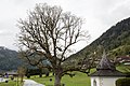
 Rotbuche bei Günzles - Pano 2016-04.jpg 3,400 × 7,600; 10.46 MB
-
 Rotbuche bei Günzles - Stamm 2016-04.jpg 3,400 × 5,100; 7.23 MB
-
 Schirmföhre, Weikersdorf 01.JPG 5,184 × 3,456; 10.49 MB
-
 Schirmföhre, Weikersdorf 02.JPG 3,456 × 5,184; 7.18 MB
-
 Schirmföhre, Weikersdorf 03.JPG 3,456 × 5,184; 10.28 MB
-
 Schirmföhre, Weikersdorf 04.JPG 5,184 × 3,456; 9.49 MB
-
 Schirmföhre, Weikersdorf 05.JPG 5,184 × 3,456; 9.54 MB
-
 Schirmföhre, Weikersdorf 06.JPG 5,184 × 3,456; 8.99 MB
-
 Schirmföhre, Weikersdorf 07.JPG 3,456 × 5,184; 9.92 MB
-
 Schirmföhre, Weikersdorf 08.JPG 5,184 × 3,456; 7.58 MB
-
 Schirmföhre, Weikersdorf 09.JPG 5,184 × 3,456; 11.78 MB
-
 Schirmföhre, Weikersdorf 10.JPG 3,456 × 5,184; 10.78 MB
-
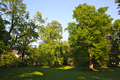
 Schlosspark Leesdorf I.png 3,888 × 2,592; 17.17 MB
-
 Schlosspark Leesdorf II.png 3,857 × 2,571; 12.42 MB
-
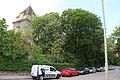 Schlosspark Leesdorf, Ansicht Osten 01.jpg 5,184 × 3,456; 8.9 MB
-
 Schlosspark Leesdorf, Ansicht Osten 02.jpg 5,184 × 3,456; 7.45 MB
-
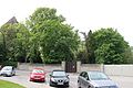
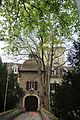 Schlosspark Leesdorf, Eingang 01.jpg 3,456 × 5,184; 11.09 MB
-
 Schlosspark Leesdorf, Eingang 02.jpg 3,456 × 5,184; 7.51 MB
-
 Schwarzkiefer, Ebreichsdorf 01.jpg 3,456 × 5,184; 11.6 MB
-
 Schwarzkiefer, Ebreichsdorf 02.jpg 3,456 × 5,184; 9.87 MB
-
 Schwarzkiefer, Ebreichsdorf 03.jpg 3,456 × 5,184; 14.29 MB
-
 Schwarzkiefer, Ebreichsdorf 04.jpg 3,456 × 5,184; 14.12 MB
-
 Schwarzkiefer, Ebreichsdorf 05.jpg 3,456 × 5,184; 12.77 MB
-
 Schwarzkiefer, Ebreichsdorf 06.jpg 3,456 × 5,184; 13.12 MB
-
 Schwarzkiefer, Ebreichsdorf 07.jpg 3,456 × 5,184; 13.96 MB
-
 Schwarzkiefer, Ebreichsdorf 08.jpg 3,456 × 5,184; 10.1 MB
-
 Sommerlinde bei Günzles - Stamm 2016-04 NDM ZT-037.jpg 3,000 × 4,500; 6.7 MB
-
 Sommerlinde BN-132.png 2,079 × 3,119; 9.15 MB
-
 Sommerlinde in Günzles - Stamm 2016-04 NDM ZT-039.jpg 3,000 × 4,500; 6.27 MB
-
 Sommerlinde in Günzles 02 2016-04 NDM ZT-039.jpg 4,800 × 3,200; 7.12 MB
-
 Stieleiche, Ketzergasse 01.JPG 3,456 × 5,184; 10.22 MB
-
 Stieleiche, Ketzergasse 02.JPG 3,456 × 5,184; 11.51 MB
-
 Stieleiche, Ketzergasse 03.JPG 3,456 × 5,184; 10.9 MB
-
 Stieleiche, Ketzergasse 04.JPG 3,456 × 5,184; 8.77 MB
-
 Stieleiche, Ketzergasse 05.JPG 3,456 × 5,184; 10.82 MB
-
 Stieleiche, Wienersdorf 02.JPG 3,456 × 5,184; 11.36 MB
-
 Stieleiche, Wienersdorf 04.JPG 3,456 × 5,184; 8.86 MB
-
 Stieleiche, Wienersdorf 05.JPG 5,184 × 3,456; 4.8 MB
-
 Stieleiche, Wienersdorf 06.JPG 5,184 × 3,456; 4.79 MB
-
 Stieleiche, Wienersdorf 07.JPG 5,184 × 3,456; 4.7 MB
-
 Stieleiche, Wienersdorf 08.JPG 5,184 × 3,456; 5.68 MB
-
 Stieleiche, Wienersdorf 09.JPG 3,456 × 5,184; 12.9 MB
-
 Stieleiche, Wienersdorf 10.JPG 3,456 × 5,184; 9.4 MB
-
 Stieleiche, Wienersdorf 11.JPG 3,456 × 5,184; 9.85 MB
-
 Stieleiche139.JPG 3,000 × 4,000; 3.94 MB
-
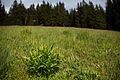
 Sumpfdotterblume im Naturdenkmal Erlenauwald am Attenreither Bach.jpg 3,900 × 2,600; 4.56 MB
-
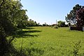
 Urzeitkrebswiese, Gramatneusiedl 01.jpg 5,184 × 3,456; 8.38 MB
-
 Urzeitkrebswiese, Gramatneusiedl 02.jpg 5,184 × 3,456; 7.58 MB
-
 Urzeitkrebswiese, Gramatneusiedl 03.jpg 5,184 × 3,456; 7.05 MB
-
 Urzeitkrebswiese, Gramatneusiedl 04.jpg 5,184 × 3,456; 9.04 MB
-
 Urzeitkrebswiese, Gramatneusiedl 05.jpg 5,184 × 3,456; 10.09 MB
-
 Urzeitkrebswiese, Gramatneusiedl 06.jpg 5,184 × 3,456; 12.22 MB
-
 Urzeitkrebswiese, Gramatneusiedl 07.jpg 5,184 × 3,456; 9.41 MB
-
 Urzeitkrebswiese, Gramatneusiedl 08.jpg 5,184 × 3,456; 10.25 MB
-
 Weilburgpark I.png 2,504 × 3,756; 10.85 MB
-
 Weilburgpark II.png 2,592 × 3,888; 15.17 MB
-
 Weilburgpark III.png 2,592 × 3,888; 15.53 MB
-
 Weilburgpark IV.png 2,390 × 3,586; 10.5 MB
-
 Weilburgpark V.png 3,810 × 2,540; 15.95 MB
-
 Weilburgpark VI.png 3,888 × 2,592; 18.24 MB
-
 Weilburgpark VII.png 3,888 × 2,592; 18.57 MB
-
 Weißföhre, Baden 01.jpg 5,184 × 3,456; 10.78 MB
-
 Weißföhre, Baden 02.jpg 5,184 × 3,456; 10.77 MB
-
 Weißföhre, Baden 03.jpg 3,456 × 5,184; 11.32 MB
-
 Weißföhre, Baden 04.jpg 3,456 × 5,184; 9.25 MB
-
 Weißföhre, Baden 05.jpg 3,456 × 5,184; 11.12 MB
-
 Yponomeuta cagnagella Nationalpark Donau-Auen Lobau Mai 2016 04.jpg 3,600 × 5,400; 11.75 MB


_-_1.jpg)

.jpg)
.jpg)
_mit_Marterl_-_1.jpg)
_mit_Marterl_-_2.jpg)
_mit_Marterl_-_3.jpg)


