Category:India Tercera Nuova Tavola
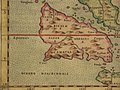
English: The "New Map of the Third India", depicting the "Indian Archipelago" (Indonesia) and contrasted with Ptolemy's "India within the Ganges" (India) and "India beyond the Ganges" (Indochina), from Vincenzo Valgrisi's 1561 Geografia di Claudio Tolomeo, printed at Venice.
Metadata:
- Obj Height: 18 cm
- Obj Width: 24 cm
- Scale 1:30,000,000
- Note: Engraved modern map of Southeast Asia, covers the region from the Gulf of Bengal to Canton, and south to include most of Indonesia and the Philippines. Relief shown pictorially.
- Country: Indonesia, Philippines
- Region: Asia, Southeastern
- Full Title: India Tercera Nuova Tavola. India terzera Ventesimaottava tavola nvova. (To accompany) La geografia di Claudio Tolomeo Alessandrino, nuouamente tradotta di Greco in Italiano, da Girolamo Ruscelli ... In Venetia, Appresso Vincenzo Valgrisi, M.D.LXI. (1561).
- Authors: Ptolemy, Claudius; Ruscelli, Girolamo; Giuseppe Moletti, M.
- Publisher: Vincenzo Valgrisi, Venice
Media in category "India Tercera Nuova Tavola"
The following 7 files are in this category, out of 7 total.
-
 India Tercera Nuova Tavola 1.jpg 800 × 600; 151 KB
-
 India Tercera Nuova Tavola (Southeast Asia) southeast.jpg 800 × 600; 141 KB
-
 B26056096A - India tercera nvova tavola.jpg 5,715 × 4,473; 5.14 MB
-
 India Tercera Nuova Tavola (Southeast Asia) southwest.jpg 800 × 600; 135 KB
-
 India Tercera Nuova Tavola northeast.jpg 800 × 600; 131 KB
-
 India Tercera Nuova Tavola" (Southeast Asia) northwest.jpg 800 × 600; 135 KB
-
 India Tercera Nuova Tavola.jpg 907 × 651; 272 KB

_southeast.jpg)

_southwest.jpg)

_northwest.jpg)
