Category:Industrial District, Seattle, Washington
Human settlement in Seattle, Washington, United States   | |||||
| Upload media | |||||
| Instance of | |||||
|---|---|---|---|---|---|
| Location | Seattle, King County, Washington, Pacific Northwest, Washington, Pacific States Region | ||||
 | |||||
Subcategories
This category has the following 18 subcategories, out of 18 total.
A
- Argo Yard (3 F)
F
- Frye-Bruhn Company packing plant (10 F)
H
M
O
P
R
S
- Schwager & Nettleton Mill (4 F)
- South Canal project (Seattle) (15 F)
- Spokane Street Bridge (27 F)
W
Media in category "Industrial District, Seattle, Washington"
The following 200 files are in this category, out of 222 total.
(previous page) (next page)-
-
 1903 Seattle tidelands panorama (left half).jpg 3,756 × 1,939; 946 KB
-
 1903 Seattle tidelands panorama (right half).jpg 3,796 × 1,923; 899 KB
-
 1903 Seattle tidelands panorama.jpg 7,512 × 1,924; 4.63 MB
-
 1st Ave S, looking north, April 29, 1925 (SEATTLE 299).jpg 768 × 536; 79 KB
-

-
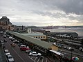
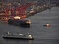
 2005 Seattle harbor container port night.jpg 3,027 × 2,270; 2.28 MB
-
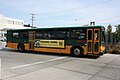
 40' Gillig Phantom -3437 (3822896016).jpg 3,888 × 2,592; 3.04 MB
-
 664 Nevada Street, Seattle, 1931 (14780338156).jpg 1,200 × 935; 306 KB
-
 Aerial of Alaskan Way Viaduct south of Downtown Seattle, 1960 (52474347222) (cropped).jpg 3,402 × 2,681; 4.12 MB
-
 Aerial of Alaskan Way Viaduct south of Downtown Seattle, 1960 (52474347222).jpg 4,000 × 3,151; 4.87 MB
-
 Aerial of Hanford Street Dock and Spokane Street Dock Seattle, 1960.jpg 1,413 × 672; 446 KB
-
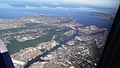
 Aerial of Harbor Island and Downtown Seattle, 1968.jpg 2,973 × 2,358; 8.42 MB
-
 Aerial photograph of CID, downtown, Qwest (cropped).jpg 1,788 × 2,088; 5.64 MB
-

-
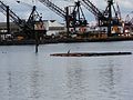
 Aerial view of barges and warehouses on Duwamish Waterway.jpg 3,264 × 2,448; 3.93 MB
-
 Aerial view of Harbor Island in Seattle.jpg 3,264 × 2,448; 4.88 MB
-
 Aerial view of Seattle Freeway and Highway 99 cloverleaf in Seattle.jpg 3,264 × 2,448; 6.38 MB
-

-
-
 Anderson's 1890 map - mudflats south of King Street.jpg 820 × 1,475; 348 KB
-
 Anderson's Map of Seattle Tide Lands, circa 1907 (MOHAI 13438).jpg 1,035 × 1,200; 218 KB
-

-
 Asahel Curtis - panoramic view of Seattle from the tideflats, circa 1904.jpg 2,712 × 1,235; 352 KB
-
 Asahel Curtis panorama of Seattle from Beacon Hill, 1914.jpg 2,302 × 1,089; 342 KB
-
 Asahel Curtis panorama of Seattle tideflats (1916).jpg 1,444 × 715; 163 KB
-

-
 Baist Seattle 1905 plate 10 - A - raw.jpg 2,592 × 1,944; 653 KB
-
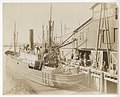
 Barton & Company from the water, circa 1917.jpg 3,039 × 1,019; 530 KB
-
 Beacon Hill and tideflats, Seattle (CURTIS 192).jpeg 618 × 512; 48 KB
-

-

-

-
 CM Johnson (25334332102).jpg 5,023 × 3,349; 874 KB
-
 CM Juarez off the Duwamish (24822198494).jpg 4,798 × 3,199; 844 KB
-
 CMs Burgess & Harrell (25334333112).jpg 5,038 × 3,359; 950 KB
-
 Container Terminal of Seattle - panoramio.jpg 4,000 × 2,664; 1.3 MB
-
 Cranes - seattle.jpg 2,400 × 1,600; 2.55 MB
-
 Cruise Ship.jpg 2,304 × 1,728; 2.75 MB
-
-
-
 Downtown Seattle 2.JPG 2,048 × 1,536; 1.36 MB
-

-
 Downtown Seattle from the Space Needle.jpg 4,272 × 2,848; 9.49 MB
-
Downtown Seattle Graffiti.webm 1 min 29 s, 352 × 288; 7.76 MB
-
 Downtown Seattle skyline looking north from Interstate 5 (cropped).jpg 3,185 × 2,009; 2.34 MB
-
 Downtown Seattle skyline looking north from Interstate 5.jpg 6,000 × 4,000; 9.53 MB
-
 Duwamish Head 03.jpg 4,288 × 2,848; 6.55 MB
-
 Duwamish pano 01.jpg 7,123 × 2,722; 8.45 MB
-
 Factories in the Georgetown district, Seattle (CURTIS 1601).jpeg 768 × 718; 78 KB
-
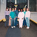 Female employees at Seattle City Light south shops, 1992 (52377011773).jpg 3,618 × 3,657; 11.65 MB
-

-

-

-
 FMIB 44571 Weiding and Independent Fisheries Co, Inc, Seattle, Wash.jpeg 1,630 × 867; 676 KB
-
 FMIB 44613 Interior View Factory--Puget Sound Machinery Depot.jpeg 753 × 872; 241 KB
-
 FMIB 44974 San Juan Fishing & Packing Co, Seattle, U S A.jpeg 1,280 × 560; 270 KB
-

-

-
 FMIB 45217 San Juan Fishing and Packing Co, Seattle USA.jpeg 1,243 × 565; 190 KB
-
 Freighter Antonio Chavez, 1978.gif 1,200 × 1,179; 867 KB
-
 From Space Needle @シアトル - panoramio.jpg 1,024 × 768; 203 KB
-

-

-
 Harbor Island and Downtown Seattle, 1990 (51190257418).jpg 2,119 × 3,181; 3.32 MB
-
 Harbor Island and West Seattle Bridge - Flickr - brewbooks.jpg 1,920 × 1,080; 1.44 MB
-
 Harbor Island, Alki and West Seattle from Columbia Center (3793787493).jpg 3,888 × 2,592; 2.55 MB
-
 Heron in Duwamish River.jpg 3,648 × 2,736; 2.12 MB
-
 Houses on Dakota Street, 1931 (49701296136).jpg 700 × 524; 74 KB
-
 IBEW picket line at Seattle City Light South Service Center, 1975 (52344581497).jpg 4,000 × 2,708; 2.34 MB
-
 ILWU Local 19 - 1A.jpg 2,589 × 1,402; 741 KB
-
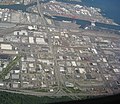 Industrial District - Seattle.jpg 2,817 × 2,448; 3.21 MB
-
 Industrial District - SoDo Seattle.jpg 3,264 × 2,448; 3.92 MB
-
 Industrial District, Seattle, WA, USA - panoramio (1).jpg 2,931 × 2,617; 1.52 MB
-
 Industrial District, Seattle, WA, USA - panoramio (2).jpg 4,608 × 3,456; 3.39 MB
-
 Industrial District, Seattle, WA, USA - panoramio (3).jpg 4,608 × 3,456; 3.41 MB
-
 Industrial South Seattle - Flickr - brewbooks.jpg 3,264 × 2,448; 3.97 MB
-
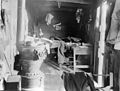 Interior of shack in Seattle tideflats, 1915.jpg 3,159 × 2,400; 992 KB
-
-
 Jackson Street Regrade, June 10, 1908 - DPLA - 97f4eb554efec498bc282cbabedbb9be.jpg 5,920 × 4,789; 1.41 MB
-

-

-
-
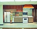 Kitchen at Seattle City Light south service center, 1970 (52887432588).jpg 3,774 × 2,984; 6.48 MB
-

-
 Line0535.jpg 700 × 1,040; 137 KB
-
 Looking across Pike Place Market to Elliott Bay.jpg 3,264 × 2,448; 1.96 MB
-

-
-

-

-
 Missing Dawg Ad (3800697714).jpg 3,888 × 2,592; 3.08 MB
-

-
 Newell Mill Co, Seattle, Washington (CURTIS 1487).jpeg 750 × 512; 84 KB
-
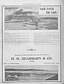
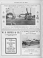
 Normal business of Puget Sound... - panoramio.jpg 3,264 × 2,448; 2 MB
-

-
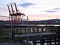 Orange cranes.jpg 1,024 × 768; 570 KB
-
 Out In Elliot Bay May 2012 (192451759).jpeg 2,048 × 1,157; 541 KB
-
 Over the Duwamish River - Flickr - brewbooks.jpg 1,920 × 1,080; 1.3 MB
-

-
-

-
 Panorama of harbor and shipyards, Seattle (CURTIS 475).jpeg 768 × 602; 58 KB
-
 Panorama of harbor and shipyards, Seattle (CURTIS 476).jpeg 768 × 614; 44 KB
-
 Panorama of harbor and shipyards, Seattle (CURTIS 477).jpeg 768 × 609; 39 KB
-
 Panorama of harbor and shipyards, Seattle (CURTIS 478).jpeg 768 × 622; 32 KB
-
 Panorama of Seattle from Beacon Hill (CURTIS 88).jpeg 768 × 610; 58 KB
-
 Pike Place Market Park - panoramio (2).jpg 4,000 × 2,656; 2.43 MB
-
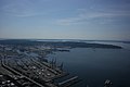
 Port of Seattle (16803440368).jpg 2,048 × 1,477; 2.23 MB
-
 Port of Seattle - panoramio.jpg 1,080 × 720; 173 KB
-
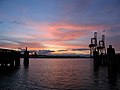 Port of Seattle at Sundown.jpg 1,024 × 768; 471 KB
-
 Port of Seattle.JPG 2,560 × 1,920; 1.12 MB
-
 Port of seattle.jpg 2,240 × 1,680; 1.45 MB
-

-

-
 Quick Shuttle (7878896592).jpg 5,184 × 3,456; 5.67 MB
-

-
 Riding Sound Transit - panoramio.jpg 4,608 × 3,456; 3.84 MB
-
 Riding Sound Transit to Tukwila - Flickr - brewbooks.jpg 3,888 × 2,592; 3.01 MB
-
 Sales - panoramio.jpg 3,264 × 2,448; 2.02 MB
-

-
 San Juan Fishing and Packing Co, Seattle (CURTIS 42).jpeg 768 × 597; 55 KB
-
 Seattle (34865278061).jpg 4,608 × 3,456; 7.73 MB
-
 Seattle - 4th Avenue Drive-In - 1940.jpg 1,200 × 925; 320 KB
-
 Seattle - bridge or viaduct work at Spokane Street and Airport Way, 1963.jpg 1,200 × 959; 358 KB
-
 Seattle - Discovery Park 06.jpg 2,592 × 1,944; 2.45 MB
-
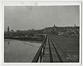
 Seattle - East Waterway Terminal, 1915 (22761986476).jpg 3,357 × 2,499; 1.74 MB
-
 Seattle - Federal Center South 01.jpg 4,288 × 2,848; 5.87 MB
-
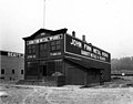
 Seattle - Fluckinger Machine Works sign.jpg 3,264 × 2,448; 1.85 MB
-
 Seattle - Harbor Island and East Duwamish Waterway, circa 1980 (24751255614).jpg 1,200 × 794; 238 KB
-
 Seattle - Harbor Island and Mount Rainier, featuring Fisher Flour Mill.jpg 4,288 × 2,848; 5.24 MB
-
 Seattle - Horses and wagons on W. Spokane Street, 1918 (45684961052).jpg 1,200 × 775; 182 KB
-
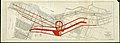
 Seattle - Industrial District map.jpg 1,169 × 1,474; 378 KB
-
 Seattle - industrial waterfront 1915.jpg 2,812 × 1,752; 1.23 MB
-
 Seattle - Island Tug and Barge 01.jpg 4,288 × 2,848; 4.84 MB
-
 Seattle - Island Tug and Barge 02.jpg 4,288 × 2,848; 4.35 MB
-
 Seattle - Jack Block pano.jpg 11,371 × 1,691; 2.26 MB
-
 Seattle - Lander Street sewer construction, 1910 (48250199862).gif 718 × 1,237; 735 KB
-
 Seattle - Lander Street sewer pipeline being built over tide flats, 1910.jpg 1,200 × 916; 339 KB
-
 Seattle - Northern Fish Co. Pier from Centennial Mill, 1903.jpg 1,555 × 936; 212 KB
-
 Seattle - Ontario Motel 01.jpg 4,288 × 2,848; 4.43 MB
-
 Seattle - panoramic view from Water Taxi at Seacrest Park 01.jpg 8,988 × 1,712; 4.02 MB
-
 Seattle - panoramio (5).jpg 3,715 × 1,103; 385 KB
-
 Seattle - panoramio.jpg 1,599 × 1,199; 362 KB
-
 Seattle - Salty's at Alki from the water 01 (cropped).jpg 2,580 × 1,708; 2.05 MB
-
 Seattle - Salty's at Alki from the water 01.jpg 4,288 × 2,848; 5.37 MB
-
 Seattle - Sound Transit light rail under construction 01.jpg 2,592 × 1,944; 748 KB
-
 Seattle - Sound Transit light rail under construction 02.jpg 2,592 × 1,944; 775 KB
-
 Seattle - South Oregon Street near the Duwamish River 01.jpg 6,000 × 4,000; 10.81 MB
-
 Seattle - stadiums from Elliott Bay 01.jpg 4,288 × 2,848; 4.48 MB
-
 Seattle - structures east of Centennial Mill on pier, 1903.jpg 2,541 × 1,134; 423 KB
-
 Seattle - sunset near Qwest Field 01.jpg 2,592 × 1,944; 564 KB
-
 Seattle - sunset near Qwest Field 01A.jpg 2,592 × 1,944; 773 KB
-
 Seattle - sunset near Qwest Field 02.jpg 2,592 × 1,944; 615 KB
-
 Seattle - sunset near Qwest Field 02A.jpg 2,592 × 1,944; 829 KB
-
 Seattle - sunset near Qwest Field 03.jpg 2,592 × 1,944; 627 KB
-
 Seattle - sunset near Qwest Field 03A.jpg 2,592 × 1,944; 796 KB
-
 Seattle - The Big Building.jpg 2,592 × 1,944; 731 KB
-
 Seattle - Triple X Root Beer - 1940.jpg 1,200 × 914; 298 KB
-
 Seattle - View from José Rizal Park, circa 1980 (51372642414).jpg 4,012 × 2,551; 8.27 MB
-
 Seattle - view west from Beacon Hill 01.jpg 3,264 × 2,448; 2.21 MB
-
 Seattle - worker on Spokane Street sewer project, 1918 (50404547698).jpg 4,466 × 2,921; 3.94 MB
-
 Seattle 1903 tidelands promo drawing.jpg 663 × 254; 35 KB
-
 Seattle City Council District 1 neighborhoods.png 3,639 × 3,641; 4.59 MB
-
 Seattle City Light south service center, 1998.jpg 1,200 × 802; 257 KB
-
 Seattle container port, seen from Smith Tower.jpg 4,288 × 2,848; 3.38 MB
-
 Seattle container port.jpg 3,072 × 1,728; 1.16 MB
-
 Seattle containers.jpg 1,024 × 768; 437 KB
-
 Seattle GM New Look bus on Airport Way in 1983.jpg 1,872 × 1,227; 756 KB
-
 Seattle in 2013.jpg 2,048 × 1,536; 1.01 MB
-
-

-

-
-

-

-
 Seattle Map - Industrial District.png 394 × 698; 14 KB
-
 Seattle National Weather Service docks adjacent to downtown viaduct.jpg 700 × 962; 128 KB
-
 Seattle pano from Jack Block Park -June 2010.jpg 9,753 × 3,003; 2.57 MB
-
 Seattle port cranes 01.jpg 2,515 × 1,536; 1.21 MB
-
 Seattle port cranes 03.jpg 2,492 × 1,678; 1.28 MB
-
 Seattle skyline 1 Sept 2008 wide pano.jpg 18,053 × 1,546; 6.62 MB
-
 Seattle skyline from west, between 1903 and 1906 (SEATTLE 6142).jpg 768 × 550; 22 KB
-
 Seattle Space Needle view August 26, 2015.jpg 2,156 × 1,321; 925 KB
-
 Seattle Tide Lands, Volume Two, index, 1894-1896 (MOHAI 13416).jpg 1,200 × 926; 201 KB
-

-
 Seattle tideflats from Beacon Hill, 1900 (SEATTLE 537).jpg 768 × 607; 82 KB
-
 Seattle tideflats, Seattle (CURTIS 472).jpeg 768 × 606; 52 KB
-
 Seattle tideflats, Seattle (CURTIS 473).jpeg 768 × 557; 50 KB
-
 Seattle, from Beacon Hill (CURTIS 87).jpeg 768 × 621; 56 KB
-
-
 Seattle,Washington,USA. - panoramio (3).jpg 1,649 × 1,043; 367 KB
-
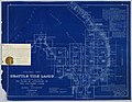
 Seattle-1911-map-Industrial-District.jpg 815 × 751; 315 KB
-
 Seattle-Columbia-Center-looking-SSW.jpg 3,658 × 1,089; 976 KB
-
 Seattleport1.jpg 600 × 450; 47 KB
-
 SeattleSkylineSuperPanorama.jpg 24,285 × 1,164; 4.54 MB
-
 SeattleWaterfrontFromSafeco.jpg 1,632 × 1,232; 459 KB
-
 Selfie (15812177332).jpg 6,028 × 4,012; 2.18 MB
-
 Smith Cannery Machines Company, ca. 1915 - DPLA - c310ee4ae29e17e5960aad9b19688677.jpg 7,341 × 6,029; 5.18 MB
-
 Snopac Innovator 01.jpg 4,288 × 2,848; 4.53 MB

.jpg)
.jpg)
.jpg)
.jpg)

.jpg)
.jpg)
_(cropped).jpg)
.jpg)


.jpg)


.jpg)
.jpg)

.jpg)
.jpeg)

.jpg)
.jpg)
.jpg)
.jpg)
.jpg)
.jpg)


.jpg)


.jpeg)
.jpg)
.jpeg)


.jpg)
.jpg)
.jpg)

.jpg)

.jpg)
.jpg)


.jpg)
.jpg)
.jpg)


.jpg)
.jpg)
.jpeg)
.jpg)
.jpg)


.jpeg)
.jpg)
.jpeg)
.jpeg)


.jpeg)

.jpg)
.jpeg)
.jpeg)
.jpeg)
.jpeg)
.jpeg)
.jpeg)
.jpg)
.jpg)


.jpg)
.jpg)
.jpg)

.jpg)
.jpeg)
.jpg)


.jpg)


.jpg)

.jpg)


.gif)


.jpg)


.jpg)
.jpg)


.jpg)
.jpg)
.jpg)
.jpg)
.jpg)
.jpg)


.jpg)

.jpg)
.jpeg)
.jpeg)

.jpg)


.jpg)


.jpeg)
.jpg)
.jpg)
.jpeg)
.jpeg)
.jpg)
.jpeg)
.jpg)
.jpeg)