Category:Industry buildings in Knottingley
Media in category "Industry buildings in Knottingley"
The following 19 files are in this category, out of 19 total.
-
 Ardagh Group glass factory - geograph.org.uk - 4881731.jpg 1,024 × 683; 128 KB
-
 Ardagh Group Knottingley glass factory - geograph.org.uk - 4881828.jpg 640 × 1,024; 166 KB
-
 Ardagh Group on Spawd Bone Lane, Knottingley - geograph.org.uk - 4121869.jpg 1,600 × 1,064; 592 KB
-
 Buildings alongside Knottingley ^ Goole Navigation - geograph.org.uk - 4120406.jpg 1,600 × 1,064; 461 KB
-
 Canal bridge - geograph.org.uk - 2803128.jpg 4,288 × 3,216; 2.26 MB
-
 Celeste on the Knottingley ^ Goole Navigation - geograph.org.uk - 4120409.jpg 1,600 × 1,064; 816 KB
-
 Eskdale barge moored at Ferrybridge - geograph.org.uk - 6304180.jpg 4,608 × 3,072; 1.93 MB
-
 Fernley Green Road, Knottingley - geograph.org.uk - 4119025.jpg 1,600 × 1,064; 431 KB
-
 Harkers Boatyard and Glassworks - geograph.org.uk - 5653159.jpg 4,608 × 3,456; 2.62 MB
-
 Hydro electric plant on King's Mill weir - geograph.org.uk - 5647256.jpg 4,025 × 2,718; 2.43 MB
-

-
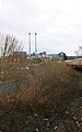
 Industry in Knottingley - geograph.org.uk - 4118546.jpg 1,600 × 1,064; 685 KB
-
 Knottingley ^ Goole Navigation - geograph.org.uk - 4120381.jpg 1,600 × 1,064; 458 KB
-
 Silos at Plasmor, off Womersley Road, Knottinghley - geograph.org.uk - 6003656.jpg 2,560 × 1,920; 2.42 MB
-
 Stolzle Flacconage, Knottingley - geograph.org.uk - 5266676.jpg 640 × 480; 39 KB
-
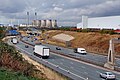 TK Maxx warehouse next to the M62 - geograph.org.uk - 5973139.jpg 4,608 × 3,072; 3.14 MB
-
 Total depot on Pottery Lane, Ferrybridge - geograph.org.uk - 4121814.jpg 1,600 × 1,064; 489 KB
-

-


