Category:Information boards in Landkreis Bamberg
Urban districts (cities): Amberg · Ansbach · Augsburg · Bamberg · Bayreuth · Coburg · Erlangen · Fürth · Hof · Ingolstadt · Kaufbeuren · Landshut · Memmingen · Munich · Nuremberg · Passau · Regensburg · Rosenheim · Schweinfurt · Straubing · Würzburg
Media in category "Information boards in Landkreis Bamberg"
The following 38 files are in this category, out of 38 total.
-
 Burgebrach Grasmannsdorfer Straße (02).jpg 4,734 × 3,876; 5.03 MB
-
 Burgebrach St Vitus (03).jpg 5,184 × 3,720; 6.22 MB
-
 Freizeitkarte Oberhaid vor der Kellergasse nördlich von Unterhaid.jpg 4,920 × 3,407; 8.96 MB
-
 Geologischer Aufschluss am Bamberger Kreuzberg nördlich von Dörfleins (Hinweistafel).jpg 6,000 × 4,000; 10.6 MB
-
 Grasmannsdorf Nikolaibrücke (04).jpg 4,926 × 3,414; 6.48 MB
-
 Hirschaider Wässerwiesen Infotafel-20190523-RM-164811.jpg 4,163 × 2,867; 4.12 MB
-
 Hirschaider Wässerwiesen Infotafel-20190523-RM-164825.jpg 5,150 × 3,614; 6.48 MB
-

-
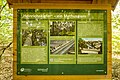
 Informationstafel Der Bamberger Hauptsmoorwald an der Kunigundenruh.jpg 5,379 × 3,704; 8.28 MB
-
 Informationstafel Der Stoffkreislauf im Wald im Hauptsmoor.jpg 6,000 × 4,000; 12.65 MB
-
 Informationstafel Die Hornisse im Hauptsmoor.jpg 6,000 × 4,000; 11.28 MB
-
 Informationstafel Felsenkeller in Lauter.jpg 5,274 × 4,000; 12.43 MB
-
 Informationstafel Heimische Vogelarten im Hauptsmoor.jpg 6,000 × 4,000; 9.06 MB
-
 Informationstafel Heinrichskiefer im Hauptsmoor.jpg 6,000 × 4,000; 9.11 MB
-
 Informationstafel im NWR Seelaub.jpg 4,667 × 3,470; 8.12 MB
-
 Informationstafel Kunigundenmartern im Hauptsmoor.jpg 6,000 × 4,000; 9.94 MB
-
 Informationstafel Lauf der Itz bei Daschendorf.jpg 6,000 × 4,000; 10.54 MB
-
 Informationstafel Nutzfunktionen des Waldes im Hauptsmoor.jpg 6,000 × 4,000; 11.23 MB
-
 Informationstafel Oberjägermarter im Hauptsmoor.jpg 4,600 × 3,817; 9.02 MB
-
 Informationstafel Wasserwandern auf dem Main bei der Kanuanlegestelle Staffelbach.jpg 4,725 × 3,845; 6.95 MB
-
 Informationstafel Wiesenbewässerung bei Daschendorf.jpg 6,000 × 4,000; 11.47 MB
-
 Informationstafel zum Rathauskeller Viereth D-4-71-207-41 2.jpg 3,462 × 3,176; 5.98 MB
-
 Informationstafel zum Rathauskeller Viereth D-4-71-207-41.jpg 5,514 × 4,000; 8.74 MB
-
 Ivo Hennemann Kopie.jpg 1,330 × 2,362; 432 KB
-
 Jungfernhoehle (Tafel).jpg 1,600 × 1,442; 674 KB
-
 Kapellenweg Königsfeld.jpg 3,281 × 4,213; 3.6 MB
-
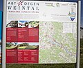 Karte und Informationstafel Abt-Degen-Weintal bei der Kanuanlegestelle Staffelbach.jpg 4,659 × 3,840; 7.52 MB
-
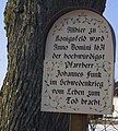
 Pfarrer-Funk-Gedenktafel gegenüber der Aufseßquelle - panoramio.jpg 1,428 × 1,448; 262 KB
-
 PfarrerFunkDenkmal.jpg 615 × 685; 84 KB
-
 Königsfeld.jpg 4,608 × 3,456; 4.21 MB
-
 Litzendorf Hügelgräber Explanation plate P2RM0139.jpg 4,478 × 3,456; 7.19 MB
-
 Mürsbach, St. Sebastian (59).jpg 4,617 × 3,652; 2.64 MB
-
 Mürsbach, St. Sebastian (64).jpg 2,243 × 2,608; 1.56 MB
-
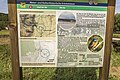
 Oberleinleiter Basaltbruch Infotafel-20200327-RM-160908.jpg 2,485 × 3,962; 3.39 MB
-
 Roßdorf am Forst Infotafel-20210929-RM-151151.jpg 2,243 × 2,607; 1.87 MB
-
 Veitenstein Erklärungstafel 0229-2.jpg 3,777 × 3,390; 7.96 MB
-
 Wanderkarte am Parkplatz Johannishof (1).jpg 5,200 × 3,818; 9.55 MB
-
 Wanderkarte am Parkplatz Johannishof (2).jpg 3,721 × 4,902; 8.48 MB
.jpg)
.jpg)

.jpg)
.jpg)


.jpg)


.jpg)
.jpg)


.jpg)
.jpg)