Category:Information boards in Landkreis Schwäbisch Hall
Urban districts (cities): Baden-Baden · Freiburg · Heidelberg · Heilbronn · Karlsruhe · Mannheim · Pforzheim · Stuttgart ·
Deutsch: Informationstafeln im Landkreis Schwäbisch Hall
Subcategories
This category has only the following subcategory.
Media in category "Information boards in Landkreis Schwäbisch Hall"
The following 34 files are in this category, out of 34 total.
-
 2014-05-04 Gruendischer Brunnen Infotafel 1.jpg 2,727 × 3,732; 11.71 MB
-
 2014-05-04 Gruendischer Brunnen Infotafel 2.jpg 2,376 × 3,302; 9.1 MB
-
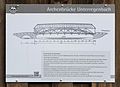 2017-04-17 Archenbrücke Unterregenbach Infotafel.jpg 2,314 × 1,680; 2.48 MB
-
 Altenbergturm-08-Tafel.jpg 4,320 × 3,240; 5.67 MB
-
 Bühlertann, Tannenburg, Burgkapelle, Informationstafel.JPG 2,112 × 2,816; 2.5 MB
-
 Bühlertann, Tannenburg, Informationstafel am inneren Burgtor.JPG 2,112 × 2,816; 2.32 MB
-
 Crailsheim johanneskirche tafel.jpg 3,456 × 4,608; 4.71 MB
-
 Crailsheim Süddeutschland 2010 1010192.jpg 3,000 × 4,000; 4.04 MB
-
 Crailsheim Süddeutschland 2010 1010311.jpg 3,000 × 4,000; 3.99 MB
-
 Erhardskapelle (Comburg) Info.jpg 4,592 × 2,584; 6.84 MB
-
 Exterior of St. Michael (Schwäbisch Hall) Info.jpg 2,584 × 4,592; 6.69 MB
-
 Fichtenberg 2018 07.jpg 3,975 × 2,783; 1.5 MB
-
 Fichtenberg 2018 08.jpg 3,292 × 3,376; 1.01 MB
-
 InfoTafel 1 zur Landhege in Mainhardt, Zoom.jpg 2,224 × 1,447; 1.73 MB
-
 InfoTafel 1 zur Landhege in Mainhardt.jpg 3,024 × 3,024; 3.15 MB
-
 InfoTafel 2 zur Landhege in Mainhardt, Zoom.jpg 2,768 × 1,982; 2.9 MB
-
 InfoTafel 2 zur Landhege in Mainhardt.jpg 3,024 × 3,024; 3.03 MB
-
 Infotafel 3, die Räuber vom Mainhardter Wald und die Landhege.jpg 2,987 × 2,890; 4.97 MB
-
 InfoTafel 4 zur Landhege in Mainhardt, Zoom.jpg 2,755 × 1,958; 3.38 MB
-
 Katzensteinmsu.JPG 1,536 × 2,048; 673 KB
-
 Kernerturm-02-Tafel.jpg 4,320 × 3,240; 5.56 MB
-
 Landappbw 218080 1824 Bergwerk ehemaliges Steinsalzbergwerk Wilhelmsglück.jpg 3,264 × 1,840; 1.35 MB
-
 Landappbw 218087 1824 Brücke Infotafel Kochersteg Wilhelmsglück.jpg 1,840 × 3,263; 810 KB
-
 Landappbw 345980 1820 Wings of Hope vor der Michaelskirche Sulzbach am Kocher.jpg 3,264 × 1,840; 1.3 MB
-
 Landappbw 645526 1824 Wegweiser Wegweiser Gaildorf.jpg 1,839 × 3,264; 923 KB
-
 Leofels Plan.jpg 2,048 × 1,536; 1.22 MB
-
 Naturschutzgebiet Ahorn-Lindenwald 202006 02.jpg 3,024 × 4,032; 4.72 MB
-
 Schlittenweg Schmiedelfelder Forst (Nestelberg) Ebnisee.JPG 3,200 × 2,400; 3.83 MB
-
 Schloss Tullau Info.jpg 2,584 × 4,592; 6.73 MB
-
 Schwäbisch Hall Infotafel.jpg 2,816 × 1,880; 1.62 MB
-
 St Bonifatius - Crailsheim 002.jpg 6,000 × 4,000; 10.53 MB
-
 St. Johannes Baptist (Steinbach) Info.jpg 2,584 × 4,592; 6.83 MB
-
 Untere Herrngasse 2 Schwäbisch Hall 6.JPG 3,240 × 4,320; 4.65 MB
-
 ViereckschanzeLangenburgHinweisschild.jpg 3,888 × 2,592; 3.93 MB


_Info.jpg)
_Info.jpg)


_Ebnisee.JPG)


_Info.jpg)

