Category:Information boards in the United States
Countries of North America: Canada · Costa Rica · El Salvador · Haiti · Mexico · United States of America‡
Other territories: Greenland · Guadeloupe
‡: partly located in North America
Other territories: Greenland · Guadeloupe
‡: partly located in North America

Subcategories
This category has the following 19 subcategories, out of 19 total.
*
A
C
- Information boards in California (16 F)
- Information boards in Colorado (14 F)
H
- Information boards in Hawaii (3 F)
I
- Information boards in Indiana (empty)
M
- Information boards in Minnesota (39 F)
N
- Information boards in Nevada (27 F)
U
- Information boards in Utah (5 F)
V
W
Media in category "Information boards in the United States"
The following 30 files are in this category, out of 30 total.
-
-
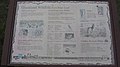
 Chapters in Athens Heritage-A School and Town Develop-1.jpg 4,032 × 3,024; 4.27 MB
-
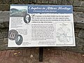
 Chapters in Athens History 2.jpg 4,032 × 3,024; 3.7 MB
-
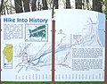 Chicago Portage Hike Into History.JPG 2,061 × 1,616; 1.56 MB
-
-
 Downtown lakeland signage with a map.jpg 6,936 × 9,248; 13.07 MB
-
 Dunckley Pass information boards.JPG 5,471 × 3,792; 15.57 MB
-
 Dunckley Pass.JPG 4,879 × 3,601; 16.19 MB
-
 Estados Unidos, carteles 1997 05.jpg 1,062 × 665; 678 KB
-
 Estados Unidos, carteles 1997 06.jpg 710 × 1,062; 916 KB
-
 Francis E. Walter Dam Information Sign.jpeg 1,463 × 2,168; 1.43 MB
-
 Fremont Meadow Commemorative Sign.jpg 2,797 × 2,098; 2.53 MB
-
 GAP's Boston Trail Map and Point of Interest (50066981891).jpg 3,024 × 4,032; 2.96 MB
-
 Athens GA Downtown Street Sign Map 1.jpg 3,024 × 4,032; 2.81 MB
-
 Glover-Archbold-Park-DC.jpg 2,272 × 1,704; 768 KB
-
 Information kiosk.jpg 3,263 × 2,175; 603 KB
-
 Kenilwoth Park and Aquatic Garden views 02.jpg 4,032 × 3,024; 3.37 MB
-
 Map of Chicago Portage.JPG 1,016 × 1,179; 472 KB
-
 Memorial to the "Start Westward of the United States" (front).jpg 4,032 × 2,268; 17.63 MB
-
 Meyersdale's Trail Map and Points of Interest (49852090598).jpg 3,024 × 4,032; 2.77 MB
-
 Monumento Nacional Navajo 1989 08.jpg 1,019 × 727; 590 KB
-
 PHL Terminal A Information Boards.jpg 3,264 × 2,448; 1.72 MB
-
 PHL Terminal F Information Board.jpg 4,000 × 3,000; 2.99 MB
-
 Piceance State Wildlife Area information boards.JPG 6,000 × 4,000; 16.56 MB
-
 Rainbow Bridge 1989 01.jpg 1,060 × 660; 571 KB
-
 Ripple Creek Overlook.JPG 5,567 × 3,527; 15.94 MB
-
 River Ridge Trail Information board.jpg 1,536 × 2,048; 1.82 MB
-
 Scrubgrass Run Abandoned Mine Drainage Project sign.jpg 4,032 × 3,024; 2.04 MB
-
 Shivering Sands Natural Area and Cave Point Clay Banks Natual Area.jpg 3,072 × 4,080; 3.82 MB
-
 View from Dunckley Pass.JPG 3,914 × 2,710; 10.64 MB
.JPG)


.JPG)


.jpg)


.jpg)
.jpg)


