Category:Inondation risk maps of Gers (department)
Subcategories
This category has only the following subcategory.
Media in category "Inondation risk maps of Gers (department)"
The following 2 files are in this category, out of 2 total.
-
32-UHR.jpg 5,457 × 3,543; 1,009 KB
-
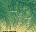
France Rivers of Gers with 1977 inundation effects.svg 625 × 557; 964 KB

