Category:Insel Werd
| Object location | | View all coordinates using: OpenStreetMap |
|---|
island in Lake Constance, Switzerland  | |||||
| Upload media | |||||
| Instance of | |||||
|---|---|---|---|---|---|
| Part of | |||||
| Location |
| ||||
| Located in or next to body of water | |||||
| Heritage designation |
| ||||
| Width |
| ||||
| Length |
| ||||
| Population |
| ||||
| Area |
| ||||
 | |||||
|
This is a category about a cultural property of national significance in Switzerland with KGS number 10238
|
Media in category "Insel Werd"
The following 34 files are in this category, out of 34 total.
-
 2007-07-19 Insel Werd 03.jpg 7,240 × 1,341; 3.52 MB
-
 2007-07-19 Insel Werd 06.jpg 8,502 × 1,925; 6.68 MB
-
 2007-07-19 Insel Werd 09.jpg 5,335 × 1,876; 4.24 MB
-
 2007-07-19 Insel Werd 360°.jpg 13,298 × 1,349; 6.55 MB
-
 2008-03-01 Insel Werd 01.jpg 4,498 × 1,382; 1.96 MB
-
 2008-03-01 Insel Werd 02 360°.jpg 13,245 × 1,278; 5.27 MB
-
 2008-03-01 Insel Werd 03.jpg 9,636 × 1,378; 3.78 MB
-
 2008-03-01 Insel Werd 04.jpg 11,165 × 1,376; 4.04 MB
-
 2008-03-01 Insel Werd 05.jpg 7,335 × 1,481; 3.87 MB
-
 2008-03-01 Insel Werd 06.jpg 5,226 × 1,900; 2.69 MB
-
 2008-03-01 Insel Werd 07.jpg 4,510 × 1,396; 1.96 MB
-
 2008-03-01 Insel Werd 08.jpg 5,662 × 1,403; 2.52 MB
-
 Aerials SH 20.09.2005 15-11-03.jpg 1,947 × 1,459; 2.06 MB
-
 Aerials SH 20.09.2005 15-11-24.jpg 1,499 × 1,376; 2.07 MB
-
 Aerials SH 20.09.2005 15-11-31.jpg 1,750 × 1,367; 2.12 MB
-
 CH-TG-Eschenz-Insel Werd 001.jpg 12,720 × 3,712; 12.25 MB
-
 Eschenz mit Werd.JPG 1,605 × 1,038; 529 KB
-
 Eschenz-Insel-Werd.jpg 2,000 × 1,333; 2.7 MB
-
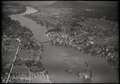 ETH-BIB-Stein am Rhein, Insel Werd-LBS H1-010738.tiff 6,438 × 4,487; 82.84 MB
-
 ETH-BIB-Stein am Rhein, Insel Werd-LBS H1-017278.tif 6,462 × 4,535; 84 MB
-
 ETH-BIB-Stein am Rhein, Insel Werd-LBS H1-017282.tiff 6,471 × 4,508; 83.61 MB
-
 Im 1957 in Eschenz (Insel Werd) 04.jpg 2,272 × 1,704; 776 KB
-
 Insel Werd im Rhein, Okt. 2017.jpg 4,000 × 3,000; 10.03 MB
-
 Insel Werd.jpg 4,531 × 2,675; 10.1 MB
-
 InselWerd.JPG 1,280 × 960; 488 KB
-
 Merian Stein am Rhein 1642.jpg 3,000 × 1,861; 2.91 MB
-
 Steg zur Insel Werd.jpg 3,456 × 5,184; 6.53 MB
-
 Stein am Rhein (27762064738).jpg 3,024 × 4,032; 3.83 MB
-
 Stein am Rhein - Blick auf Insel Werd (8-2011) - panoramio.jpg 1,000 × 750; 330 KB
-
 Stein am Rhein - Insel Werd (8-2011) - panoramio (1).jpg 1,000 × 750; 264 KB
-
 Stein am Rhein Übersicht.JPG 3,908 × 2,591; 2.87 MB
-
 Werdinsel Brücke.JPG 4,000 × 3,000; 6.07 MB
-
 Werdinsel Spirale.JPG 4,000 × 3,000; 6.38 MB
-
 Werdinseln.JPG 4,000 × 3,000; 3.91 MB


_04.jpg)


.jpg)
_-_panoramio.jpg)
_-_panoramio_(1).jpg)


