Category:Interstate 35 in Oklahoma
section of Interstate Highway in Oklahoma, United States .svg) _map.svg) | |||||
| Upload media | |||||
| Instance of | |||||
|---|---|---|---|---|---|
| Part of | |||||
| Location | |||||
| Transport network | |||||
| Length |
| ||||
| Terminus | |||||
| |||||
English: Media related to Interstate 35 in Oklahoma (I‑35), a 235.96-mile (379.74 km) section of Interstate Highway in Oklahoma, United States, that connects I‑35/U.S. Route 77 in Texas with I‑35/Kansas Turnpike in Kansas.
Subcategories
This category has the following 2 subcategories, out of 2 total.
2
Media in category "Interstate 35 in Oklahoma"
The following 22 files are in this category, out of 22 total.
-
 HPIM2184.JPG 3,040 × 2,288; 1.1 MB
-
 I-35 (OK 1957).svg 600 × 600; 18 KB
-
 I-35 (OK) map.svg 1,475 × 860; 287 KB
-
 I-35 (OK).svg 601 × 601; 17 KB
-
 I-35 Oklahoma City2.jpg 2,048 × 1,365; 308 KB
-
 I-35 SOUTH I-44 WEST Okla City Downtown.png 1,904 × 1,874; 298 KB
-
 I35i40us62.jpg 1,656 × 1,242; 591 KB
-
 I35oklahoma102.jpg 1,536 × 399; 68 KB
-
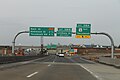
 Int35nRoadOK-Exit231-US177 (28324241129).jpg 2,400 × 1,600; 1.71 MB
-
 Interstate 35 at Main St in Norman Okla.jpg 3,088 × 2,056; 1.55 MB
-
 Interstate 35 U.S. 70 concurrency.jpg 4,032 × 3,024; 2.04 MB
-
 Marietta and Overbrook Oklahoma Aerial (50995462888).jpg 2,400 × 3,600; 3.92 MB
-
 Marietta Oklahoma Aerial (50995462888) (cropped).jpg 1,477 × 1,036; 860 KB
-
 Ok145.jpg 1,256 × 942; 354 KB
-
 Ok9east.jpg 2,576 × 1,932; 1.26 MB
-
 Ok9east2.jpg 1,656 × 1,242; 608 KB
-
 Ok9east3.jpg 4,272 × 2,848; 3.06 MB
-
 Oklahoma City, Oklahoma 1955 Yellow Book.jpg 800 × 818; 154 KB
-
 Oklahoma City, United States (Unsplash).jpg 5,472 × 3,648; 1.26 MB
-
 Oklahoma I-35 exit 66.jpg 2,048 × 1,536; 725 KB
-
 Oklahoma Sign I-35.jpg 3,264 × 2,448; 1.67 MB
-
 Sign gantry downed, I-35 Norman OK.jpg 1,869 × 1,402; 544 KB

.svg)


.jpg)


.jpg)
_(cropped).jpg)


.jpg)


