Category:Interstate 43
 | number: | (fourty-three) |
|---|---|---|
| Interstate Highways: | 24 · 25 · 26 · 27 · 29 · 30 · 35 · 37 · 39 · 40 · 41 · 42 · 43 · 44 · 45 · 49 · 55 · 57 · 59 |
Interstate Highway in Wisconsin, United States   | |||||
| Upload media | |||||
| Instance of | |||||
|---|---|---|---|---|---|
| Location | Wisconsin | ||||
| Transport network | |||||
| Owned by | |||||
| Maintained by | |||||
| Inception |
| ||||
| Length |
| ||||
 | |||||
English: Media related to Interstate 43, a 191.55-mile (308.27 km) Interstate Highway entirely within Wisconsin, United States.
Subcategories
This category has the following 4 subcategories, out of 4 total.
Media in category "Interstate 43"
The following 36 files are in this category, out of 36 total.
-
 AcuityInsuranceSign.jpg 1,582 × 590; 215 KB
-
 Aerial view of Denmark, Wisconsin and vicinity in Brown and Manitowoc counties, Wisconsin 2020.png 9,488 × 12,564; 219.02 MB
-
 Availability of data on 6-lane Freeway in January.pdf 1,650 × 1,275; 166 KB
-
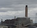
 Edgewater Generating Station - panoramio.jpg 3,648 × 2,736; 2.35 MB
-
 Green Bay Skyline - panoramio.jpg 3,648 × 2,736; 557 KB
-
 HankAaronStateTrail, ValleyPowerPlant.jpg 1,200 × 800; 165 KB
-
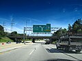
 I-43 at Wisconsin Highway 20.jpg 2,304 × 1,728; 913 KB
-
 I43 Ex72C.JPG 1,280 × 960; 317 KB
-
 I43atU S 151Sign.jpg 2,304 × 1,728; 942 KB
-
 I43atWis83.jpg 2,304 × 1,728; 804 KB
-
 I43WIS57Offramp.jpg 2,304 × 1,728; 823 KB
-
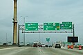
 Int43nInt94wRoad-Int794eSign (28429233786).jpg 1,200 × 800; 372 KB
-
 Int43nInt94wUS41nSignsRoadCurve (28429233686).jpg 1,200 × 800; 612 KB
-
 Int43nRoad-CrossingRampsInt794 (28429233916).jpg 1,200 × 800; 467 KB
-
 Int43nRoad-Exit310C-Int794-Int94-US41 (33836245510).jpg 2,400 × 1,600; 1.48 MB
-
 Int43nRoad-Exit76A-Wis190eSign (28429234016).jpg 1,200 × 800; 473 KB
-
 Int43nRoadSign (28429234166).jpg 1,200 × 800; 464 KB
-
 Int43sRoad-Exit82A-Wis32Sign (28461666475).jpg 1,200 × 800; 494 KB
-
 Int43sRoad-Exit82AB-Wis32sWis100w (27845493183).jpg 1,200 × 800; 465 KB
-
 Int43sWis32sWis57sLakeCircleTourSignsRoad (28461665775).jpg 1,200 × 800; 450 KB
-
 Int94wInt43nMileMarker (28429233516).jpg 1,200 × 800; 467 KB
-
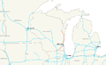 Interstate 43 map.png 2,128 × 1,286; 59 KB
-
 Interstate 43.jpg 2,048 × 1,536; 1.02 MB
-
 J. P. Pulliam Generating Station - panoramio.jpg 3,648 × 2,736; 2.26 MB
-
 Junction of I-43 and I-894, Near Milwaukee, Wisconsin (9181914524).jpg 4,000 × 3,000; 2.54 MB
-
 Marq Approach 0207a.JPG 1,280 × 960; 319 KB
-
 Marq approach 0207b.JPG 1,280 × 960; 322 KB
-
 Marq Const 0207a.JPG 1,280 × 960; 326 KB
-
 Sheboygan Tower 3 - panoramio.jpg 3,648 × 2,736; 2.39 MB
-
 The Road to Milwaukee (17954814).jpg 1,600 × 1,200; 478 KB
-
 Wis120NorthernTerminus.jpg 2,304 × 1,434; 622 KB
-
 WIS23I43.jpg 2,304 × 1,728; 607 KB
-
 WIS28I43.jpg 2,304 × 1,728; 746 KB
-
 WIS42I43.jpg 2,304 × 1,728; 751 KB
-
 Wisconsin Av Ovrpss.JPG 1,280 × 960; 329 KB
-
 Wisconsin Highway 11 at Interstate 43.jpg 1,936 × 1,288; 987 KB


.jpg)
.jpg)
.jpg)
.jpg)
.jpg)
.jpg)
.jpg)
.jpg)
.jpg)
.jpg)


.jpg)


.jpg)


