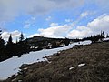
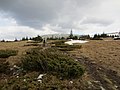
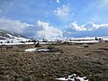
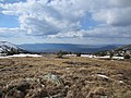
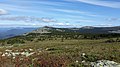
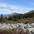
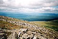
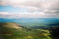
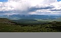
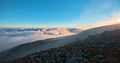
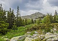
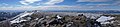
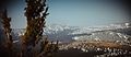
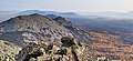
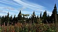
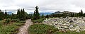
Category:Iremel
mountain ridge in the Southern Ural  | |||||
| Upload media | |||||
| Instance of | |||||
|---|---|---|---|---|---|
| Part of | |||||
| Location | Bashkortostan, Russia | ||||
| Mountain range | |||||
| Elevation above sea level |
| ||||
 | |||||
| Parent categories were assigned using the {{Category Russia}} template. In general, new categories should not be added by hand. The tree of categories is maintained automatically, any human edits may be overridden by bot. |
| This is the category of the protected area of Russia number 0210061 | |
| This template and pages using it are maintained by the Russian WLE team. Please read the guidelines before making any changes that can affect the database! |
Media in category "Iremel"
The following 200 files are in this category, out of 203 total.
(previous page) (next page)-
 "Ирәмәл" тауы башында.jpg 5,152 × 3,864; 7.97 MB
-
 Beloretsky District, Republic of Bashkortostan, Russia - panoramio (15).jpg 2,816 × 2,112; 1.23 MB
-
 Beloretsky District, Republic of Bashkortostan, Russia - panoramio (16).jpg 2,816 × 2,112; 1.4 MB
-
 Beloretsky District, Republic of Bashkortostan, Russia - panoramio (18).jpg 2,816 × 2,112; 1.14 MB
-
 Beloretsky District, Republic of Bashkortostan, Russia - panoramio (19).jpg 2,112 × 2,816; 1.29 MB
-
 Beloretsky District, Republic of Bashkortostan, Russia - panoramio (20).jpg 2,816 × 2,112; 1.65 MB
-
 Beloretsky District, Republic of Bashkortostan, Russia - panoramio (21).jpg 2,816 × 2,112; 1.39 MB
-
 Beloretsky District, Republic of Bashkortostan, Russia - panoramio (23).jpg 2,816 × 2,112; 1.39 MB
-
 Beloretsky District, Republic of Bashkortostan, Russia - panoramio (24).jpg 2,816 × 2,112; 1.56 MB
-
 Beloretsky District, Republic of Bashkortostan, Russia - panoramio (25).jpg 2,816 × 2,112; 1.55 MB
-
 Beloretsky District, Republic of Bashkortostan, Russia - panoramio (27).jpg 2,816 × 2,112; 1.45 MB
-
 Big Iremel mountain peak 1.jpg 2,448 × 3,264; 3.86 MB
-
 Big Iremel mountain peak 2.jpg 2,448 × 3,264; 3.24 MB
-
 Big Iremel mountain peak 3.jpg 2,308 × 3,124; 2.42 MB
-
 Big Iremel mountain peak 4.jpg 2,448 × 3,264; 2.66 MB
-
 Big Iremel mountain peak 5.jpg 3,264 × 2,448; 2.43 MB
-
 Big Iremel mountain peak 6.jpg 2,448 × 3,264; 2.8 MB
-
 Big Iremel mountain peak 7.jpg 3,264 × 2,448; 3.38 MB
-
 BolshoyIremel.jpg 3,000 × 2,000; 2.4 MB
-
 Forest Point (11815578855).jpg 1,296 × 864; 1.01 MB
-
 HfGc54jMvDE.jpg 1,536 × 2,048; 683 KB
-
 HfGc55jMvDE.jpg 1,536 × 2,048; 628 KB
-
 Iremel (11816265096).jpg 1,296 × 864; 841 KB
-
 Iremel (29391062735).jpg 5,184 × 3,456; 16.45 MB
-
 Iremel (29391068425).jpg 5,184 × 3,456; 15.3 MB
-
 Iremel -30°C (11815538175).jpg 1,296 × 864; 927 KB
-
 Iremel by Konstantin Tsibin.jpg 2,000 × 808; 319 KB
-
 Iremel mnt (11815611135).jpg 1,296 × 864; 823 KB
-
 Iremel Mount.jpg 1,296 × 864; 519 KB
-
 Iremel mountain country (11816392476).jpg 1,296 × 864; 402 KB
-
 Iremel.jpg 3,648 × 2,736; 4.5 MB
-
 Like Mars (28720313623).jpg 5,184 × 3,456; 8.99 MB
-
 Malyj Iremel mnt (11815593855).jpg 1,296 × 864; 538 KB
-
 MG 3854-Fullsize.jpg 5,616 × 3,744; 11.97 MB
-
 Mount Iremel 2.jpg 3,648 × 2,736; 5.41 MB
-
 Mount Iremel.jpg 3,264 × 2,448; 1.85 MB
-
 Mt M Iremel.jpg 1,920 × 1,080; 1.32 MB
-
 On top of Iremel mnt (11815625775).jpg 1,296 × 864; 484 KB
-
 On top of Iremel mnt (11815877753).jpg 1,296 × 864; 409 KB
-
 On top of Iremel mnt (11816056414).jpg 1,296 × 864; 416 KB
-
 On top of Iremel mnt (11816373286).jpg 1,296 × 864; 527 KB
-
 On top of Iremel mnt (11816386206).jpg 1,296 × 864; 420 KB
-
 P1011019 Вид с горы Большой Иремель.JPG 3,264 × 2,448; 1.6 MB
-
 Zigalga ridge (11816329716).jpg 1,296 × 864; 634 KB
-
 ZvX-m5kZUvQ.jpg 1,280 × 853; 276 KB
-
 Б.Иремель в облаках - panoramio.jpg 3,648 × 2,736; 5.1 MB
-
 Башкирия. д. Байсакалово. Начало тропы в природный парк Иремель (2).jpg 3,917 × 5,876; 21.75 MB
-
 Башкирия. д. Байсакалово. Начало тропы в природный парк Иремель. (1).jpg 4,087 × 6,131; 22.49 MB
-
 Башкирия. д. Байсакалово. Река Белая. Начало тропы в природный парк Иремель. (1).jpg 6,240 × 4,160; 25.96 MB
-
 Башкирия. д. Байсакалово. Река Белая. Начало тропы в природный парк Иремель. (2).jpg 6,255 × 7,175; 36.58 MB
-
 БГУ студенттары Ирәмәл башында.jpg 5,152 × 3,415; 6.64 MB
-
 Большой Иремель.jpg 3,648 × 2,736; 3.67 MB
-
 Брод - panoramio - Pesotsky (1).jpg 3,648 × 2,736; 6.16 MB
-
 В окресностях горы Иремель.jpg 3,214 × 2,364; 1.52 MB
-
 В поселке Тюлюк.jpg 2,540 × 1,693; 2.31 MB
-
 Вершина Большого Иремеля.jpg 5,788 × 3,788; 19.89 MB
-
 Вершина Большой Шелом 2.jpg 4,012 × 3,000; 1.9 MB
-
 Вершина Большой Шелом.jpg 4,012 × 3,000; 2.16 MB
-
 Вершина горы Большой Иремель, Башкортостан, Россия.jpg 3,264 × 2,448; 1.55 MB
-
 Вершина Иремеля в облаках.JPG 4,608 × 3,072; 6.81 MB
-
 Вершина Кабан Большого Иремеля.jpg 4,684 × 2,889; 13.24 MB
-
 Вид за полкилометра до подножья Иремеля с видом на каменную реку.jpg 4,128 × 2,322; 5.01 MB
-
 Вид на Большой Иремель с горы Сукташ.jpg 5,860 × 3,781; 4.91 MB
-
 Вид на гору Абараш-Баш д. Байсакалово р-ка. Башкирия.jpg 6,328 × 3,560; 16.28 MB
-
 Вид на запад - panoramio (4).jpg 3,648 × 2,736; 5.26 MB
-
 Вид на Малый Иремель и г. Сукташ из посёлка Тюлюк.jpg 8,192 × 1,856; 13.95 MB
-
 Вид на малый Иремель с плато Большого Иремеля.jpg 2,746 × 1,830; 2.29 MB
-
 Вид на один хребтов Иремеля.jpg 4,128 × 2,322; 4.87 MB
-
 Вид на отрог Малого Иремеля (1345,7 м) - panoramio.jpg 3,648 × 2,736; 5.73 MB
-
 Вид на плато горы Большой Иремель.jpg 4,288 × 2,848; 7.55 MB
-
 Вид на хребет Иремеля у каменной реки.jpg 1,080 × 1,080; 181 KB
-
 Вид на юг - panoramio (3).jpg 3,648 × 2,736; 4.45 MB
-
 Вид с "Большого Иремеля".jpg 1,920 × 1,280; 2.19 MB
-
 Вид с Большого Иремеля 1.jpg 2,973 × 1,982; 2.8 MB
-
 Вид с Большого Иремеля 2.jpg 2,952 × 1,968; 2.38 MB
-
 Вид с Большого Иремеля.jpg 4,920 × 3,259; 13.19 MB
-
 Вид с вершины Большого Иремеля.jpg 5,392 × 3,380; 10 MB
-
 Вид с вершины горы Большой Иремель.jpg 1,280 × 825; 335 KB
-
 Вид с вершины Кабан Большого Иремеля.jpg 5,710 × 3,757; 16.3 MB
-
 Вид с горы "Большой Иремель".jpg 1,920 × 1,001; 1.12 MB
-
 Вид с горы Большой Иремель.jpg 3,264 × 2,448; 1.7 MB
-
 Вид с горы Иремель.jpg 9,452 × 2,266; 8.48 MB
-
 Вид с Иремеля.JPG 4,608 × 3,456; 2.81 MB
-
 Вид с Малого Иремеля.jpg 4,928 × 3,264; 9.21 MB
-
 Вид с плато Большого Иремеля.jpg 807 × 605; 136 KB
-
 Вид с плато Иремеля.JPG 4,608 × 3,456; 5.04 MB
-
 Вид с подножья горы Иремель.jpg 1,080 × 1,080; 109 KB
-
 Вид со склона вершины горы Большой Иремель.jpg 4,288 × 2,848; 7.45 MB
-
 Гора Абараш-Баш и хребет Аваляк д. Байсакалово р-ка. Башкирия.jpg 11,000 × 3,133; 28.76 MB
-
 Гора Иремель и окрестности.jpg 4,225 × 2,817; 11.51 MB
-
 Гора Иремель и окрестности2.jpg 5,184 × 3,456; 12.49 MB
-
 Гора Иремель и окрестности3.jpg 4,999 × 3,333; 13.39 MB
-
 Гора Иремель.tif 6,016 × 4,000; 6.51 MB
-
 Гора Малый Иремель.jpg 4,000 × 2,828; 4.4 MB
-
 Горное плато на вершине Большого Иремеля.jpg 8,192 × 1,856; 12.4 MB
-
 Горы Иремяли (Иремель) от Керебинского рудника на Южном Урале.jpg 1,000 × 818; 114 KB
-
 За полкилометра до подножья Иремеля.jpg 3,813 × 2,322; 5.7 MB
-
 Запруда - panoramio.jpg 3,648 × 2,736; 5.77 MB
-
 Зимняя Гора Иремель.tif 5,832 × 4,000; 8.12 MB
-
 Иремель , Ларкино ущелье.tif 4,000 × 6,016; 37.32 MB
-
 Иремель - panoramio (1).jpg 3,648 × 2,736; 5.32 MB
-
 Иремель - panoramio.jpg 3,648 × 2,736; 4.92 MB
-
 Иремель 1.jpg 1,280 × 960; 318 KB
-
 Иремель за стеной снегопада - panoramio.jpg 3,648 × 2,736; 4.42 MB
-
 Иремель с воздуха.jpg 5,354 × 3,567; 15.1 MB
-
 Иремель, Түлек 1.JPG 2,048 × 1,536; 581 KB
-
 Иремель, Түлек 2.JPG 2,048 × 1,536; 653 KB
-
 Иремель. Вид с вершины.jpg 5,152 × 3,864; 4.79 MB
-
 Иремель. Восхождение на вершину.jpg 5,152 × 3,864; 4.78 MB
-
 Иремель. Деревья покрыты лишайником.jpg 5,152 × 3,864; 4.86 MB
-
 Иремель. Дорога в Ларкино ущелье.jpg 5,152 × 3,864; 4.7 MB
-
 Иремель. Еще чуть-чуть.jpg 5,152 × 3,864; 5.02 MB
-
 Иремель. Земляника.jpg 5,152 × 3,864; 4.74 MB
-
 Иремель. И на вершине цветут цветы.jpg 5,152 × 3,864; 4.57 MB
-
 Иремель. Камень покрытый мхом.jpg 5,152 × 3,864; 4.72 MB
-
 Иремель. Колокольчик.jpg 5,152 × 3,864; 4.65 MB
-
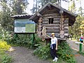
 Иремель. КПП.jpg 5,152 × 3,864; 4.61 MB
-
 Иремель. Красота!.jpg 5,152 × 3,864; 4.83 MB
-
 Иремель. Ларкино ущелье.jpg 5,152 × 3,864; 4.42 MB
-
 Иремель. Ляпота!.jpg 5,152 × 3,864; 4.61 MB
-
 Иремель. Маркировка маршрута.jpg 5,152 × 3,864; 4.67 MB
-
 Иремель. Можжевельник.jpg 5,152 × 3,864; 4.75 MB
-
 Иремель. Мраморная гора.jpg 5,152 × 3,864; 4.75 MB
-
 Иремель. Муравейник.jpg 5,152 × 3,864; 4.65 MB
-
 Иремель. Мы на вершине!.jpg 5,152 × 3,864; 4.7 MB
-
 Иремель. На вершине.jpg 5,152 × 3,864; 4.32 MB
-
 Иремель. На развилке дорог.jpg 5,152 × 3,864; 4.95 MB
-
 Иремель. Начало начал.jpg 5,152 × 3,864; 5.03 MB
-
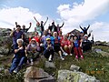
 Иремель. Наша группа.jpg 5,152 × 3,864; 4.73 MB
-
 Иремель. Николай Кустовский из Минска.jpg 3,864 × 5,152; 4.7 MB
-
 Иремель. Образцы вандализма.jpg 5,152 × 3,864; 4.78 MB
-
 Иремель. Очередь за водой.jpg 5,152 × 3,864; 4.68 MB
-
 Иремель. Перевал.jpg 5,152 × 3,864; 4.79 MB
-
 Иремель. Природа - художник!.jpg 5,152 × 3,864; 4.79 MB
-
 Иремель. Резиденция Бабы-Яги.jpg 5,152 × 3,864; 4.53 MB
-
 Иремель. Река каменная, в журчанье - настоящее.jpg 5,152 × 3,864; 4.37 MB
-
 Иремель. Ромашки.jpg 5,152 × 3,864; 4.68 MB
-
 Иремель. Сила жизни.jpg 5,152 × 3,864; 4.76 MB
-
 Иремель. Сказка!.jpg 5,152 × 3,864; 4.74 MB
-
 Иремель. Течет каменная река.jpg 5,152 × 3,864; 4.63 MB
-
 Иремель. Туристская баня.jpg 5,152 × 3,864; 4.67 MB
-
 Иремель. Чем не шишкинский лес?.jpg 5,152 × 3,864; 4.72 MB
-
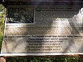
 Иремель... Вся информация в табличке.jpg 5,152 × 3,864; 4.75 MB
-
 Иремель.jpg 2,560 × 1,707; 1.01 MB
-
 Иремель.Первые пошли.jpg 5,152 × 3,864; 4.54 MB
-
 Иремель2.jpg 1,280 × 960; 271 KB
-
 Иремель2018.jpg 5,152 × 3,864; 4.6 MB
-
 Ирәмәл тауы башында болоттар асылғанда.jpg 5,152 × 3,375; 6.14 MB
-
 Ирәмәл тауы.jpg 3,264 × 1,830; 1.8 MB
-
 КПП ЮУГПЗ заповедник 2.jpg 4,008 × 3,000; 1.74 MB
-
 КПП ЮУГПЗ заповедник.jpg 4,012 × 3,000; 1.99 MB
-
 Курумник на подъёме к Шеломам 2.jpg 4,008 × 3,000; 1.73 MB
-
 Курумник на подъёме к Шеломам 3.jpg 4,012 × 3,000; 2.39 MB
-
 Курумник на подъёме к Шеломам 4.jpg 4,004 × 3,000; 2.14 MB
-
 Курумник на подъёме к Шеломам.jpg 4,008 × 3,000; 2.33 MB
-
 Курумник на седловине около Большой Шелом.jpg 4,500 × 3,000; 2.64 MB
-
 Курумник на склоне Шелома 5.jpg 4,012 × 3,000; 2.36 MB
-
 Ларкино ущелье 1.jpg 2,973 × 1,982; 3.04 MB
-
 Ларкино ущелье, рка Тюлюк.jpg 2,005 × 3,024; 2.85 MB
-
 Лес на курумах - panoramio.jpg 1,600 × 1,200; 1,013 KB
-
 Малый Иремель (1).jpg 4,902 × 3,247; 10.29 MB
-
 Малый Иремель.jpg 4,354 × 1,887; 5.17 MB
-
 Малый Шелом.jpg 6,503 × 3,000; 3.23 MB
-
 Мраморная река на горе Большой Иремель.jpg 3,264 × 2,448; 1.77 MB
-
 На Иремеле.JPG 4,608 × 3,072; 6.14 MB
-
 На склоне вершины горы Большой Иремель.jpg 4,288 × 2,848; 7.64 MB
-
 Панорама Малый Шелом.jpg 7,532 × 3,000; 4.33 MB
-
 Плато горы Большой Иремель 2.jpg 4,288 × 2,848; 7.12 MB
-
 Плато горы Большой Иремель 3.jpg 4,288 × 2,848; 7.56 MB
-
 Плато горы Большой Иремель 4.jpg 4,288 × 2,848; 5.87 MB
-
 Плато горы Большой Иремель 5.jpg 4,288 × 2,848; 7.56 MB
-
 Плато горы Большой Иремель.jpg 4,288 × 2,848; 7.7 MB
-
 Плато Иремеля.jpg 2,667 × 1,500; 2.88 MB
-
 По дороге на "Большой Иремель".jpg 1,920 × 987; 1.86 MB
-
 По дороге на Иремель (1).jpg 4,928 × 3,264; 10.33 MB
-
 По дороге на Иремель (3).jpg 4,928 × 3,264; 10.21 MB
-
 По дороге на Иремель.jpg 4,928 × 3,264; 8.61 MB
-
 По пути к вершине Большой Иремель.jpg 5,203 × 3,344; 15.16 MB
-
 Поверхность вершины Большого Иремеля.jpg 6,016 × 4,016; 20.51 MB
-
 Подъем на гору Иремель.jpg 5,451 × 3,634; 7.53 MB
-
 Поляна - panoramio - Pesotsky (5).jpg 3,648 × 2,736; 5.65 MB
-
 Природа у подножья Иремеля с видом на национальное растения Башкортостана - Курай.jpg 4,128 × 2,322; 4.65 MB
-
 Природный парк "Иремель".jpg 2,214 × 1,476; 2 MB
-
 Природный парк «Иремель» 2.jpg 6,016 × 4,016; 10.85 MB
-
 Природный парк «Иремель» панорама 1.jpg 10,144 × 3,606; 18.09 MB
-
 Природный парк «Иремель» панорама 2.jpg 7,895 × 3,166; 17.43 MB
-
 Природный парк «Иремель», вид с вершины горы Большой Иремель.jpg 5,503 × 3,674; 10.48 MB
-
 Природный парк «Иремель».jpg 5,629 × 3,758; 14.09 MB
-
 Река Тюлюк 1.jpg 2,854 × 1,902; 2.78 MB
-
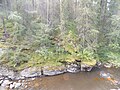
 Ручей на склоне горы Иремель.jpg 3,000 × 2,000; 3.73 MB
-
 Скальный останец - panoramio.jpg 3,648 × 2,736; 5.42 MB
-
 Склон вершины горы Большой Иремель.jpg 4,288 × 2,848; 7.87 MB
-
 Склон горы Большой Иремель.jpg 3,072 × 2,304; 1.24 MB
-
 Спуск с вершины Большой Иремель.jpg 5,697 × 3,668; 13.44 MB
-
 Стоянка - panoramio (1).jpg 3,648 × 2,736; 6.31 MB
-
 Туристическая тропа на гору Большой Иремель, Белорецкий район, Башкортостан, Россия.jpg 3,264 × 2,448; 1.72 MB
-
 У подножия вершины горы Большой Иремель и вид на плато.jpg 4,288 × 2,848; 7.71 MB
-
 У подножья Иремеля с видом на поляну и малый хребет.jpg 4,128 × 2,322; 5.24 MB
-
 Флора Иремеля.jpg 4,016 × 6,016; 21.85 MB
-
 Хвойная компания. Плато горы Большой Иремель.jpg 2,848 × 4,288; 8.26 MB

.jpg)
.jpg)
.jpg)
.jpg)
.jpg)
.jpg)
.jpg)
.jpg)
.jpg)
.jpg)


.jpg)


.jpg)
.jpg)
.jpg)
.jpg)
.jpg)

.jpg)
.jpg)
.jpg)


.jpg)
.jpg)
.jpg)
.jpg)
.jpg)

.jpg)


.jpg)
.jpg)
.jpg)
.jpg)


.jpg)


.jpg)


_-_panoramio.jpg)


.jpg)


_%D0%BE%D1%82_%D0%9A%D0%B5%D1%80%D0%B5%D0%B1%D0%B8%D0%BD%D1%81%D0%BA%D0%BE%D0%B3%D0%BE_%D1%80%D1%83%D0%B4%D0%BD%D0%B8%D0%BA%D0%B0_%D0%BD%D0%B0_%D0%AE%D0%B6%D0%BD%D0%BE%D0%BC_%D0%A3%D1%80%D0%B0%D0%BB%D0%B5.jpg)


.jpg)


.jpg)


.jpg)
.jpg)


.jpg)


.jpg)


