Category:Isham
Deutsch: Isham ist ein Dorf und Civil parish in Northamptonshire, England. Der Ort liegt an der A509, fünf Kilometer südlich von Kettering und etwa anderthalb Kilometer westlich von Burton Latimer. Der River Ise befindet sich östlich des Dorfes. Administrativ gehört Isham zum North Northamptonshire. Zum Zeitpunkt der Volkszählung 2001 wohnten 743 Personen in Isham, davon 373 Männer und 370 Frauen.
English: Isham is a village and civil parish in Northamptonshire, England. It is on the A509 road, three miles south of Kettering and a mile to the west of Burton Latimer. The River Ise is east of the village. Administratively, it is part of the North Northamptonshire district. The 2011 Census recorded the parish's population as 772 people.
Español: Isham es un pueblo y una parroquia civil del distrito de North Northamptonshire, en el condado de Northamptonshire (Inglaterra).
Nederlands: Isham is een plaats en civil parish in het bestuurlijke gebied North Northamptonshire, in het Engelse graafschap Northamptonshire met 743 inwoners.
Polski: Isham – wieś w Anglii, w hrabstwie Northamptonshire, w dystrykcie North Northamptonshire. Leży 19 km na północny wschód od miasta Northampton i 102 km na północny zachód od Londynu. Miejscowość liczy 743 mieszkańców.
Svenska: Isham är en by och en civil parish i North Northamptonshire i Northamptonshire i England. Orten har 771 invånare (2011). Byn nämndes i Domedagsboken (Domesday Book) år 1086, och kallades då Hisham/Isham.

village and civil parish in Northamptonshire, United Kingdom  | |||||
| Upload media | |||||
| Instance of | |||||
|---|---|---|---|---|---|
| Location | North Northamptonshire, Northamptonshire, East Midlands, England | ||||
| Population |
| ||||
| Said to be the same as | Isham (Wikimedia duplicated page, civil parish) | ||||
 | |||||
Media in category "Isham"
The following 62 files are in this category, out of 62 total.
-
 A509 near Burton Latimer cemetery - geograph.org.uk - 1817400.jpg 640 × 480; 170 KB
-
 Bridge over the Midland Mainline - geograph.org.uk - 1983412.jpg 640 × 480; 87 KB
-
 Bridleway to Orlingbury Road, Pytchley - geograph.org.uk - 6661283.jpg 1,024 × 768; 328 KB
-
 Bus stop, Isham - geograph.org.uk - 1100150.jpg 640 × 480; 38 KB
-
 Cricket Pavilion at Orlingbury. - geograph.org.uk - 460625.jpg 640 × 480; 80 KB
-
 Fairfield Road sign in Isham - geograph.org.uk - 1100156.jpg 640 × 480; 79 KB
-
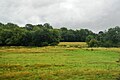
 Farmland south of Burton Latimer - geograph.org.uk - 4744493.jpg 640 × 426; 61 KB
-
 Field edge between Pytchley and Orlingbury - geograph.org.uk - 6623605.jpg 768 × 1,024; 265 KB
-
 Footpath to Dunbelly Barn - geograph.org.uk - 212008.jpg 640 × 480; 113 KB
-
 From the train bridge - geograph.org.uk - 2473714.jpg 1,502 × 1,127; 121 KB
-
 Green Lane in Isham - geograph.org.uk - 1100130.jpg 640 × 480; 66 KB
-
 High Speed Train - geograph.org.uk - 2409952.jpg 1,024 × 768; 221 KB
-
 Hillsboro Farm - geograph.org.uk - 4744490.jpg 640 × 289; 33 KB
-
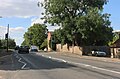
 House on Wellingborough Road, Isham - geograph.org.uk - 6203200.jpg 1,908 × 1,262; 1.4 MB
-
 House on Wellingborough Road, Isham - geograph.org.uk - 6224929.jpg 1,920 × 1,280; 1.25 MB
-
 Isham C of E Primary School, Isham - geograph.org.uk - 1100146.jpg 640 × 480; 68 KB
-
 Isham C of E Primary School, Isham - geograph.org.uk - 1100147.jpg 640 × 480; 56 KB
-
 Isham footbridge and River Ise with East Midlands Trains Meridian DMU.jpg 3,300 × 1,560; 872 KB
-
 Isham Village Sign - geograph.org.uk - 1373928.jpg 640 × 479; 260 KB
-
 Isham Village Sign - geograph.org.uk - 1373944.jpg 640 × 480; 364 KB
-
 Išhamo kaimo ženklas.jpg 3,024 × 4,032; 4.9 MB
-
 Išhamo senoji architektūra.jpg 4,032 × 3,024; 7.8 MB
-
 Middle Street sign in Isham - geograph.org.uk - 1100127.jpg 640 × 480; 46 KB
-
 Mill Lane sign in Isham - geograph.org.uk - 1100143.jpg 640 × 480; 64 KB
-
 Near Burton Latimer - geograph.org.uk - 4782784.jpg 640 × 426; 49 KB
-
 Nocturnal Isham - geograph.org.uk - 1165373.jpg 640 × 480; 52 KB
-
 Post box - geograph.org.uk - 1100159.jpg 640 × 480; 31 KB
-
 Prepared field near Orlingbury - geograph.org.uk - 6661355.jpg 1,024 × 768; 133 KB
-
 Public footpath sign and post box - geograph.org.uk - 1100134.jpg 640 × 480; 39 KB
-
 Road sign - geograph.org.uk - 1100154.jpg 640 × 480; 50 KB
-

-
 South Street sign in Isham - geograph.org.uk - 1100137.jpg 640 × 480; 58 KB
-
 Stream between Pytchley and Orlingbury - geograph.org.uk - 6625055.jpg 768 × 1,024; 281 KB
-
 The grass view - geograph.org.uk - 2473706.jpg 1,502 × 1,127; 143 KB
-
 The Lilacs, Church Street, Isham - geograph.org.uk - 1100139.jpg 640 × 480; 48 KB
-
 The Lilacs, Church Street, Isham - geograph.org.uk - 1100144.jpg 640 × 480; 70 KB
-
 The local Newsagents for Isham - geograph.org.uk - 1100103.jpg 640 × 480; 42 KB
-
 The local Newsagents for Isham - geograph.org.uk - 1100107.jpg 640 × 480; 39 KB
-
 The Millglade sign in Isham - geograph.org.uk - 1100142.jpg 640 × 480; 37 KB
-

-

-

-
 The Sorrels sign in Isham - geograph.org.uk - 1100145.jpg 640 × 480; 70 KB
-
 Tree by the River Ise - geograph.org.uk - 4782789.jpg 640 × 366; 31 KB
-
 Wellingborough Road, Isham - geograph.org.uk - 6203202.jpg 1,878 × 1,214; 1.69 MB
-
 Wellingborough Road, Isham - geograph.org.uk - 6224927.jpg 1,892 × 1,238; 1.81 MB
-
 Crossing the railway - geograph.org.uk - 390589.jpg 640 × 480; 57 KB
-
 Finedon Furnaces Industry - geograph.org.uk - 229297.jpg 640 × 439; 82 KB
-

-
 Frisby Lane, Little Harrowden - geograph.org.uk - 191361.jpg 640 × 480; 75 KB
-
 Furnace Lane - geograph.org.uk - 229306.jpg 640 × 484; 72 KB
-
 Green Fields - geograph.org.uk - 144328.jpg 640 × 480; 119 KB
-
 Kettering Retail Park - geograph.org.uk - 472409.jpg 640 × 428; 87 KB
-
 Kettering south - geograph.org.uk - 390608.jpg 640 × 480; 71 KB
-
 Midland Mainline Railway - geograph.org.uk - 229279.jpg 640 × 480; 73 KB
-
 Morrisons - geograph.org.uk - 144304.jpg 640 × 480; 88 KB
-
 Over the A14 - geograph.org.uk - 376773.jpg 640 × 480; 60 KB
-
 The Orlingbury Road - geograph.org.uk - 212002.jpg 640 × 480; 118 KB
-
 Track to North Lodge - geograph.org.uk - 212345.jpg 640 × 403; 111 KB
-
 Urban Bridleway - geograph.org.uk - 144321.jpg 640 × 480; 102 KB
-
 View across Wheat Fields - geograph.org.uk - 211998.jpg 640 × 480; 95 KB
-
 View from Orlingbury Road - geograph.org.uk - 212287.jpg 640 × 480; 135 KB


