Category:Island of Stroma
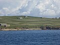
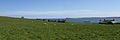
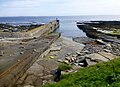
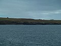
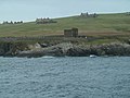
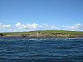
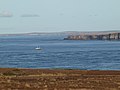
The Island of Stroma is an island off the north of Scotland. Although it is close to the Orkney Islands, it is administratively part of Caithness - the cat Orkney Islands is here, because it is commonly associated with them.
island off the northern coast of the mainland of Scotland, UK  | |||||
| Upload media | |||||
| Instance of | |||||
|---|---|---|---|---|---|
| Part of | |||||
| Location |
| ||||
| Located in or next to body of water | |||||
| Width |
| ||||
| Length |
| ||||
| Highest point |
| ||||
| Population |
| ||||
| Area |
| ||||
 | |||||
Subcategories
This category has the following 3 subcategories, out of 3 total.
Media in category "Island of Stroma"
The following 80 files are in this category, out of 80 total.
-
 Abandon Croft North Of Tree Geo - geograph.org.uk - 4633074.jpg 2,560 × 1,920; 2.95 MB
-
 Abandoned Dwellings on Stroma - geograph.org.uk - 3493389.jpg 640 × 492; 49 KB
-
 Abandoned houses on the Isle of Stroma - geograph.org.uk - 4474648.jpg 640 × 480; 440 KB
-
 Abandoned houses on the Isle of Stroma - geograph.org.uk - 4474680.jpg 640 × 480; 388 KB
-
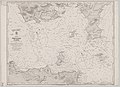 Admiralty Chart No 2162 Scotland Pentland Firth, Published 1858.jpg 8,326 × 6,052; 5.48 MB
-
 Admiralty Chart No 2180b Southern portion of the Orkney Islands, Scotland, Published 1886.jpg 11,787 × 8,260; 11.67 MB
-

-
-
 Buoy - Stroma - geograph.org.uk - 894650.jpg 640 × 427; 62 KB
-
 Cairn Hill (Stroma) - geograph.org.uk - 4632799.jpg 2,560 × 1,920; 2.98 MB
-
 Cemetery on Scarton Point - geograph.org.uk - 3592894.jpg 3,872 × 2,592; 2.57 MB
-
 Cliffs on north west Stroma coast - geograph.org.uk - 5806734.jpg 1,024 × 575; 115 KB
-
 Coast of Stroma - geograph.org.uk - 894128.jpg 640 × 427; 55 KB
-
 Coastal View Near Langaton Point - geograph.org.uk - 4629266.jpg 2,484 × 1,814; 2.13 MB
-
 Ewes and lambs on Stroma - geograph.org.uk - 4632813.jpg 2,524 × 1,413; 2.04 MB
-
 Geo, on west of Stroma - geograph.org.uk - 895899.jpg 640 × 427; 76 KB
-
 House on Stroma - geograph.org.uk - 3592871.jpg 3,665 × 2,444; 2.08 MB
-
 Island dwelling - geograph.org.uk - 2222931.jpg 640 × 482; 107 KB
-
 Island harbour - geograph.org.uk - 2222933.jpg 640 × 482; 126 KB
-
 Island of Stroma - geograph.org.uk - 2146582.jpg 3,872 × 2,592; 4.9 MB
-
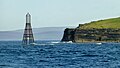
 Island of Stroma whirlpool - geograph.org.uk - 2146591.jpg 3,872 × 2,592; 4.15 MB
-
 Langaton Point - geograph.org.uk - 3470339.jpg 640 × 480; 53 KB
-
 Mell Head - geograph.org.uk - 3470310.jpg 640 × 480; 50 KB
-
 Mell Head - geograph.org.uk - 819501.jpg 640 × 480; 39 KB
-
 North end of Stroma - geograph.org.uk - 5901566.jpg 1,024 × 576; 69 KB
-
 Ordnance Survey One-Inch Sheet 12 Wick, Published 1947.jpg 8,808 × 12,871; 10 MB
-
 Ordnance Survey One-Inch Sheet 7 Pentland Firth, Published 1959.jpg 8,236 × 9,868; 6.93 MB
-
 Pentalina passing Stroma.jpg 4,692 × 1,565; 990 KB
-
 Pier At Nethertown - geograph.org.uk - 4633216.jpg 2,454 × 1,770; 1.73 MB
-
 Rammie Geo As Seen From Red Head - geograph.org.uk - 4633065.jpg 2,560 × 1,920; 2.91 MB
-
 Red Head - geograph.org.uk - 3470318.jpg 640 × 480; 53 KB
-
 Red Head, Stroma - geograph.org.uk - 5901524.jpg 1,024 × 1,024; 198 KB
-
 Rocky Coastline Near Mell Head - geograph.org.uk - 4632838.jpg 2,468 × 1,792; 1.69 MB
-
 Ruined Croft Near Rocky Shore - geograph.org.uk - 4633075.jpg 2,560 × 1,920; 2.81 MB
-
 Ruined houses - geograph.org.uk - 2222923.jpg 640 × 482; 130 KB
-
 Scarton Point - geograph.org.uk - 3491426.jpg 640 × 480; 64 KB
-
 Skerry Geo - geograph.org.uk - 3493414.jpg 640 × 480; 51 KB
-
 Stroma 1a.JPG 640 × 480; 84 KB
-
 Stroma 2007, aerial - geograph.org.uk - 3147700.jpg 640 × 427; 40 KB
-
 Stroma 2a.JPG 640 × 480; 96 KB
-
 Stroma bed.jpg 4,288 × 2,848; 2.97 MB
-
 Stroma cemetery - geograph.org.uk - 2222909.jpg 640 × 482; 112 KB
-
 Stroma church.jpg 2,848 × 4,288; 2.95 MB
-
 Stroma cliffs and shipwreck - geograph.org.uk - 894074.jpg 640 × 427; 71 KB
-
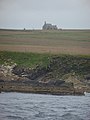
 Stroma from Mey Hill - geograph.org.uk - 3512604.jpg 640 × 480; 51 KB
-
 Stroma from the Pentland Firth.jpg 5,440 × 1,704; 2.35 MB
-
 Stroma from the sea - geograph.org.uk - 824600.jpg 640 × 480; 54 KB
-
 Stroma harbour - geograph.org.uk - 2222895.jpg 640 × 482; 120 KB
-
 Stroma Harbour.jpg 4,288 × 2,848; 3.03 MB
-
 Stroma house interior.jpg 4,288 × 2,848; 2.97 MB
-
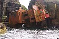 Stroma Island -shipwreck of Bettina Danica-4Aug2008.jpg 3,872 × 2,592; 1.16 MB
-
 Stroma looking northwards.jpg 3,264 × 1,412; 890 KB
-
 Stroma mausoleum and houses.jpg 2,592 × 1,728; 1.66 MB
-
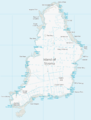 Stroma OS map.png 1,174 × 1,550; 151 KB
-
 Stroma pier and beach July 1904.jpg 4,538 × 3,266; 8.02 MB
-
 Stroma puffin.jpg 1,128 × 1,608; 560 KB
-
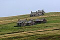 Stroma ruined houses.jpg 1,786 × 1,184; 860 KB
-
 Stroma shore line - geograph.org.uk - 2222917.jpg 640 × 482; 117 KB
-
 Stroma, cliffs and deserted village - geograph.org.uk - 2580496.jpg 640 × 480; 54 KB
-
 Stroma, Old church.jpg 4,288 × 3,216; 6.43 MB
-
-
 Stroma, the lighthouse - geograph.org.uk - 596866.jpg 640 × 338; 24 KB
-
 Stromafromcaithness.jpg 640 × 145; 24 KB
-
 StromaTheGloup.JPG 1,704 × 2,272; 2.26 MB
-
 Stromavault.jpg 640 × 480; 102 KB
-
 Telephone box (disused), Stroma - geograph.org.uk - 958516.jpg 640 × 427; 108 KB
-
 The Gloup - geograph.org.uk - 4633206.jpg 2,560 × 1,920; 2.43 MB
-
 Tree Geo, Island of Stroma - geograph.org.uk - 3493404.jpg 640 × 480; 68 KB
-
 Tree Geo, Stroma - geograph.org.uk - 3592879.jpg 3,872 × 2,592; 2.63 MB
-
 Unnamed geo on Stroma - geograph.org.uk - 3592887.jpg 3,872 × 2,592; 2.94 MB
-
 Uppertown - geograph.org.uk - 5893488.jpg 640 × 427; 249 KB
-
 View From Above The Subterranean Passage - geograph.org.uk - 4633223.jpg 2,556 × 1,914; 2.56 MB
-
 View towards Stroma island - geograph.org.uk - 479758.jpg 551 × 384; 55 KB
-
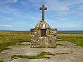
 War Memorial Close Up - geograph.org.uk - 4633057.jpg 2,560 × 1,920; 2.51 MB
-
 War Memorial On Stroma - geograph.org.uk - 4633055.jpg 2,560 × 1,920; 2.4 MB
-
 Warning Beacon And Mell Head - geograph.org.uk - 4632830.jpg 2,217 × 1,248; 1.24 MB
-
 Warning Beacon off Mell Head - geograph.org.uk - 5893500.jpg 640 × 427; 206 KB
-
 West coast of Stroma - geograph.org.uk - 5901534.jpg 1,024 × 576; 128 KB
-
 Western coast of the Isle of Stroma - geograph.org.uk - 4465060.jpg 640 × 480; 353 KB
-
 X hypoxylon.jpg 1,536 × 2,023; 327 KB


_-_Elizabeth_Bush.jpg)

_-_geograph.org.uk_-_4632799.jpg)


,_Stroma_-_geograph.org.uk_-_958516.jpg)


