Category:Ith
mountain range   | |||||
| Upload media | |||||
| Instance of | |||||
|---|---|---|---|---|---|
| Location | Lower Saxony, Germany | ||||
| Length |
| ||||
| Mountain range |
| ||||
| Elevation above sea level |
| ||||
 | |||||
Subcategories
This category has the following 5 subcategories, out of 5 total.
B
- Burg Lauenstein (Ith) (8 F)
F
- Flugplatz Ithwiesen (3 F)
J
- Jungfernstein (Ith) (3 F)
N
- Naturschutzgebiet Ithwiesen (49 F)
Media in category "Ith"
The following 35 files are in this category, out of 35 total.
-
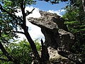
 Adam und Eva, Felsen im Ith.jpg 2,606 × 1,956; 4.71 MB
-
 Bremke vom Ith.jpg 4,032 × 3,024; 1.43 MB
-
 Colostygia pectinataria20060604.jpg 2,048 × 1,536; 2.58 MB
-
De-Ith.ogg 1.4 s; 14 KB
-
 Dielmissen.jpg 1,196 × 474; 294 KB
-
 Felsen im Ith.jpg 3,648 × 2,736; 5.37 MB
-
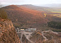
 HA 140 Südhang Thüster Berg.JPG 3,648 × 2,736; 2.91 MB
-
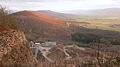
 HA 140 Thüste und Wallensen.JPG 3,648 × 2,736; 2.53 MB
-
 Harderode rosa N Hauswand.jpg 629 × 1,042; 822 KB
-
 Harderode rosa N Transparent depoNIE.jpg 1,332 × 927; 1.57 MB
-
 Holzen-Ith im Jan.2010 - panoramio.jpg 3,968 × 2,232; 2.41 MB
-
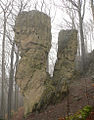 Ith Adam und Eva Klippen.jpg 768 × 982; 798 KB
-
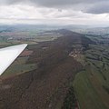 Ith aus der Luft.jpg 3,456 × 3,456; 1.72 MB
-
 Ith Hangwald Ithkopf.jpg 1,500 × 1,084; 1.4 MB
-
 Ith Klippenvorsprünge Moos.jpg 1,737 × 1,009; 1.81 MB
-
 Ith memorial helicopter 1979.jpg 2,736 × 3,648; 2.85 MB
-
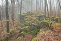 Ith Steinabhang Nebel cropped.jpg 1,097 × 740; 927 KB
-
 Ith Steinabhang Nebel.jpg 1,548 × 740; 1.25 MB
-
 Ith Steinblock Kamm.jpg 895 × 643; 778 KB
-
 Ith vom Süntel.jpg 3,614 × 1,265; 3.08 MB
-
 Ith von Oben.jpg 3,085 × 2,664; 1.08 MB
-
 Ith-Hils-Karte.png 840 × 800; 882 KB
-
 IthFelsDetail.jpg 1,024 × 685; 167 KB
-
 Ithkamm mit Steinbruch klein.jpg 956 × 674; 988 KB
-
 Ithkamm mit Steinbruch.jpg 1,415 × 789; 1,002 KB
-
 Ithkamm.jpg 300 × 139; 51 KB
-
 Ithklippen.jpg 699 × 517; 331 KB
-
 Karte Niedersaechsisches Bergland.jpg 1,420 × 967; 964 KB
-
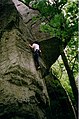 Klettern im Ith 01.jpg 2,367 × 3,570; 763 KB
-
 Klettern im Ith 02.jpg 1,472 × 878; 963 KB
-
 Klettern im Ith 03.jpg 1,010 × 1,497; 979 KB
-
 Lauenstein (Oswald Reißert).jpg 730 × 516; 252 KB
-
 Lauensteiner Steinbruch Ith Abbruchkante.jpg 3,062 × 1,066; 3.81 MB
-
 Lüerdissen Panorama 2004.jpg 12,499 × 574; 3.43 MB
-
 Reliefkarte Alfeld Umgebung.png 900 × 900; 1.6 MB


.jpg)
