Category:Itteringham
English: Itteringham is a village and civil parish in the English county of Norfolk, some northwest of the market town of Aylsham
village in the United Kingdom  | |||||
| Upload media | |||||
| Instance of | |||||
|---|---|---|---|---|---|
| Location | North Norfolk, Norfolk, East of England, England | ||||
| Area |
| ||||
| Said to be the same as | Itteringham (Wikimedia duplicated page, civil parish) | ||||
 | |||||
Subcategories
This category has the following 6 subcategories, out of 6 total.
E
M
Media in category "Itteringham"
The following 200 files are in this category, out of 213 total.
(previous page) (next page)-
 A dip in the ground - geograph.org.uk - 1294950.jpg 630 × 581; 97 KB
-
 A farm surrounded by fields - geograph.org.uk - 1295121.jpg 640 × 480; 69 KB
-
 A five-bar field gate - geograph.org.uk - 1137013.jpg 640 × 480; 93 KB
-
 A ruined barn - geograph.org.uk - 878421.jpg 640 × 480; 171 KB
-
 A rural lane - Wolterton Road - geograph.org.uk - 1295155.jpg 640 × 502; 72 KB
-
 A sea of barley - geograph.org.uk - 878419.jpg 480 × 640; 180 KB
-
 A section of boardwalk - geograph.org.uk - 1025956.jpg 640 × 480; 182 KB
-
 A sheltered area for cattle - geograph.org.uk - 1294969.jpg 640 × 480; 144 KB
-
 Access road to Dairy Farm - geograph.org.uk - 1295117.jpg 640 × 480; 72 KB
-
 Approach to Itteringham - geograph.org.uk - 1295158.jpg 550 × 630; 118 KB
-
 Approaching Wolterton Road - geograph.org.uk - 1294835.jpg 640 × 480; 120 KB
-
 Automobile Association Sign, Itteringham - geograph.org.uk - 205581.jpg 640 × 480; 142 KB
-
 Barley field opposite Mossymere Wood - geograph.org.uk - 3938074.jpg 640 × 480; 97 KB
-
 Barleyfield beside Keeper's Lane - geograph.org.uk - 878418.jpg 480 × 640; 179 KB
-
 Bracket fungi - geograph.org.uk - 1137198.jpg 640 × 480; 123 KB
-
 Bracket fungi on dead tree - geograph.org.uk - 1137182.jpg 640 × 480; 130 KB
-
 Brickkiln Plantation - geograph.org.uk - 1295086.jpg 640 × 480; 160 KB
-
 Brickkiln Plantation - geograph.org.uk - 1295129.jpg 640 × 480; 167 KB
-
 Bullrushes and reeds - geograph.org.uk - 1025952.jpg 480 × 640; 123 KB
-
 Bure Valley Community Centre - geograph.org.uk - 876176.jpg 640 × 451; 121 KB
-
 Bure Valley Community Centre, Itteringham - geograph.org.uk - 5957846.jpg 3,456 × 2,592; 3.96 MB
-
 Bus shelter and telephone box - geograph.org.uk - 876165.jpg 640 × 480; 158 KB
-
 Car park near Bunker's Hill - geograph.org.uk - 554100.jpg 640 × 480; 111 KB
-
 Cattle in field near Itteringham - geograph.org.uk - 4466165.jpg 4,912 × 3,264; 6.22 MB
-
 Cattle in pasture west of Wolterton Park - geograph.org.uk - 2478397.jpg 640 × 480; 243 KB
-

-
 Cattle pasture beside the River Bure - geograph.org.uk - 1025993.jpg 640 × 441; 146 KB
-
 Cereal field beside the path - geograph.org.uk - 1136982.jpg 640 × 480; 116 KB
-
 Cottage adjoining Mannington Hall - geograph.org.uk - 878974.jpg 640 × 452; 161 KB
-
 Cottages on Wolterton Road - geograph.org.uk - 1294882.jpg 640 × 480; 96 KB
-
 Cow parsley flowering in abundance - geograph.org.uk - 1295143.jpg 640 × 480; 103 KB
-
 Dairy Farm - geograph.org.uk - 1295094.jpg 640 × 480; 77 KB
-
 Downstream view with reflections of trees - geograph.org.uk - 653420.jpg 640 × 480; 110 KB
-
 Drain through woodland - geograph.org.uk - 1136958.jpg 640 × 480; 139 KB
-
 Driveway to Robin Farm - geograph.org.uk - 1136956.jpg 640 × 480; 172 KB
-
 Driveway to Wolterton Hall - geograph.org.uk - 778019.jpg 480 × 640; 181 KB
-
 Exiting the woodland - geograph.org.uk - 1026032.jpg 480 × 640; 143 KB
-
 Farm access meets Wolterton Road - geograph.org.uk - 1295106.jpg 640 × 480; 72 KB
-
 Farm access road - geograph.org.uk - 1295099.jpg 640 × 480; 100 KB
-
 Farm bridge over drain - geograph.org.uk - 1026008.jpg 640 × 461; 167 KB
-
 Farmland next to New Road, Itteringham Common - geograph.org.uk - 4177867.jpg 4,320 × 3,240; 5.84 MB
-
 Field adjoining footpath - geograph.org.uk - 1137010.jpg 640 × 480; 89 KB
-
 Field east of Itteringham Common - geograph.org.uk - 4134603.jpg 1,600 × 1,064; 383 KB
-
 Field entrance - geograph.org.uk - 878434.jpg 640 × 448; 174 KB
-
 Field gate - geograph.org.uk - 1294977.jpg 640 × 480; 92 KB
-

-
 Fields adjoining Wolterton Road - geograph.org.uk - 1295150.jpg 640 × 563; 98 KB
-
 Fields south of Prior's Loke - geograph.org.uk - 1136980.jpg 640 × 480; 72 KB
-
 Fields west of Itteringham Common - geograph.org.uk - 4134909.jpg 1,600 × 1,064; 445 KB
-
 Flowering oilseed rape crop by Mere Farm - geograph.org.uk - 4190911.jpg 640 × 480; 186 KB
-

-
 Footbridge over drain - geograph.org.uk - 1137081.jpg 480 × 640; 151 KB
-
 Footbridge over the River Bure - geograph.org.uk - 1025959.jpg 480 × 640; 168 KB
-
 Footbridge over the River Bure - geograph.org.uk - 205562.jpg 640 × 480; 157 KB
-
 Footpath crossing Wolterton Road - geograph.org.uk - 1294857.jpg 640 × 480; 132 KB
-
 Footpath marker - geograph.org.uk - 1137078.jpg 480 × 640; 168 KB
-
 Footpath meets farm track - geograph.org.uk - 1295018.jpg 640 × 480; 120 KB
-
 Footpath skirting stock fence - geograph.org.uk - 1294913.jpg 480 × 640; 105 KB
-
 Footpath to Church Road - geograph.org.uk - 1294815.jpg 640 × 480; 103 KB
-
 Footpath to Church Road - geograph.org.uk - 1294866.jpg 480 × 640; 94 KB
-
 Footpath to Dairy Farm - geograph.org.uk - 4466154.jpg 4,912 × 3,264; 6.41 MB
-
 Footpath to Saxthorpe - geograph.org.uk - 1137007.jpg 640 × 480; 146 KB
-
 Footpath to White House Farm - geograph.org.uk - 4465986.jpg 4,912 × 3,264; 5.53 MB
-
 Footpath to Wolterton Road - geograph.org.uk - 1294811.jpg 640 × 480; 120 KB
-
 Gate at the end of the path - geograph.org.uk - 1026015.jpg 480 × 640; 186 KB
-
 Gate into a cattle pasture - geograph.org.uk - 1026026.jpg 480 × 640; 184 KB
-
 Gate on farm track - geograph.org.uk - 1295027.jpg 640 × 480; 111 KB
-
 George V postbox - geograph.org.uk - 876151.jpg 460 × 640; 135 KB
-
 Grazing land by River Bure - geograph.org.uk - 4465994.jpg 4,912 × 3,264; 7.81 MB
-
 Grazing land near Itteringham Common - geograph.org.uk - 4465998.jpg 4,912 × 3,264; 6.59 MB
-
 Green door - geograph.org.uk - 876164.jpg 480 × 640; 175 KB
-
 Here the cows were fed during summer - geograph.org.uk - 1026013.jpg 640 × 449; 181 KB
-
 Horse paddocks - geograph.org.uk - 1294799.jpg 640 × 480; 123 KB
-
 An empty feeder - geograph.org.uk - 1025983.jpg 480 × 640; 189 KB
-
 Itteringham Common - geograph.org.uk - 1025946.jpg 640 × 448; 147 KB
-
 Itteringham footpath - geograph.org.uk - 4467485.jpg 4,912 × 3,264; 7.28 MB
-
 Itteringham Mill - geograph.org.uk - 4190901.jpg 602 × 640; 199 KB
-
 Keeper's Lane - geograph.org.uk - 1136994.jpg 640 × 480; 115 KB
-
 Keeper's Lane past derelict barn - geograph.org.uk - 878425.jpg 640 × 480; 171 KB
-
 Kincardine, Itteringham - geograph.org.uk - 4466174.jpg 4,912 × 3,264; 5.91 MB
-
 Lane to Little Barningham - geograph.org.uk - 5610834.jpg 1,600 × 1,200; 317 KB
-
 Looking upstream along the River Bure - geograph.org.uk - 1025960.jpg 480 × 640; 101 KB
-
 Mannington Hall, Eastern aspect - geograph.org.uk - 5861403.jpg 6,687 × 4,463; 5.91 MB
-
 Mannington Hall, Eastern aspect - geograph.org.uk - 5861413.jpg 6,347 × 4,236; 5.89 MB
-

-
 Mannington Hall, South aspect - geograph.org.uk - 5861399.jpg 7,360 × 4,912; 6.72 MB
-
 Mannington Hall, South aspect - geograph.org.uk - 5861405.jpg 4,776 × 3,188; 4.07 MB
-
 Mannington Hall, The bell in the flower border - geograph.org.uk - 5861421.jpg 5,964 × 3,981; 7.66 MB
-
 Mannington Hall, The bridge over the moat - geograph.org.uk - 5861415.jpg 6,324 × 4,220; 7.17 MB
-
 Mannington Hall, The North West corner - geograph.org.uk - 5861412.jpg 6,523 × 4,353; 7.3 MB
-

-

-
 Mossy tree trunks - geograph.org.uk - 1137090.jpg 480 × 640; 136 KB
-
 Mossymere Wood - geograph.org.uk - 1137127.jpg 640 × 480; 130 KB
-
 Northwest through Itteringham Common - geograph.org.uk - 554083.jpg 640 × 480; 70 KB
-
 Oak displaying autumnal colours - geograph.org.uk - 1026003.jpg 480 × 640; 193 KB
-
 Oak Grove - geograph.org.uk - 4466181.jpg 4,912 × 3,264; 6.94 MB
-
 Octagonal summerhouse - geograph.org.uk - 1026029.jpg 640 × 480; 178 KB
-
 Old AA information sign at Itteringham - geograph.org.uk - 4600206.jpg 640 × 480; 234 KB
-
 Old building and cattle, Itteringham - geograph.org.uk - 4466168.jpg 4,912 × 3,264; 7.72 MB
-
 One of many drains - geograph.org.uk - 1136964.jpg 640 × 480; 195 KB
-
 Ordnance Survey Cut Mark - geograph.org.uk - 4561351.jpg 4,000 × 3,000; 4.07 MB
-
 Overgrown drain in cattle pasture - geograph.org.uk - 1026005.jpg 480 × 640; 202 KB
-
 Pasture with oak tree - geograph.org.uk - 1136971.jpg 640 × 480; 120 KB
-
 Path approaching farm track - geograph.org.uk - 1295000.jpg 640 × 480; 141 KB
-
 Path through cattle pasture - geograph.org.uk - 1026012.jpg 640 × 445; 144 KB
-
 Path to White House Farm - geograph.org.uk - 1295080.jpg 640 × 480; 119 KB
-
 Path to Wolterton Road - geograph.org.uk - 1294794.jpg 640 × 480; 129 KB
-
 Pea Harvesting, near Itteringham - geograph.org.uk - 205565.jpg 640 × 480; 122 KB
-
 Piggies and farm buildings - geograph.org.uk - 4466188.jpg 4,912 × 3,264; 2.13 MB
-
 Pond at White House Farm - geograph.org.uk - 4465990.jpg 4,912 × 3,264; 6.56 MB
-
 Pond beside footpath - geograph.org.uk - 1295006.jpg 480 × 640; 136 KB
-
 Primitive Methodist Chapel - geograph.org.uk - 1294898.jpg 480 × 640; 95 KB
-
 Primitive Methodist Chapel - geograph.org.uk - 1294903.jpg 640 × 480; 103 KB
-
 Primitive Methodist Chapel - geograph.org.uk - 1294907.jpg 640 × 480; 100 KB
-
 Prior's Loke - geograph.org.uk - 1136976.jpg 527 × 640; 138 KB
-

-

-
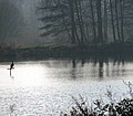
 River Bure - geograph.org.uk - 3500497.jpg 640 × 457; 162 KB
-
 River Bure - reflections - geograph.org.uk - 653416.jpg 640 × 480; 114 KB
-
 Road from Itteringham Common - geograph.org.uk - 4466008.jpg 4,912 × 3,264; 5.5 MB
-
 Road next to Mossymere Wood - geograph.org.uk - 3938067.jpg 640 × 480; 72 KB
-
 Road next to Mossymere Wood - geograph.org.uk - 3938071.jpg 640 × 480; 59 KB
-
 Road past Mannington Hall - geograph.org.uk - 878926.jpg 480 × 640; 150 KB
-
 Robin Farm - geograph.org.uk - 1136986.jpg 640 × 480; 176 KB
-
 Small pond on a field's edge - geograph.org.uk - 1137059.jpg 640 × 480; 116 KB
-
 Small pond on the edge of Mossymere Wood - geograph.org.uk - 1137118.jpg 640 × 480; 136 KB
-
 Start of a public footpath - geograph.org.uk - 1294788.jpg 480 × 640; 149 KB
-
 Stick and measuring jug - geograph.org.uk - 878431.jpg 480 × 640; 171 KB
-
 Stile into cattle pasture - geograph.org.uk - 1294987.jpg 480 × 640; 141 KB
-
 Stile into pasture - geograph.org.uk - 878929.jpg 480 × 640; 125 KB
-
 Stile on footpath - geograph.org.uk - 1136969.jpg 480 × 640; 178 KB
-
 Stile on footpath - geograph.org.uk - 1295038.jpg 480 × 640; 114 KB
-
 Stile over a stock fence - geograph.org.uk - 1026016.jpg 480 × 640; 176 KB
-
 Stile over stock fence - geograph.org.uk - 1294938.jpg 480 × 640; 148 KB
-
 Stock fence made from hurdles - geograph.org.uk - 1294931.jpg 640 × 480; 130 KB
-
 Stock fence made from hurdles - geograph.org.uk - 1294979.jpg 640 × 480; 91 KB
-
 Swans on pond at White House Farm - geograph.org.uk - 4468475.jpg 4,912 × 3,264; 7.41 MB
-
 Terraced cottages on Wolterton Road - geograph.org.uk - 1294886.jpg 640 × 491; 80 KB
-
 Terraced cottages on Wolterton Road - geograph.org.uk - 1294890.jpg 640 × 480; 87 KB
-
 The Church of St Mary at Itteringham - geograph.org.uk - 4561358.jpg 4,000 × 3,000; 3.05 MB
-
 The path narrows - geograph.org.uk - 1137055.jpg 480 × 640; 170 KB
-
 The Rectory - geograph.org.uk - 876197.jpg 640 × 480; 164 KB
-
 The southern edge of Mossymere Wood - geograph.org.uk - 1137099.jpg 480 × 640; 141 KB
-

-
 The Walpole Arms public house - geograph.org.uk - 1026043.jpg 640 × 448; 96 KB
-
 This way to Wolterton - geograph.org.uk - 1295113.jpg 640 × 480; 82 KB
-
 Track leading east - geograph.org.uk - 1026019.jpg 480 × 640; 180 KB
-
 Track through Brickkiln Plantation - geograph.org.uk - 1295084.jpg 498 × 640; 157 KB
-
 Track through Brickkiln Plantation - geograph.org.uk - 1295136.jpg 640 × 480; 152 KB
-
 Track to Dairy Farm - geograph.org.uk - 1295022.jpg 640 × 480; 132 KB
-
 Undulating fields - geograph.org.uk - 1137111.jpg 640 × 480; 123 KB
-
 Undulating fields - geograph.org.uk - 1295051.jpg 640 × 523; 80 KB
-
 View across a cattle pasture - geograph.org.uk - 1294961.jpg 640 × 480; 76 KB
-
 View across Itteringham Common - geograph.org.uk - 1025987.jpg 480 × 640; 185 KB
-
 View across undulating farmland - geograph.org.uk - 1295060.jpg 640 × 480; 107 KB
-
 View along electric fence - geograph.org.uk - 1294805.jpg 480 × 640; 110 KB
-
 View along Matlaske Road - geograph.org.uk - 4190909.jpg 640 × 480; 186 KB
-

-
 View east along field edge - geograph.org.uk - 1137073.jpg 640 × 480; 78 KB
-
 View east along overgrown drain - geograph.org.uk - 1025977.jpg 480 × 640; 174 KB
-
 View from the edge of Mossymere Wood - geograph.org.uk - 1137106.jpg 640 × 480; 112 KB
-
 View NE from Keeper's Lane - geograph.org.uk - 878441.jpg 640 × 480; 186 KB
-

-

-

-
 View south along Church Road - geograph.org.uk - 876168.jpg 480 × 640; 185 KB
-
 View south along Keeper's Lane - geograph.org.uk - 878417.jpg 480 × 640; 161 KB
-
 View south along Wolterton Road - geograph.org.uk - 1294875.jpg 480 × 640; 118 KB
-
 View to Dairy Farm - geograph.org.uk - 1295048.jpg 640 × 480; 80 KB
-
 View towards Broom Hill - geograph.org.uk - 1294995.jpg 640 × 505; 79 KB
-
 View towards Journey's End - geograph.org.uk - 554078.jpg 480 × 640; 74 KB
-

-

-
 Village Shop and Post Office - geograph.org.uk - 876149.jpg 640 × 480; 147 KB
-
 Waterlogged cattle pasture - geograph.org.uk - 1026000.jpg 640 × 463; 160 KB
-
 Wet ground - geograph.org.uk - 1137093.jpg 534 × 640; 189 KB
-
 Wet ground beside the River Bure - geograph.org.uk - 1137023.jpg 480 × 640; 138 KB
-

-
 Wingfield House - geograph.org.uk - 1026039.jpg 480 × 640; 101 KB
-
 Woodland beside the path - geograph.org.uk - 1026023.jpg 480 × 640; 183 KB
-
 You have been warned - twice - geograph.org.uk - 1025964.jpg 480 × 640; 160 KB
-
 A field boundary - geograph.org.uk - 1025999.jpg 480 × 640; 192 KB
-
 A host for bracket fungi - geograph.org.uk - 1137167.jpg 640 × 480; 158 KB
-
 A leaning tree - geograph.org.uk - 1137064.jpg 480 × 640; 175 KB
-
 A soggy path - geograph.org.uk - 1137067.jpg 480 × 640; 150 KB
-
-
 A tranquil scene - geograph.org.uk - 1137045.jpg 640 × 559; 92 KB
-
 A tree that stands out - geograph.org.uk - 779224.jpg 480 × 640; 176 KB
-
 A tributary of the Bure - geograph.org.uk - 270671.jpg 480 × 640; 238 KB
-

-
 Adjoining pastures - geograph.org.uk - 1025980.jpg 468 × 640; 185 KB
-
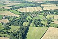 Aerial view of Itteringham - geograph.org.uk - 17601.jpg 640 × 428; 168 KB
-
 Approaching yet another cattle pasture - geograph.org.uk - 1026007.jpg 640 × 480; 136 KB
-

-
 Cattle pasture - geograph.org.uk - 777980.jpg 640 × 480; 148 KB
-
 Children's play area - geograph.org.uk - 778000.jpg 480 × 640; 185 KB
-
 Dairy Farm, Itteringham - geograph.org.uk - 205569.jpg 640 × 480; 132 KB
-
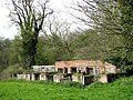 Derelict farm buildings - geograph.org.uk - 779105.jpg 640 × 480; 197 KB
-
 Fly agaric - geograph.org.uk - 270676.jpg 480 × 640; 206 KB


