Category:Ivychurch
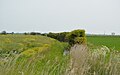
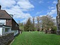
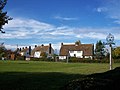
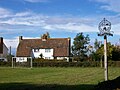
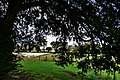
English: Ivychurch is a village and civil parish in the Folkestone and Hythe District of Kent, England. The village is located on the Romney Marsh, three miles (4.8km) north-west of New Romney. The parish council consists of five members.
village in the United Kingdom  | |||||
| Upload media | |||||
| Instance of | |||||
|---|---|---|---|---|---|
| Location | Folkestone and Hythe, Kent, South East England, England | ||||
| Said to be the same as | Ivychurch (Wikimedia duplicated page, civil parish) | ||||
 | |||||
Subcategories
This category has the following 2 subcategories, out of 2 total.
B
- RAF Brenzett (22 F)
I
Media in category "Ivychurch"
The following 200 files are in this category, out of 360 total.
(previous page) (next page)-
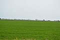
 A young crop - geograph.org.uk - 5114604.jpg 640 × 366; 43 KB
-
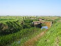
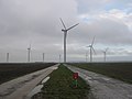
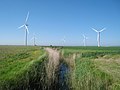
 Access road in Little Cheyne Court Wind Farm - geograph.org.uk - 2188109.jpg 3,072 × 2,304; 1.54 MB
-
 Access road in Little Cheyne Court Wind Farm - geograph.org.uk - 2188117.jpg 3,011 × 2,241; 1.03 MB
-
 Access road to Little Cheyne Court Farm - geograph.org.uk - 2066363.jpg 3,072 × 2,304; 1.43 MB
-
 Access road to Wind Turbine 9 and Meteorological Mast A - geograph.org.uk - 2188093.jpg 3,072 × 2,304; 1.39 MB
-
 Access road to Wind Turbines 13 and 14 - geograph.org.uk - 2188113.jpg 3,072 × 2,304; 1.24 MB
-
 Approaching Ivychurch - geograph.org.uk - 5114412.jpg 640 × 426; 84 KB
-
 Arable land - geograph.org.uk - 5102709.jpg 640 × 426; 71 KB
-
 Ashford Road - geograph.org.uk - 4745012.jpg 640 × 480; 89 KB
-

-
 Banking near Whitehouse Farm - geograph.org.uk - 1896487.jpg 1,024 × 768; 239 KB
-
 Barn at Home Farm - geograph.org.uk - 1979895.jpg 1,024 × 768; 193 KB
-
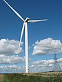
 Base of Wind Turbine - geograph.org.uk - 1879782.jpg 1,024 × 768; 160 KB
-
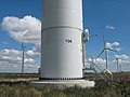 Base of Wind Turbine 106 - geograph.org.uk - 2066455.jpg 3,072 × 2,304; 1.64 MB
-
 Blades of Wind Turbine 106 - geograph.org.uk - 2066471.jpg 3,072 × 2,304; 1.3 MB
-
 Blue House Farm - geograph.org.uk - 5467068.jpg 640 × 426; 72 KB
-
 Blue House Farm - geograph.org.uk - 5467071.jpg 640 × 426; 63 KB
-
 Blue House Farm - geograph.org.uk - 5467073.jpg 640 × 426; 56 KB
-
 Brenzett Channel, a rainbow and Melon Farm - geograph.org.uk - 2151949.jpg 3,072 × 1,728; 1.3 MB
-
 Brenzett Sewer and a rainbow - geograph.org.uk - 2151942.jpg 3,072 × 1,728; 1.08 MB
-
 Bridge Farm Cottages, Ivychurch - geograph.org.uk - 5315452.jpg 640 × 480; 113 KB
-
 Bridge over Brenzett Sewer - geograph.org.uk - 2435481.jpg 640 × 480; 116 KB
-
 Bridge over Brenzett Sewer - geograph.org.uk - 2436596.jpg 640 × 480; 98 KB
-
 Bridge over Wainway Petty Sewer - geograph.org.uk - 1880910.jpg 1,024 × 768; 272 KB
-
 Bridge over Wainway Petty Sewer - geograph.org.uk - 909120.jpg 640 × 427; 52 KB
-
 Bridleway off Wenham's Lane - geograph.org.uk - 5106727.jpg 640 × 426; 88 KB
-
 Bridleway to Rhee Wall - geograph.org.uk - 2223066.jpg 3,072 × 2,304; 1.89 MB
-
 Bridleway to Rhee Wall - geograph.org.uk - 2223069.jpg 3,072 × 2,304; 1.51 MB
-
 Bridleway to the A259 Rhee Wall - geograph.org.uk - 2226843.jpg 3,072 × 2,304; 2.74 MB
-
 Callington Court Farm - geograph.org.uk - 5467064.jpg 640 × 426; 70 KB
-
 Cereals - geograph.org.uk - 5114588.jpg 640 × 426; 61 KB
-
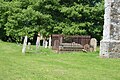 Chest tomb - geograph.org.uk - 5114493.jpg 640 × 426; 113 KB
-
 Church Farm - geograph.org.uk - 2046269.jpg 3,072 × 2,304; 1.6 MB
-
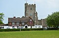 Church of St George - geograph.org.uk - 5114459.jpg 640 × 410; 56 KB
-
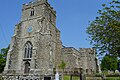 Church of St George - geograph.org.uk - 5114483.jpg 640 × 426; 104 KB
-
 Church of St George - geograph.org.uk - 5114488.jpg 426 × 640; 76 KB
-
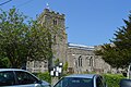 Church of St George - geograph.org.uk - 5114516.jpg 640 × 426; 94 KB
-
 Clubb's Lane - geograph.org.uk - 4002534.jpg 640 × 480; 134 KB
-
 Clubb's Lane - geograph.org.uk - 4993302.jpg 4,608 × 3,456; 3.4 MB
-
 Communications hotspot in Ivychurch - geograph.org.uk - 3972043.jpg 480 × 640; 124 KB
-
 Construction Site - geograph.org.uk - 5114621.jpg 640 × 426; 48 KB
-
 Corrugated barn - geograph.org.uk - 5114624.jpg 640 × 426; 53 KB
-
 Cottage at Home Farm - geograph.org.uk - 3984756.jpg 4,000 × 3,000; 4.19 MB
-
 Cottage near Ivychurch - geograph.org.uk - 3984750.jpg 4,000 × 3,000; 4.06 MB
-
 Cracked soil in Great Britain - geograph.org.uk - 2435909.jpg 480 × 640; 190 KB
-
 Crop Field at Walland Marsh - geograph.org.uk - 1539519.jpg 640 × 427; 67 KB
-
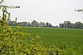
 Crop Fields near Ivychurch - geograph.org.uk - 3237746.jpg 2,256 × 1,496; 916 KB
-
 Damaged asbestos barn - geograph.org.uk - 5315434.jpg 640 × 480; 84 KB
-
 Drain and Daffodils - geograph.org.uk - 3432879.jpg 2,256 × 1,496; 901 KB
-
 Drain near Little Cheyne court - geograph.org.uk - 3432864.jpg 2,256 × 1,496; 933 KB
-
 Drainage channel and footpath towards Tillery Lane - geograph.org.uk - 2226966.jpg 3,072 × 2,304; 1.71 MB
-
 Drainage Channel at Little Cheyne Court - geograph.org.uk - 1880883.jpg 1,024 × 768; 192 KB
-
 Drainage Channel in Beaconsfield Fleet - geograph.org.uk - 2188013.jpg 3,072 × 2,304; 1.92 MB
-
 Drainage channel in Little Cheyne Court Farm - geograph.org.uk - 2188088.jpg 3,072 × 2,304; 1.89 MB
-
 Drainage channel in the Romney Marshes - geograph.org.uk - 2152019.jpg 3,072 × 2,304; 1.6 MB
-
 Drainage channel junction in Romney Marshes - geograph.org.uk - 2152030.jpg 3,072 × 2,304; 1.39 MB
-
 Drainage channel junction in Walland Marsh - geograph.org.uk - 2188136.jpg 3,072 × 2,304; 1.61 MB
-
 Drainage Channel near Barnland Farm - geograph.org.uk - 2226963.jpg 3,072 × 2,304; 1.48 MB
-
 Drainage channel near Hook Wall - geograph.org.uk - 2189403.jpg 3,072 × 2,304; 2.18 MB
-
 Drainage channel to Walland Marsh Reservoir - geograph.org.uk - 2188032.jpg 3,072 × 2,304; 1.72 MB
-
 Drainage Ditch - geograph.org.uk - 458685.jpg 427 × 640; 96 KB
-
 Dungeness Branch Line - geograph.org.uk - 1978371.jpg 1,024 × 768; 237 KB
-
 Embankment and drainage ditch near Beaconsfield Fleet - geograph.org.uk - 2188019.jpg 3,072 × 2,304; 2.36 MB
-
 Entrance to Old Moat House - geograph.org.uk - 2046250.jpg 3,072 × 2,304; 2.26 MB
-
 Exit to Main Road - geograph.org.uk - 3433019.jpg 2,256 × 1,496; 754 KB
-
 Extensive arable - geograph.org.uk - 5106723.jpg 640 × 426; 44 KB
-
 Farm bridge on the Brenzett Channel - geograph.org.uk - 2151955.jpg 3,072 × 2,304; 1.55 MB
-
 Farm road east from Melon Lane - geograph.org.uk - 5315479.jpg 640 × 480; 100 KB
-
 Farm Road in Little Cheyne Court Wind Farm - geograph.org.uk - 2188086.jpg 3,072 × 2,304; 1.5 MB
-
 Farm track on raised bank on Romney Marsh - geograph.org.uk - 3099638.jpg 2,256 × 1,496; 926 KB
-
 Farm track to Little Cheyne Court Farm - geograph.org.uk - 2067050.jpg 3,072 × 2,304; 1.5 MB
-
 Farm track to Turbine 106 - geograph.org.uk - 2066424.jpg 2,304 × 3,072; 1.55 MB
-
 Farmland near Little Cheyne court - geograph.org.uk - 3432872.jpg 2,256 × 1,496; 924 KB
-
 Farmland on the Marsh - geograph.org.uk - 3099645.jpg 2,256 × 1,496; 924 KB
-
 Farmland, Romney Marsh - geograph.org.uk - 5117929.jpg 640 × 426; 66 KB
-
 Field drain - geograph.org.uk - 5114628.jpg 640 × 426; 87 KB
-
 Field near Ivychurch - geograph.org.uk - 5114414.jpg 640 × 426; 68 KB
-
 Field of potatoes - geograph.org.uk - 4002526.jpg 640 × 480; 134 KB
-
 Field of Turf - geograph.org.uk - 459160.jpg 427 × 640; 89 KB
-
 Field of Wheat - geograph.org.uk - 2435895.jpg 640 × 480; 96 KB
-
 Fields and an unnamed lane - geograph.org.uk - 3190042.jpg 2,256 × 1,496; 905 KB
-
 Fields near Guldeford Lane Corner - geograph.org.uk - 4365003.jpg 640 × 428; 48 KB
-
 Fields near Hook House - geograph.org.uk - 2433938.jpg 2,256 × 1,496; 770 KB
-
 Flat arable land - geograph.org.uk - 5106607.jpg 640 × 426; 49 KB
-
 Flat farmland - geograph.org.uk - 5114631.jpg 640 × 426; 49 KB
-
 Flat field - geograph.org.uk - 5106709.jpg 640 × 426; 47 KB
-
 Flat field - geograph.org.uk - 5106717.jpg 640 × 426; 45 KB
-
 Flat field - geograph.org.uk - 5106721.jpg 640 × 426; 56 KB
-
 Flat^ - geograph.org.uk - 5114539.jpg 640 × 365; 31 KB
-
 Flat^^ - geograph.org.uk - 5106711.jpg 640 × 426; 59 KB
-
 Footbridge in Romney Marshes (3) - geograph.org.uk - 2152060.jpg 3,072 × 2,304; 1.65 MB
-
 Footbridge in Romney Marshes - geograph.org.uk - 2151997.jpg 3,072 × 2,304; 1.73 MB
-
 Footbridge in the Romney Marshes - geograph.org.uk - 2152026.jpg 3,072 × 2,304; 1.37 MB
-
 Footbridge near Little Cheyne Court - geograph.org.uk - 1879785.jpg 1,024 × 768; 236 KB
-
 Footbridge near St Georges Church - geograph.org.uk - 2436619.jpg 480 × 640; 115 KB
-

-
 Footpath and track junction in Little Cheyne Court Wind Farm - geograph.org.uk - 2067031.jpg 3,072 × 2,304; 1.55 MB
-
 Footpath beside embankment near Whitehouse Farm - geograph.org.uk - 2188003.jpg 3,072 × 2,304; 1.64 MB
-
 Footpath crosses Melon Lane - geograph.org.uk - 2151960.jpg 3,072 × 2,304; 1.82 MB
-
 Footpath crosses Moor Lane - geograph.org.uk - 2046231.jpg 3,072 × 2,304; 1.78 MB
-
 Footpath crosses Tillery Lane - geograph.org.uk - 2226956.jpg 3,072 × 2,304; 1.69 MB
-
 Footpath crosses Yoakes Lane - geograph.org.uk - 2228480.jpg 3,072 × 2,304; 1.82 MB
-
 Footpath gate and bridge, Ivychurch - geograph.org.uk - 3561972.jpg 1,024 × 768; 122 KB
-
 Footpath junction near Ivychurch - geograph.org.uk - 2151967.jpg 3,072 × 2,304; 2.63 MB
-
 Footpath near Ivychurch - geograph.org.uk - 3984744.jpg 4,000 × 3,000; 4.34 MB
-
 Footpath off the road - geograph.org.uk - 5114553.jpg 640 × 426; 108 KB
-
 Footpath through Little Cheyne Court Farm - geograph.org.uk - 2188077.jpg 3,072 × 2,304; 1.99 MB
-
 Footpath to Beacon Street - geograph.org.uk - 2067069.jpg 3,072 × 2,304; 2.6 MB
-
 Footpath to Ivychurch - geograph.org.uk - 2151991.jpg 3,072 × 1,728; 1.19 MB
-
 Footpath to Spring Farm Road - geograph.org.uk - 2046233.jpg 3,072 × 2,304; 1.99 MB
-
 Footpath to the Kent Ditch - geograph.org.uk - 2066333.jpg 3,072 × 2,304; 1.77 MB
-
 Footpath to Yoakes Lane - geograph.org.uk - 5114583.jpg 640 × 426; 73 KB
-
 Gate and stile in Walland Marsh - geograph.org.uk - 2188021.jpg 3,072 × 2,304; 2.04 MB
-
 Gate to Romney Marsh Nature Reserve - geograph.org.uk - 2187953.jpg 3,072 × 2,304; 1.53 MB
-

-
 Grain Store at Little Cheyne Court - geograph.org.uk - 1873780.jpg 1,024 × 768; 130 KB
-
 Graves, Church of St George - geograph.org.uk - 5114498.jpg 640 × 426; 126 KB
-
 Graves, Church of St George - geograph.org.uk - 5114504.jpg 640 × 426; 107 KB
-
 Harvested field near Rheewall Farm - geograph.org.uk - 2575143.jpg 2,256 × 1,496; 840 KB
-
 Hedge and ditch - geograph.org.uk - 5106959.jpg 640 × 401; 52 KB
-
 Home Farm - geograph.org.uk - 2151986.jpg 3,072 × 1,728; 995 KB
-
 Home Farm Cottage - geograph.org.uk - 5114572.jpg 640 × 426; 97 KB
-
 Hook Wall - geograph.org.uk - 2189419.jpg 3,072 × 2,304; 1.67 MB
-
 Hook Wall, near Brookland - geograph.org.uk - 2433933.jpg 2,256 × 1,496; 795 KB
-
 Ivy Lodge - geograph.org.uk - 5114522.jpg 640 × 426; 88 KB
-
 Ivychurch Village Hall - geograph.org.uk - 5114416.jpg 640 × 405; 54 KB
-
 Ivychurch Village Hall - geograph.org.uk - 5114417.jpg 640 × 376; 46 KB
-
 Ivychurch Village Hall - geograph.org.uk - 5114479.jpg 640 × 426; 67 KB
-
 Ivychurch, field to east of churchyard.jpg 1,536 × 2,048; 1.03 MB
-
-
 Ivychurch, recreation ground 1.jpg 2,048 × 1,536; 707 KB
-
 Ivychurch, recreation ground 2.jpg 2,048 × 1,536; 822 KB
-

-
-
 Ivychurch, St. George's Church, North east aspect - geograph.org.uk - 4762037.jpg 3,679 × 2,455; 5.14 MB
-
 Ivychurch, St. George's Church, North west aspect - geograph.org.uk - 4762040.jpg 3,603 × 2,336; 4.93 MB
-
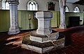
 Ivychurch, St. George's Church, The altar - geograph.org.uk - 4762000.jpg 3,646 × 2,406; 5.04 MB
-
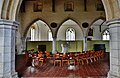
 Ivychurch, St. George's Church, The c14th south porch - geograph.org.uk - 4761965.jpg 3,601 × 2,329; 6.54 MB
-
 Ivychurch, St. George's Church, The c14th south porch - geograph.org.uk - 4762026.jpg 3,851 × 2,623; 6.15 MB
-

-
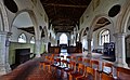
 Ivychurch, St. George's Church, The chancel from the nave - geograph.org.uk - 4761980.jpg 3,675 × 2,447; 3.82 MB
-
-

-

-
-
-

-

-
-
-
-
 Ivychurch, St. George's Church, The pulpit 1 - geograph.org.uk - 4761995.jpg 3,668 × 3,516; 6.36 MB
-
 Ivychurch, St. George's Church, The pulpit 2 - geograph.org.uk - 4761997.jpg 5,304 × 3,336; 6.71 MB
-
 John Deere Tractor - geograph.org.uk - 5114613.jpg 640 × 426; 66 KB
-
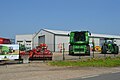 John Deere Tractor Depot - geograph.org.uk - 5114601.jpg 640 × 426; 59 KB
-
 John Deere Tractor Depot - geograph.org.uk - 5114608.jpg 640 × 426; 54 KB
-
 Junction of access roads in Little Cheyne Court Wind Farm - geograph.org.uk - 2188103.jpg 3,072 × 2,304; 1.45 MB
-
 Junction of Moor Lane with Road from Ivychurch - geograph.org.uk - 3190048.jpg 2,256 × 1,496; 898 KB
-
 Junction on Yoakes Lane - geograph.org.uk - 2228473.jpg 3,072 × 2,304; 2.01 MB
-
 Knowlden Farm - geograph.org.uk - 5106732.jpg 640 × 426; 69 KB
-
 Knowleden Farm - geograph.org.uk - 5106735.jpg 640 × 426; 87 KB
-
 Knowleden Farm - geograph.org.uk - 5114547.jpg 640 × 391; 54 KB
-
 Lane across Romney Marsh - geograph.org.uk - 5114578.jpg 640 × 426; 89 KB
-
 Lane junction on Moor Lane - geograph.org.uk - 2046243.jpg 3,072 × 2,304; 1.95 MB
-
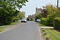
 Lane, Ivychurch - geograph.org.uk - 5114467.jpg 640 × 426; 86 KB
-
 Little Cheyne Court - geograph.org.uk - 1880953.jpg 1,024 × 768; 163 KB
-
 Little Cheyne Court - geograph.org.uk - 3433001.jpg 2,256 × 1,496; 782 KB
-
 Little Cheyne Court Dual Carriageway - geograph.org.uk - 1880963.jpg 1,024 × 683; 173 KB
-
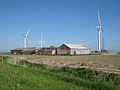 Little Cheyne Court Farm - geograph.org.uk - 1879783.jpg 1,024 × 768; 185 KB
-
 Little Cheyne Court Farm Wind Turbine and pylon - geograph.org.uk - 2067059.jpg 2,304 × 3,072; 1.68 MB
-
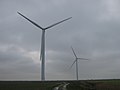
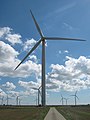
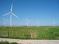
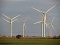
 Little Cheyne Court Wind Farm - geograph.org.uk - 1873755.jpg 1,024 × 683; 122 KB
-
 Little Cheyne Court Wind Farm - geograph.org.uk - 1873762.jpg 1,024 × 768; 185 KB
-
 Little Cheyne Court Wind Farm - geograph.org.uk - 1879780.jpg 1,024 × 768; 217 KB
-
 Little Cheyne Court Wind Farm - geograph.org.uk - 1879781.jpg 768 × 1,024; 194 KB
-
 Little Cheyne Court Wind Farm - geograph.org.uk - 1879786.jpg 1,024 × 768; 202 KB
-
 Little Cheyne Court Wind Farm - geograph.org.uk - 1880933.jpg 9,693 × 2,132; 6.36 MB
-
 Little Cheyne Court wind farm - geograph.org.uk - 2737976.jpg 640 × 480; 45 KB
-
 Little Cheyne Court Wind Farm - geograph.org.uk - 6150102.jpg 480 × 640; 39 KB
-
 Little Cheyne Court Wind Farm and drain - geograph.org.uk - 2067067.jpg 3,072 × 2,304; 1.57 MB
-
 Little Cheyne Court Wind Farm in the fog - geograph.org.uk - 2481010.jpg 3,072 × 1,728; 935 KB
-
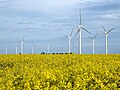
 Little Cheyne Court wind turbines - geograph.org.uk - 2737979.jpg 640 × 480; 43 KB
-
 Little Cheyne Wind Farm - geograph.org.uk - 6150116.jpg 640 × 480; 86 KB
-
 Lodgeland Farm - geograph.org.uk - 3237751.jpg 2,256 × 1,496; 837 KB
-
 Looking east-northeast along Ivychurch Road - geograph.org.uk - 4749813.jpg 3,264 × 2,448; 2.26 MB
-
 Lydd DVOR - geograph.org.uk - 5102857.jpg 640 × 380; 54 KB
-
 Lydd DVOR - geograph.org.uk - 5102860.jpg 640 × 363; 57 KB
-
 Lydd DVOR - geograph.org.uk - 5106604.jpg 640 × 426; 91 KB
-
 Lydd DVOR - geograph.org.uk - 5106612.jpg 640 × 426; 71 KB
-
 Lydd DVOR - geograph.org.uk - 5106613.jpg 640 × 426; 60 KB
-
 Mast by Wenham's Lane - geograph.org.uk - 5106615.jpg 426 × 640; 39 KB
-
 May blossom - geograph.org.uk - 5106705.jpg 640 × 426; 53 KB
-
 Melon Farm - geograph.org.uk - 1979902.jpg 1,024 × 768; 251 KB
-
 Melon Farm - geograph.org.uk - 5114563.jpg 640 × 426; 74 KB
-
 Melon Lane - geograph.org.uk - 3208986.jpg 2,256 × 1,496; 954 KB
-
 Melon Lane and drain - geograph.org.uk - 3208982.jpg 2,256 × 1,496; 924 KB
-
 Moat Barn - geograph.org.uk - 2046246.jpg 3,072 × 2,304; 1.94 MB
-
 Moor Lane - geograph.org.uk - 1944424.jpg 1,024 × 768; 214 KB
-
 Moor Lane - geograph.org.uk - 4057704.jpg 4,000 × 3,000; 4.07 MB
-
 Moor Lane - geograph.org.uk - 4057705.jpg 4,000 × 3,000; 4.24 MB
-
 Moor Lane - geograph.org.uk - 4057710.jpg 4,000 × 3,000; 4 MB


_-_geograph.org.uk_-_2152060.jpg)


