Category:J. Strom Thurmond Dam
dam on the Savannah River on the border of Georgia and South Carolina in the United States  | |||||
| Upload media | |||||
| Instance of | |||||
|---|---|---|---|---|---|
| Named after | |||||
| Location |
| ||||
| Inception |
| ||||
| Nominal power capacity |
| ||||
| Elevation above sea level |
| ||||
| Drainage basin |
| ||||
| Reservoir created | |||||
 | |||||
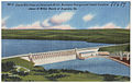
English: Media related to the J. Strom Thurmond Dam (formerly, and still in Georgia, the Clarks Hill Dam), a dam on the Savannah River on the border of Georgia and South Carolina in southeastern United States, that forms Lake Strom Thurmond.
Media in category "J. Strom Thurmond Dam"
The following 107 files are in this category, out of 107 total.
-
 Thurmond Dam Control Room (9372416230).jpg 5,616 × 3,744; 6.62 MB
-
 210602-A-TO519-001.jpg 3,936 × 2,624; 7.31 MB
-
 210602-A-TO519-002.jpg 3,936 × 2,624; 5.39 MB
-
 210602-A-TO519-003.jpg 3,936 × 2,624; 6.26 MB
-
 210602-A-TO519-004.jpg 3,936 × 2,624; 6.51 MB
-
 210602-A-TO519-005.jpg 3,936 × 2,624; 7.45 MB
-
 210602-A-TO519-006.jpg 3,936 × 2,624; 6.68 MB
-
 210602-A-TO519-007.jpg 3,936 × 2,624; 6.69 MB
-
 210602-A-TO519-008.jpg 3,936 × 2,624; 6.41 MB
-
 210602-A-TO519-009.jpg 3,936 × 2,624; 7.29 MB
-
 210602-A-TO519-010.jpg 3,936 × 2,624; 6.76 MB
-
 210602-A-TO519-011.jpg 3,936 × 2,624; 7.31 MB
-
 210602-A-TO519-012.jpg 3,936 × 2,624; 6.8 MB
-
 210602-A-TO519-013.jpg 3,936 × 2,624; 7.33 MB
-
 210602-A-TO519-014.jpg 3,936 × 2,624; 7.08 MB
-
 210602-A-TO519-015.jpg 3,936 × 2,624; 7.65 MB
-
 210602-A-TO519-016.jpg 3,936 × 2,624; 6.95 MB
-
 210602-A-TO519-017.jpg 3,936 × 2,624; 7.39 MB
-
 210602-A-TO519-018.jpg 2,624 × 3,936; 6.7 MB
-
 210602-A-TO519-019.jpg 3,936 × 2,624; 5.53 MB
-
 210602-A-TO519-020.jpg 3,936 × 2,624; 7.22 MB
-
 210602-A-TO519-021.jpg 3,936 × 2,624; 5.39 MB
-
 210602-A-TO519-022.jpg 3,936 × 2,624; 7.07 MB
-
 210602-A-TO519-023.jpg 3,936 × 2,624; 6.51 MB
-
 210602-A-TO519-024.jpg 3,936 × 2,624; 7.23 MB
-
 210602-A-TO519-025.jpg 3,936 × 2,624; 7.25 MB
-
 210602-A-TO519-026.jpg 3,936 × 2,624; 7.11 MB
-
 210602-A-TO519-027.jpg 2,624 × 3,936; 5.31 MB
-
 210602-A-TO519-028.jpg 3,936 × 2,624; 7.26 MB
-
 210602-A-TO519-029.jpg 3,936 × 2,624; 7.1 MB
-
 210602-A-TO519-030.jpg 3,936 × 2,624; 6.39 MB
-
 210602-A-TO519-031.jpg 3,936 × 2,624; 6.38 MB
-
 210602-A-TO519-032.jpg 3,936 × 2,624; 7.03 MB
-
 210602-A-TO519-033.jpg 3,936 × 2,624; 7.62 MB
-
 210602-A-TO519-034.jpg 3,936 × 2,624; 6.69 MB
-
 210602-A-TO519-035.jpg 3,936 × 2,624; 6.55 MB
-
 210602-A-TO519-036.jpg 3,936 × 2,624; 5.83 MB
-
 210602-A-TO519-037.jpg 3,936 × 2,624; 7.35 MB
-
 210602-A-TO519-038.jpg 3,936 × 2,624; 7.21 MB
-
 210602-A-TO519-039.jpg 3,936 × 2,624; 5.38 MB
-
 210602-A-TO519-040.jpg 3,936 × 2,624; 6.75 MB
-
 210602-A-TO519-041.jpg 3,936 × 2,624; 6.68 MB
-
 210602-A-TO519-042.jpg 3,936 × 2,624; 7.1 MB
-
 210602-A-TO519-043.jpg 3,936 × 2,624; 6.3 MB
-
 210602-A-TO519-044.jpg 3,936 × 2,624; 5.82 MB
-
 210602-A-TO519-045.jpg 3,936 × 2,624; 5.15 MB
-
 210602-A-TO519-046.jpg 3,936 × 2,624; 7.45 MB
-
 210602-A-TO519-047.jpg 3,936 × 2,624; 6.32 MB
-
 210602-A-TO519-048.jpg 3,936 × 2,624; 7.35 MB
-
 210602-A-TO519-049.jpg 3,936 × 2,624; 7.02 MB
-
 210602-A-TO519-050.jpg 3,936 × 2,624; 6.77 MB
-
 210602-A-TO519-051.jpg 3,936 × 2,624; 6.84 MB
-
 210602-A-TO519-052.jpg 3,936 × 2,624; 6.89 MB
-
 210602-A-TO519-053.jpg 3,936 × 2,624; 6.48 MB
-
 210602-A-TO519-054.jpg 3,936 × 2,624; 6.56 MB
-
 210602-A-TO519-055.jpg 3,936 × 2,624; 5.37 MB
-
 210602-A-TO519-056.jpg 3,936 × 2,624; 7.23 MB
-
 210602-A-TO519-057.jpg 3,936 × 2,624; 6.15 MB
-
 210602-A-TO519-058.jpg 3,936 × 2,624; 7.52 MB
-
 210602-A-TO519-059.jpg 3,936 × 2,624; 6.84 MB
-
 210602-A-TO519-060.jpg 3,936 × 2,624; 6.29 MB
-
 Cement Silo Clark Hill Dam (29192157693).jpg 715 × 750; 112 KB
-
 Clark Hill Dam (8342854323).jpg 1,500 × 952; 1.14 MB
-
-
 Corps tests Thurmond Dam spillway gates (9372406234).jpg 960 × 720; 58 KB
-
 Crowd gathers to view Thurmond Dam spillway gate test (9369626589).jpg 4,272 × 2,356; 2.48 MB
-
 J. Strom Thurmond Dam and Lake Project - power plant.jpg 4,288 × 2,848; 3.39 MB
-
 J. Strom Thurmond Spillway Gate Test IMG 7710 Montone.jpg 6,000 × 4,000; 16.4 MB
-
 J. Strom Thurmond Spillway Gate Test IMG 7713 edited-1.jpg 6,000 × 4,000; 16.56 MB
-
 J. Strom Thurmond Spillway Gate Test IMG 7718 edited-1.jpg 6,000 × 4,000; 17.43 MB
-
 J. Strom Thurmond Spillway Gate Test IMG 7723 edited-1.jpg 6,000 × 4,000; 16.71 MB
-
 J. Strom Thurmond Spillway Gate Test IMG 7724 Simpson.jpg 6,000 × 4,000; 16.02 MB
-
 J. Strom Thurmond Spillway Gate Test IMG 7732 edited-1.jpg 6,000 × 4,000; 22.07 MB
-
 J. Strom Thurmond Spillway Gate Test IMG 7740 edited-1.jpg 4,000 × 6,000; 16.38 MB
-
 J. Strom Thurmond Spillway Gate Test IMG 7751 edited-1.jpg 6,000 × 4,000; 16.31 MB
-
 J. Strom Thurmond Spillway Gate Test IMG 7757 Simpson Geary.jpg 6,000 × 4,000; 16.06 MB
-
 J. Strom Thurmond Spillway Gate Test IMG 7768 Nix.jpg 6,000 × 4,000; 15.93 MB
-
 J. Strom Thurmond Spillway Gate Test IMG 7789 edited-1.jpg 6,000 × 4,000; 18.51 MB
-
 J. Strom Thurmond Spillway Gate Test IMG 7794 edited-1.jpg 6,000 × 4,000; 17.13 MB
-
 J. Strom Thurmond Spillway Gate Test IMG 7798 Vann.jpg 6,000 × 4,000; 18.16 MB
-
 J. Strom Thurmond Spillway Gate Test IMG 7803 edited-1.jpg 6,000 × 4,000; 15.44 MB
-
 J. Strom Thurmond Spillway Gate Test IMG 7807 edited-1.jpg 4,000 × 6,000; 16.87 MB
-
 J. Strom Thurmond Spillway Gate Test IMG 7810 Hendren.jpg 6,000 × 4,000; 19.32 MB
-
 J. Strom Thurmond Spillway Gate Test IMG 7813 edited-1.jpg 6,000 × 4,000; 17.43 MB
-
 J. Strom Thurmond Spillway Gate Test IMG 7820 edited-1.jpg 6,000 × 4,000; 16.4 MB
-
 J. Strom Thurmond Spillway Gate Test IMG 7830 Montone.jpg 6,000 × 4,000; 16.54 MB
-
 J. Strom Thurmond Spillway Gate Test IMG 7833 Montone.jpg 6,000 × 4,000; 17.17 MB
-

-

-

-

-

-

-

-
 Savannah River Scenic Byway - J. Strom Thurmond Lake - NARA - 7721670.jpg 1,194 × 769; 454 KB
-

-

-

-

-

-

-

-

-
 Scan099, October 22, 2003 (29192255673).jpg 3,002 × 2,420; 821 KB
-
 Storage-Clark Hill Dam Sept. 10, 1948 (29818389135).jpg 627 × 951; 107 KB
-
 USACE Strom Thurmond Dam spillway.jpg 1,500 × 1,000; 476 KB
-
 ThurmondDam.jpg 1,600 × 1,080; 316 KB
.jpg)


.jpg)
.jpg)
.jpg)
.jpg)
.jpg)


.jpg)


.jpg)
.jpg)
