Category:January 2008 in Shropshire
Deutsch: Bilder, die im Januar 2008 in Shropshire aufgenommen worden sind. Bitte beachten Sie, dass dies weder das Datum des Uploads noch das Datum des Scannens eines Fotos ist.
English: Images/pictures taken in Shropshire during January 2008. Note this is not the date of the upload, nor the date a photo was scanned.
Español: Fotografías o imágenes tomadas en Shropshire durante enero 2008. No es la fecha de subida ni escaneo, sino la fecha en que las fotografías o imágenes se crearon.
Esperanto: Bildoj faritaj en Shropshire en januaro 2008. Tio ne estas la dato, kiam la bildoj estis alŝutitaj aŭ skanitaj.
Français : Photographies ou images prises en Shropshire durant janvier 2008. Ce n'est pas la date du téléchargement ou du scan.
Galego: Fotografías ou imaxes tomadas en Shropshire durante xaneiro 2008. Non é a data de subida nin escaneamento, senón a data na que se crearon as fotografías ou imaxes.
Italiano: Fotografie o immagini scattate a Shropshire nel gennaio 2008. Nota bene: la data non si riferisce né a quella di upload né a quella in cui la foto è stata digitalizzata.
Norsk bokmål: Bilder tatt i Shropshire i løpet av januar 2008. Merk at dette ikke er datoen for opplasting, eller når et bilde har blitt skannet.
Norsk nynorsk: Bilete teke i Shropshire i løpet av januar 2008. Merk at dette ikkje er datoen for opplasting, eller når eit bilete har vorte skanna.
Русский: Изображения, сделанные в Shropshire в течение январь 2008 (не дата загрузки изображения).
Українська: Зображення, зроблені в Shropshire протягом січень 2008. Зауважте, що це не дата завантаження чи дата сканування фотографії.
| January 2007 | ← | January 2008 | → | January 2009 | |||||||
| Jan | Feb | Mar | Apr | May | Jun | Jul | Aug | Sep | Oct | Nov | Dec |
| 45 | 52 | 33 | 35 | 57 | 26 | 46 | 18 | 11 | 125 | 23 | 36 |
|---|---|---|---|---|---|---|---|---|---|---|---|
Media in category "January 2008 in Shropshire"
The following 45 files are in this category, out of 45 total.
-
 "Wot you lookin' at" - geograph.org.uk - 651211.jpg 640 × 480; 85 KB
-
 27 hours^ Wot's the rush^ - geograph.org.uk - 666529.jpg 640 × 480; 58 KB
-
 A 490 near Marrington Farm - geograph.org.uk - 1036231.jpg 640 × 480; 80 KB
-
 Alongside the A458 - geograph.org.uk - 659180.jpg 640 × 480; 60 KB
-
 Arable land - geograph.org.uk - 652333.jpg 640 × 480; 88 KB
-
 Avenue at Linley Hall - geograph.org.uk - 652490.jpg 640 × 480; 112 KB
-

-
 Bryn Kinallt Estate - geograph.org.uk - 672433.jpg 640 × 427; 89 KB
-
 BT management centre building - geograph.org.uk - 647746.jpg 640 × 480; 58 KB
-
 Cambrian Heritage Railway 1.jpg 300 × 225; 10 KB
-

-
 Clee Liberty Common car park - geograph.org.uk - 659796.jpg 640 × 421; 77 KB
-
 Clungunford Bridge - geograph.org.uk - 653831.jpg 640 × 480; 90 KB
-
 Entrance to Park Farm - geograph.org.uk - 667751.jpg 640 × 480; 64 KB
-
 Fields and knoll - geograph.org.uk - 654300.jpg 640 × 480; 86 KB
-
 Fields by the lane to Rorrington - geograph.org.uk - 654259.jpg 640 × 359; 71 KB
-
 Former Royal Salop Infirmary - geograph.org.uk - 1220231.jpg 640 × 480; 94 KB
-
 From Days Gone By - geograph.org.uk - 653319.jpg 480 × 640; 128 KB
-
 Montgomery Canal tree stub removal - geograph.org.uk - 651085.jpg 640 × 428; 109 KB
-
 New addition to the Stafford Park skyline - geograph.org.uk - 661021.jpg 640 × 480; 171 KB
-

-
 Shifnal Railway Station.jpg 640 × 480; 69 KB
-

-
 The Dutch Cottage, Clunbury - geograph.org.uk - 655010.jpg 640 × 480; 82 KB
-
 The Grove Inn, Pentre - geograph.org.uk - 650027.jpg 640 × 480; 58 KB
-
 The Old Miners Arms, Priest Weston - geograph.org.uk - 654321.jpg 640 × 480; 81 KB
-
 The Post Office - geograph.org.uk - 653896.jpg 640 × 480; 72 KB
-
 The Postbox - geograph.org.uk - 653324.jpg 640 × 480; 107 KB
-
 The Shropshire Way by Holdgate Farm - geograph.org.uk - 674523.jpg 640 × 463; 139 KB
-
 The Stables Inn - geograph.org.uk - 652388.jpg 640 × 480; 75 KB
-
 The trains don't run anymore - geograph.org.uk - 667281.jpg 640 × 480; 77 KB
-
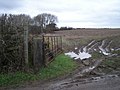
 Two stiles and a boggy path - geograph.org.uk - 672035.jpg 640 × 480; 99 KB
-
 Victorian Methodist church - geograph.org.uk - 652316.jpg 640 × 480; 57 KB
-
 Wyre Forest public car park - geograph.org.uk - 673695.jpg 640 × 480; 179 KB
-
 'Right of Way' past Cantlop Wood. - geograph.org.uk - 652672.jpg 640 × 480; 92 KB
-
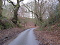
 Another wet slippery lane in January. - geograph.org.uk - 653977.jpg 640 × 480; 91 KB
-
 Between the Trees - geograph.org.uk - 657979.jpg 640 × 480; 141 KB
-
 Big puddle in heavy rain - geograph.org.uk - 655568.jpg 640 × 480; 85 KB
-
 Folly Farm - geograph.org.uk - 652550 (cropped).jpg 637 × 119; 15 KB
-
 Footpath past Bucle's Coppice - geograph.org.uk - 659142.jpg 640 × 480; 64 KB
-
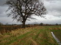
 Hardwick Oak - geograph.org.uk - 652498.jpg 640 × 480; 147 KB
-
 Muddy path - geograph.org.uk - 659202.jpg 640 × 480; 70 KB
-
 Pasture in mid winter - geograph.org.uk - 651591.jpg 480 × 640; 100 KB
-
 Rolling hills, deep valleys - geograph.org.uk - 654255.jpg 640 × 438; 71 KB
-
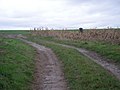 Track into field - geograph.org.uk - 659204.jpg 640 × 480; 64 KB


_-_geograph.org.uk_-_664352.jpg)


.jpg)