Category:January 2009 in Lincolnshire
Deutsch: Bilder, die im Januar 2009 in Lincolnshire aufgenommen worden sind. Bitte beachten Sie, dass dies weder das Datum des Uploads noch das Datum des Scannens eines Fotos ist.
English: Images/pictures taken in Lincolnshire during January 2009. Note this is not the date of the upload, nor the date a photo was scanned.
Español: Fotografías o imágenes tomadas en Lincolnshire durante enero 2009. No es la fecha de subida ni escaneo, sino la fecha en que las fotografías o imágenes se crearon.
Esperanto: Bildoj faritaj en Lincolnshire en januaro 2009. Tio ne estas la dato, kiam la bildoj estis alŝutitaj aŭ skanitaj.
Français : Photographies ou images prises en Lincolnshire durant janvier 2009. Ce n'est pas la date du téléchargement ou du scan.
Galego: Fotografías ou imaxes tomadas en Lincolnshire durante xaneiro 2009. Non é a data de subida nin escaneamento, senón a data na que se crearon as fotografías ou imaxes.
Italiano: Fotografie o immagini scattate a Lincolnshire nel gennaio 2009. Nota bene: la data non si riferisce né a quella di upload né a quella in cui la foto è stata digitalizzata.
Norsk bokmål: Bilder tatt i Lincolnshire i løpet av januar 2009. Merk at dette ikke er datoen for opplasting, eller når et bilde har blitt skannet.
Norsk nynorsk: Bilete teke i Lincolnshire i løpet av januar 2009. Merk at dette ikkje er datoen for opplasting, eller når eit bilete har vorte skanna.
Русский: Изображения, сделанные в Lincolnshire в течение январь 2009 (не дата загрузки изображения).
Українська: Зображення, зроблені в Lincolnshire протягом січень 2009. Зауважте, що це не дата завантаження чи дата сканування фотографії.
| January 2008 | ← | January 2009 | → | January 2010 | |||||||
| Jan | Feb | Mar | Apr | May | Jun | Jul | Aug | Sep | Oct | Nov | Dec |
| 123 | 25 | 89 | 74 | 104 | 81 | 122 | 128 | 147 | 2 | 24 | 128 |
|---|---|---|---|---|---|---|---|---|---|---|---|
Subcategories
This category has the following 9 subcategories, out of 9 total.
0
1
Media in category "January 2009 in Lincolnshire"
The following 114 files are in this category, out of 114 total.
-
 St Wilfred's Church - geograph.org.uk - 1102370.jpg 640 × 480; 81 KB
-
 Dam Road, Barton Upon Humber - geograph.org.uk - 1102284.jpg 640 × 425; 71 KB
-
 Housing Development on Humber Road - geograph.org.uk - 1103109.jpg 640 × 425; 87 KB
-
 National Grid Location C16, Dam Road - geograph.org.uk - 1102270.jpg 640 × 425; 125 KB
-
 Victorian Houses on Dam Road - geograph.org.uk - 1102251.jpg 640 × 425; 90 KB
-
 Fields from Moor Road - geograph.org.uk - 1102568.jpg 640 × 480; 84 KB
-
 Fields Near Moor Road - geograph.org.uk - 1102554.jpg 640 × 480; 71 KB
-
 New River Ancholme - geograph.org.uk - 1106518.jpg 640 × 353; 76 KB
-
 North Kelsey Carrs - geograph.org.uk - 1106406.jpg 640 × 403; 80 KB
-
 Westfield Farm - geograph.org.uk - 1106653.jpg 640 × 480; 94 KB
-
 Barton Haven - geograph.org.uk - 1110156.jpg 640 × 480; 92 KB
-
 Thorngarth Lane, Barrow Upon Humber - geograph.org.uk - 1112609.jpg 640 × 415; 393 KB
-

-
 Thorngarth Lane, Barrow Upon Humber - geograph.org.uk - 1112650.jpg 640 × 431; 328 KB
-
 Barrow Haven Boatyard - geograph.org.uk - 1112634.jpg 640 × 480; 398 KB
-
 The Entrance to Old Ferry Wharf - geograph.org.uk - 1112628.jpg 640 × 578; 326 KB
-
 47 and 49 High Street - geograph.org.uk - 1113934.jpg 640 × 427; 79 KB
-
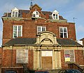
 Boston Exchange - geograph.org.uk - 1114020.jpg 640 × 427; 63 KB
-
 Towards Cadney - geograph.org.uk - 1114236.jpg 640 × 352; 74 KB
-
 Field drain and track - geograph.org.uk - 1114154.jpg 640 × 480; 109 KB
-
 Guilicar Lane - geograph.org.uk - 1114255.jpg 640 × 480; 71 KB
-
 Guilicar Lane field gate - geograph.org.uk - 1114190.jpg 640 × 411; 84 KB
-
 TESCO, Barton-Upon-Humber - geograph.org.uk - 1120305.jpg 640 × 480; 319 KB
-

-
 The White Hart Inn, Crowle - geograph.org.uk - 1121666.jpg 640 × 480; 226 KB
-
-
 Ayscough Street, Grimsby - geograph.org.uk - 1122041.jpg 640 × 471; 91 KB
-
 Littlefield Lane , Grimsby - geograph.org.uk - 1121722.jpg 640 × 480; 122 KB
-
 Pelham Road, Grimsby - geograph.org.uk - 1121738.jpg 640 × 459; 116 KB
-
 Pelham Road, Immingham - geograph.org.uk - 1122060.jpg 640 × 480; 73 KB
-
 Barton Upon Humber Tower Mill - geograph.org.uk - 1126047.jpg 480 × 640; 73 KB
-

-
 Weir, Denton Reservoir - geograph.org.uk - 1126988.jpg 640 × 427; 108 KB
-
 Between North and South Gulham - geograph.org.uk - 1124360.jpg 480 × 640; 90 KB
-
 Church Street, Scawby - geograph.org.uk - 1124175.jpg 640 × 480; 132 KB
-
 High Street, Barton upon Humber - geograph.org.uk - 1126169.jpg 640 × 471; 110 KB
-
 Barton Upon Humber Tower Mill - geograph.org.uk - 1127838.jpg 640 × 534; 85 KB
-
 Thoresway AA Sign - geograph.org.uk - 1107046.jpg 640 × 480; 66 KB
-
 Wet pasture - geograph.org.uk - 1114213.jpg 640 × 347; 76 KB
-
 Unmapped reservoir - geograph.org.uk - 1114902.jpg 640 × 401; 84 KB
-
 Station Lane, Owmby and field drain - geograph.org.uk - 1115940.jpg 640 × 480; 109 KB
-
 Information highway, Owmby - geograph.org.uk - 1115746.jpg 640 × 405; 91 KB
-
 Brocklesby Hunt at Riby Grove Farm - geograph.org.uk - 1123694.jpg 640 × 480; 68 KB
-
 White Gate at Riby Grove Farm - geograph.org.uk - 1123830.jpg 640 × 480; 109 KB
-
 Brat Hill, Scunthorpe - geograph.org.uk - 1125605.jpg 640 × 380; 321 KB
-
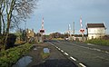
 Elsham Level Crossing - geograph.org.uk - 1123634.jpg 640 × 426; 298 KB
-
 Elsham Level Crossing - geograph.org.uk - 1123654.jpg 640 × 397; 294 KB
-
 Denton Reservoir - geograph.org.uk - 1128242.jpg 640 × 427; 61 KB
-
 Denton Reservoir - geograph.org.uk - 1128252.jpg 640 × 427; 83 KB
-
 Denton Reservoir - geograph.org.uk - 1128830.jpg 640 × 427; 83 KB
-
 Denton Reservoir - geograph.org.uk - 1129170.jpg 640 × 423; 102 KB
-
 Northern shore, Denton Reservoir - geograph.org.uk - 1128985.jpg 640 × 427; 130 KB
-
 Small field near Denton Reservoir - geograph.org.uk - 1126962.jpg 640 × 427; 85 KB
-
 Walkers at Denton Reservoir - geograph.org.uk - 1128251.jpg 640 × 480; 86 KB
-
 Willow at Denton Reservoir - geograph.org.uk - 1127001.jpg 640 × 427; 152 KB
-
 Earth bank at Denton Reservoir - geograph.org.uk - 1128990.jpg 427 × 640; 97 KB
-
 Footpath at Denton Reservoir - geograph.org.uk - 1128253.jpg 640 × 427; 147 KB
-
 Old railway track, Denton - geograph.org.uk - 1126936.jpg 427 × 640; 161 KB
-
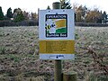 Operation Bumblebee - geograph.org.uk - 1129226.jpg 640 × 480; 108 KB
-
 Public footpath to the reservoir - geograph.org.uk - 1126898.jpg 640 × 427; 100 KB
-
 Public footpath, Denton - geograph.org.uk - 1125292.jpg 640 × 427; 185 KB
-

-
 Old Beck at Denton Reservoir - geograph.org.uk - 1129028.jpg 450 × 640; 132 KB
-
 Picnic table at Denton Reservoir - geograph.org.uk - 1129006.jpg 640 × 427; 122 KB
-
 Public footpath at Denton Reservoir - geograph.org.uk - 1129055.jpg 427 × 640; 117 KB
-
 Pylons near West Halton - geograph.org.uk - 1131603.jpg 640 × 480; 67 KB
-
 The Old Immingham Road - geograph.org.uk - 1133869.jpg 640 × 480; 111 KB
-
 Kettleby Beck - geograph.org.uk - 1141234.jpg 640 × 355; 74 KB
-
 Kettleby Beck and bridge - geograph.org.uk - 1141278.jpg 640 × 480; 83 KB
-
 Water management - geograph.org.uk - 1141262.jpg 640 × 281; 61 KB
-
 Froghall Carrs - geograph.org.uk - 1141198.jpg 640 × 372; 90 KB
-
 Froghall Carrs - geograph.org.uk - 1141479.jpg 640 × 298; 71 KB
-
 Church of St. Maurice, Horkstow - geograph.org.uk - 1141498.jpg 640 × 527; 157 KB
-
 Churchyard, St. Maurice, Horkstow - geograph.org.uk - 1141472.jpg 428 × 640; 137 KB
-
 The Road to West Halton - geograph.org.uk - 1129865.jpg 640 × 480; 113 KB
-
 Cleethorpe Road, Grimsby - geograph.org.uk - 1129783.jpg 640 × 480; 68 KB
-
 Entering West Halton - geograph.org.uk - 1131625.jpg 640 × 480; 79 KB
-
 Pylons near West Halton - geograph.org.uk - 1131613.jpg 640 × 480; 79 KB
-
 22-24 Melville Street - geograph.org.uk - 1109608.jpg 640 × 427; 74 KB
-
 Terraced Houses on Holydyke - geograph.org.uk - 1131595.jpg 640 × 566; 128 KB
-
 The Sign of The Brocklesby Ox - geograph.org.uk - 1133129.jpg 595 × 640; 123 KB
-
 Hopeful Horses - geograph.org.uk - 1135943.jpg 640 × 416; 98 KB
-
 On Horkstow Road - geograph.org.uk - 1140593.jpg 640 × 362; 40 KB
-

-
 King Street, Barton Upon Humber - geograph.org.uk - 1139370.jpg 480 × 640; 105 KB
-
 Track to a Lincolnshire farm - geograph.org.uk - 1139057.jpg 640 × 480; 166 KB
-
 Derwent Road, Scunthorpe - geograph.org.uk - 1140273.jpg 640 × 437; 184 KB
-
 Bridge over Kettleby Beck - geograph.org.uk - 1141302.jpg 640 × 423; 100 KB
-
 Church of St. Maurice, Horkstow - geograph.org.uk - 1141446.jpg 640 × 427; 139 KB
-
 On Saxby Hill - geograph.org.uk - 1141518.jpg 640 × 554; 182 KB
-
 Balderson's motors - geograph.org.uk - 1140856.jpg 640 × 395; 92 KB
-
 Ancaster signal box - geograph.org.uk - 1114366.jpg 428 × 640; 59 KB
-
 Ashby Ville lagoons, Scunthorpe - geograph.org.uk - 1140263.jpg 453 × 640; 180 KB
-
 Challenger MT765C crawler tractor at Lamma 2009 - IMG 4620.jpg 3,088 × 2,056; 1.02 MB
-
 County Hospital - geograph.org.uk - 1137740.jpg 640 × 555; 136 KB
-
 Deserted beach - geograph.org.uk - 1124330.jpg 640 × 480; 58 KB
-
 Humber Bridge - geograph.org.uk - 1110141.jpg 640 × 552; 85 KB
-

-
 Kite surfers - geograph.org.uk - 1108659.jpg 640 × 427; 47 KB
-

-
 Low tide at Cleethorpes - geograph.org.uk - 1123842.jpg 640 × 480; 53 KB
-
 Low tide on the Humber - geograph.org.uk - 1123458.jpg 640 × 480; 55 KB
-
 New River Ancholme Facing North - geograph.org.uk - 1104772.jpg 640 × 480; 68 KB
-
 Permissive path from Viking Way - geograph.org.uk - 1115905.jpg 640 × 480; 133 KB
-
 Red Arrow - geograph.org.uk - 1137581.jpg 500 × 333; 59 KB
-
 Sandy island and Bull Sand Fort - geograph.org.uk - 1123492.jpg 640 × 480; 50 KB
-

-
 The Humber Foreshore at Hessle - geograph.org.uk - 1138503.jpg 480 × 640; 63 KB
-
 Track near Grasby House Farm - geograph.org.uk - 1116047.jpg 640 × 395; 96 KB
-
 Turnpike Milestone - geograph.org.uk - 1108220.jpg 640 × 427; 105 KB
-
 Turnpike milestone - geograph.org.uk - 1108252.jpg 640 × 427; 128 KB
-
 Turnpike milestone - geograph.org.uk - 1108274.jpg 640 × 427; 129 KB
-
 Willingham Road - geograph.org.uk - 1108241.jpg 640 × 427; 126 KB
-
 Anthony's Bank - geograph.org.uk - 1108641.jpg 640 × 427; 62 KB


_at_Waters%27_Edge_Park_-_geograph.org.uk_-_1139357.jpg)


